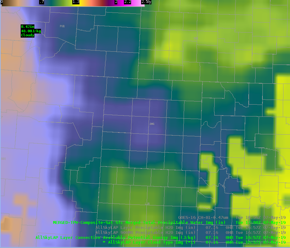
Differences in TPW and LAP in pre-storm environment over AMA

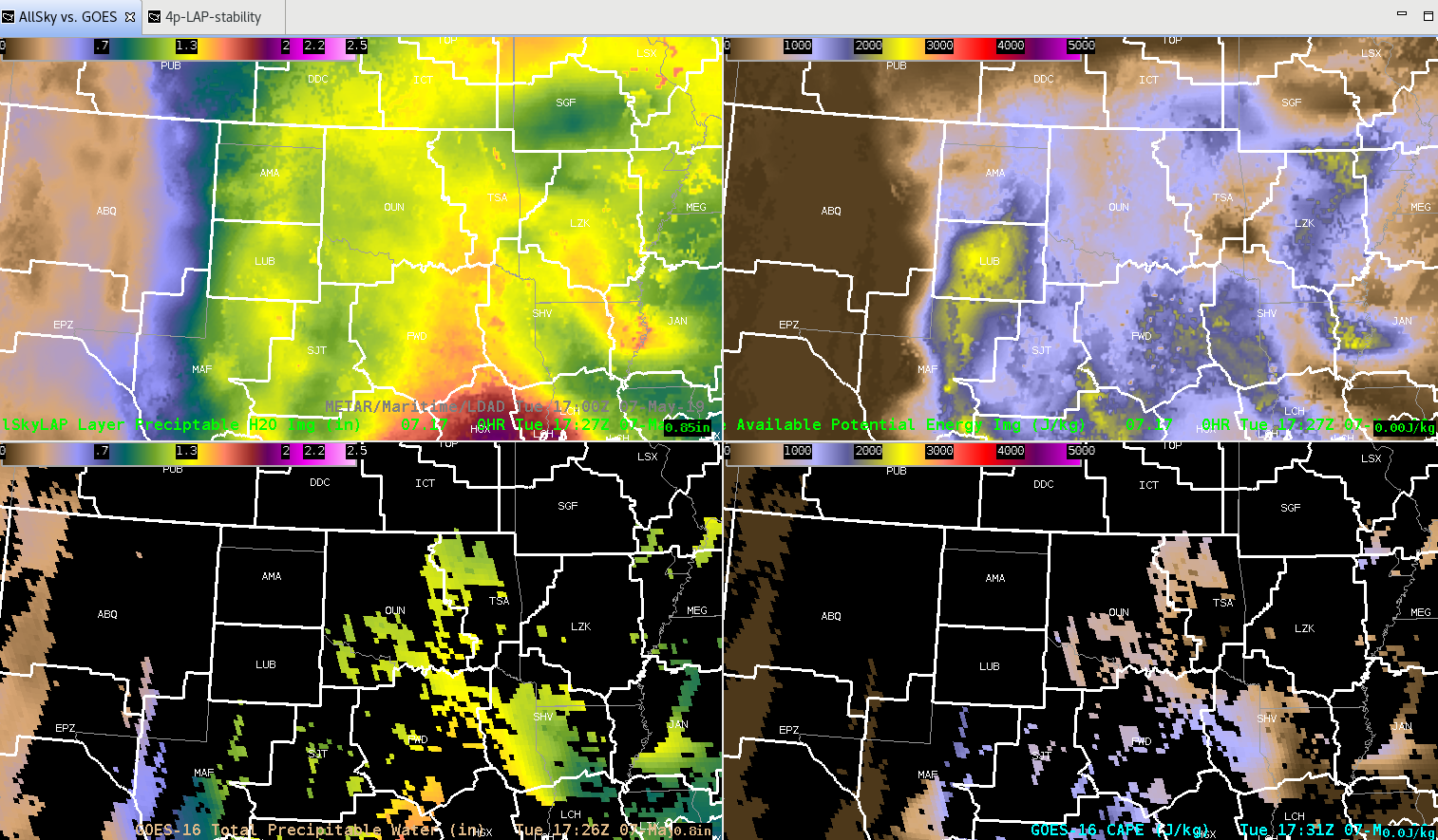
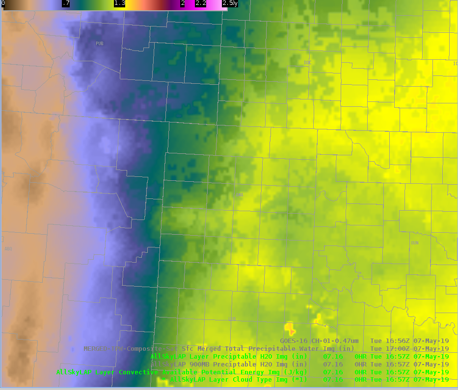
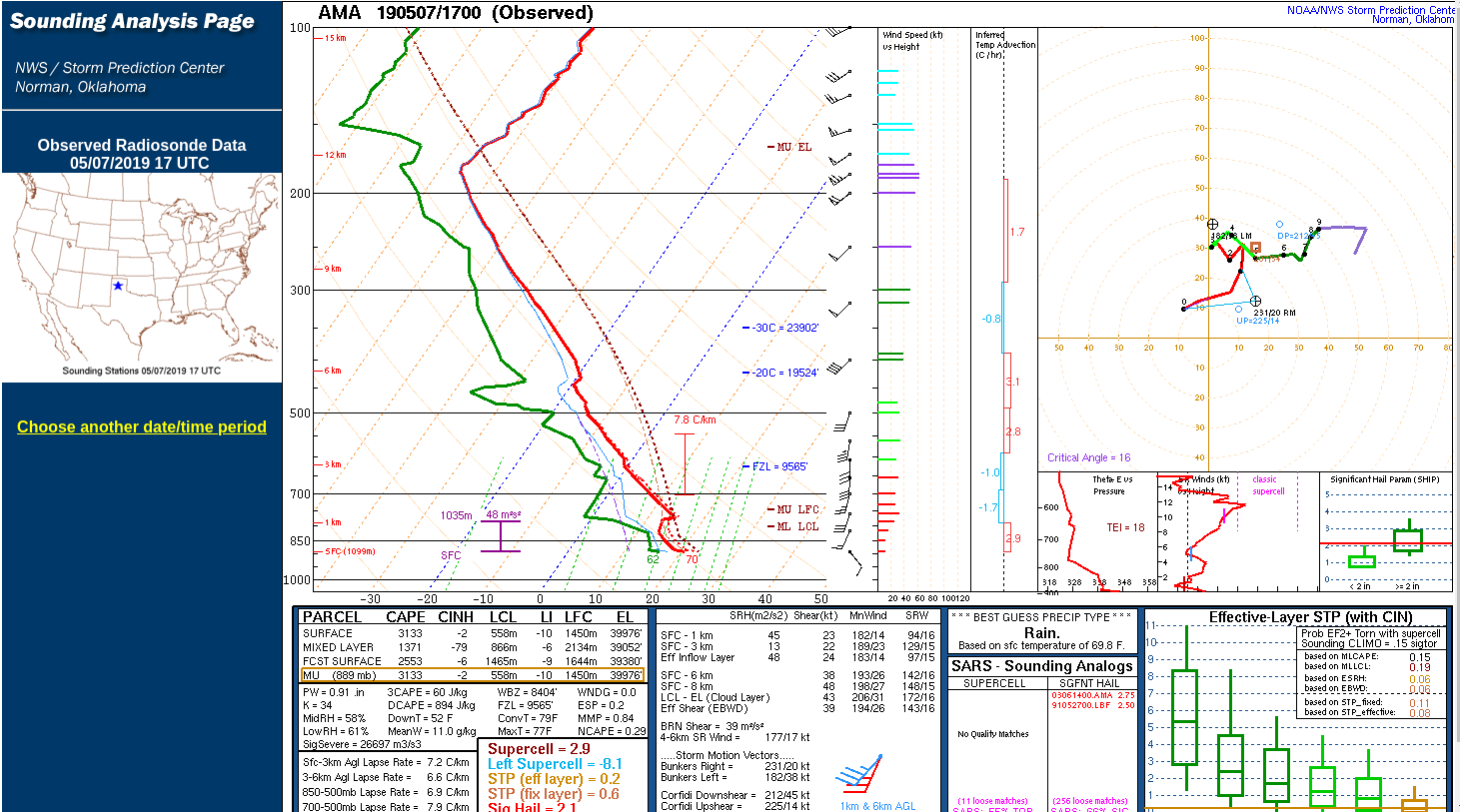
Noticed a major difference in the pre-storm environment at 17Z, just before convective initiation, between the TPW and LAPS products Total Precipitable Water Products. AllSkyLAP Total Precipitable H20 was observing ~1.25″ at 17Z whereas the Avd. Blended TPW observed ~0.7″ at 17Z. A special 17Z sounding observed 0.9″. While AllSkyLAP ‘looked’ more realistic from a mesoanalysis standpoint, the sounding was closer to the Adv. Blended TPW product. Would like to see more sounding verification between the 2 products.
#ProtectAndDissipate
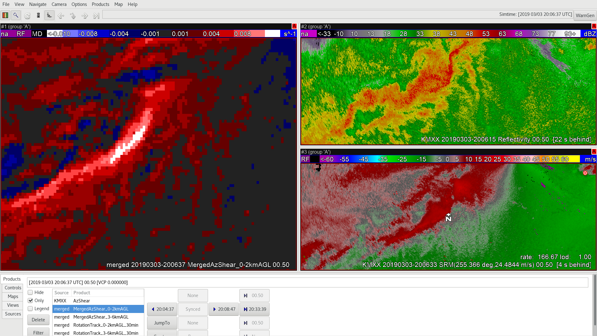
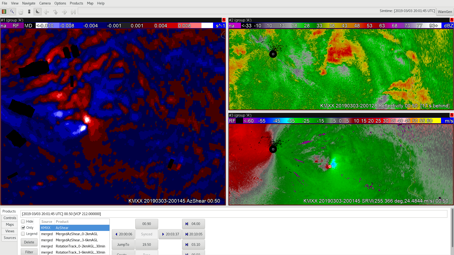
Merged AzShear utility

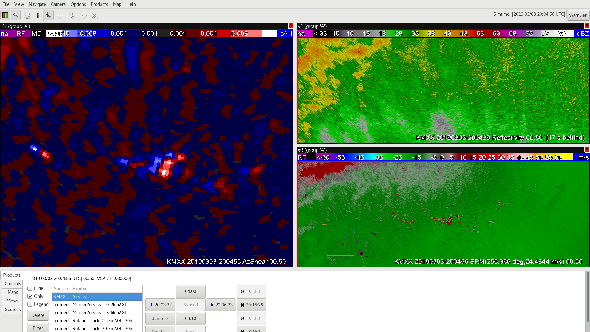
Very high utility here with the merged AZshear. Merged shear ramped up and after a couple of volume scans, My attention was drawn to an area that I would not have looked at by looking at SRM alone. This proved to be a developing tornadic situation over half an hour later! One caveat is that the area of circulation is not as precise as AzShear, of course.

ZDR_Arcophile


AzShear in Situational Awareness

Here’s an example of where AzShear is VERY useful, especially if there are a lot of storms to look at. Here is a case where the AzShear is quickly ramping up and would alert me to a developing updraft well before I might catch this with SRM alone.

ZDR_Arcophile

AllSky vs GOES Products

One of the limitations of GOES TPW is that it will not display data when there is a significant amount of clouds in the area. AllSky Layer Precip is a great alternative to GOES TPW for areas that are experiencing clouds. The same goes for AllSky CAPE vs GOES CAPE. With a MOD Risk of svr wx today across the TX Panhandle, having the AllSky Data available greatly benefits forecasters today.

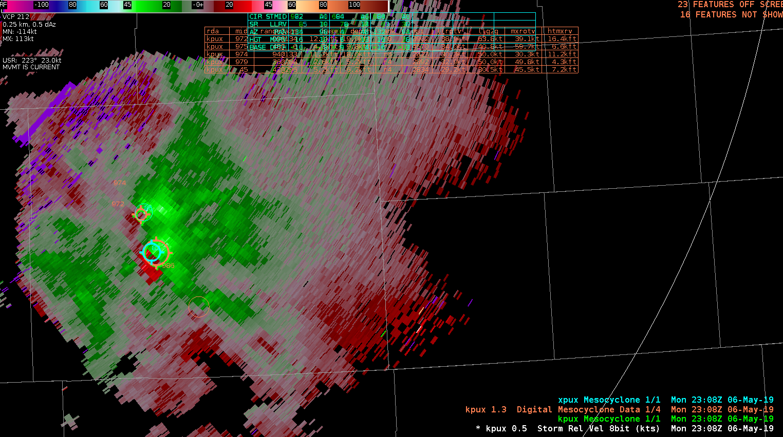
NDAM in my DMA

DMA is a television market area and my home market is next to my assigned CWA for the day. A storm on the fringes of the DMA, approaching the CWA is in a known radar hole…lowest tilt of KPUX radar (Even DDC) doesn’t provide good low-level analysis of storms that far from the dish, but NDAM showing similar detection to existing products at 2308Z…

-icafunnel

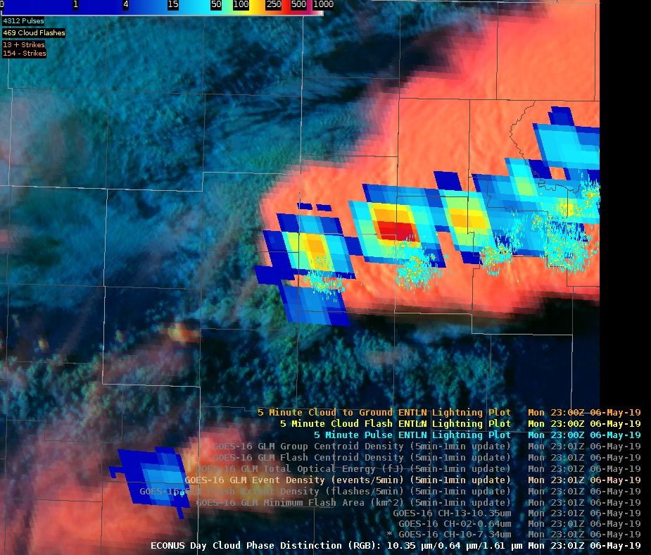
GOES GLM products offset

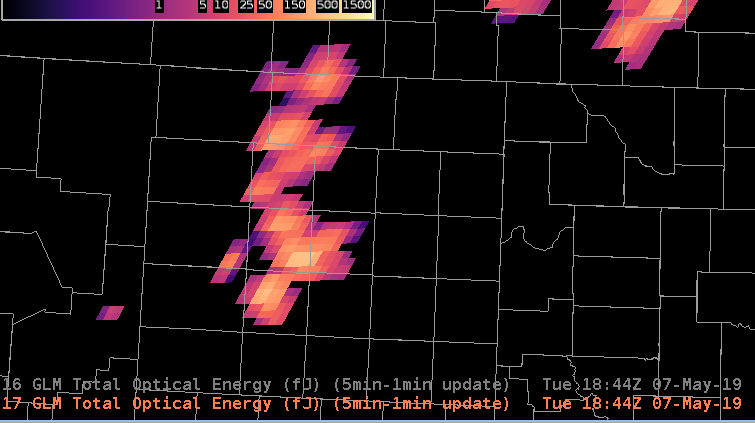
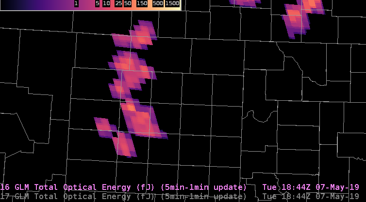
Always important to keep in mind that the locations on all GOES Products are offset based on the tilt of both GOES satellites relative to the CONUS. Good Example of the offset of GLM with ENTLN lightning data displacement shown here.

Would something like this be problematic when calculated into the ProbSevere model?

#ProtectAndDissipate