EWP2013 7 May 2013 2150 UTC Mesoscale Discussion

As was anticipated, isolated to scattered thunderstorms developed over northern and western portions of KS. This area will continue to be monitored for additional storm development, and intensification of ongoing convection as backed low level flow continues in this region. The image below shows composite reflectivity, MRMS mid level rotation tracks and MESH, reflectivity at -20 C and the HHC. This cluster of storms is gradually intensifying, and MESH has indicated the presence of severe hail.4-panel_MD_Update_05072013

We are still monitoring CWAs further south, LUB in particular, for convective initiation in the next couple of hours. A large CU field has developed in the last hour and is showing some CI and CTC signals.LUB_monitor_CICTC

However, this activity has been slow to develop, and severe convection does not appear imminent.

Austin/Frank

Tags: None

Updrafts have reached Moisture

The updrafts have reached the airmass with higher low-level moisture as evident by the darker pink/purple colors in the GOES PW Difference product. The updrafts have become better organized with a marginally severe storm currently in Western Kansas.

moisture1
Left panel is Composite Reflectivity from MRMS and the upper right is GOES PW Difference.

Hampshire

Tags: None

Moderate CTC 25 minute LT to 0.7″ MESH

At 2045z the Cloud-top-Cooling product signaled a 12 C/15min value. This is on the moderate scale and validation study states that this value should lead to a 33 minute lead time to non-severe hail.

CTC
Upper right panel is CTC

At 2112z the MESH product signaled a 0.71″ Maximum hail size which is close to what the product is suppose to signal for the forecaster.

CTC2
Upper right panel is MESH

Hampshire


Tags: None

Cells in Western Kansas are Moisture Starved

The cells which have been trying to initiate since 2 PM have struggled with only weak reflectivity returns noted. There is instability available for convective updrafts and this is noted on the GOES Theta-E Difference on the bottom right panel of the image below. The blue colors signify an unstable airmass. Some other inhibiting factor is preventing these updrafts from further organization. This is most likely due to poor moisture at the present time. The GOES Vertical PW product shows little change of moisture between the low-levels and the mid-levels of the atmosphere in Western Kansas. This is evident by the light pink/purple colors in the product in the upper right panel. As these cells move east over the next 2-3 hours, they will encounter low-level air that has a bit more moisture available as evident by the darker pink/purple colors in the product. This could have an impact on the cells and we could see the storms become better sustained.

moisture

Hampshire

Tags: None

EWP2013 7 May 2013 1930 UTC Mesoscale Discussion

Broad upper ridging resides over the Southern Plains, with cyclonic flow on both the east and west coasts. In the wake of large upper low currently positions over the Mid-Atlantic, robust moisture has struggled to return, yielding less than stellar severe parameters. Still, the presence of low to mid 50s dewpoints combined with favorable wind fields will yield a chance of a few severe storms, mainly in the form of high based multicell and supercell structures.

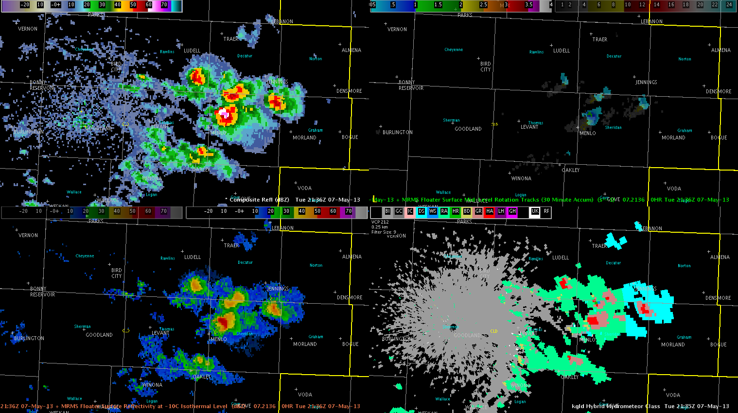
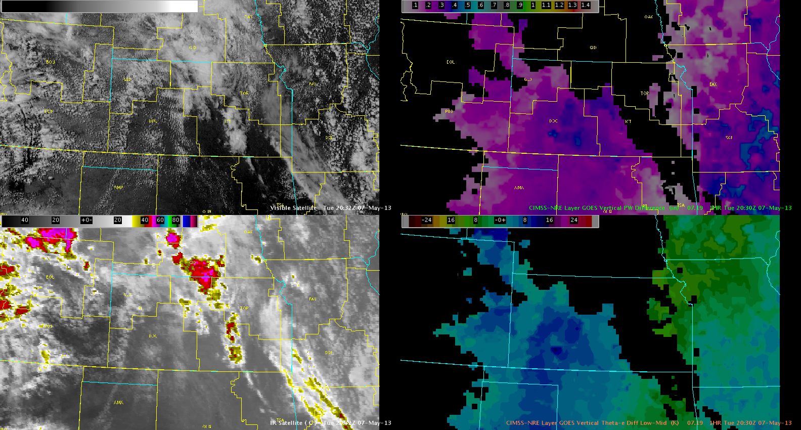
A subtle surface trough/boundary extended from the higher terrain of eastern Colorado eastward into western Kansas with a pronounced dryline over far western KS extending down into much of western and central TX. In the presence of appreciable daytime heating, these boundaries are expected to serve as a focus for convective development from now through around 22-23z. Greater storm coverage is expected further north, within area of backed surface flow near subtle trough/dryline intersection. This will correspond to the CWAs of DDC and GLD. Further south, increasing mid level heights will tend to limit convection, though isolated to widely scattered thunderstorms may develop by around 23z to 00z. Large hail, some very large, and damaging winds will be the primary hazards, with significant wind gusts possible due to inverted-V type soundings within meager low level moisture and deeply mixed atmosphere. Tornadoes do not appear to be much of a concern, but if one were to occur, it would be most likely nearer the backed winds over northern/western KS in GLDs forecast area, though lacking wind shear, both in the low levels and aloft, may tend to mitigate this potential.

Mesoscale models (WRF-ARW and WRF-NMM) are in good agreement in developing isolated to scattered supercells across much of western KS as can be seen below. Lesser activity can be noted in the TX panhandles and points southward.highresmods_050713

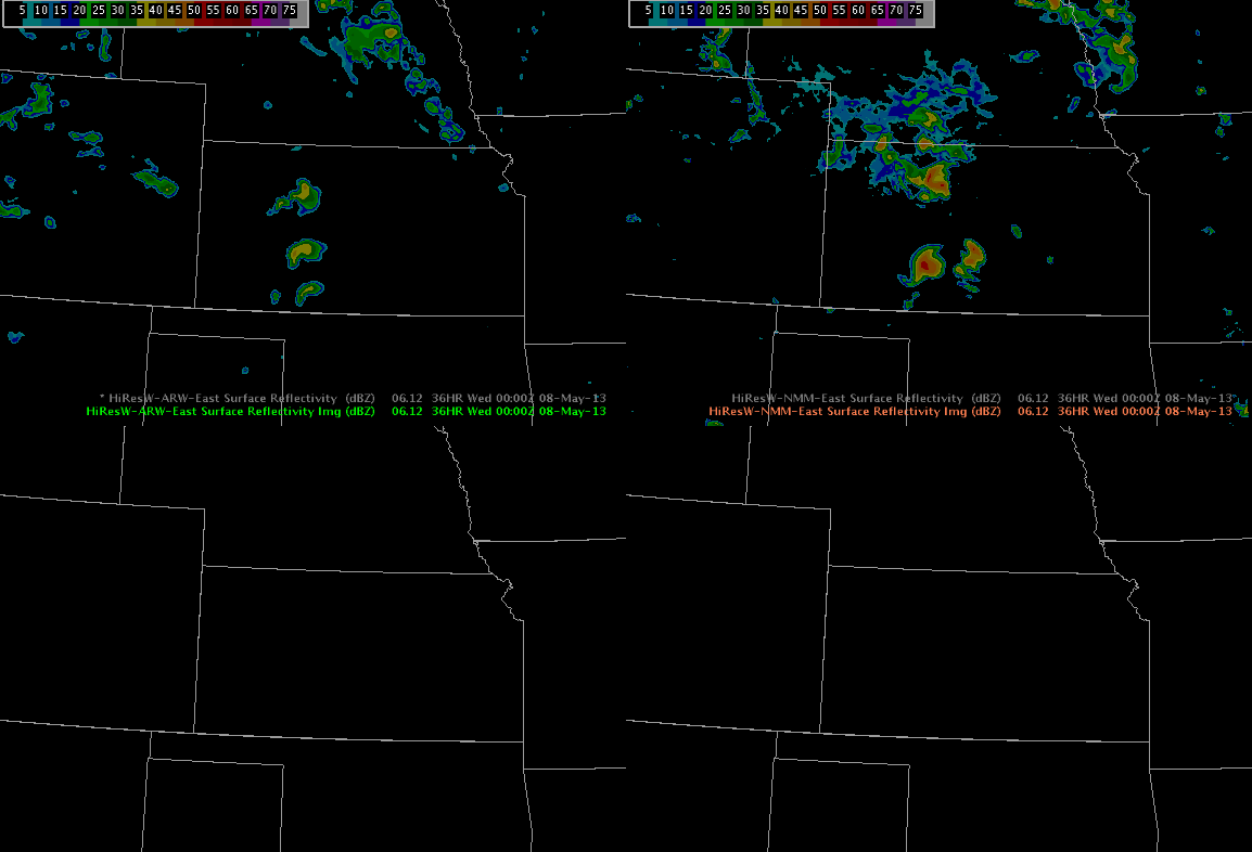
Likewise, CIRA NSSL WRF simulated IR satellite (upper left panel below) depicts thunderstorm development by around 21z over much of DDC/GLD/AMA CWAs. One difference it he more widespread nature of thunderstorms further south, which the above high res runs do not support. The OUNWRF simulated reflectivity (lower left panel) also supports this more active solution. Attm, it appears to be over convecting somewhat, especially considering lack of strongly backed sfc flow and increasing heights aloft.4paneloun+cira

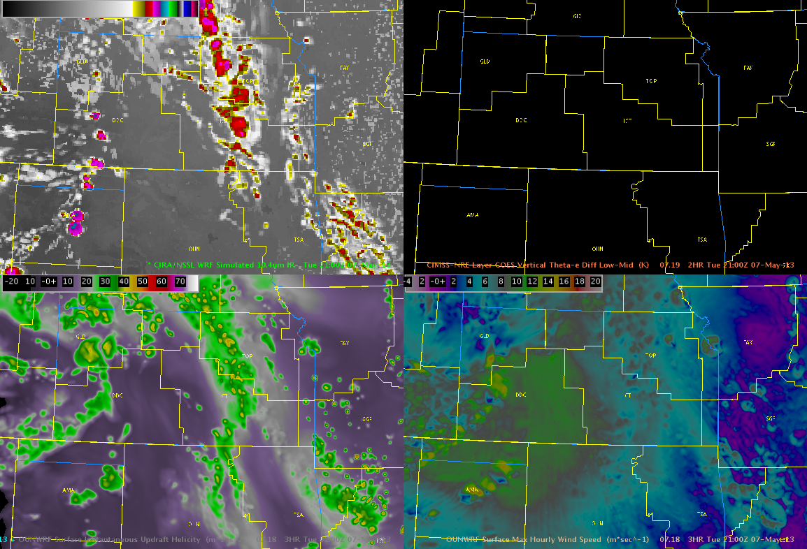
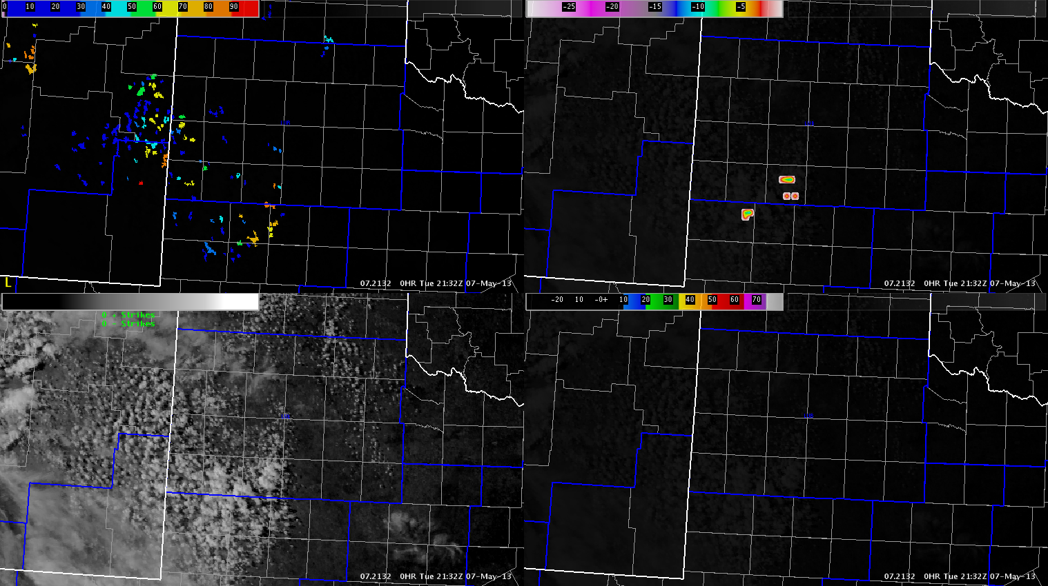
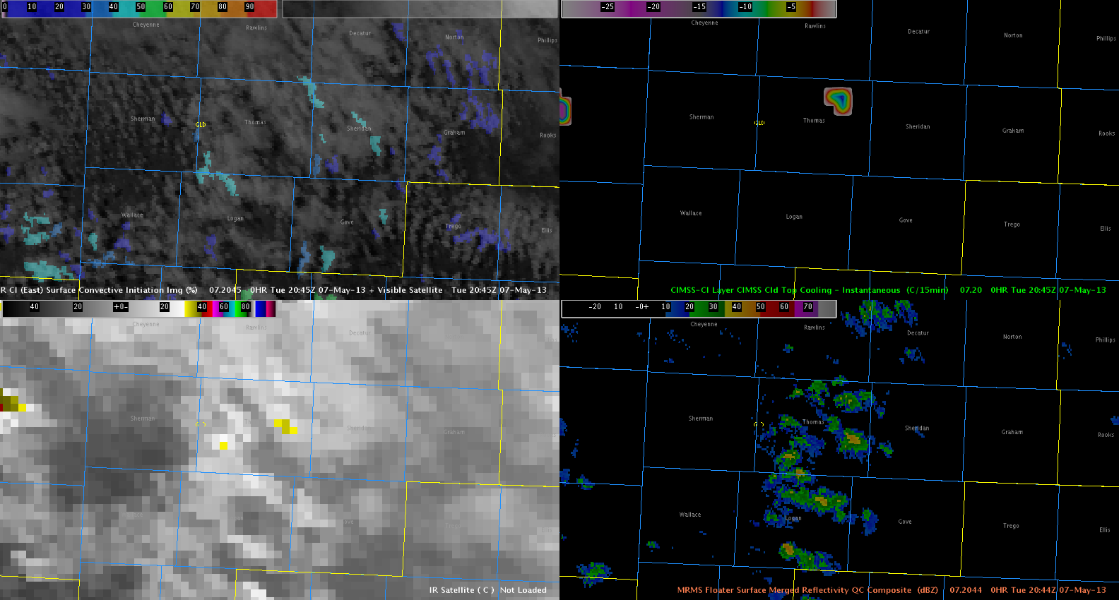
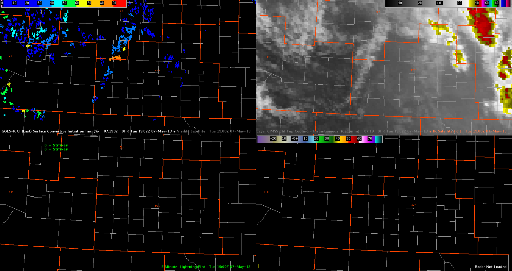
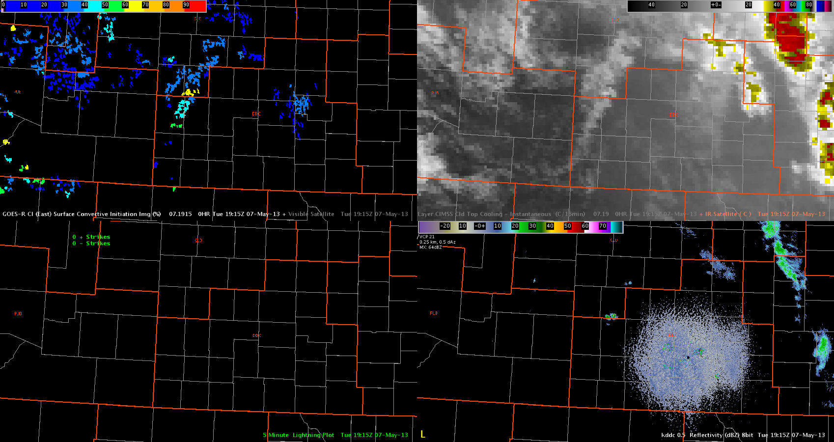
In the next few hours, storms are expected to develop first over west KS, then, in a more isolated nature, over parts of the TX panhandle and southwest TX. The CI product below has already shown areas of moderate to high CI potential within a line of agitated cumulus along the dryline and sfc trough, with a strong CI and instantaneous CTC signal over eastern CO.CI_Initiation050713

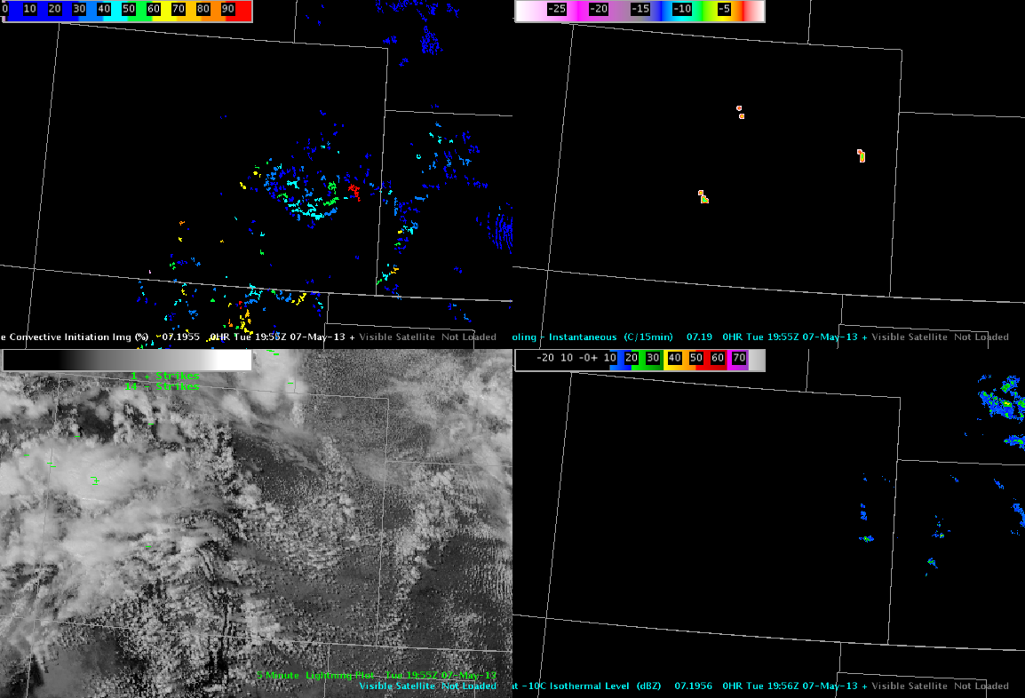
Initial thoughts are to set up shop in GLD and adjacent DDC this afternoon, with potential to migrate southward if more discrete activity develops along southern parts of the dryline. This meshes well with the EFP Severe Probabilities outlook shown below.EFP_RiskArea_050713

We will keep a close on LUB late this afternoon and evening, especially in the case that we can  sample some of the PGLM capabilities within the LMA there.

Austin/Frank

Tags: None

Using Goes-R CI to Evaluate Developing Cumulus / weak cells

A line of cumulus clouds developed across western Kansas near/after 18Z. EFP/SPC forecasts indicate this as a favorable area for storm development in the next few hours. For now, the GOES-R CI product is indicating generally low probabilities of convective initiation along this line of towering cumulus (20-60 percent).

goes_r_ci-05071902

One area with a probability of 80 percent developed, at around the same time that a small/weak cell (Z < 35 dbZ) developed in Wichita County. This indicator decreased below 70 percent in the next few products, as the cell generally failed to develop into anything stronger.

goes_r_ci-05071915

So far, the CI product appears to be correctly indicating that large-scale convective development is not imminent quite yet. Also, the CTC product has not shown any indication of rapid cooling, which also matches the current situation.

–Hatzos

Tags: None

Daily Summary: 6 May 2013

130507_reports

On Monday, the first week of the 2013 Experimental Warning Program began.  The visiting forecasters this week are Marc Austin (OUN), Hayden Frank (BOX), Jonathan Guseman (LUB), Nick Hampshire (FWD), Andrew Hatzos (ILN), and Jonathan Kurtz (OUN).  After giving our guests a brief tour of the National Weather Center, Greg Stumpf (NSSL/MDL) gave an overview of the Experimental Warning Program.  This was followed by a tutorial by Clark Payne (WDTB) for the Friday webinar.

After a brief break, we began work in the Hazardous Weather Testbed.  The forecasters took a survey to test their existing knowledge of the Multi-Radar Multi-Sensor (MRMS) system.  Shortly after, Jimmy Correia (CIMMS/SPC) of the Experimental Forecast Program delivered a forecast for the day.  After a brief discussion, we began operations.

Severe parameters were limited, but a marginal severe threat existed in North Carolina, Virginia, and Kentucky.  We asked the forecasters to use available products to hone down an operations area and to prepare a briefing.  The consensus was that the Blacksburg, Virginia County Warning Area had the greatest threat of severe weather, so we began operations there.

While in Blacksburg, forecasters issued several severe thunderstorm warnings for marginally-severe hail.  We received several verification reports, including reports of hail up to the size of nickels.  After a couple hours of operations, Geoff Stano (NASA/SPORT) delivered a group tutorial on how to use a lightning trend product (developed by the University of Alabama-Huntsville group).   After the conclusion of this tutorial, we took a break for dinner.

Upon our return, we split the forecasters between the Blacksburg , Viriginia and the Raleigh, North Carolina Weather Forecast Offices in order to avoid “warning collisions”.  Unfortunately, the severe threat had diminished somewhat.  Geoff Stano noticed that lightning was picking up close to the Lubbock CWA, so it was quickly decided that we localize to that WFO in order to take advantage.  Unfortunately, though, storms began to dissipate as they approached the LUB CWA.  After the conclusion of operations, the forecasters completed the daily survey and we finished for the day.

-Gabe Garfield, Week 1 Coordinator

Tags: None

Approximate 15 Minute Lead Time for Severe Thunderstorm Using MRMS and HSDA

An isolated storm continued to move north/northwest across northern NC. The storm began to intensify as it moved into Stokes and Rockingham Counties. Continued to monitor various MRMS products including MESH and surface height of 50 dBz echo above -20 C, as well as surface reflectivity at -10 C and 0 C. Early MESH values were below .25 inches, with the highest 50 dBz echo approximately 6000 ft below -20C. Recognizing from previous storms this evening, with such a cool air mass, and decent low level lapse rates, severe hail was possible with 50 dBz cores below -20 C. Issuing a warning as the core increased, we continued to monitor the MRMS data, noticing the MESH had increased to approximately .50 in with 50 to 57 dBz at -10 C. We also used FSI to investigate the addition to the HCA algorithm, the new HSDA (Hail Size Determination Algorithm). As the storm moved northwestward, it started to indicated large hail (1 to 2 in) and then increased to greater than 2 inch hail southwest of Meadows, NC, which is where the report of quarter size hail was reported near 0044Z. It was also near this time that the 50 dBz core was finally reaching the -20 C level. Although we only received a report of quarter size hail (1 in), the additional products improved our confidence in the severe nature of the storm.

FSI screen capture of HCA with new HSDA. The purple color is Large Hail (1-2in) and the magenta is Giant Hail (>2in).
FSI screen capture of HCA with new HSDA. The dark purple color is Large Hail (1-2in) and the pink is Giant Hail (>2in).

Kurtz/Frank

Tags: None

EWP STATUS FOR 7 MAY 2013: 1-9 p.m. SHIFT

EWP STATUS FOR 7 MAY 2013: 1 – 9 PM SHIFT

On Tuesday, forecast parameters look favorable for the development of severe thunderstorms in west Texas.  Strong directional shear will combine with weak to moderate instability to support a risk for elevated supercells.   Given the lack of quality moisture, the tornado threat should be minimal.  However, steep lapse rates and adequate moisture should result in a  large hail threat.   Additionally, a significant damaging wind threat may develop as forecast thermodynamic profiles show the classic “inverted V” shape.

Despite limited upper-level forcing, severe thunderstorms should develop by mid-afternoon.  The combination of upslope flow with seasonably-strong diabatic heating should result in the elimination of the cap by mid-afternoon.  Storms will likely organize into supercells by mid-evening, with a transition to mesoscale convective system possible later on.   However, forcing from an approaching upper-tropospheric shortwave trough will be limited before 06Z, so storms may be diurnally driven.
CWAs Likely to See Operations: Amarillo and Lubbock

-G. Garfield, Week 1 Coordinator

Tags: None

Mesoscale Outlook 5/7 00Z

A cluster of storms continues ahead of a diffuse surface boundary located across west-central North Carolina into southwest Virginia. Convergence continues to be the primary convective driver in association with an upper-level low continuing to rotate across eastern Tennessee.

sfc_boundary
Current radar imagery overlaid with surface analysis analysis showing a surface boundary.

Cold temperatures aloft, as shown by H50 temperatures near -20C, and moderately steep lapse rates will continue to support a marginal threat for large hail through 01Z. Near-surface instability will decrease in the next couple of hours as diurnal heating comes to an end and low-level theta-e values decrease as depicted by the CIMSS Nearcast tool. Tend to side with simulated satellite imagery showing storms coming to an end by 03Z across the Blacksburg County Warning Area as

nearcast_conv_stability
CIMSS Nearcast product showing instability decreasing this evening.
sim_satellite_03z
Simulated satellite imagery at 03Z as storms come to an end.

Hampshire/Guseman

Tags: None