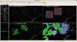
The western target is now growing enough cumulus to have one of the teams move west. Brian and Stephen will be localizing to Davenport, IA CWA to take the best advantage of evaluating CI along the cold front. CAPE is weak but lapse rates are high.
Month: May 2012
RNK 19:15UTC
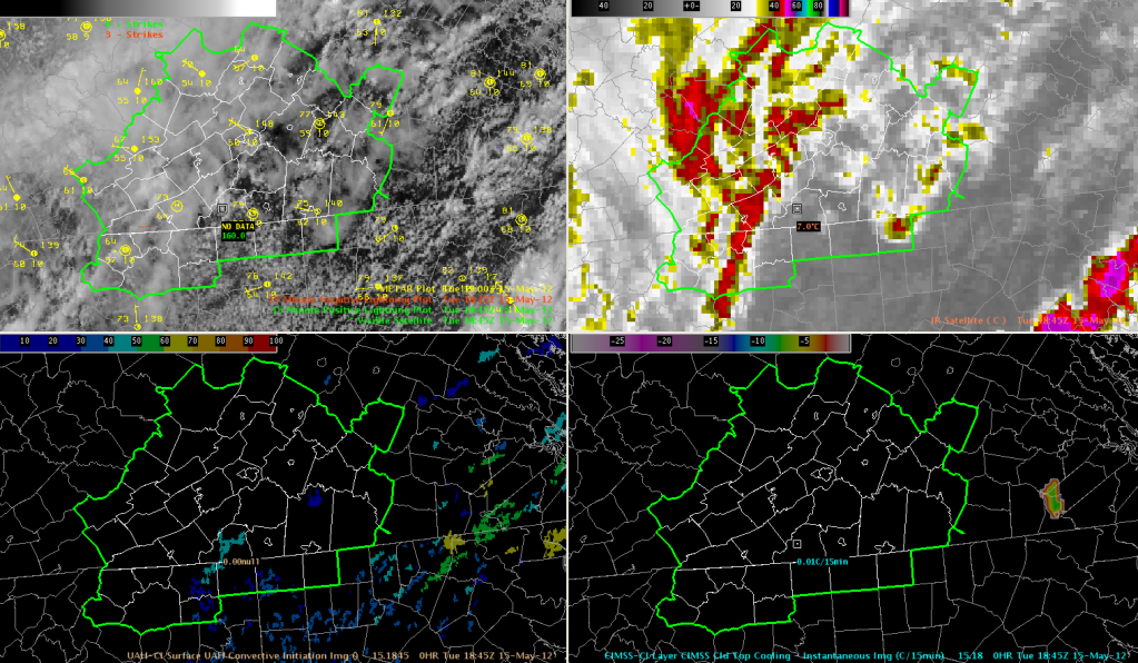
Weak Convection in the RNK CWA
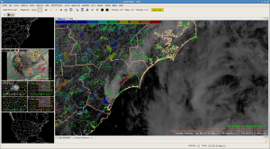
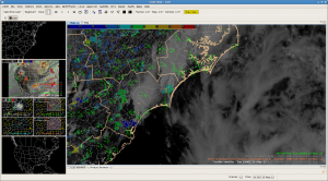
We are monitoring convection in the RNK (Blacksburg, VA) CWA this afternoon, but so far the development has been rather weak.
The 3D-VAR analysis has been useful for monitoring updraft intensity and anticipating possible stronger updrafts (top-right indicates instantaneous updrafts, bottom-right indicates 30-minute updraft history). However, none of the strong updrafts have maintained themselves beyond one “scan”.
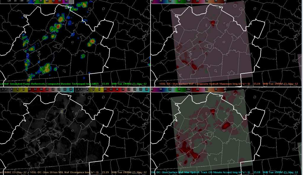
The convective initiation algorithms have struggled due to all of the cirrus blanketing the northwestern half of the RNK CWA, but some clearing in the southeast has produced some CI from the UAH algorithm. Using the new Strength of Signal output, nothing has gotten above ~50 (the included sample is just 46 in the south-central portion of the CWA), and indeed there has been little significant development in those areas. Nothing has triggered the UW Cloud Top Cooling algorithm yet in our area as of 1902 UTC.
Week #1 “Tales from the Testbed” Webinar
The “Tales from the Testbed” Webinar for Week #1 (7-11 May 2012) is now available online:
http://www.wdtb.noaa.gov/resources/HWT-EWP/week1/player.html
We will post the others as they become available.
Greg Stumpf, EWP2012 Operations Coordinator
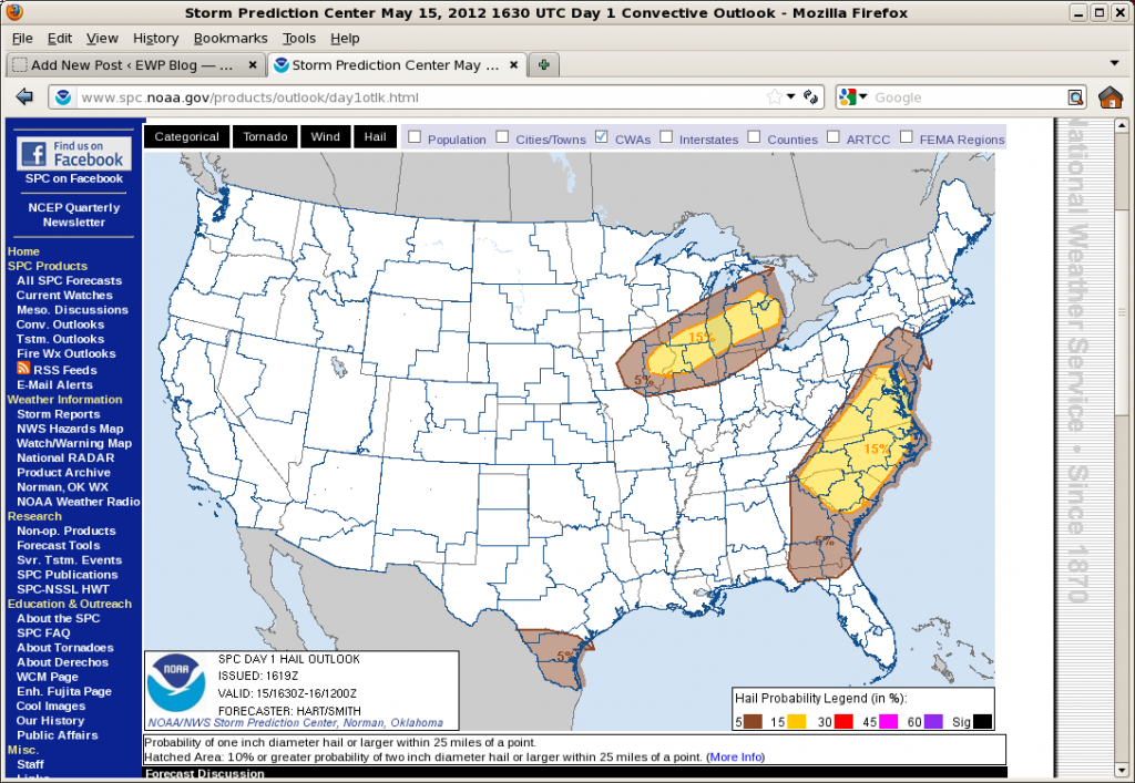
Outlook: 2012 May 15
The eastern mid-level trough and near surface cold front moved extremely slowly overnight allowing the east coast another day of good surface-based instability. Morning soundings in DC, Wallops Island and Blacksburg show near saturation over at least 300 mb above the surface and little cap. Surface moisture values are in excess of 12 g/kg. However lapse rates are relatively poor and deep layer shear is only 25 kts. The result is expected to be areas of scattered to numerous small multicells forming relatively early in the day off of high terrain to the west and subtle axis of enhanced moisture extending just east of DC. Steeper lapse rates and similar saturation along coastal North Carolina have allowed the morning sea breeze to more quickly initiate vigorous convection. Any of these areas will be susceptible to moist downbursts and marginally severe hail.
Further west, a northern stream midlevel short-wave trough is dropping into the western Great Lakes. A trailing cold front is expected to initiate convection from southeastern MN eastward to central MI. Here, moisture is sparse with surface values only around 8 g/kg. But we expect this limited moisture will be able to sustain convection owing to very steep lapse rates in the lowest 400 mb of the atmosphere. Shear is also expected to remain weak (<30 kts/6km) and thus small multicells are expected. Due to the limited moisture, we don’t expect any upscale growth here.
The plan is to work the DC LMA area and the Roanoke CWA for the early convection and then shift our focus to WI and MI for the later afternoon.
Jim LaDue, EWP2012 Week#2 Weekly Coordinator
Daily Summary – 2012 May 14
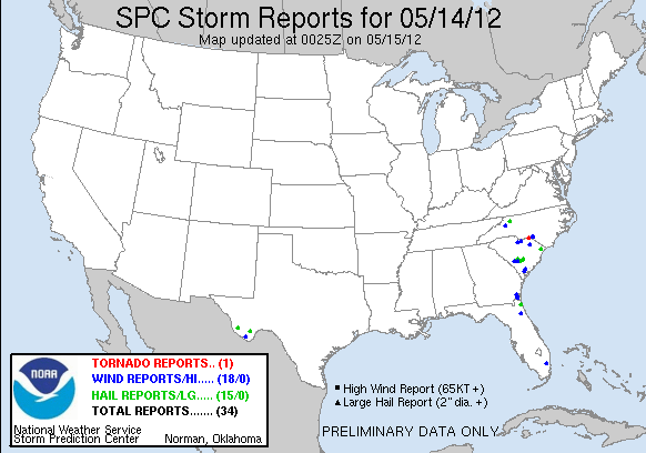
We started today in Wilmington, NC and San Antonio, TX. However the CI products were having issues with dense high clouds in NC and we subsequently shifted focus to Melbourne, FL to track convection approaching Orlando. As we shifted, two supercells formed near Myrtle Beach, SC. We were initially frustrated but a new tornado warning was issued west of Palm Beach, and the far southern county of Melbourne’s CWA. Unfortunately the storm evolved into a nonsevere state before we shifted localizations there. Meanwhile strong supercells developed west of Del Rio and tracked southeast on the Mexican side of the border. As the thunderstorms grew upscale in Mexico a spectacular haboob evolved that caused the UAH CI product to track a few cold pixels. Some were cumulus above the haboob while one of the tracks may have been triggered by the dust as it swept over a mountain range or by a cumulus cloud. Elsewhere, storms north of San Antonio were too weak to issue warnings.
Thus with the lack of warnings, the teams concentrated on inspecting the products and writing blog entries.
Jim LaDue, EWP2012 Week#2 Weekly Coordinator
EWX 00UTC
EWX 2345 – International Watch
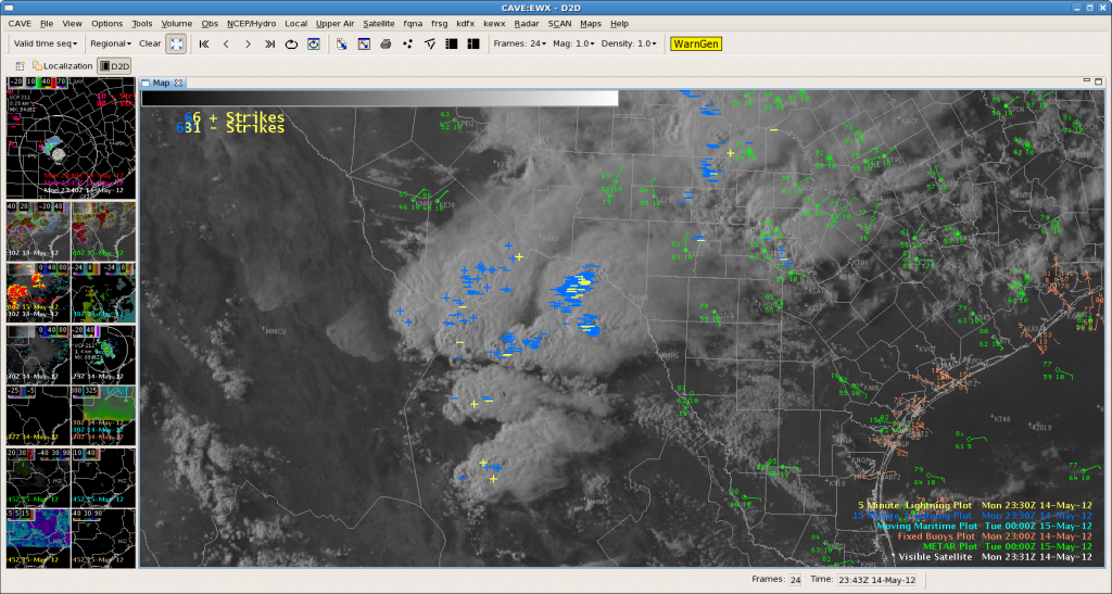
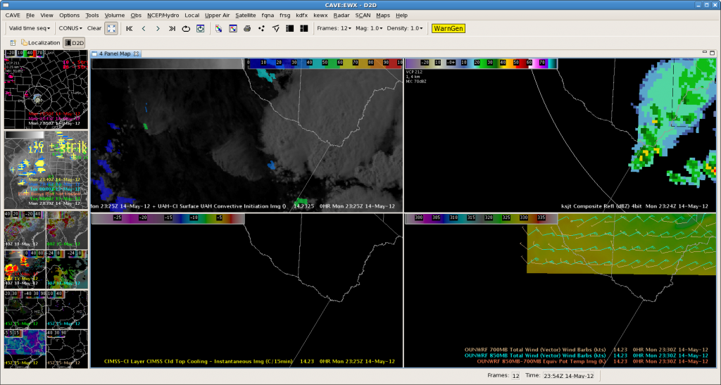
Not much going on in EWX as accurately portrayed by nearcast (theta e difference product) showing max instability just across the border in Mexico. Very nice looking convection over there and an outflow boundary over there kicking up quite a bit of dust.
The boundary/dust storm did trigger a tracked object on the UAH CI product.
Lightning Jump Project: Status Update & Summary (so far)
It has been unseasonably quiet in all of the LMA networks the past few days; unfortunately, the upcoming week does not look too promising either. In the meantime, below is a summary of severe/near severe activity in any of the networks during the project so far including the date/time & corresponding networks…
Note: No systematic verification of jumps has been processed for any of the cases.
April:
4 Apr 2012 – NALMA: approx. 2300 UTC (possibly out-of-range).
5-6 Apr 2012 – NALMA: 2300-0100 UTC.
9-10 Apr 2012 – WTLMA / OKLMA: 2100-0200 UTC (possibly out-of-range for both networks).
12 Apr 2012 – WTLMA: 0100-0500 UTC.
13-14 Apr 2012 – OKLMA: 1900-0500 UTC.
15 Apr 2012 – WTLMA: 0300-0500 (& 14 Apr OKLMA, 2100+ UTC, likely out-of-range)
17 Apr 2012 – NALMA: 1900-2100 UTC (possibly out-of-range)
20 Apr 2012 – WTLMA/OKLMA: 0000-0300 UTC
20 Apr 2012 – FL-LDAR: 1900-2300 UTC
22 Apr 2012 – FL-LDAR: 0700-0800 UTC.
25 Apr 2012 – WTLMA: 0000-0300 UTC (possibly out-of-range).
26 Apr 2012 – WTLMA: 2200-2300 UTC (possibly out-of-range).
27 Apr 2012 – NALMA: 0000-0100 UTC (possibly out-of-range).
29 Apr 2012 – WTLMA/OKLMA: 0000-0700 UTC.
29-30 Apr 2012 – WTLMA: 2300-0500 UTC.
30 Apr / 1 May 2012 – WTLMA/OKLMA: 2100-0500 UTC.
May (as of 2245 UTC on 14 May 2012):
2 May 2012 – DCLMA: 2000-2230 UTC.
3-4 May 2012 – DCLMA: 2100-0200 UTC.
4 May 2012 – DCLMA: 1600-1700 UTC.
6 May 2012 – NALMA: ~1100 UTC.
6-7 May 2012 – NALMA: 1700-0100 UTC.
7 May 2012 – NALMA: 1900-2100 UTC.
8 May 2012 – NALMA: ~1800 UTC (possibly out-of-range).
14 May 2012 – FL-LDAR: (likely non-severe and under jump threshold; HWT Spring Experiment/EWP operating in domain).


