Comparison of ENTLN and GLM Lightning Data

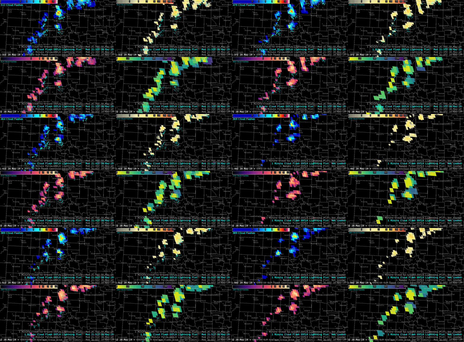
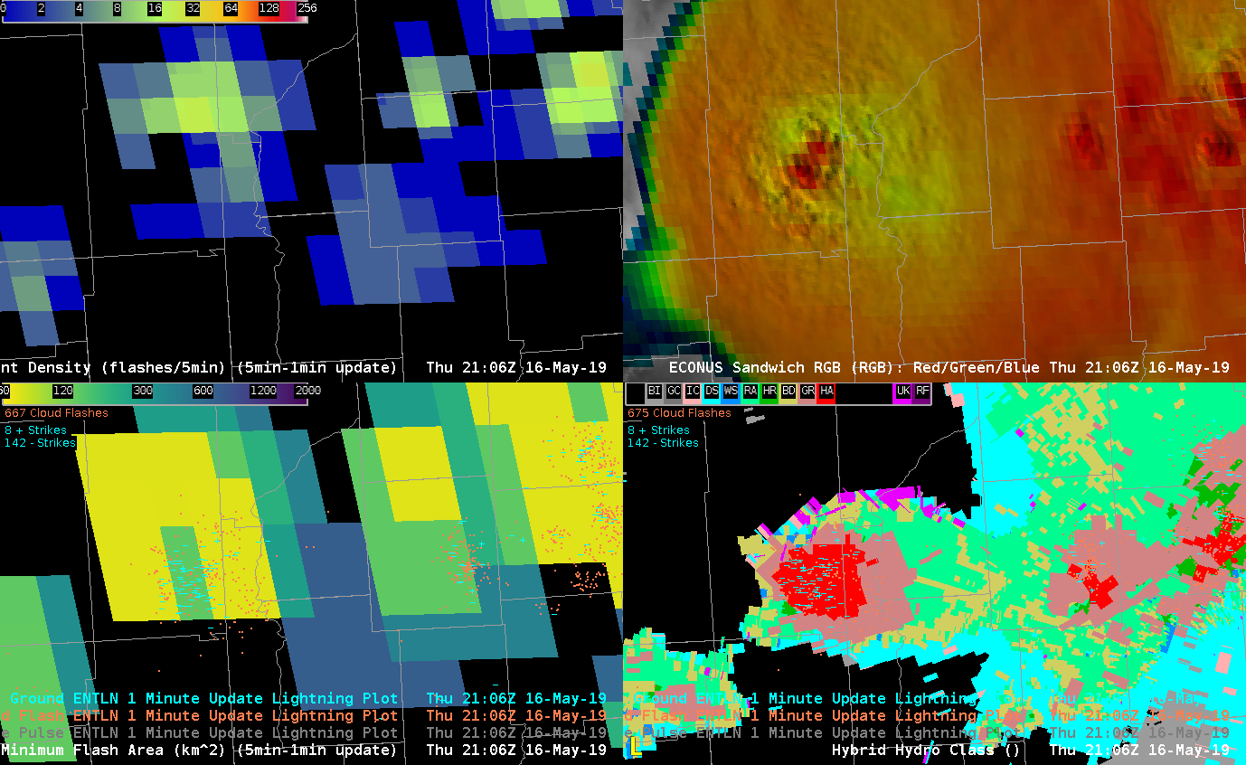
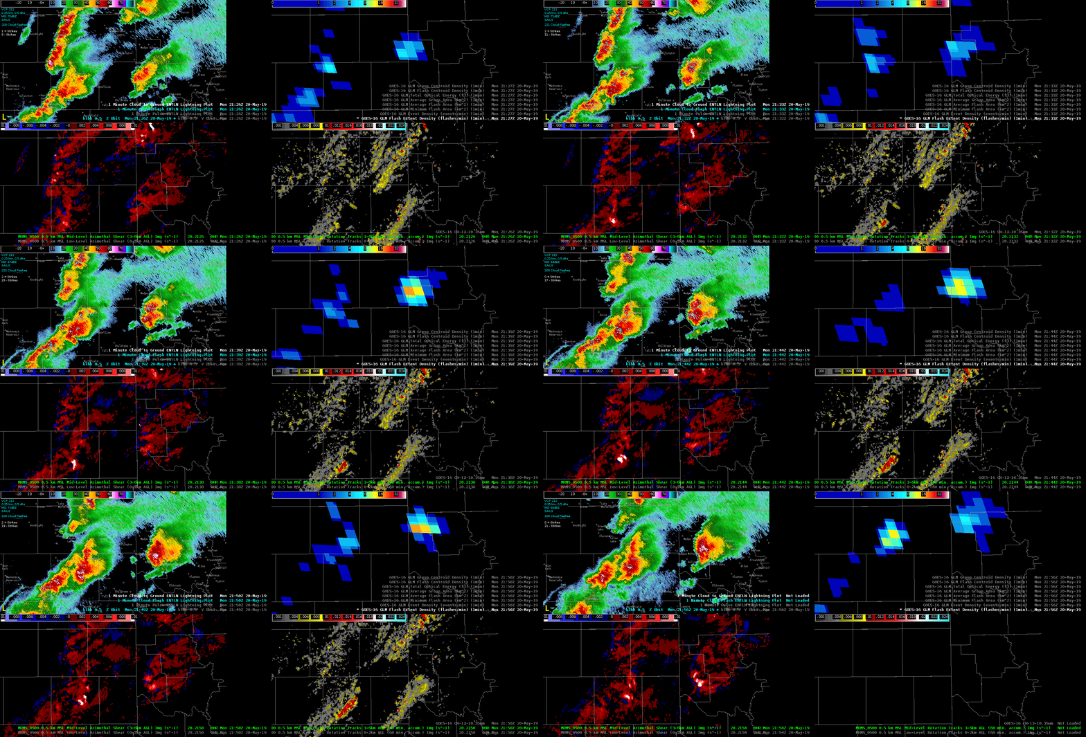
Storm of interest is the supercell NW of Childress, TX.  Increase in ENTLN lightning occurred before a substantial increase in the 0-2 km and 3-6 km MRMS azimuthal shear. The signal in the GLM flash extent density product was muted in comparison to ENTLN data. ProbTor went from 12% at 2124Z to 52% at 2130Z.  At 2140Z, ProbTor peaked at 91%, which corresponded with the maximum 0-2 km MRMS azimuthal shear (0.20 S-1) associated with this rotation track. I frequently use the ENTLN data in operations and am trying to incorporate GLM products.

So far, the most useful GLM components, largely because of their visual representation and relationship to updraft growth rate or intensity, are the flash extent density and total optical energy.  These two products helped me maintain situational awareness on individual storm intensity trends.  Plotting the flash extent density and total optical energy in a four panel with GOES IR imagery and base radar data, I can quickly decipher which storms pose the greatest risk for severe weather.  Roy

Lowest-Level Rotational Velocity Product Comparison

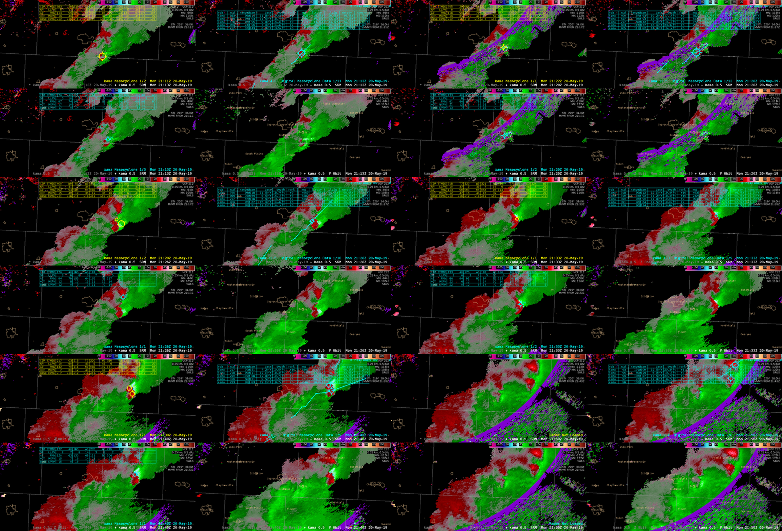
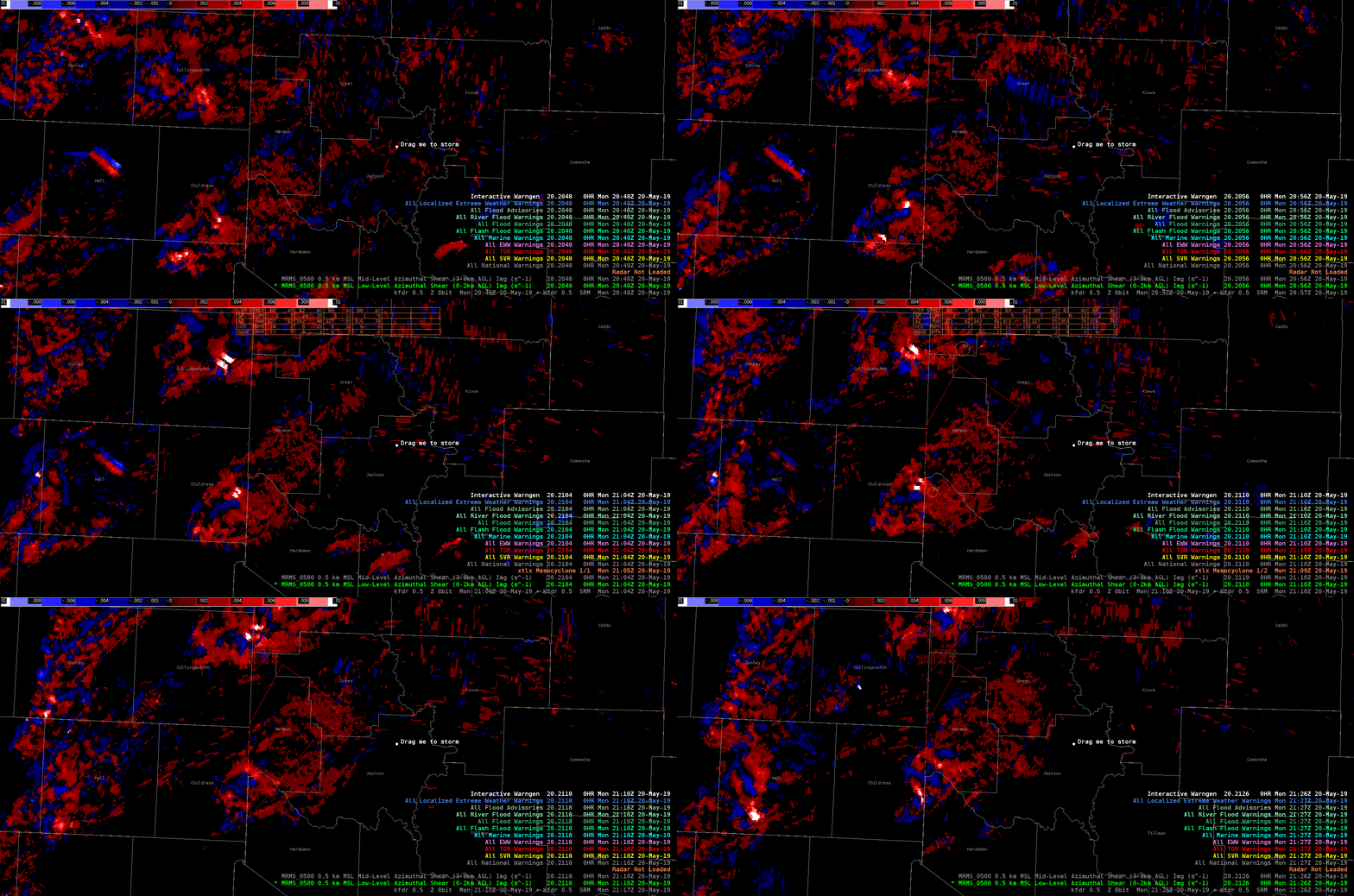
I’ve been trying really hard to come up with some useful observations regarding the three mesoscale detection algorithms, but struggling to come up with anything insightful. A loop all 3 algorithms (MDA top left, DMD top right, NMDA bottom left) is below. The three algorithms are overlayed on SRM and the bottom right panel is base V.

Two persistent mesoscyclones in Hall county are largely well-detected by all 3 algorithms with only minor differences is tracking. A relevant limitation for this storm is range from the radar (>65 nm) and interference from range folding. The New Mesocyclone Detection Algorithm (NMDA) is limited in its latency, making its real-time applicability limited. I rarely use the mesoscale detection algorithms operationally because I find the table difficult to read. It is easier for me to interrogate the radar data than to use the MDA or DMD. Perhaps reformatting the data display would help make the NMDA more usable.

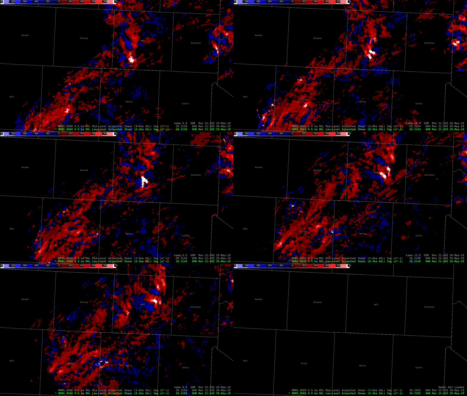
On the contrary, the AzShear product performed remarkably well on this particular cell. It is more visually obvious and helps focus forecaster attention in a very simple way. The loop is below:

For the purpose of identifying low-level rotation, AzShear does a much better job than any of the mesocyclone detection algorithms with respect to low-level rotational velocity. The mesocyclone detection algorithms do not add much value to my warning decision process. -Atlanta Braves

Observations from Hail-Producing Storms in the Panhandle of Texas

Today’s environment is ideal for all types of severe weather. Unsurprisingly, the ProbHail algorithm indicates high probabilities of hail with most of the storms. Here I’ll use dual-pol interrogation to investigate ProbHail performance and include a few  additional observations.

Of particular note is the evolution of a storm object in the mind of the ProbHail algorithm. The algorithm seems to handle merging and splitting remarkably well for both the northern-most storm and the line of storms that results at the end of the loop in the SE part of the CWA. This performance in a highly-complex radar display is promising for more isolated storms. Let’s zoom in on the southeastern storm near Wellington:

The reflectivity signal in the hail core is not particularly anomalous (~50 dBZ), but ZDR near zero and reduced CC indicate high confidence in hail production at the surface. The ProbHail shows a 98% chance of hail in that storm. We would expect high confidence and this algorithm performs well. Baseball size hail was reported with this storm! -Atlanta Braves


Merged Advanced TPW Too Low in Cloudy Areas this Afternoon

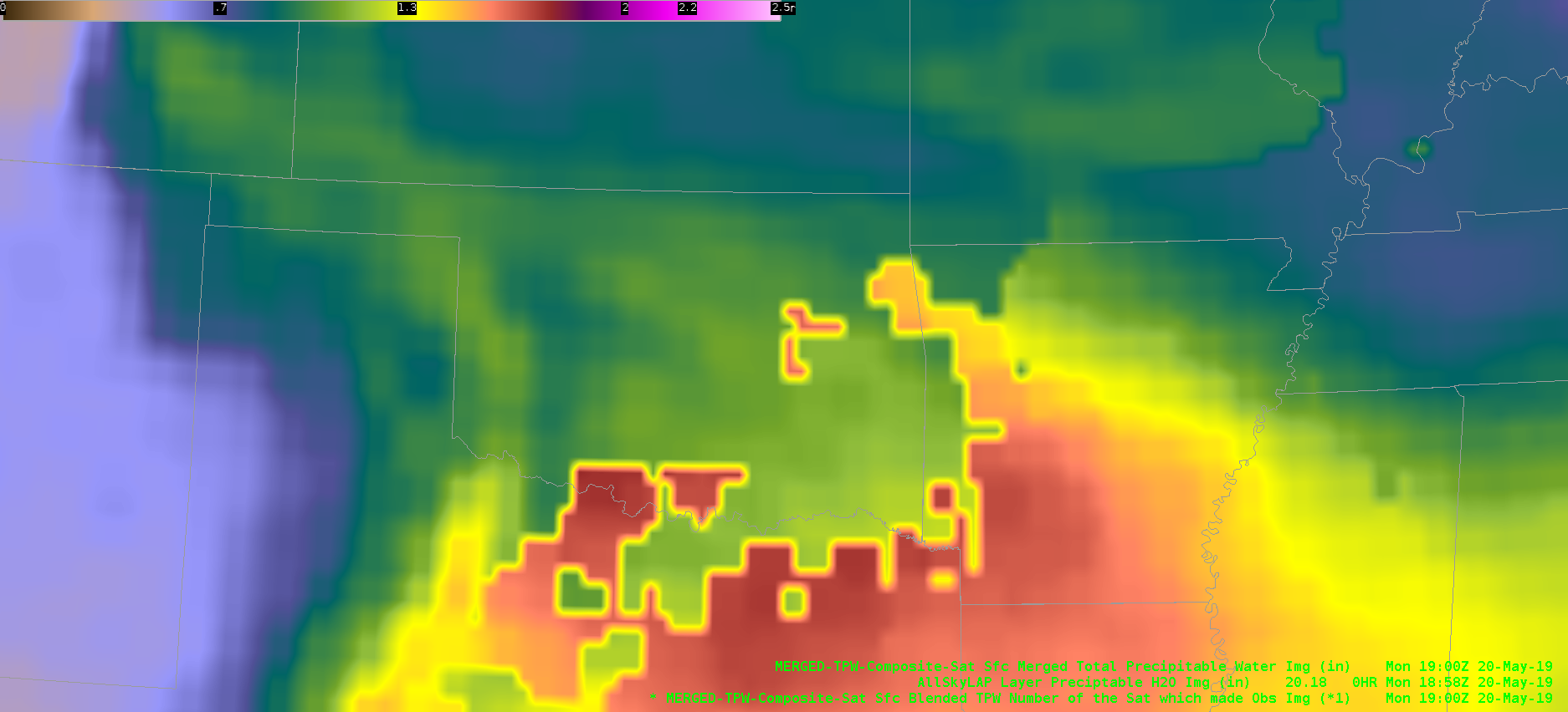
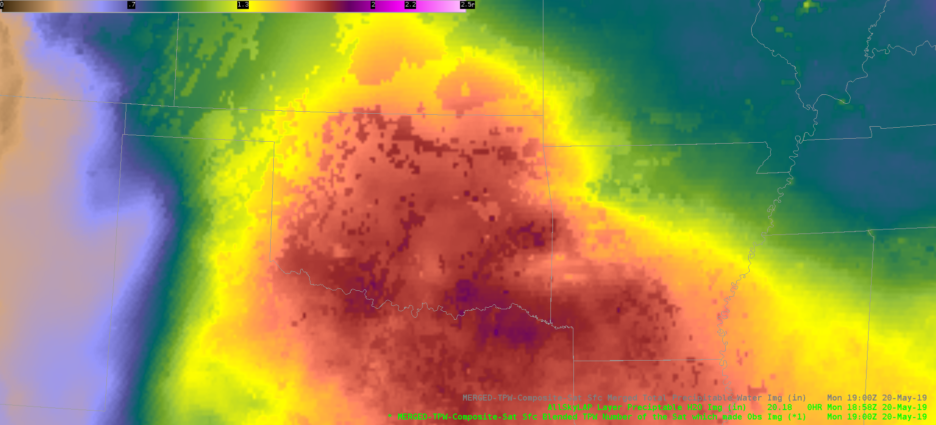
The Merged Advanced TPW is underdoing PWAT values in cloudy areas over central Oklahoma. There are discontinuities where it goes from clear to cloudy skies.

The 18z KOUN RAOB sampled 1.52″ PWATs, while the Advanced TPW is showing only around 1.00″.

Meanwhile, the All Sky LAP PWAT appears to be better representing reality, with PWATs around 1.70″

Ron Dayne

Using All-Sky LAP to Identify Areas of Destabilization

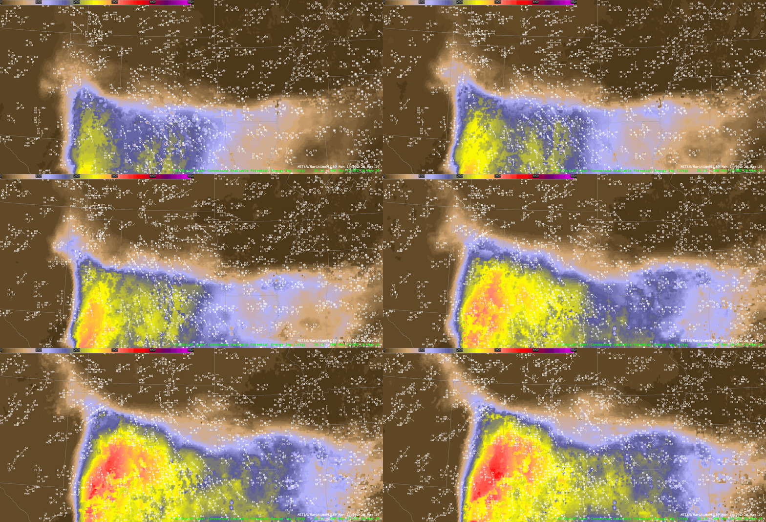
Rapid destabilization is occurring over portions of northwest Texas and southwest Oklahoma. This can be seen in the all-sky LAP CAPE product:

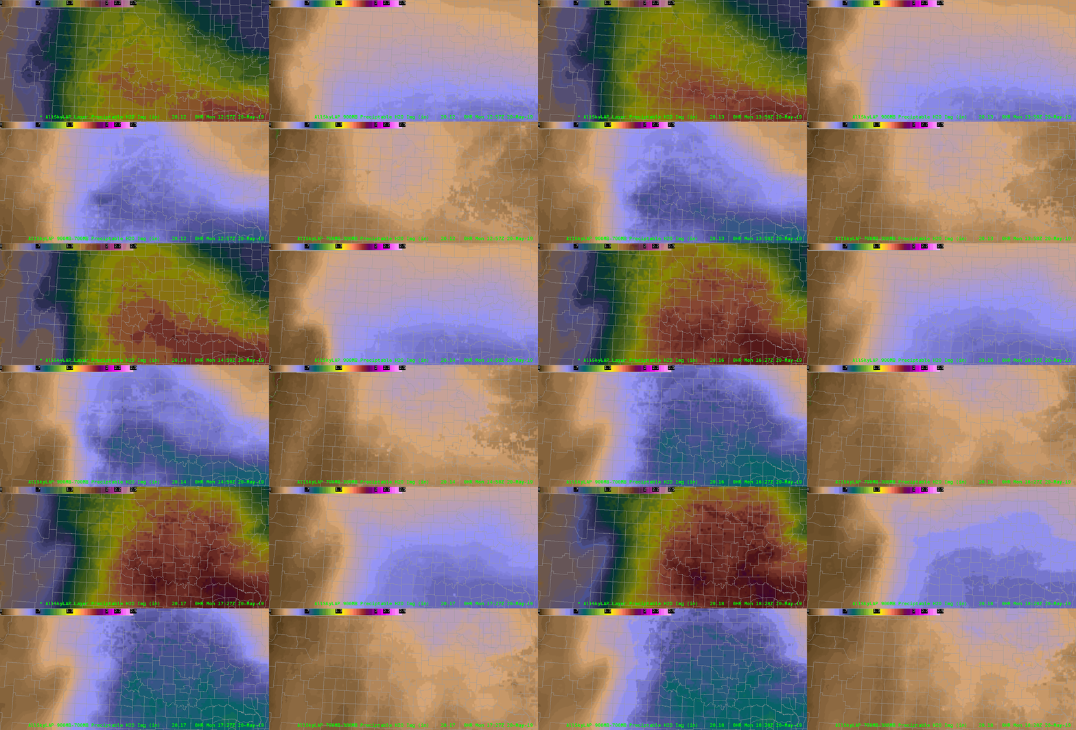
Looking at a four-panel image of all-sky LAP precipitable water for the entire layer, as well as the surface to 0.9 sigma, 0.9-0.7 sigma, and 0.7-0.3 sigma levels, we can see why this is the case. The top-right image shows low-level moistening in the surface to 0.9 sigma layer, which is confirmed by surface observations showing dewpoints rising from the low-60s to the low-70s over the course of 6 hours. Meanwhile, the bottom right image shows midlevel drying associated with steeper midlevel lapse rates advecting into the region.

Ron Dayne

GLM Flash Event Density vs Centroids

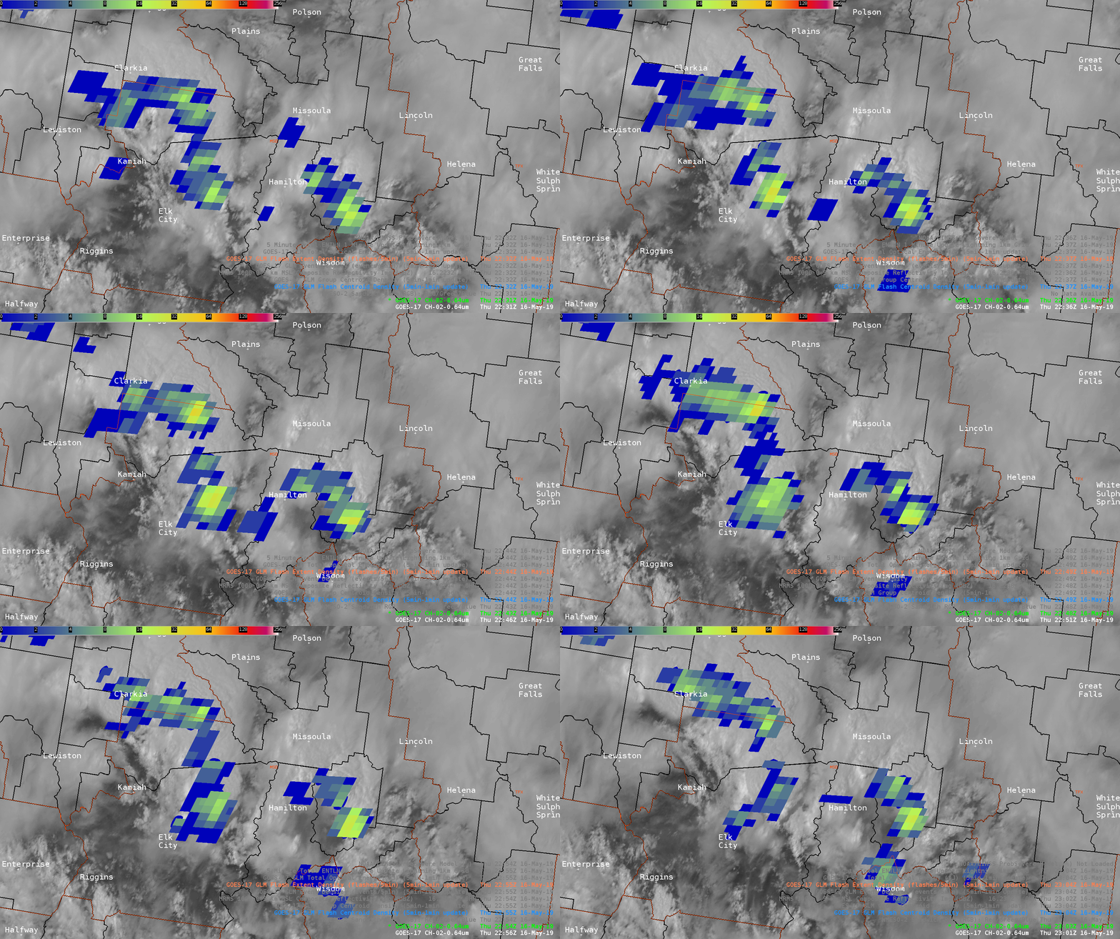
Viewing some marginal severe storms in northern Idaho from GOES 17 in this example. In the first image is the traditional Flash Extent Density product. However, have modified the color curve (User -> Awips -> GLM_FED_DC) to provide some enhancement to the lower values as detection efficiency seems to remain lower over ID/MT as we have found in MT/WY in previous days. While this is overall helpful in picking out some stronger storms, the large 8km grid boxes take up a lot of screen real estate when viewing over background satellite imagery.  Also the strongest storms are somewhat lost in the lightning data of the surrounding storms.

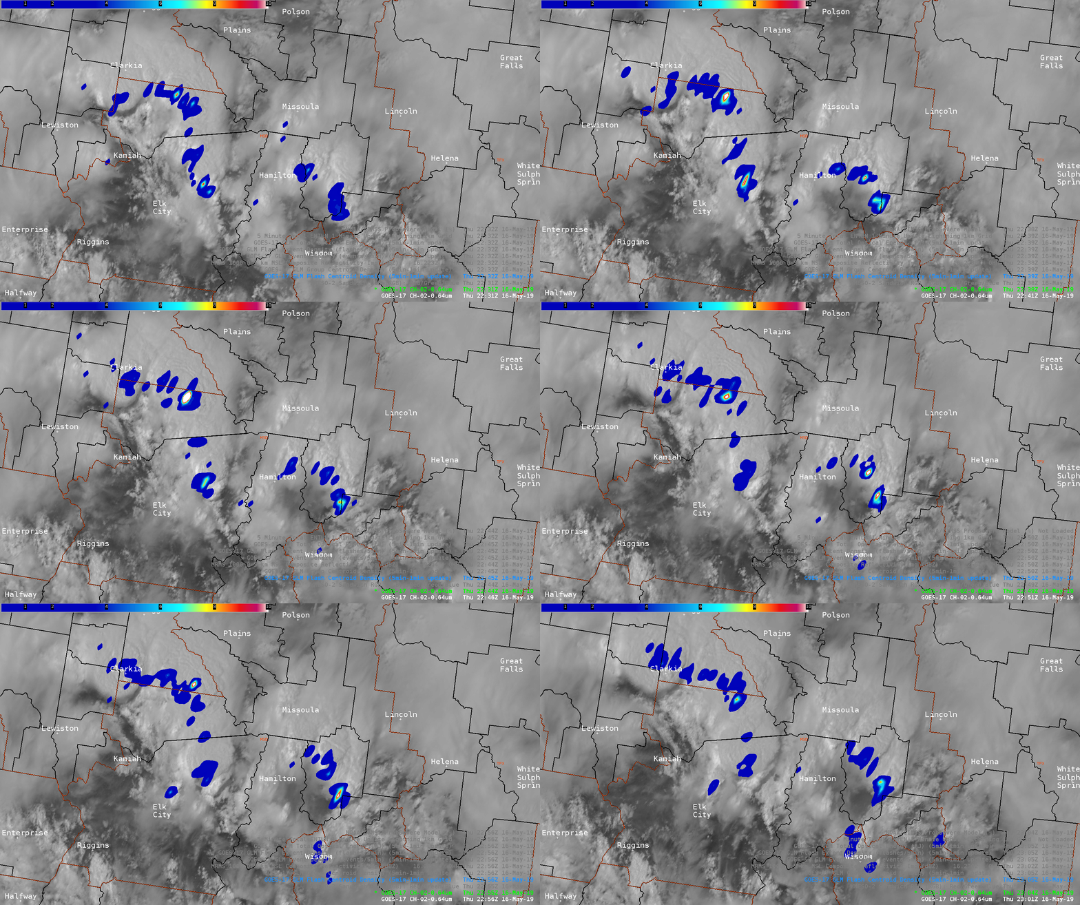
As an experiment, tried loading up the Flash Centroid Density Product. By turning on the interpolation and setting the max value to 10, this really helped to isolate and highlight the strongest cells. Of note is the cell moving toward the north, west of Missoula. Picking out the lightning jump in this storm was easier viewed on this Flash Centroid Density product, and comparing its strength to surrounding storms was also easier. It is also helpful that the product has overall small footprint.

— warmbias —

A Day to Compare

I initially wanted to compare model data, especially skew-t’s, that I usually use, to the NUCAPS products. My purpose was to  ascertain the feasibility of replacing or supplementing  point based model products with NUCAPS. As I was unable to access the model data I use daily I decided to compare NUCAPS with NAM and GFS.

First the comparisons in the rapidly changing thunderstorm environment in which I interrogated a large MCS over the Illinois/Indiana border.

I compared NUCAPS 18z skew-t (from clear air area) to NAM and GFS skew-t’s, at the same time and location.
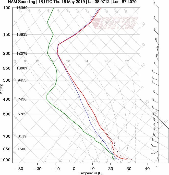
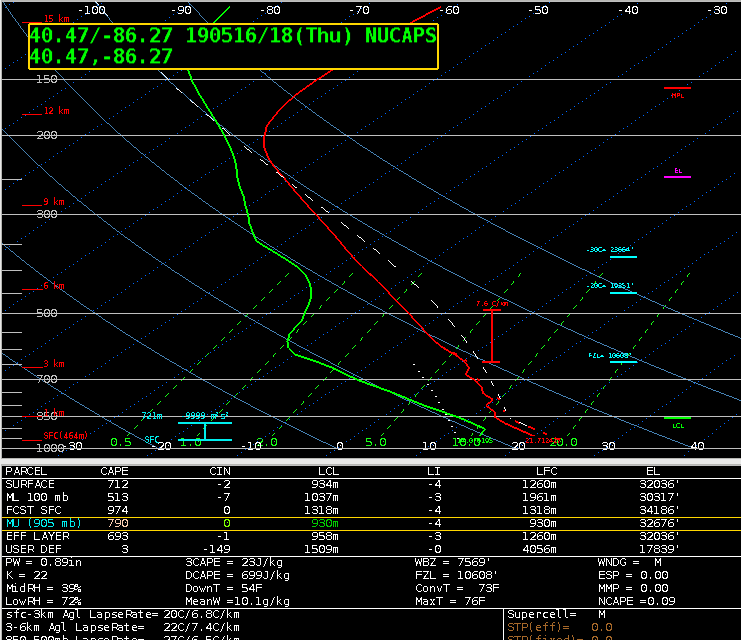
NUCAPS presents a much more stable and dry environment than the model skew-t shows, and also much more stable than the actual current environment considering this storm has already produced hail, tornadoes and heavy rain.
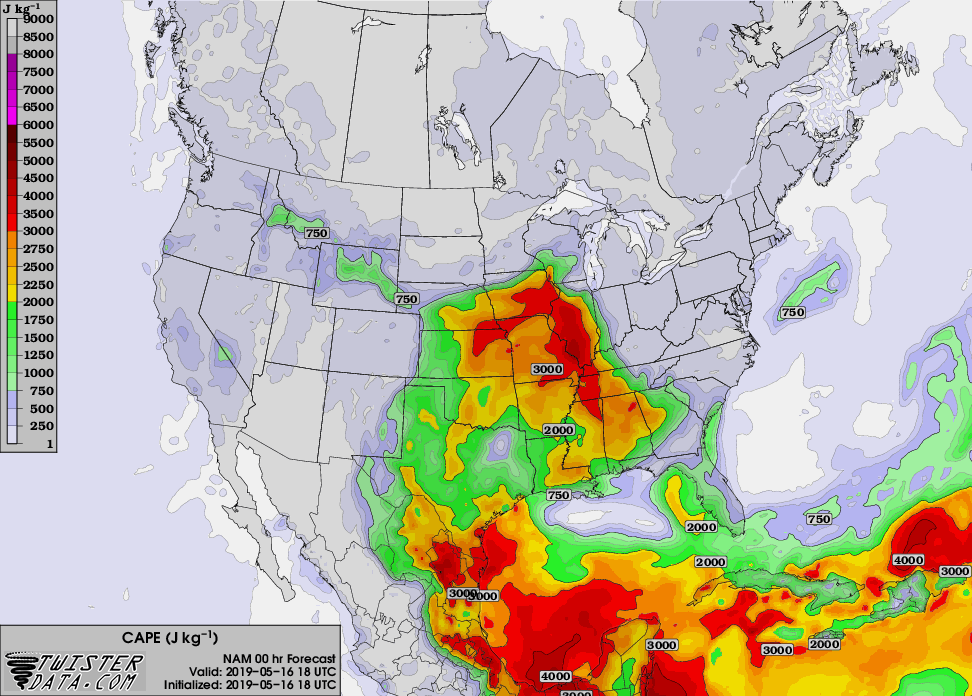
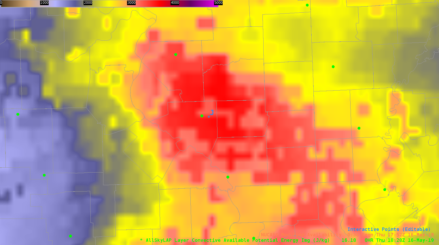
Next, I compared an AllSkyLAP CAPE img at 18z (point J on the above picture),  to a NAM CAPE map over the same area/time. AllSkyLAP seems to be about 500J/kg higher than the NAM CAPE map.

Finally, I compared a NUCAPS CAPE img and the NUCAPS Skew-T at 18z over the same area and there was a huge variance. The skew-t was higher than the CAPE img by over 1300J/kg.

Lastly I decided to compare NUCAPS and model data from a stable area, non changing area.

I compared an observed skew-t from the KS/OK boarder to a NUCAPS skew-t. There is a one hour difference in the data but for the sake of this comparison I think this will work. 
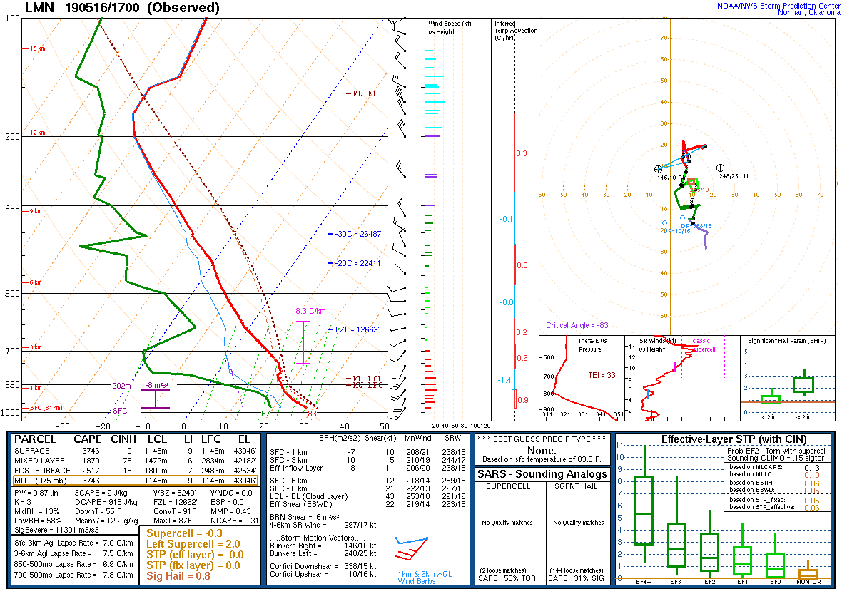
The observed skew-t is a relatively dry column with .87pw and a T/D of 31/20C  at the surface and 10/-20C at 700mb. The CAPE is at a ridiculous 3746 J/kg. But with no moisture, lifting mechanism nor shear I wouldn’t expect development. When compared to the NUCAPS skew-t one can see a definitive difference. CAPE on the NUCAPS is at 0 with T/D at 24/11C at the surface and 7.9/-9.3C at 700MB which is a huge departure from what the observed skew-t showed…but how would the observed skew-t hold up to a model skew-t?
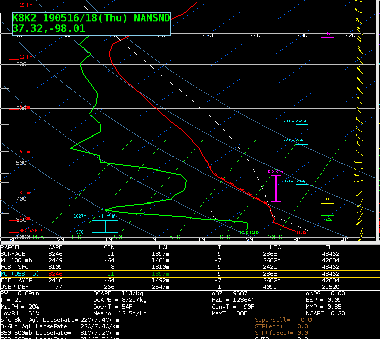
NAM 18Z model skew-t compared to the 17Z observed skew-t from the same area shows 28/17C SFC temps, only 3C off from the observed skew-t and at 700MB NAM shows 9.5/-8C only .5C off the temperature and 11 off the DP. Also, CAPE was much closer than when compared to the NUCAPS where SFC CAPE on the NAM is 3246J/kg and 3746J/kg on the observed.

Overall, after this small sample size of data, both severe weather and in clear weather, I believe that I would continue to use NAM/GFS over NUCAPS for my point based forecast needs.


***DESMOND***
FED Gives Precursor to Strenthening Supercell, but…

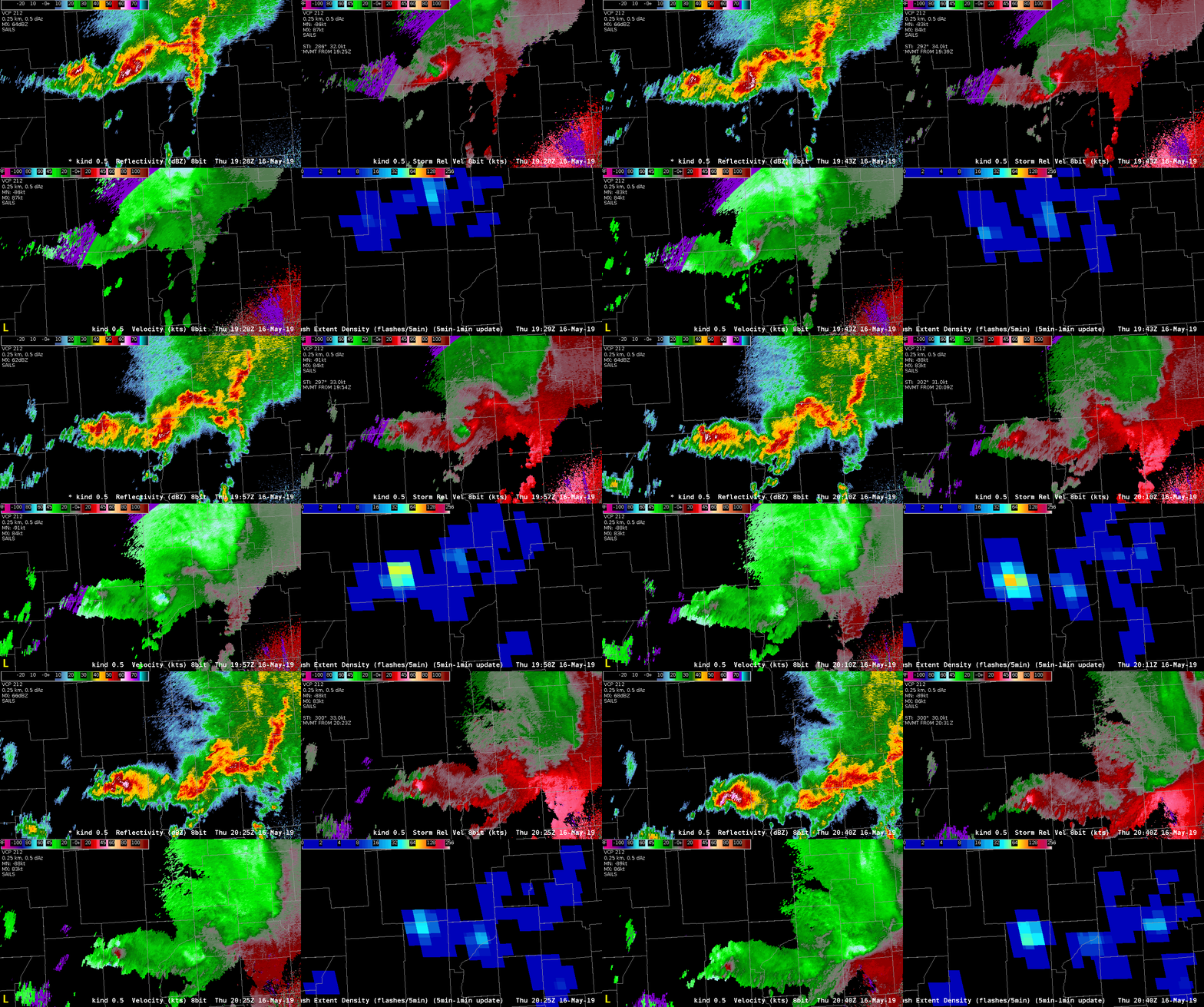
Watching the last storm in the line that is still in Illinois, the Flash Extent Density values started climbing rapidly (between 1947Z and 2020Z), which suggested to me that I should start paying attention to it. Upon interrogation, the velocity started to change from being more convergent to rotational, and eventually it appeared that a tornado was likely per the KIND radar. Interestingly, that was when the FED fell rapidly (2022Z).

Clockwise from Top Left: 0.5 KIND Reflectivity, 0.5 KIND SRM, 0.5 KIND Vel, FED

There was also an increase in FED after the tornado signature became less intense, but when it wrapped up again, the FED decreased again (not shown).

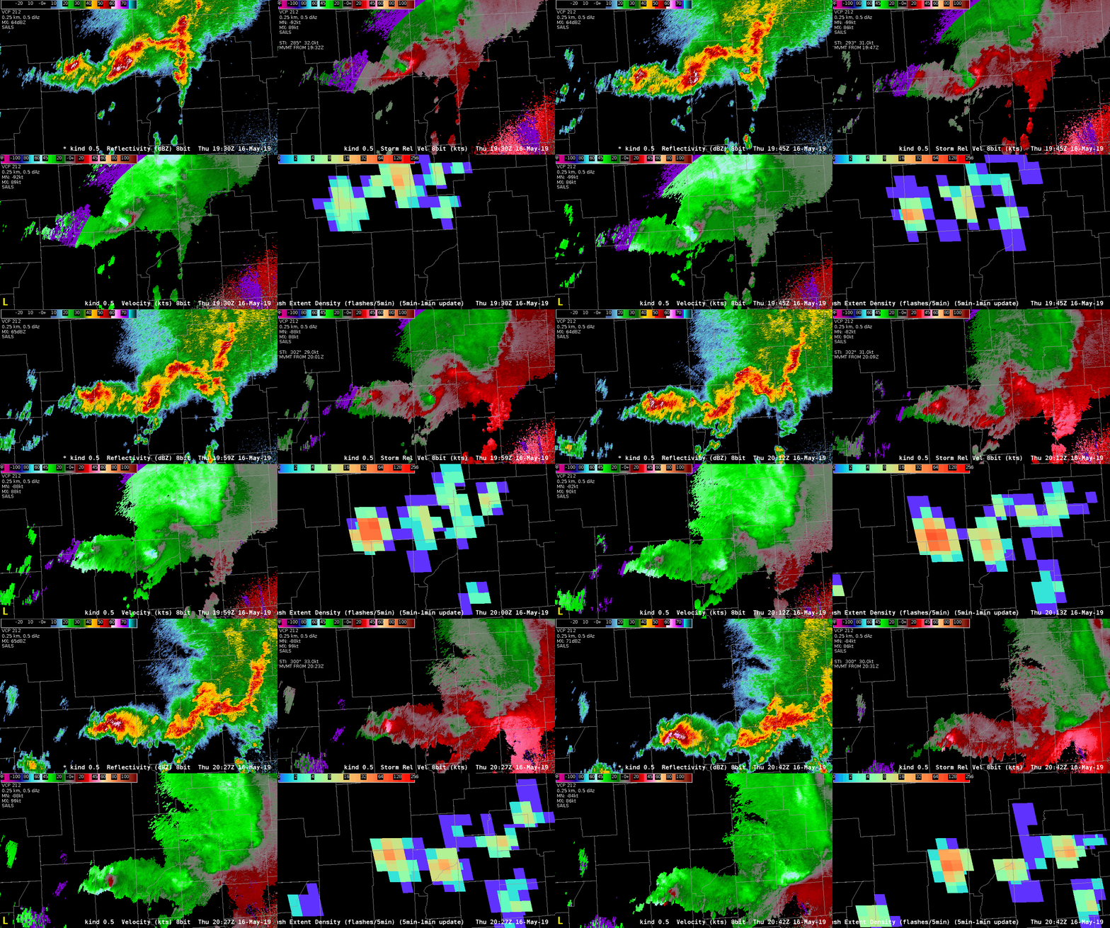
Interestingly, I also looked at these same data with the new color curve that Jonathan and Kristin worked on today, and the increase and decreases in FED were not as clear, and I don’t think it would have drawn my attention as quickly. Perhaps the lower values need to be more muted or less bright, but still within the same the rainbow color curve.

Clockwise from Top Left: 0.5 KIND Reflectivity, 0.5 KIND SRM, 0.5 KIND Vel, FED

-Tempest Sooner