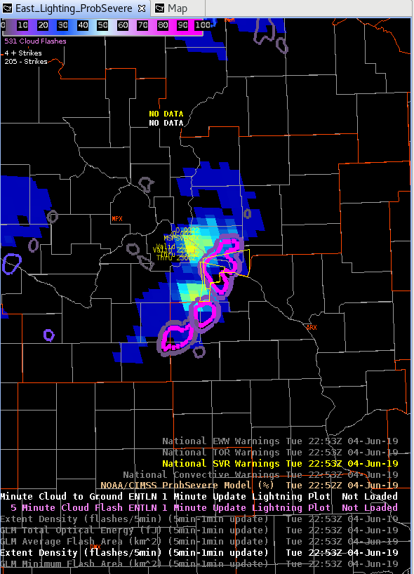
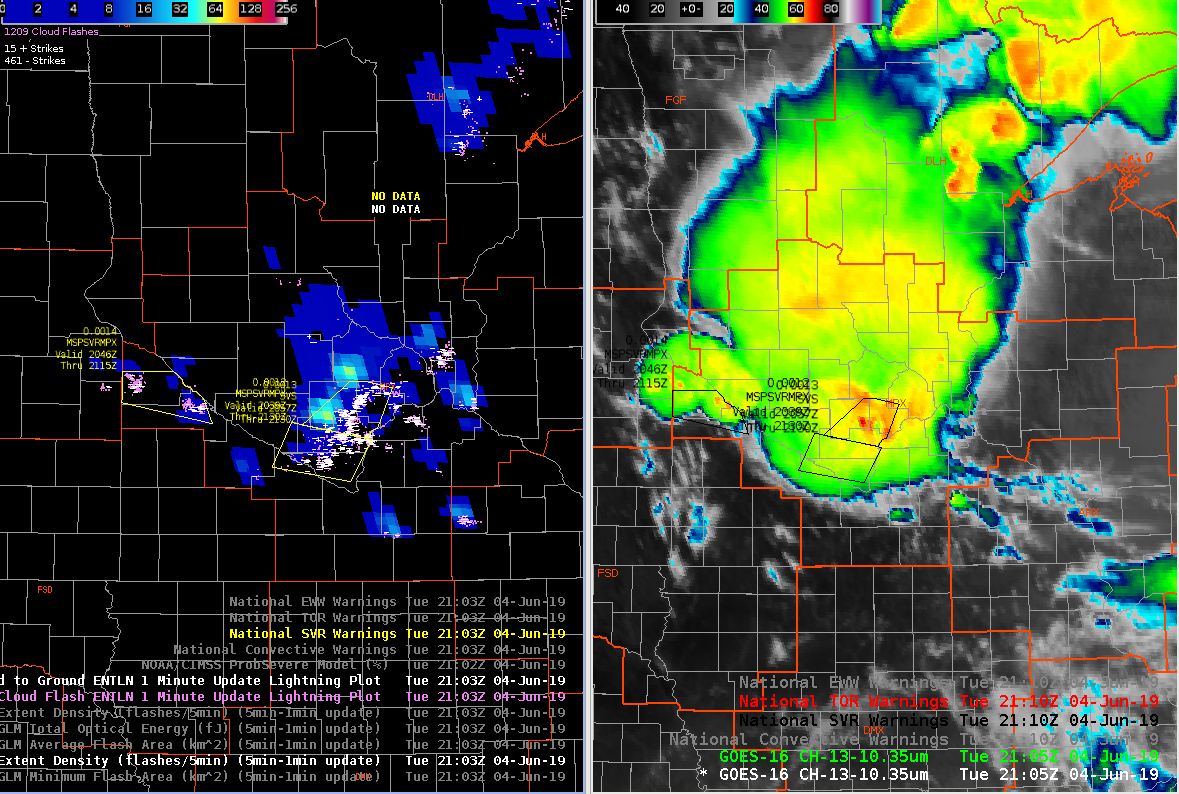
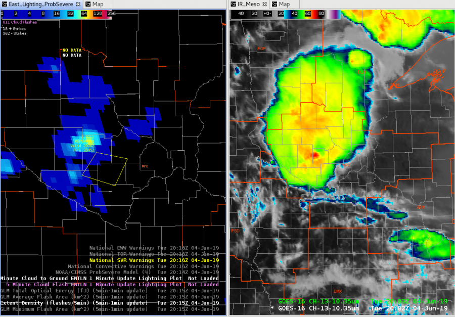
Highest FED and bright TOE…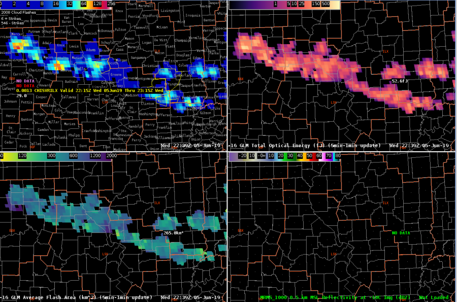
…for the cell in Monroe County MO. Cell is not that tall however, and ProbSevere is not too excited about it yet.
Charley
Official websites use .gov
A
.gov website belongs to an official government
organization in the United States.
Secure .gov websites use HTTPS
A
lock (
) or https:// means you’ve safely connected to
the .gov website. Share sensitive information only on official,
secure websites.

Highest FED and bright TOE…
…for the cell in Monroe County MO. Cell is not that tall however, and ProbSevere is not too excited about it yet.
Charley
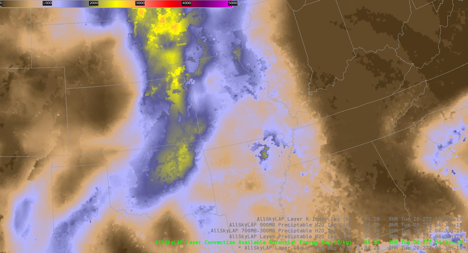
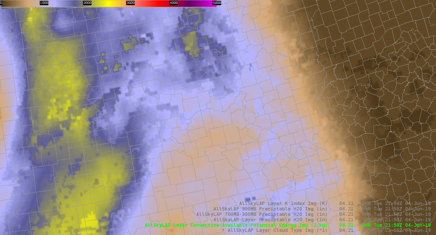
Right now I’m analyzing the various new products to nowcast where and when storms will intensify. Currently I’m comparing ALLsky cape to the mesoanalysis from the spc. Right now the mesoanalysis is higher with cape compared to allsky. Over our area the it’s cloudy so the it’s taking data from the GFS.
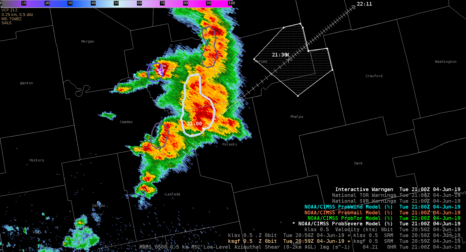
A cell in our western counties ramped up very quickly while our computers were down. Prob severe immediately directed our eye to the cell. The probsevere lined up with an uptick in vil values and velocity.
 I’m comparing the actual sounding to what’s shown on nucaps, and allsky to see what’s initializing the best. The actual sounding shows 3025kj of surface lavyer cape and 1453 of mixed layer.
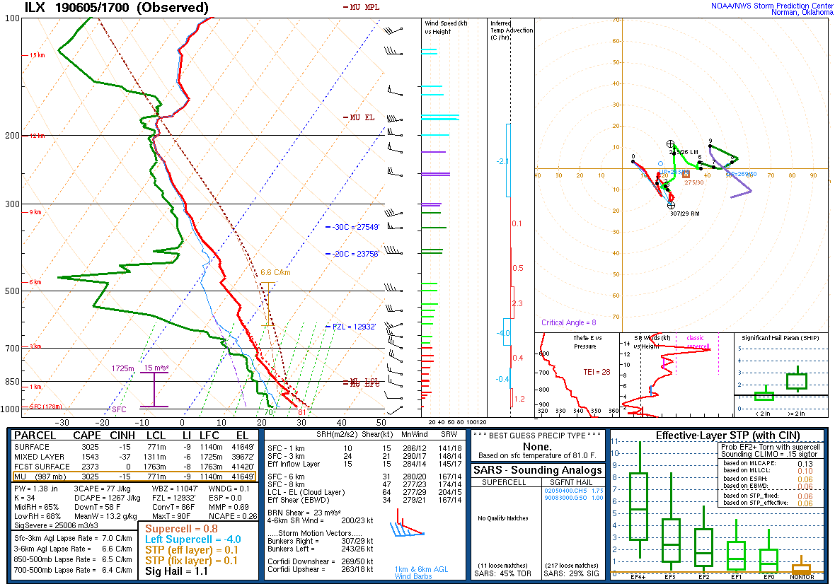
Around the same time allsky shows a similar value of cape.
The modified sounding was closest to the actual sounding with 1515kj of mixed layer cape
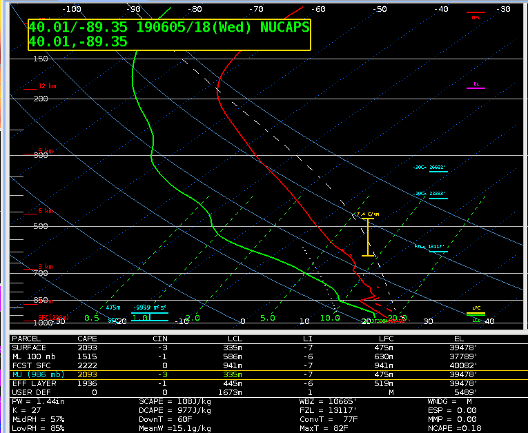
The nonmodified sounding is much lower when it comes to mixed layer and surface cape. In the case the modified sounding was more reliable and gave a more accurate picture of the current state of the atmosphere.
The all sky cape was much higher, around 2300kj.
That increase might be due to the fact that the sampled area of interest was filled in by the GFS. Whatever input the GFS was taking into might have lead to it overestimating the amount of CAPE.
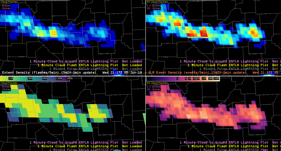
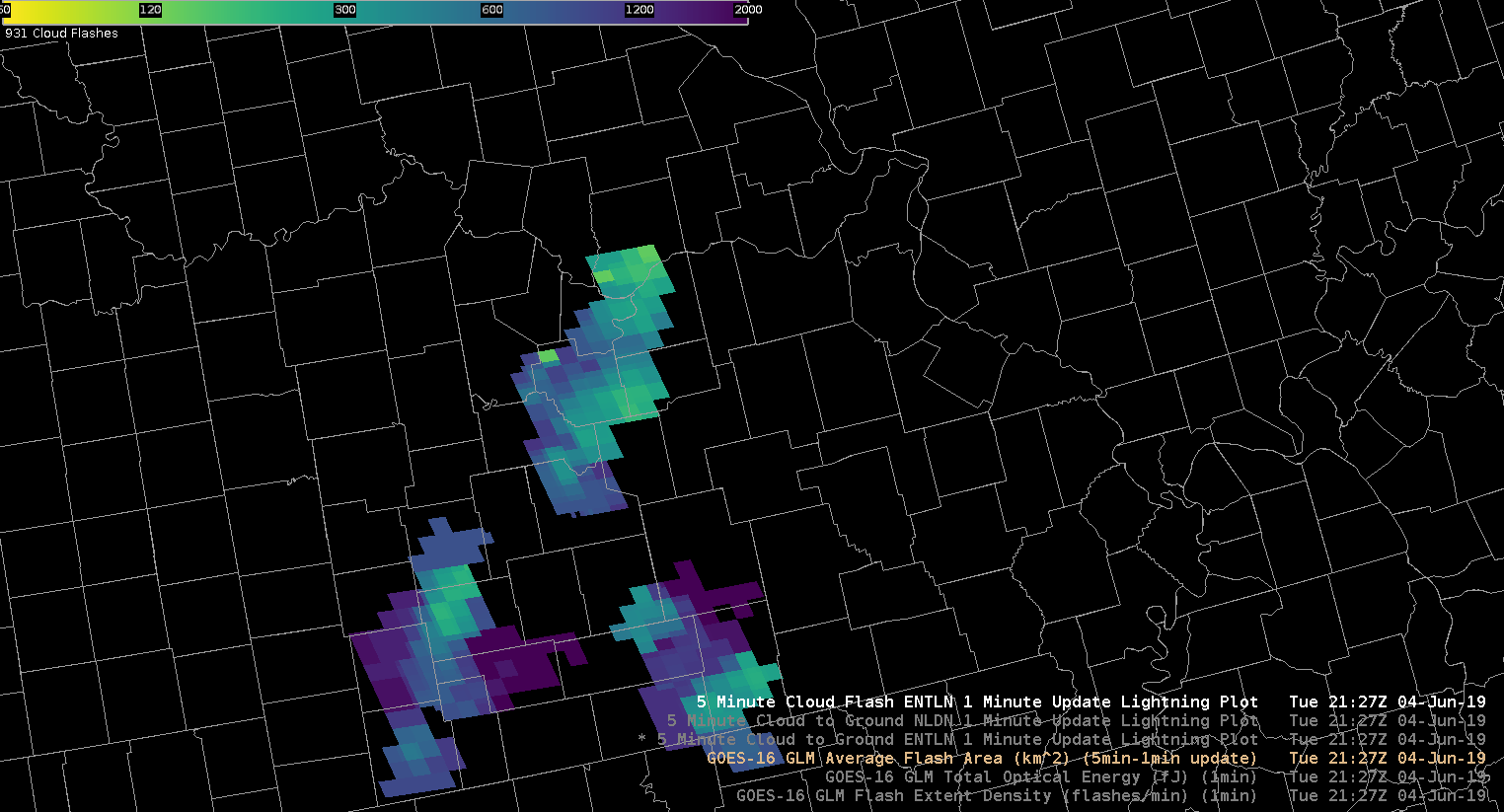
I’m also looking at GLM products to see trends with convection. The combination of event density and GLM minimum flash area help me to see the rapidly growing updrafts as well as cell that are producing hail. That’s the case right now. My warned cell is producing penny size hail.
About an hour later the FED Is starting to pick up on longer flashes, but the event density is still showing higher values. The lines up with satellite which shows overshooting tops, but storms are overall keeping their intensity. The overall trend combined with looking at stability indices aids me in nowcasting that storms will at least maintain their strength over the next hour or so.
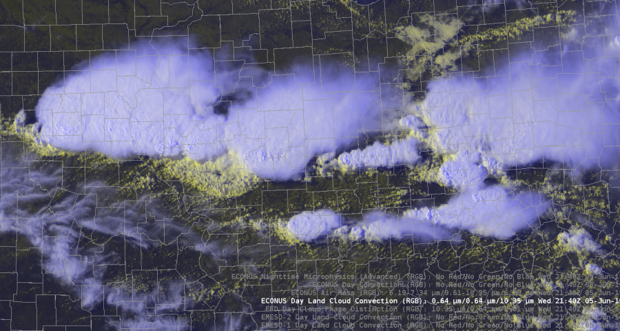
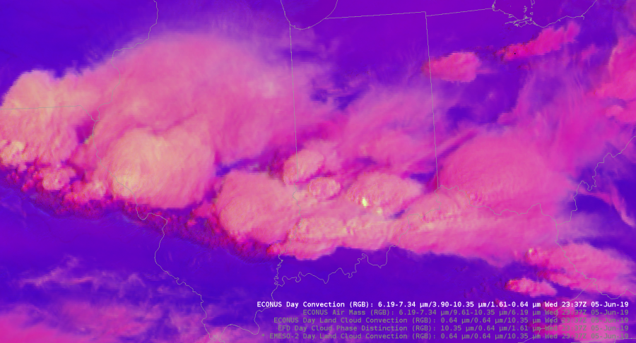
The Day Land Cloud convection RGB was helpful in analyzing different cloud tops. The color scale highlighted the thin cirrus compared to the lower thick clouds. It also dipicted the outflow boundary from our southern storms very well. It gives much more detail to the cloud types compared to the visible satellite.
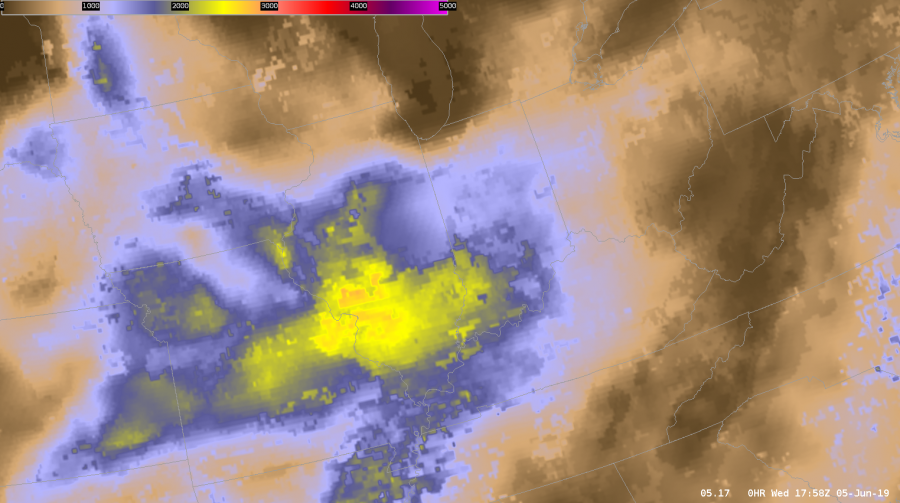
Today I also got the chance to analyze and compare the merged TPW precipital water with the allsky.
During the afternoon the PW values stayed fairly steady across the northern half of the state while moisture increased in southern Illinois.
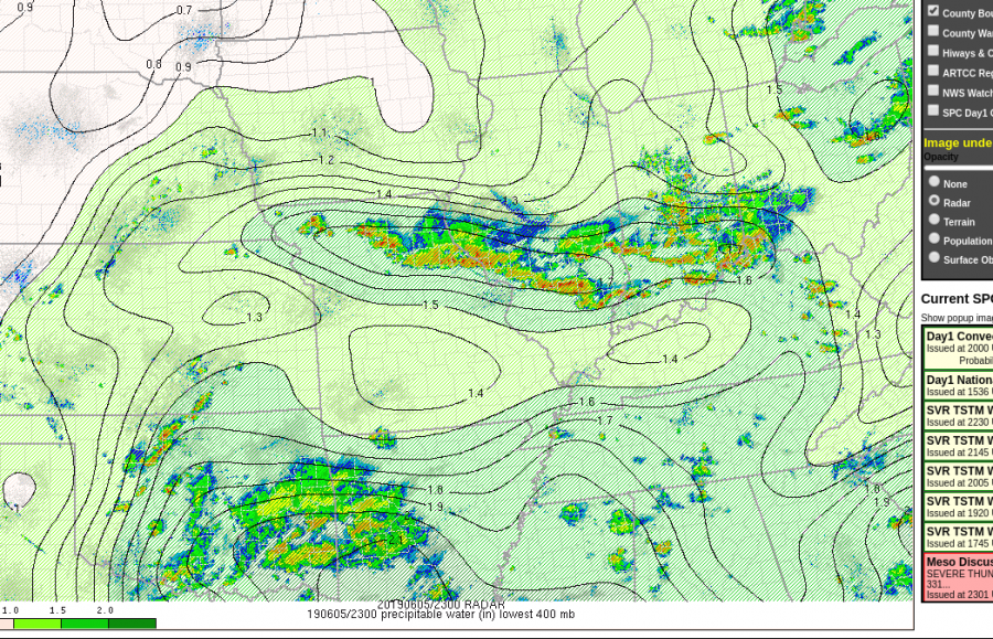
The TPW decreased PWATS to close to 1 inch as storms moved through. T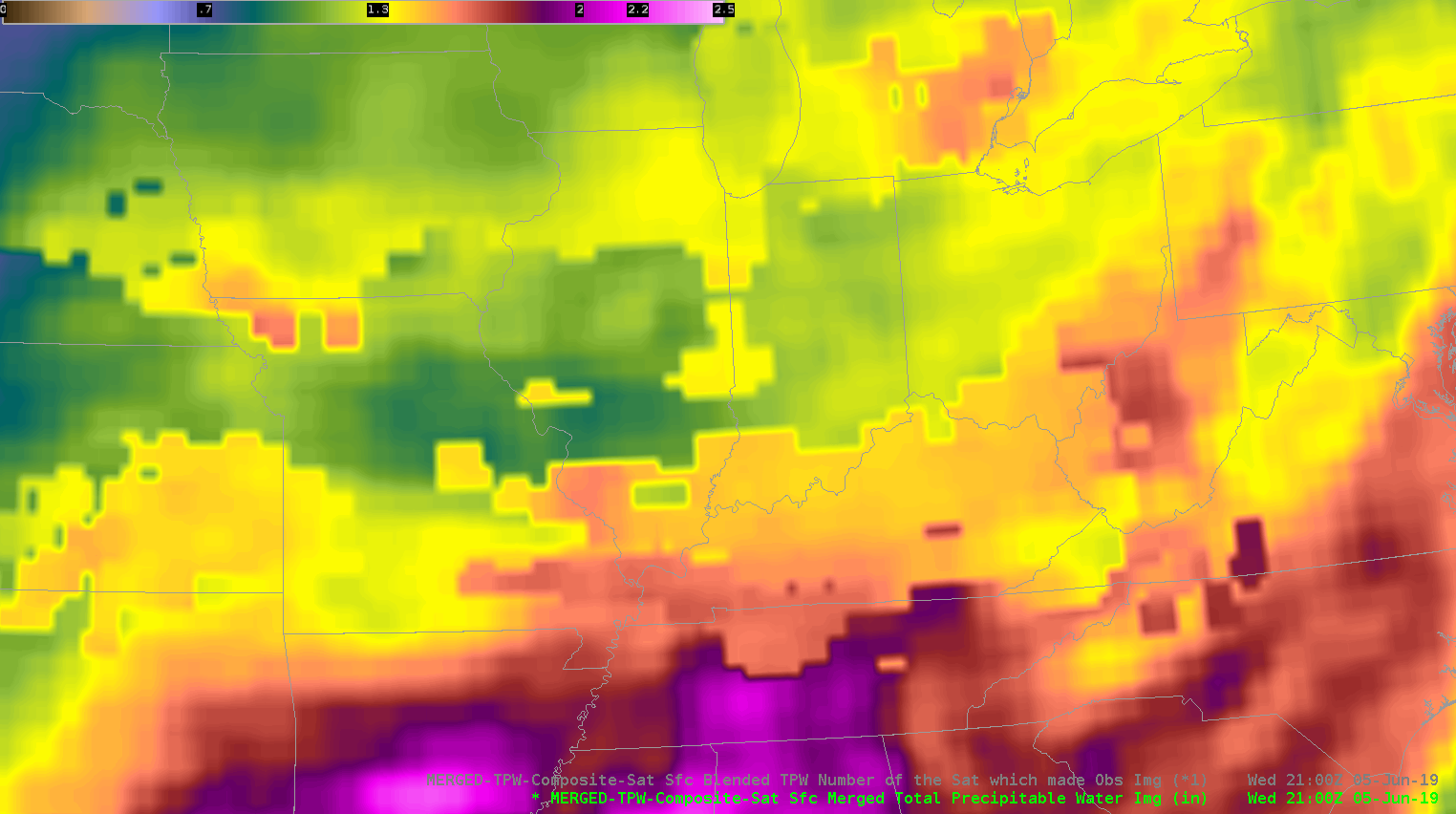
That data was sampled in a cloudy environment.
Meanwhile, the AllSky does show a decrease in PWATS but’s farther north compared to what actually happened. That data was pulled from the GFS since it was in a cloudy location. It was helpful to see how each product performed in this environment. It’s nice to have access to both in order to see which one has the best handle of the current atmosphere. That initialization helps me monitor trends and nowcast.
As storms moved south out of my DMA I used Day convection RGB just to monitor growing cells. It was clear to see the strongest storms because they had the bright yellow maxes.
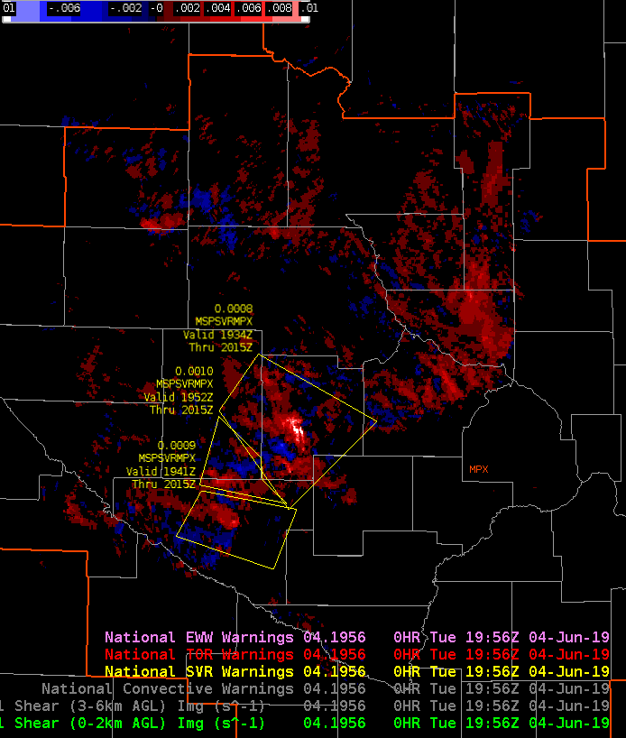
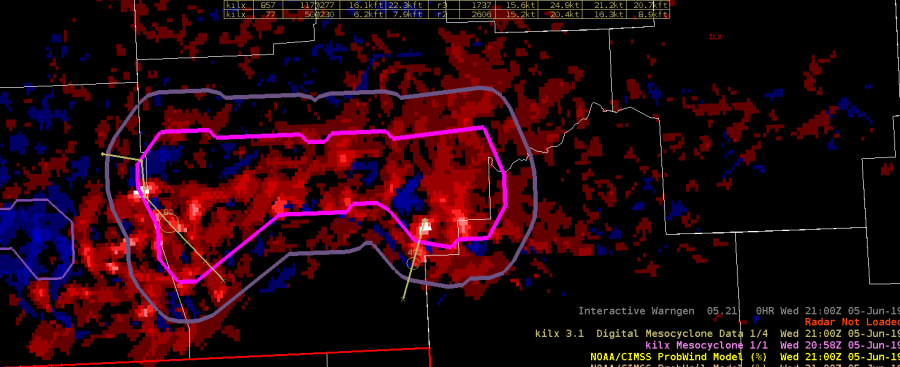
Earlier in the day was able to compare NMDA with the low level azshear. Tornadoes were’t a major threat, but the NMDA did line up with peak areas of Azshear. That storm did produce wind damage, and strong wind gusts.
Taylor Johnson.
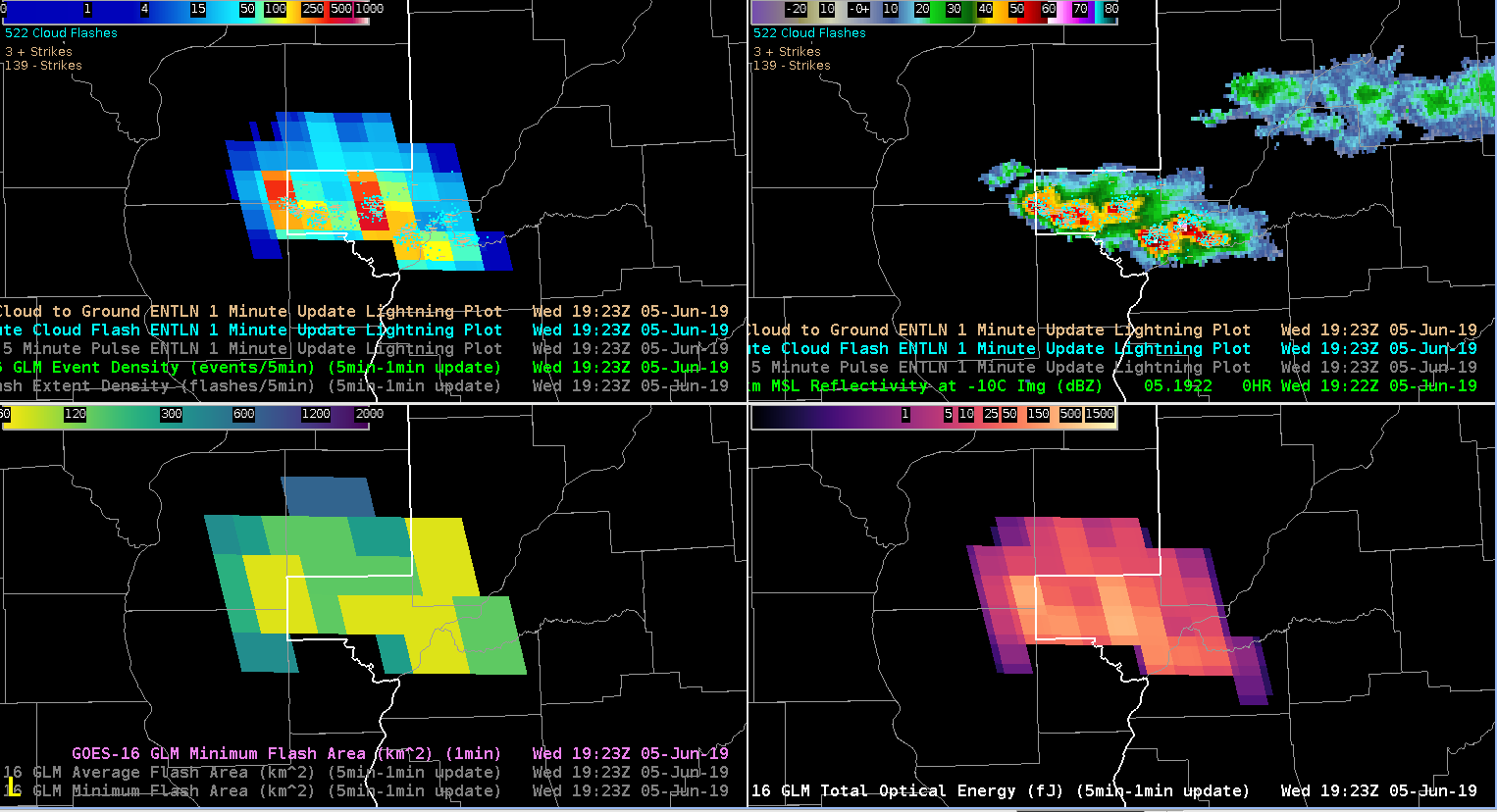
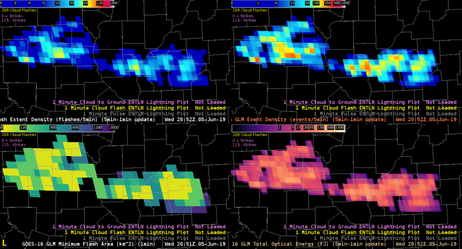
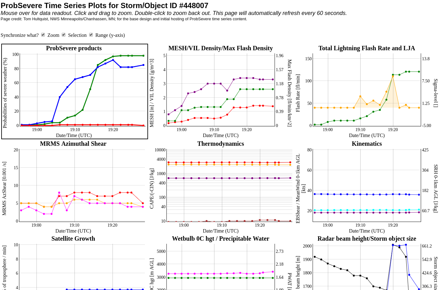
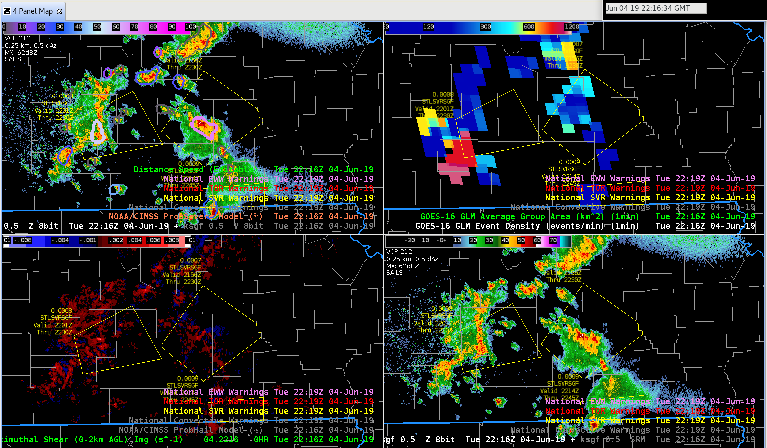
Had a unique opportunity to watch a line of strong to eventually severe storms ignite and strengthen rapidly along an old outflow boundary this afternoon using GLM data. It was interesting using the above 4 panel display to not only witness the ignition, but also the strengthening of each sequential cell along the line. By utilizing the GLM Minimum Flash Area (Bottom left) 1 minute imagery in a loop, we were able to sample the early-onset updraft core strengthening of each sequential cell along said line, and watch the event density jump up in accordance. It was also interesting to utilize the Prob-severe lightning jump data in time-series format to watch in a real-time basis. Suggested best practice would be to make these 4-panel layouts available for events like this.
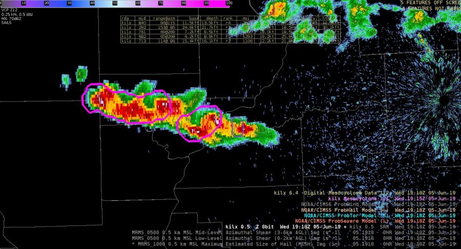
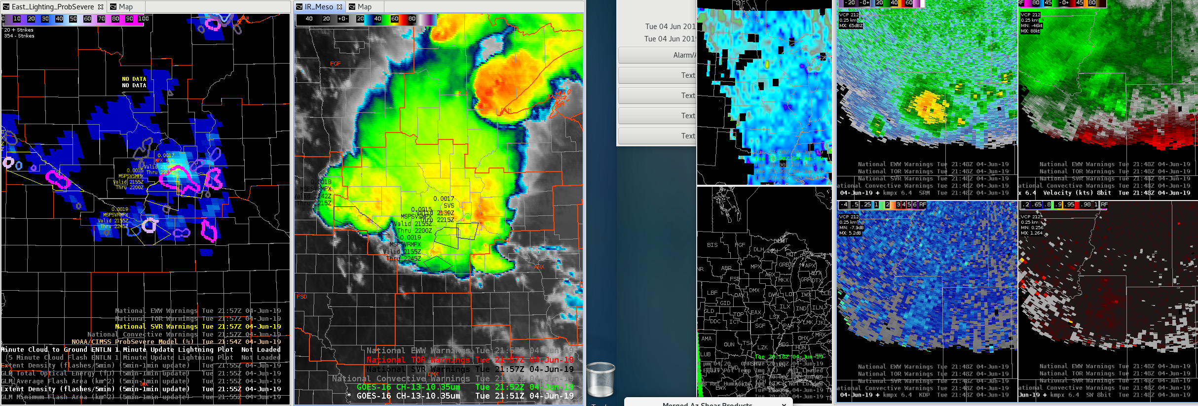
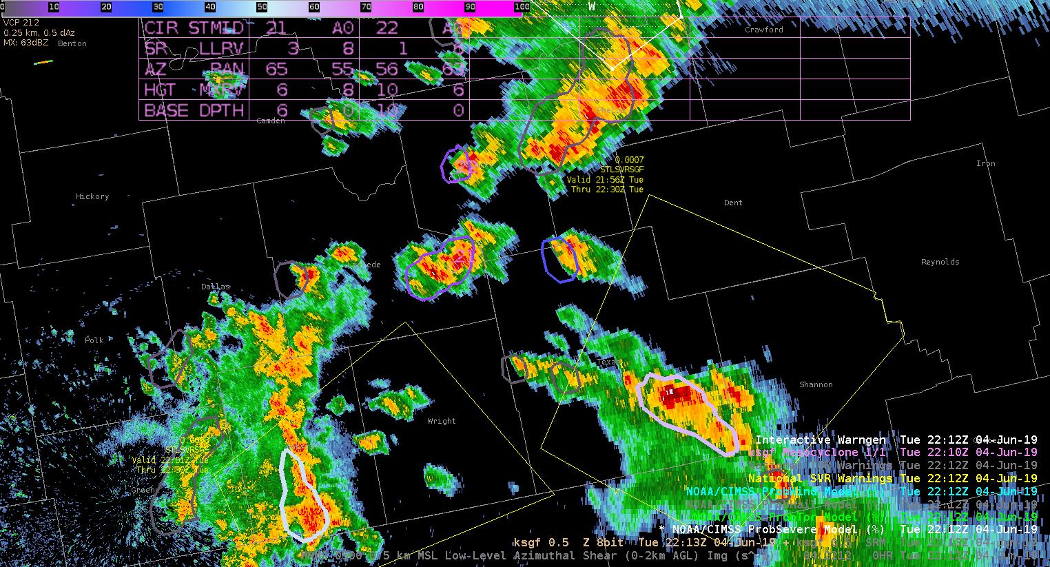
Had a few instances this afternoon where ProbTor seemed a bit high (the extra layer of ProbSevere added on). NUCAPS soundings showed high LCLs (2-3 km), whereas SPC meso page was on the order of 1.5 km…still pretty high. Had rotations aloft, and the lowest we saw a rotation was at a point where 0.5 tilt was around 5 kft. We issued a couple of SVR’s with TOR possible but no TOR warnings.
CHARLEY
Issued 3 consecutive SVR’s for hail on those western storms. Still a signal for hail, but not as strong now. More worried about a flash flood threat there given the persistence.
Charley
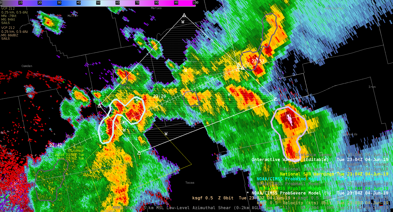
While monitoring convection across southern Missouri, the merged AzShear and ProbSevere have been great tools in diagnosing the primary severe threats: wind and hail.
AzShear has shown a few areas higher in shear, yet the ProbTor has been very low and V data has been unconvincing of the presence or threat of a tornado. ProbSevere has been useful in indicating the severe storm hazards that would be the most probable, and when compared with other data: GLM event density / avg group area, and V data, I’ve been able to issued warnings with higher confidence. GLM data will be increasingly useful with better understanding of what the different data sets mean in relation to convective development or decay.
Probably a marginal warning, but ProbSevere coming up and have 50 dbZ to mid 30 kft. Will see how this updraft holds together in that environment that didn’t look as unstable as earlier farther north.
Charley
We’re currently analyzing storms developing in the Springfield Missouri WFO. Right now I’m using various tools to monitor if these storms will become severe.
Right now I’m using a combination of radar, GLM, nucaps, and the All sky products. Currently the most helpful tools on top of what I normally use are allsky and the lightning products.
The allsky cape helped to find CAPE gradients and an increase in CAPE. The northern batch of storms were pushing into an area of increasing CAPE and in return they did intensify.
While deciding whether or not to issue a warning I also looked at AFA GLM data to see if there were new flashes developing which can be indicative of growing convection. That flashes aligned with radar and increased my confidence that storms would intensify.
That lead to me issuing a severe thunderstorm warning. The prob severe data also ramped up. So I felt confident about my warning.
I also used NUCAPS sounding predictor to look at the cape during the rest of the afternoon.
While watching storms in the Springfield area I tried using NMDA. Even after magnifying the product it was still a bit hard to see. I’m note sure if there’s a way to make the circle bigger or more pronounced. It can get busy on an active day.
As I continue to track storms I’m using Allsky CAPE to see what type of environment they are moving into. The CAPE does increase farther east so that makes me anticipate convection wane over the next few hours. I will though pay close attention to the storm farther north since they will move along the cape gradient.
I also used probsevere to increase my confidence in warning for a cell in pulaski county. The velocity ramped up as well as vil values. 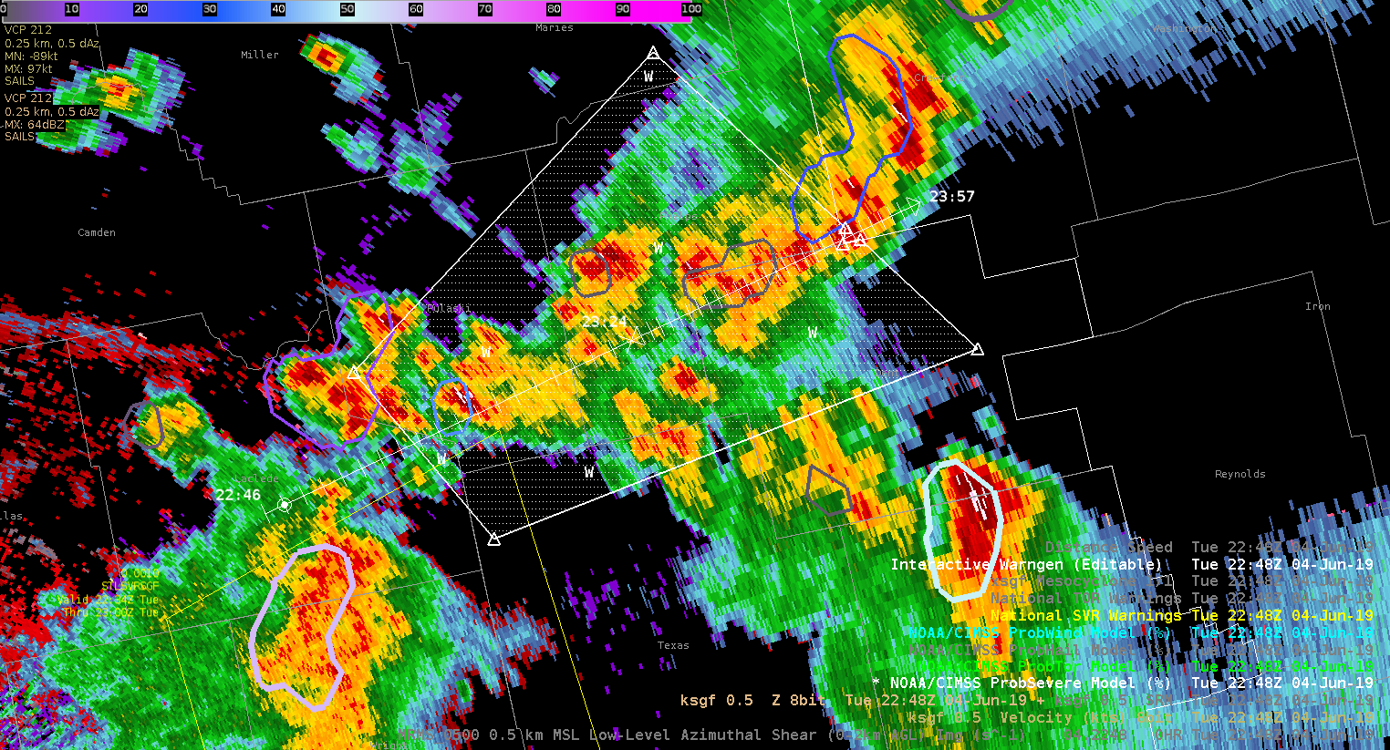
The increase in probsevere over a few scans prompted me to issue a severe thunderstorm warning.
Taylor Johnson
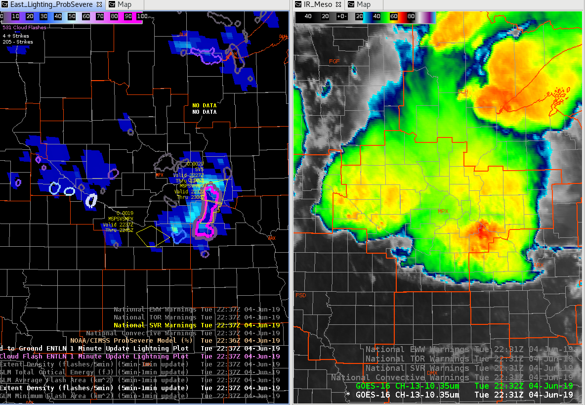
Noticed the FED was matching up well with ENTLN data in our eastern cells, but then the cells to the west should have been electrically active as well. ENTLN data shows several flashes, but FED from GLM is minimal.
Charley
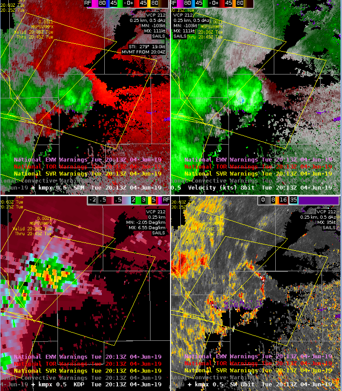
Lightning on FED starting to go up again, right as cell with rotation starts to meet up with east-west oriented boundary to the east of that cell (see bottom right spectrum width product).
AzShear product following that rotation over time well…watching for increase in intensity there.