
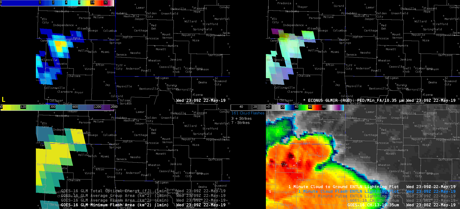
GOES-16 10.3 um IR channel in the lower right panel captured an exceptionally cold overshooting top at -82 C. This occurred toward the beginning of the animation at 2311Z in far northern Oklahoma (south of Coffeyville, KS) and preceded a large jump in the flash extend density (upper left). The minimum flash area did not change much during this loop, so it may be advantageous for this component of GLM to have a higher spatial resolution than what is currently used. The GLM RGB product (upper right) merges the flash extent density, minimum flash area, and 10.3 um cloud top temperatures. A group of bright cyan and white pixels helped highlight where all three of the aforementioned components were maximized. In addition to a substantial increase in the flash extent density 5-10 min following the -82 C cloud top temp., ENTLN ground based lightning flash counts doubled during the same time.
Although the environmental conditions already supported warning on this storm prior to the overshooting top (OT), seeing the FED and ground based lightning double, likely in response to the intense OT, may push a forecaster to upgrade the severity of the warning (larger hail, higher winds etc.) -Roy