Low CI (east) With Initial Activity

Looking at the CI product from GOES-E and it appears to have a marginal handle on the CI ongoing over western KY at the moment. In the loop below the values before CI only reached 45% before a 35 dbz echo was detected by radar. In the last frame of the loop there is a 64% noted within the line of CU, though this has not developed on radar. It will be interesting to see if there is soon higher reflectivitiese in this area.

-JB

low_CI

Tags: None

GFS Difference in Theta-E and NowCast

Today again appears to be a day where the NearCast model is being degraded by a significant amount of cloud cover over the CWA. I have loaded the difference in theta-e fields from the GFS model to fill in some of the gaps in the model. This appears to do well as a proxi for areas of convective instability in the NearCast model. Using the model difference fields in conjunction with the NearCast can help to fill in areas and allow you to get an idea if the model has a good handle on the situation and provides confidence for later in the day.

-JB

theta_e_diff_near_cast

Tags: None

Simulated Satellite Vs. IR Sat

NSSL WRF Simulated Imagery versus IR Sat

I was analyzing the NSSL-WRF simulated satellite versus the actual IR satellite and as you can see it is missing the cirrus cloud deck over the VA peninsula and eastern VA.  It also is missing the cirrus cloud deck over eastern West VA which may hamper or at least slow convection start today.

Simulated Satellite convection south

In one hour it is trying to already form storms over parts that are covered by the cirrus blanket so I wonder if this won’t happen since it hasn’t accounted for it. We shall see. ~ Vollmar

Tags: None

Storm Splitting In OUN WRF

While looking at the 5 KM derived radar reflectivity from the OUN-WRF in order to diagnose strongest cores aloft for the greatest hail potential, I noted a particular item of interest in northern Lincoln County, Colorado.  The reflectivity core clearly splits, which gives us an indication of expected storm tendency.  We can expect that splitting will occur which will place an emphasis on hail with the left moving storm and all modes of severe weather with the right moving storm.  The right moving storm eventually seems to gain a definitive supercell structure in Kit Carson County.  Such a storm would likely be the highest tornado threat in eastern Colorado today. 22May2014-2000Z4HR-OUNWRF5KMRefl

– JRM

Tags: None

Simulated Satellite to Early

Was comparing the simulated satellite to observations to attempt to get a handle on the pre-convective environment. It appears that the simulated satellite today is to quick in developing convection from southern KY into TN. It also is not handling the convection that is developing over eastern KS well. Finally it has convection developing over southwest KS that is not there in reality. This lowers the confidence in the forecast of this model for later in the day.

-JB

early_convection_initiation

Tags: None

Switching to West Texas…

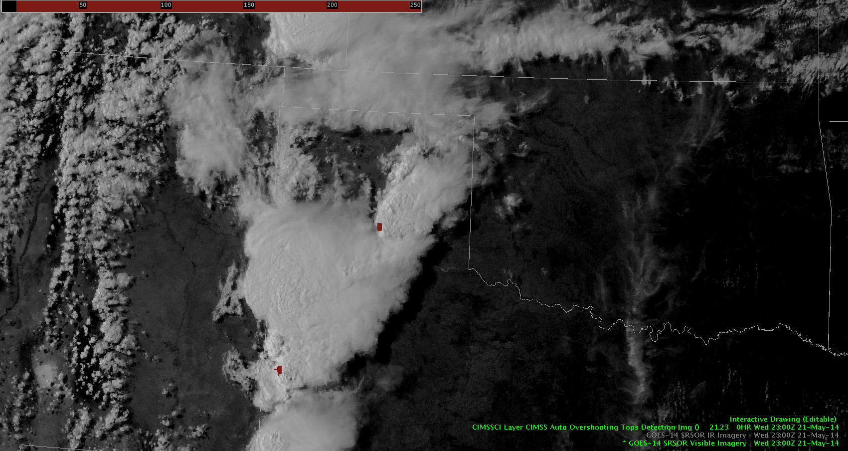
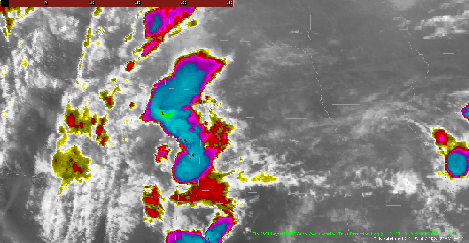
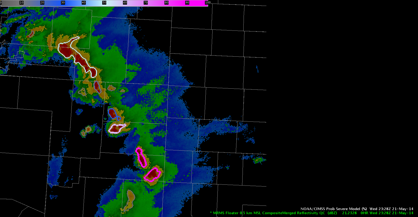
Excitingly, we’ve switched over to a region that is covered by GOES-14 SRSOR, so I pulled up the visible imagery and overlaid the overshooting top detection product. Interestingly, we noticed a very slow-moving storm in south-central AMA’s CWA that erupted on vis satellite and consequently, the OTD picked up on it. Additionally, a weak but still present enhanced V was observed with this storm on SRSOR’s IR imagery.

23Z-2357Z_SRSOR&OT

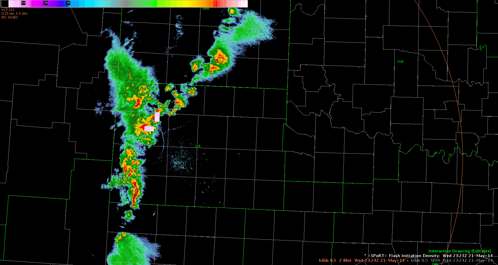
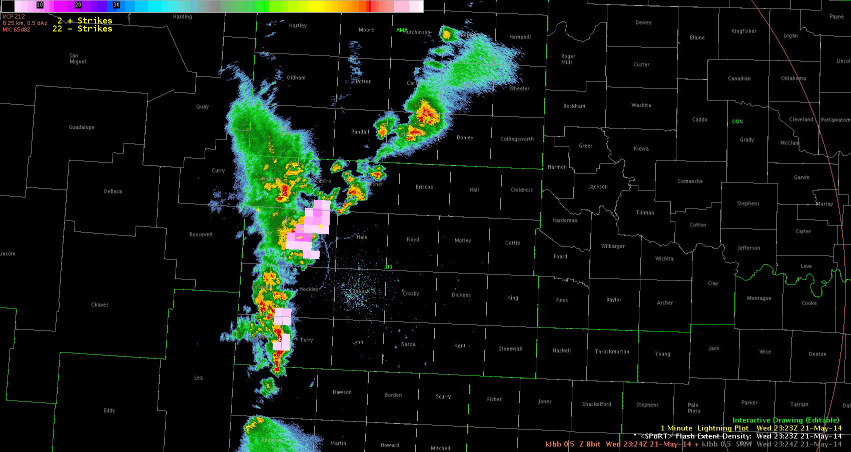
Now to center on LUB, I overlaid SPoRT’s Flash Initiation Density product on KLBB 0.5Z and observed an increase in the initial density as a cell merger occurred in northern Lamb County, TX. This increase was evident for a few minutes and then simmered down. What’s particularly important is that the SPoRT data, since it is coming in every minute, indicated this “jump” before the next volume scan came in on radar.

2324Z-2356Z_init_density
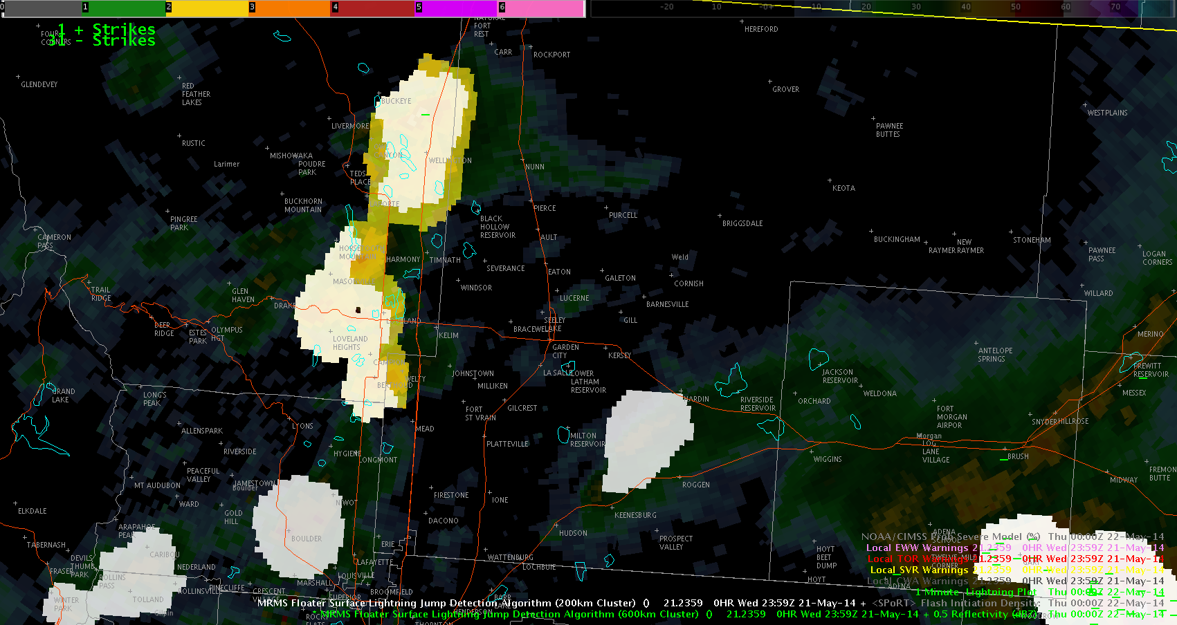
In the next loop (below), I did a similar setup with 0.5 reflectivity, SPoRT’s Flash Extent Density product, and included a 1-minute CG lightning plot as well. As anticipated, flash density responded similarly to the cell merger by showing an increase. 2324Z-0001Z_extentdens

At around the same time, WFO LUB received wind/wind damage reports in the area.

Having the 1-minute total lightning data was very helpful in being able to see the response of the cell merger and give a couple minutes more lead time to anticipate what was to come. While CGs can provide great information, having total lightning to get a better idea of what is going on is exponentially more valuable.

~Linda

Tags: None

Negating false positive/problems from larger LJDA scales.

May22nd 0009Z

With the image above I just wanted to show that sometime the LJDA can combine storms and trigger a larger sigma warning than seems realistic. Especially when the storms seem to barely touch on radar. In this case it was a 2-3 Sigma jump in Yellow which would prep the forecaster to think about warning.

This false positive can be fixed by overlaying a smaller scale LJDA over a larger one to potentially split the storms and break the sigma back down to a more realistic approximation that would not trigger a reason for warning (after suspecting it to be a false positive).

Grant H.


Tags: None

Over-Shooting Top and Heavy Rain

ost_heavy_rain

Been watching the convection over northeast CO, and although the general trend of the severity of the convection is downward, the over-shooting top algorithm continues to ping over this area. This highlights that although the storms may not be producing severe weather, i.e. hail and/or wind, they could be significant rain producers and should continue to be monitored.

-JB

Tags: None

Total Lightning to forecast strengthening storm

lightning data


I have been watching the Total Lightning product over the developing storm and it shows both flash initiation density and flash extent density that have been increasing over the last 30 minutes.  That coupled with the increase on the Prob Severe, would lead me to believe this is nearing severe limits and I would then issue a warning.  I really like these products because it shows where the updraft is developing and also where hail would be found. ~ Vollmar

Prob Severe and Demise of Storms

prob_severe_2343

Watching trends in the probability of severe over northeast CO indicates a significant downward trend in prob severe with the low-lived storm that went through DEN. This occurred as the local office allowed the warning expire and the reflectivity signatures were decreasing as well. Provided confidence in letting the warnings expire.

-JB

Tags: None