Day 1: Mesoanalysis

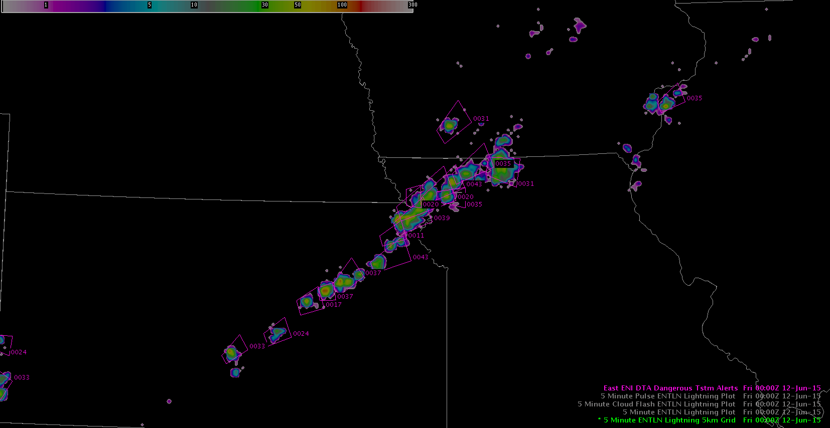
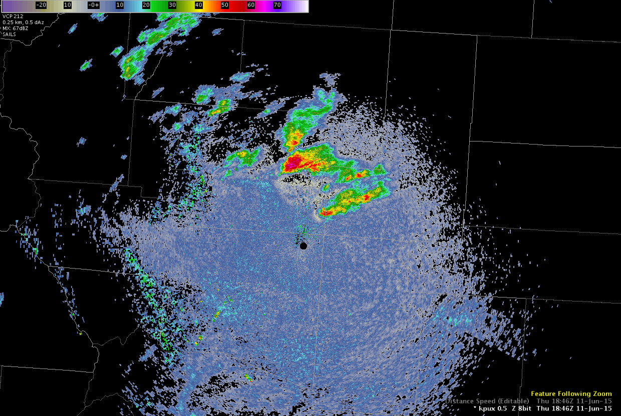
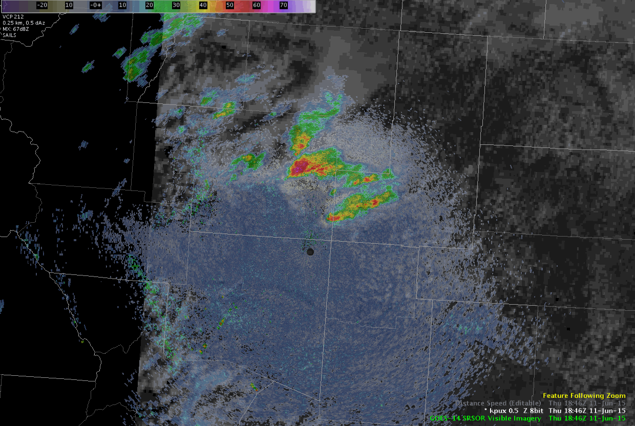
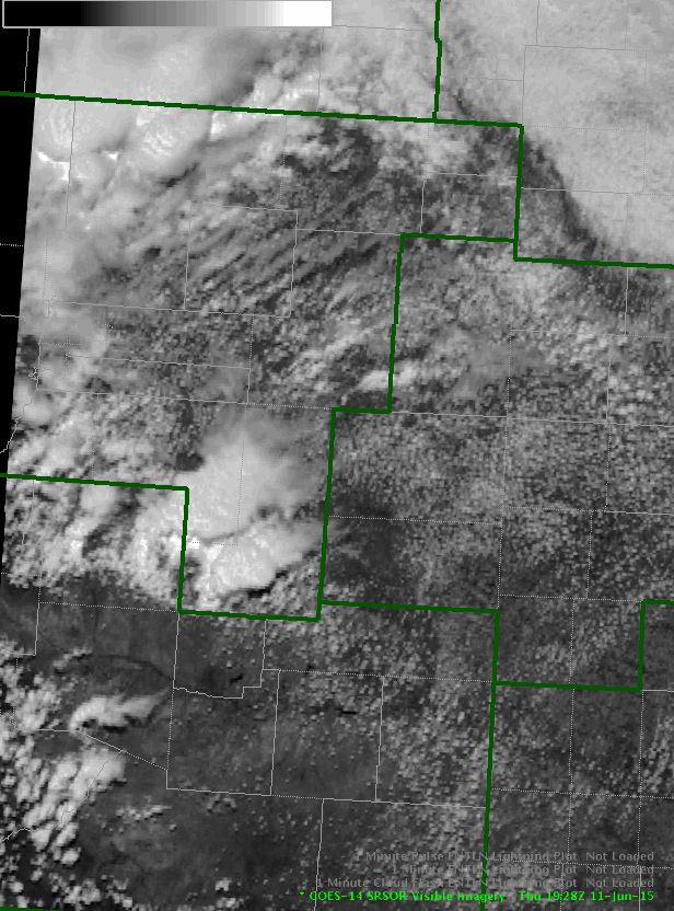
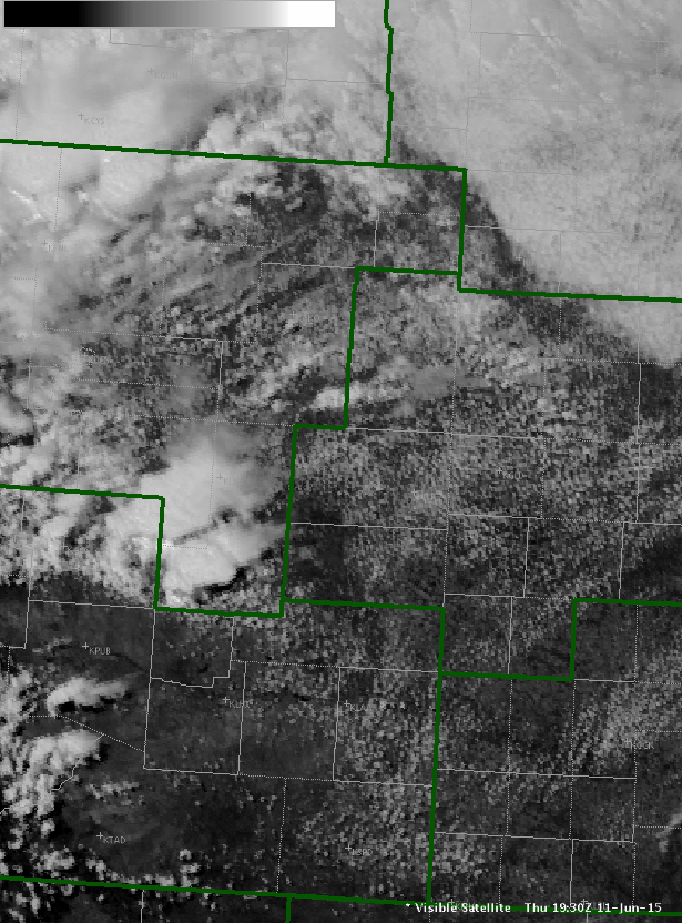
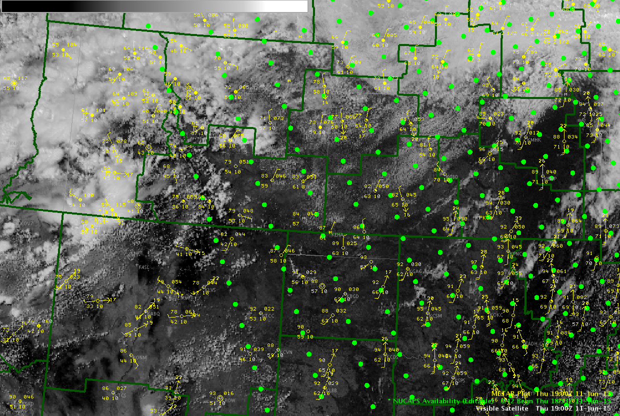
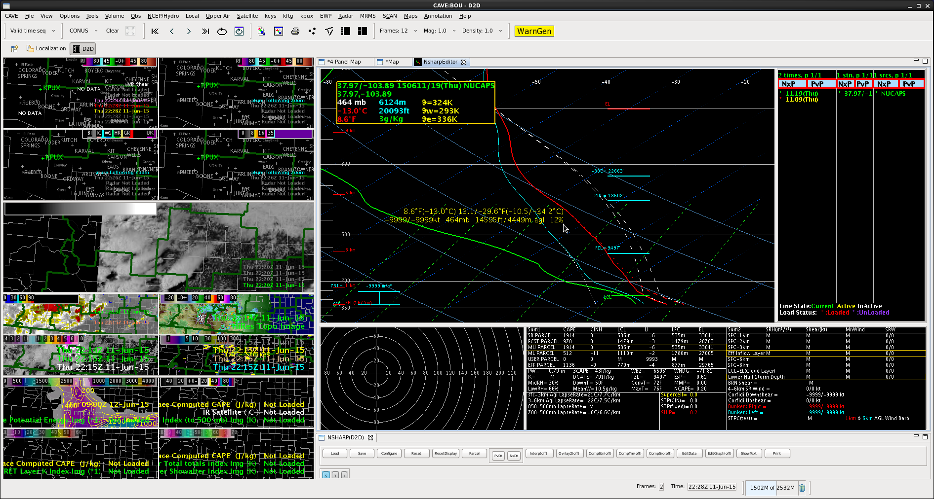
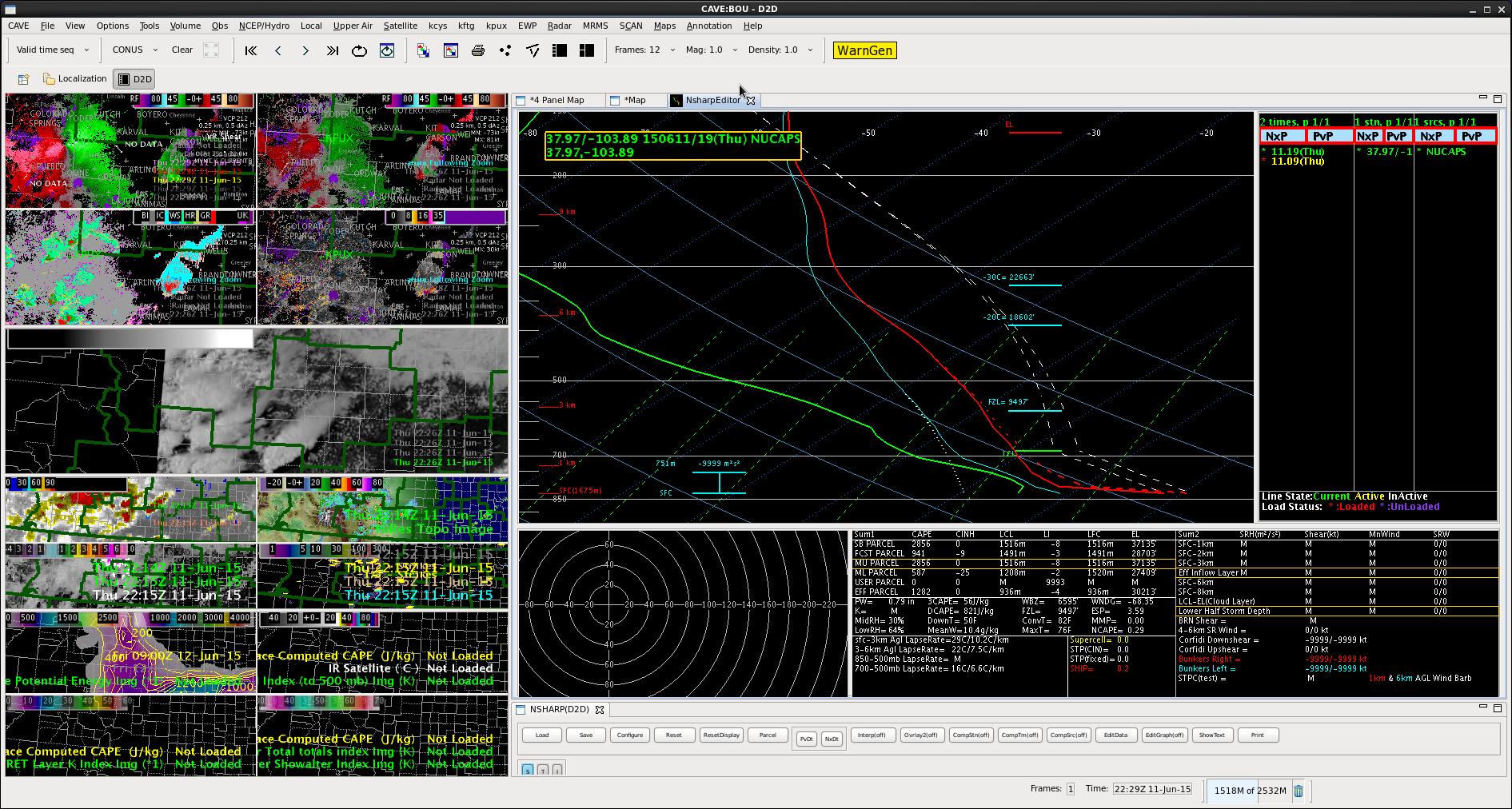
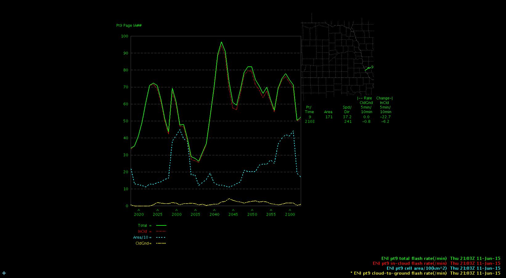
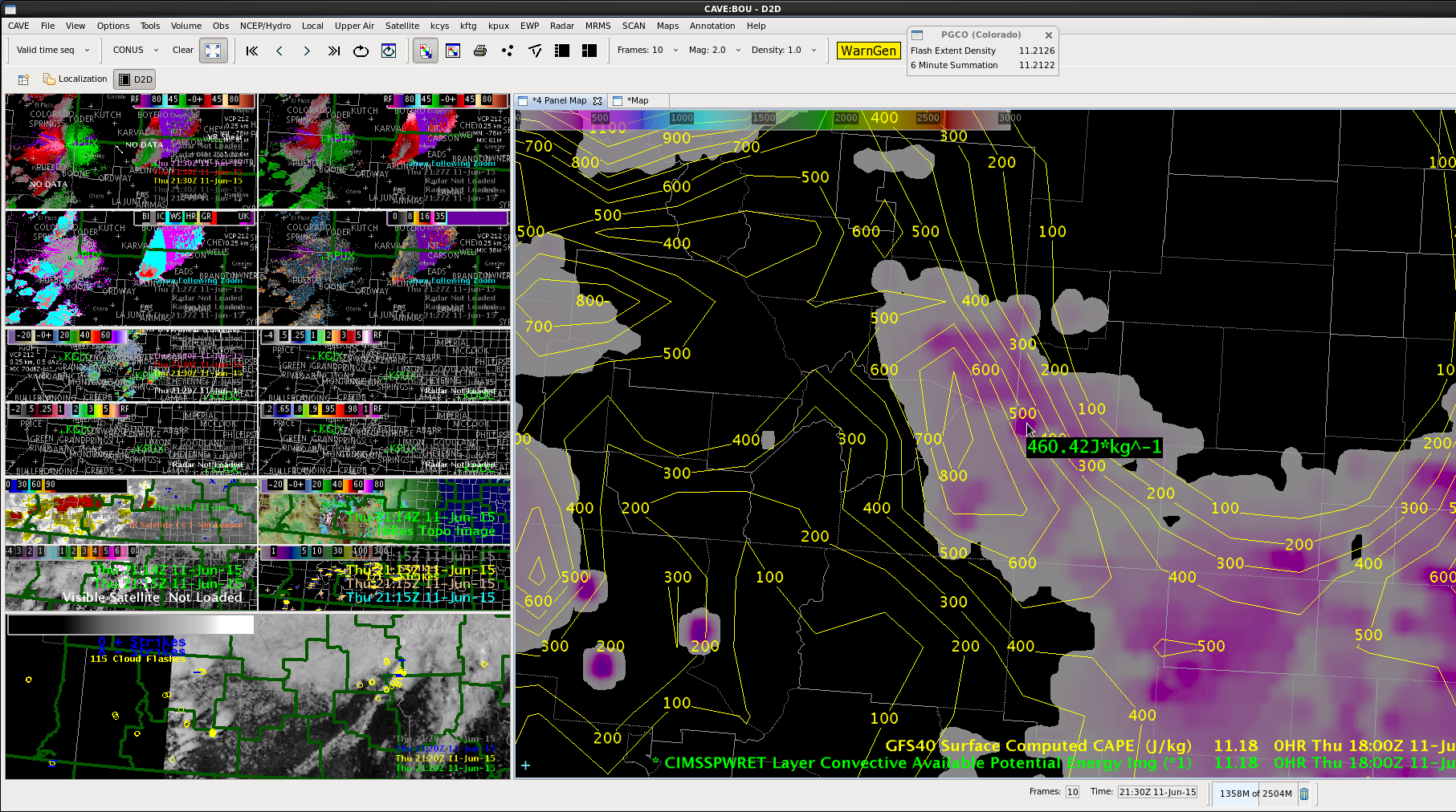
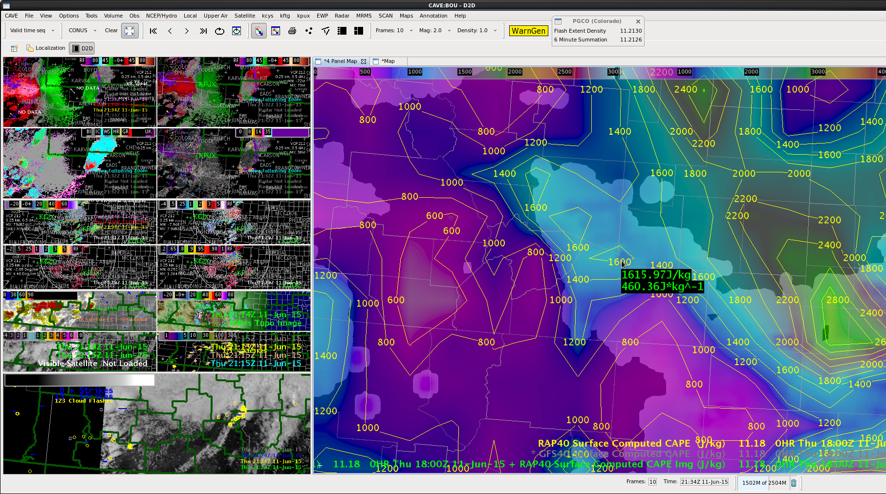
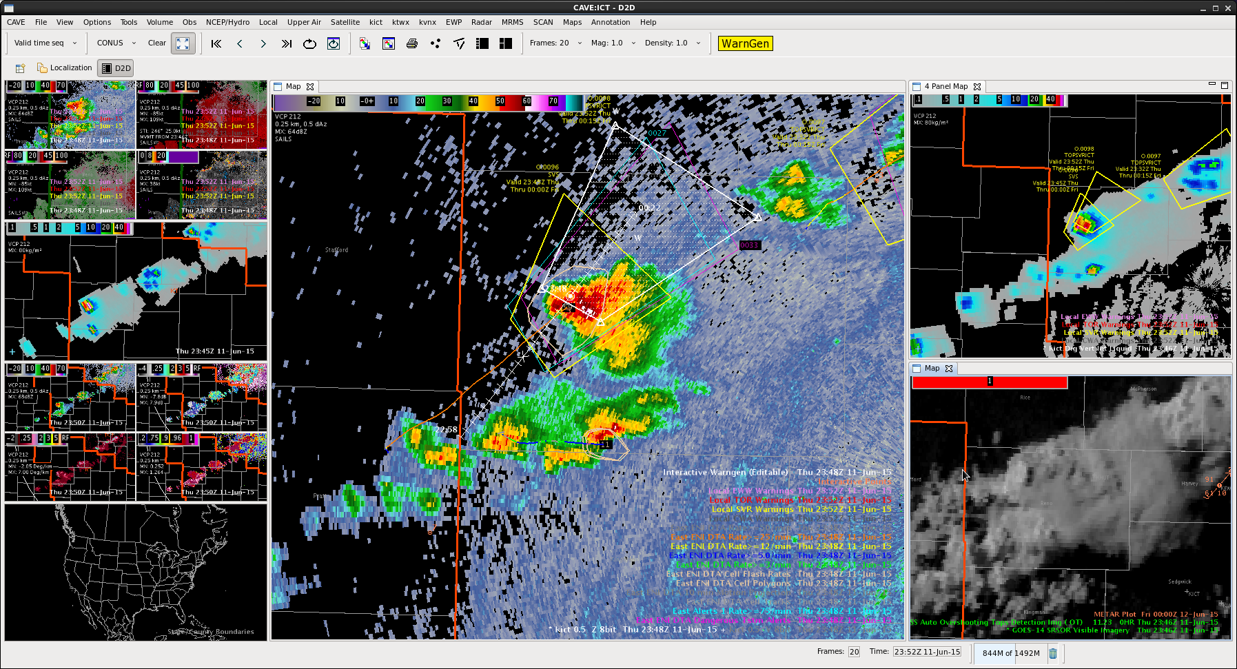
Today’s focus will be over extreme southern Texas as an outflow induced frontal boundary continues to sag south across the Corpus Christi and Brownsville CWAs. Ahead of this boundary, ample amounts of low-level moisture are in place with early afternoon dewpoints hovering in the lower to middle 70s. Latest 1-km SRSOR visible imagery from GOES-14 indicates plenty of low-level CU in place south of the boundary, however SPC mesoanalysis is already showing a moderately unstable airmass with MLCAPE values currently exceeding 2000 J/kg is some locations across far southern Texas.  So far, convection has been slow to kickoff in the unstable airmass south of the boundary, with the only notable convection of interest located along the Texas/Mexico border where the outflow induced front appeared to begin interacting with elevated terrain just west of the Rio Grande River.  That said, PROBSvr has been tracking this cell quite well so far, however probabilities for severe remain low at this time.  Also of interest is a northward moving outflow/differential heating boundary which will continue tracking north this early afternoon, before eventually colliding with the outflow induced frontal boundary approching from the north. As these two boundaries collide, expect developing/strengtheing convection as the airmass largerly remains uncapped per latest SPC mesoanalysis grapics.  Effective bulk shear of 40-45 kts remains more than supportive for severe development, however deep layered shear vector orientation along the effective outflow boundary may keep developing convection in linear segments.  Of interest however, Rapid-Refresh soundings from south-central Texas show deep inflow directly from the east with quick veering with height above 900-hPa. As a result…cannot rule out an isolated tornado or two, however very dry air aloft along with steep mid-level lapse rates will likely keep large hail and damaging winds the primary focus of severe weather concerns.

torman1

Tags: None

HWT 2016 GOES-R/JPSS Spring Experiment Begins Today!

The HWT 2016 GOES-R/JPSS Spring Experiment in Norman, OK begins today, 18 April, and will run through 13 May. Three NWS Forecasters and one Broadcast Meteorologist will participate in the GOES-R and JPSS product evaluations each week. Participants will utilize the experimental satellite-based products in a real-time AWIPS-II to issue experimental mesoscale forecast updates and severe thunderstorm and tornado warnings.

Products to be evaluated include:

  • GOES-R Legacy Atmospheric Profile (LAP) All-sky Thermodynamic Products
  • GOES-R Convective Initiation and Severe Convective Initiation
  • Probability of Severe Model
  • GOES-14 Super Rapid Scan Operations for GOES-R (SRSOR) 1-min imagery
    • Atmospheric motion vectors (updating every 10 minutes)
    • Parallax-corrected 1-min imagery
  • Total Lightning using PGLM (in LMA networks)
  • Lightning Jump Algorithm (using ENI)
  • NUCAPS Temperature and Moisture Profiles (JPSS)

You can follow this blog for live updates and forecaster posts from within the HWT.

Bill Line, SPC/HWT Satellite Liaison

Tags: None

MRMS Data and Information Sources

MRMS Data Sources

MRMS Web Browser:
http://mrms.ou.edu/applications/mrms_2d_maps_main.html

MRMS Google Maps:
http://wdssii.nssl.noaa.gov/maps/

Past Hail and Rotation Tracks:
http://ondemand.nssl.noaa.gov

NWS Enhanced Data Display (EDD):
http://preview.weather.gov/edd/

RealEarth (U. Wisconsin):
http://realearth.ssec.wisc.edu

MRMS Information Sources

Warning Decision Training Division training courses:
http://www.wdtb.noaa.gov/courses/MRMS

NOAA Virtual Laboratory MRMS Community:
https://vlab.ncep.noaa.gov/group/mrms/home

Tags: None

Busy Day for WFO TOP and EAX

Scattered to numerous strong to severe thunderstorms develop along and ahead of a surface cold front. Many DTA’s were triggered by the intense convection from mid afternoon into the early evening. The DTA boxes and 5km lightning grid total flash density product worked well as an SA tool and quick indicator of rapidly deepening convection. In addition, the storms that developed near the MO/IA line where flow was more backed did a good job in showing the right turning storms.

DTA.5km.grid

-Wacha

Tags: None

Combining SRSO and Radar Data

The high frequency satellite imagery enables the ability to better match the frequency of radar data and combine them to give a unique view in this case of the radar data near the ground and the top of the storm via satellite.   In the following animations, you can see the supercell SE of PUX in feature following zoom mode in AWIPS. Evident are storm structure, outflow boundary, inflow, and anvil development and storm top outflow all in the same image.  This helps verify the conceptual model of supercells.  MrSnow/Shasta.

Click on the images to see the animation.SuperZFeatureSRSO_VIS_Z

Tags: None

Evolution of outflow boundaries in SRSO vs standard visible imagery

Just to compare and contrast what GOES-R and SRSO offers compare to routine visible imagery is shown below. The SRSO loop contains 120 images while the standard imagery contains only 6 .  There is so much more evident in the SRSO in terms of convective development and outflow boundaries and interactions with other cells not so easily seen or imagined in the standard  imagery.  Click on the images to see the animation.  MrSnow/Shasta


VISSRSO

VISnorm

Tags: None

NUCAPS soundings just in time

A nice clear field of view in was in the development region southeast of Denver. Based on the differences in CAPE analysis in the LAP, GFS, and RAP, the NUCAP sounding was available at the optimal time to check its vertical profile, observed and derived CAPE in the undisturbed environment where the storms were headed.  This image below shows that clear area on the visible imagery vicinity KLHX La Junta, CO where the surface temp and dewpoint were 83/59.  The unmodified NUCAPS  sounding yielded about 1900 J/kg SBCAPE as the surface dewpoint was 60 but the temperature was much cooler than observed.  However, modifying the sounding with the observed surface T/Td at KLHX, the resulted CAPE was over 2800 J/kg much higher than just about any other method.   MrSnow/Shasta

NUCAPSpick


NUCAPS_Unmod

NUCAPSmod

Tags: None

LAP gets a bad RAP

Looked at the LAP CAPE output again today at 1800 UTC 11 June 2015 southeast of Den ver, CO.   It did not seem to capture the magnitude of the CAPE.  In the first image below the sampled 460 J/kg grid seems to represent where the satellite added information to the GFS background and agreed nicely with the GFS 6h first guess.  The overall gradient and orientation seems pretty good as well. CAPE

The problem is that the CAPE seems very low when compared to the RAP analysis.

Given the strong supercell development, tend to believe the RAP vs the LAP analysis.  The second image below shows the same sampled location in the LAP. That is overlaid with the RAP which is showing 1600 J/kg at 1800 UTC.

RAPLAP

MrSnow/Shasta


Tags: None

Downstream SVR for Reno and beyond Charley

SVR2_ICT_2SVR2_ICT_1

Lightning data steady state on time series.  DVIL is a little low, but SRS showing another updraft with shadow in the area of the cell.  Had a report earlier of pea size hail in Langdon, which was southeast of the core.  ProbSevere indicated a mature storm with continued high values.

SVR2_ICT_3

Tags: None