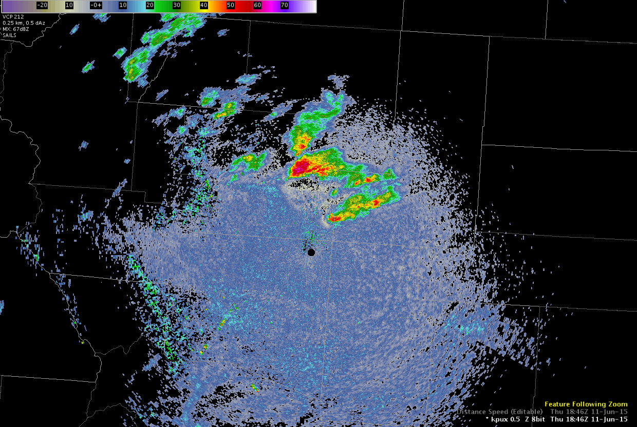
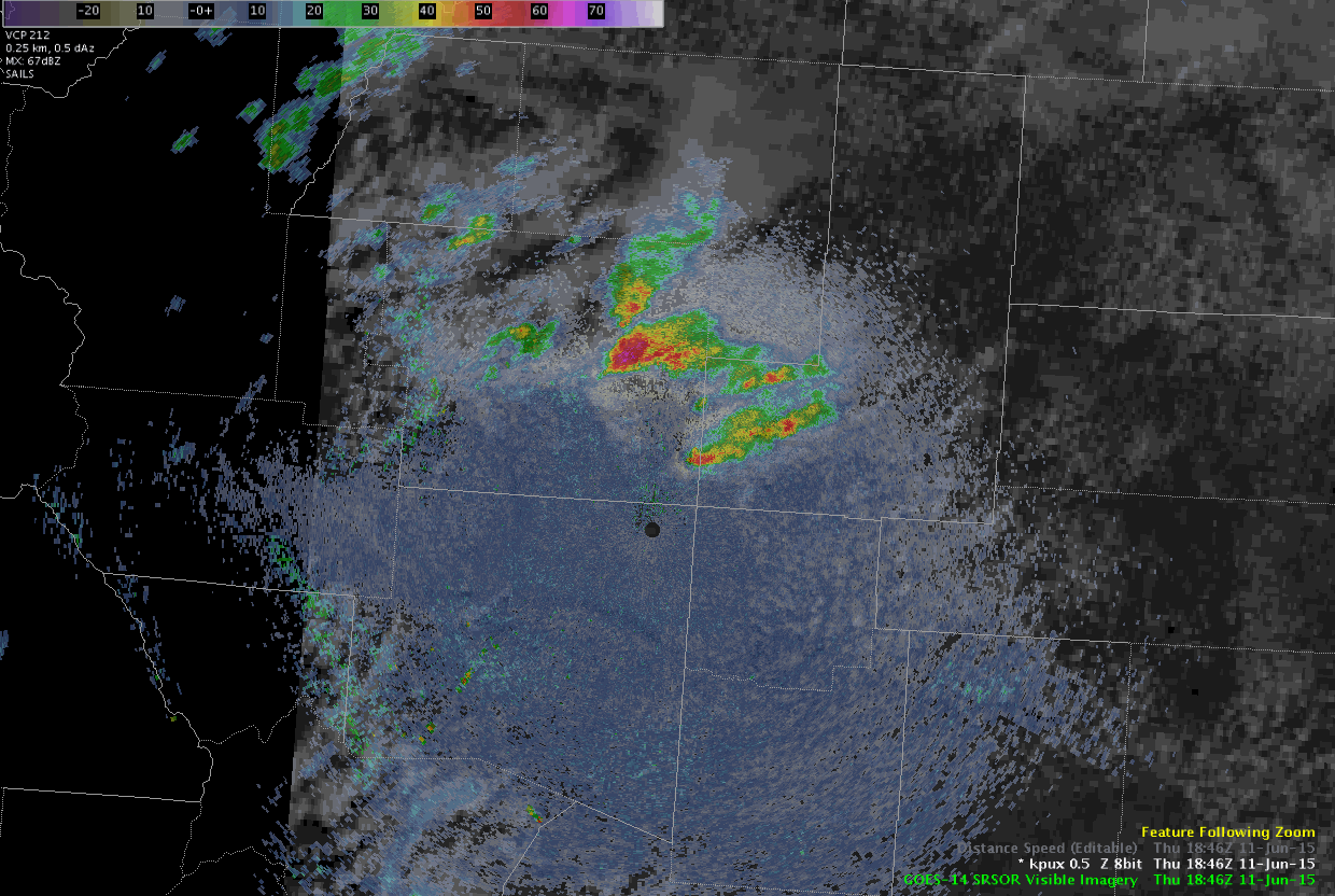
The high frequency satellite imagery enables the ability to better match the frequency of radar data and combine them to give a unique view in this case of the radar data near the ground and the top of the storm via satellite. In the following animations, you can see the supercell SE of PUX in feature following zoom mode in AWIPS. Evident are storm structure, outflow boundary, inflow, and anvil development and storm top outflow all in the same image. This helps verify the conceptual model of supercells. MrSnow/Shasta.
Click on the images to see the animation.