Summary – 28 April 2008

Our first day of operations with our visiting forecasters was a moderate success. The orientation briefing went about 30 minutes long, so we didn’t start WDSSII training until 330pm. This will probably be the norm. Once that was complete, we begin training and briefing on the gridded warning experiment. That didn’t end until about 530pm when we morphed into me demonstrating the gridded warning software on the tail end of the event in NE North Carolina and SE Virginia. We did not have a chance to issue warnings on the major tornadoes that occurred today as they happened before we were ready, but there we did issue a few low-probability tornado warnings on the remaining mesocyclones before they went offshore. Our “IOP” lasted only about 90 minutes and then we had a dinner break. Afterwards, each forecaster was given hands-on training with the gridded warning software, and we ended the day with a 30 minutes discussion, captured nicely by Kristin on the live blog. I also made a few “live blog” entries during our “IOP” that I’ll need to clean up.

No pictures to show today since our “IOP” really wasn’t a true IOP (I operated the software most of the time), and we won’t be using these data in any post-analysis. But we may play back a little of the data at the debriefing on Tuesday.

Greg Stumpf (EWP Weekly Coordinator, 28 April – 2 May)
Tags: None

Summary – 24 April 2008

From 3-5pm, I trained Liz Quoetone, Jim LaDue, and Pail Schlatter on WDSSII. At the end of the training session, I tested a bug fix for the gridded warning software, and now, none of the warnings are automagically disappearing any more! Just a few more small issues, and the software should be ready to go.

Starting around 545pm, we began our gridded warning IOP centered on several storm which developed in NW KS. I spent the first hour explaining the software to Liz and Jim. Then, Jim took over the driver’s seat, followed by Liz, and then we wrapped up at 830pm. Several severe storms developed in the area, including one supercell that was a very large hail producer, and possibly a tornado producer. We issue gridded warnings for both hail and tornado on that storm.

During the event, we decided to try a new thing – live blogging. Jim and Liz put their thoughts on the blog as the event was occurring. I’ve decided that this would be a great idea for the gridded warning experiment. The cognizant scientist and/or one of the forecaster/evaluators should blog live during the IOP to share their thoughts in real time. We’ll try to put these live blog on a separate page in the EWP Blog.

Friday is the first of our end-of-week debriefings at 10am. We really don’t have a firm plan for how we are going to conduct these just yet, so we will probably spend some time discussing how we are going to conduct these weekly debriefings in the following 6 weeks.

Greg Stumpf (EWP Weekly Coordinator, 21-25 April)

Tags: None

Summary – 23 April 2008

The first few hours of the day was spent training Patrick Burke and Angelyn Kolodziej with an archived PAR case. As would a WFO participant would do, they provided feedback on the case, compared the output to KTLX data, and filled out a survey. At the same time, I was testing out new fixes on the gridded warning software. Most of the bugs have been resolved, but a few remain and seem attainable before actual operations begin next Monday.

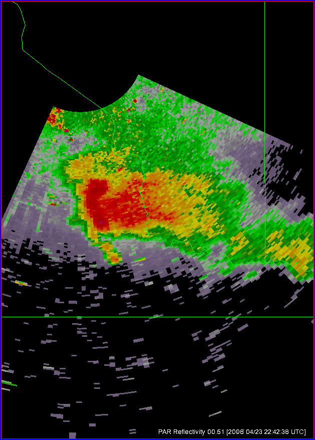
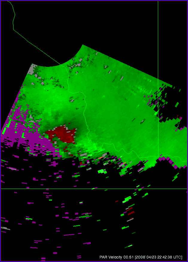
Our Intensive Operations Period (IOP) went from 5-8pm. During this time, we collected PAR data on a non-tornadic supercell which developed about 20-30 miles south of Norman:

We also loosely operated the gridded warning project over a number of domains, including Central Oklahoma, one a supercell NE of Midland TX, and a large bow echo complex that moved from west of FTW into the DFW metroplex. During this time, I was still testing the software for various bugs, and found one remaining issue that appears we can have fixed soon. Mike Magsig and Patrick Burke operated the software during this time. After the IOP, we had a great discussion from Patrick’s warning forecaster perspective on how probabilities currently factor into his warning decision making. He will be adding his thoughts to this blog in the next day or two.

Greg Stumpf (EWP Weekly Coordinator, 21-25 April)

Tags: None

Summary – 22 April 2008

Storms developed along the “stationary” front in eastern OK and western and NW AR today, and we concentrated our gridded warning efforts on an IOP from 5-9pm.

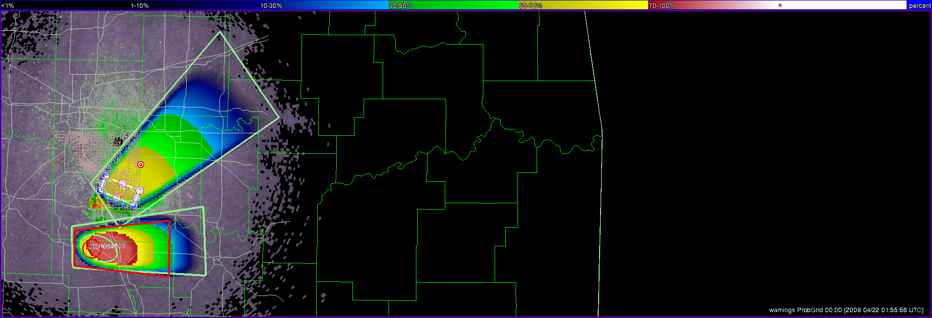
Mike Magsig (WDTB) played the forecaster/evaluator role today for the gridded warning experiment and he spent considerable time issuing gridded warnings. From the technology standpoint, a change to the contour code to sync warning times to specific products was working, but there were some side effects that caused some partially drawn warnings to disappear before they could be finished and saved. From the science standpoint, Mike spent a lot of time concerned with how to define the initial threat areas in relation to various storm structure elements. This was his first time to actually issue gridded probabilistic warnings, and it was good to finally give him some experience given that many of the ideas behind the concepts were his. At a few times, the warning grids we saved were not actually representative of the meteorology as we were trying to hammer the software issues, so these portions of this case might be “flagged” if used in future evaluation.

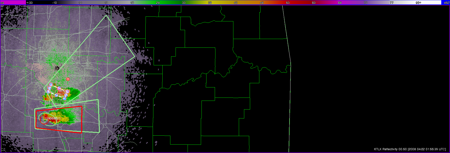
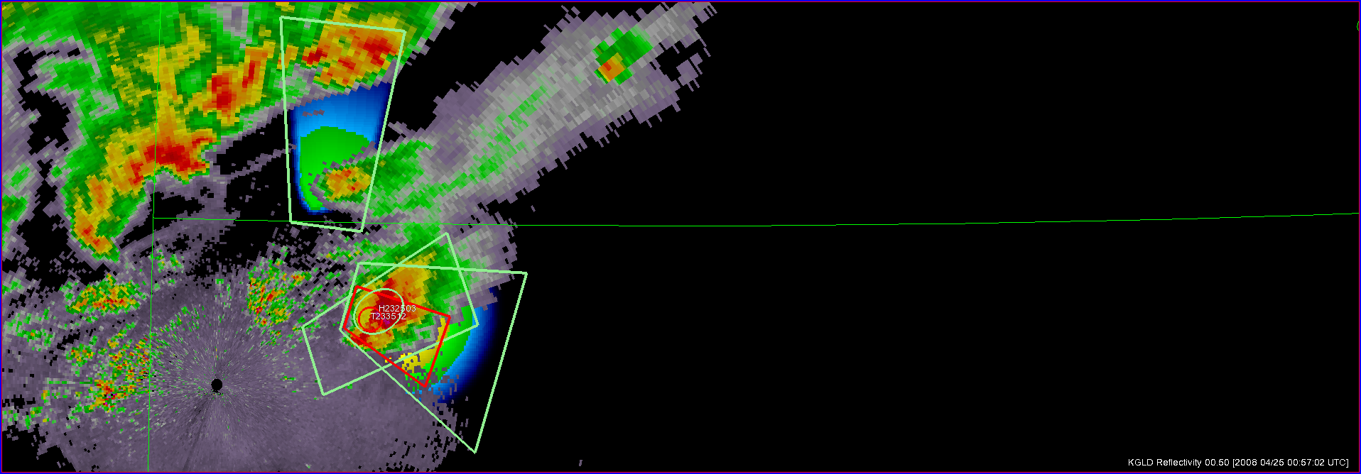
Here’s several screen captures during one moment in time during the IOP.

Storms did not form within 150 km of Norman, and thus we did not have a concerted PAR data collection (i.e., no real-time evaluation), although the radar was running in “long-range” mode throughout today’s event.

Greg Stumpf (EWP Weekly Coordinator, 21-25 April)

Tags: None

Summary – 21 April 2008

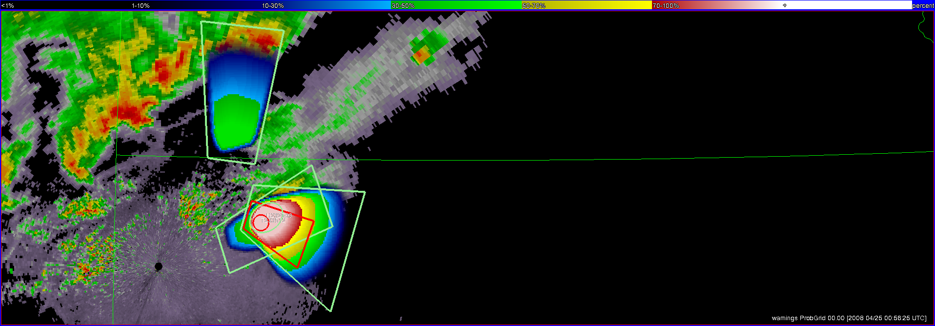
The cap held in Oklahoma until just before sunset today, when the leading edge of a moisture surge, seen as a westward-moving boundary, collided with the dryline. A supercell developed in western Garvin County and tracked slowly eastward, calving off at least one significant left-split that raced off to the northeast. We tested out the gridded probabilistic warning software today on these two storms (the left- and right-moving pair). There were still a few issues with regarding to time syncing of the various products, and the current threat area grids are still sometimes missing from the one-minute grid updates. Otherwise, the new storm motion-tool worked well and I was able to keep up with the two storms with not much difficulty. I issued and maintained high probability hail warnings for each storm, as well as a very low-probability tornado warning on the right mover. Here are a few images taken from WDSSII.

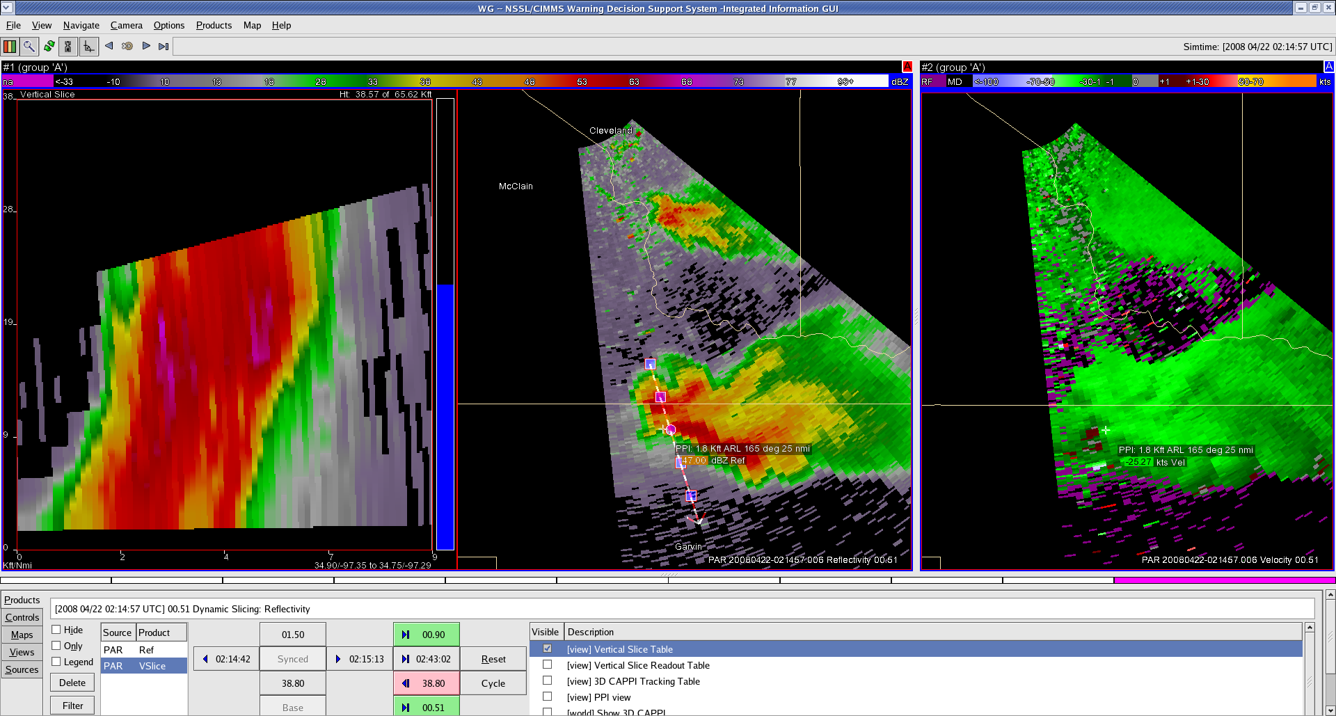
We also ran the Phased Array Radar (PAR) in TSS mode (Temporal Sensitivity Study) during the life time of the storms. The storm was moving slow enough to afford us the option of collecting a “half sector” 45 degrees wide. An image:

There were no CASA operations, as the storms were outside of the radar network.

Greg Stumpf (EWP Weekly Coordinator, 21-25 April)

Addendum:

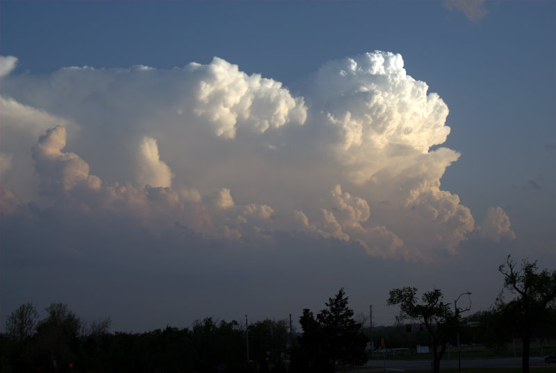
Here is an image of the storm from outside of the NWC around 8 pm CDT:

A view of the 20080421 Storm from the NWC

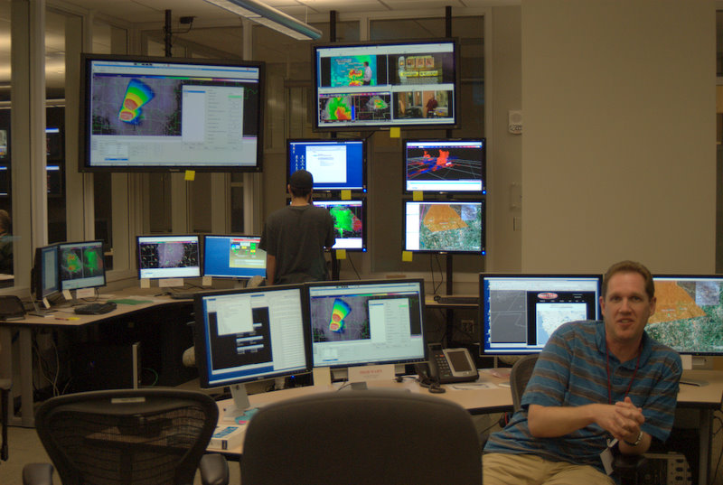
Also, we had the Situational Awareness Display (SAD) operating. Here’s an example of how this might look:

Situalional Awareness Display during first

Kevin Manross (Backup EWP Weekly Coordinator, 21-25 April)

Tags: None