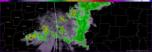
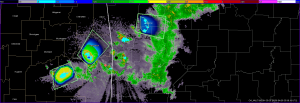
Storms developed along the “stationary” front in eastern OK and western and NW AR today, and we concentrated our gridded warning efforts on an IOP from 5-9pm.
Mike Magsig (WDTB) played the forecaster/evaluator role today for the gridded warning experiment and he spent considerable time issuing gridded warnings. From the technology standpoint, a change to the contour code to sync warning times to specific products was working, but there were some side effects that caused some partially drawn warnings to disappear before they could be finished and saved. From the science standpoint, Mike spent a lot of time concerned with how to define the initial threat areas in relation to various storm structure elements. This was his first time to actually issue gridded probabilistic warnings, and it was good to finally give him some experience given that many of the ideas behind the concepts were his. At a few times, the warning grids we saved were not actually representative of the meteorology as we were trying to hammer the software issues, so these portions of this case might be “flagged” if used in future evaluation.
Here’s several screen captures during one moment in time during the IOP.
Storms did not form within 150 km of Norman, and thus we did not have a concerted PAR data collection (i.e., no real-time evaluation), although the radar was running in “long-range” mode throughout today’s event.
Greg Stumpf (EWP Weekly Coordinator, 21-25 April)


