An official website of the United States government
Here’s how you know
Official websites use .gov A
.gov website belongs to an official government
organization in the United States.
Secure .gov websites use HTTPS A
lock (
) or https:// means you’ve safely connected to
the .gov website. Share sensitive information only on official,
secure websites.
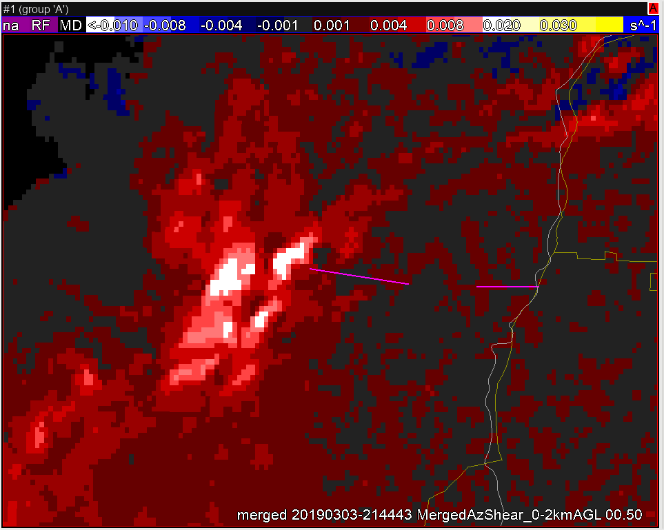
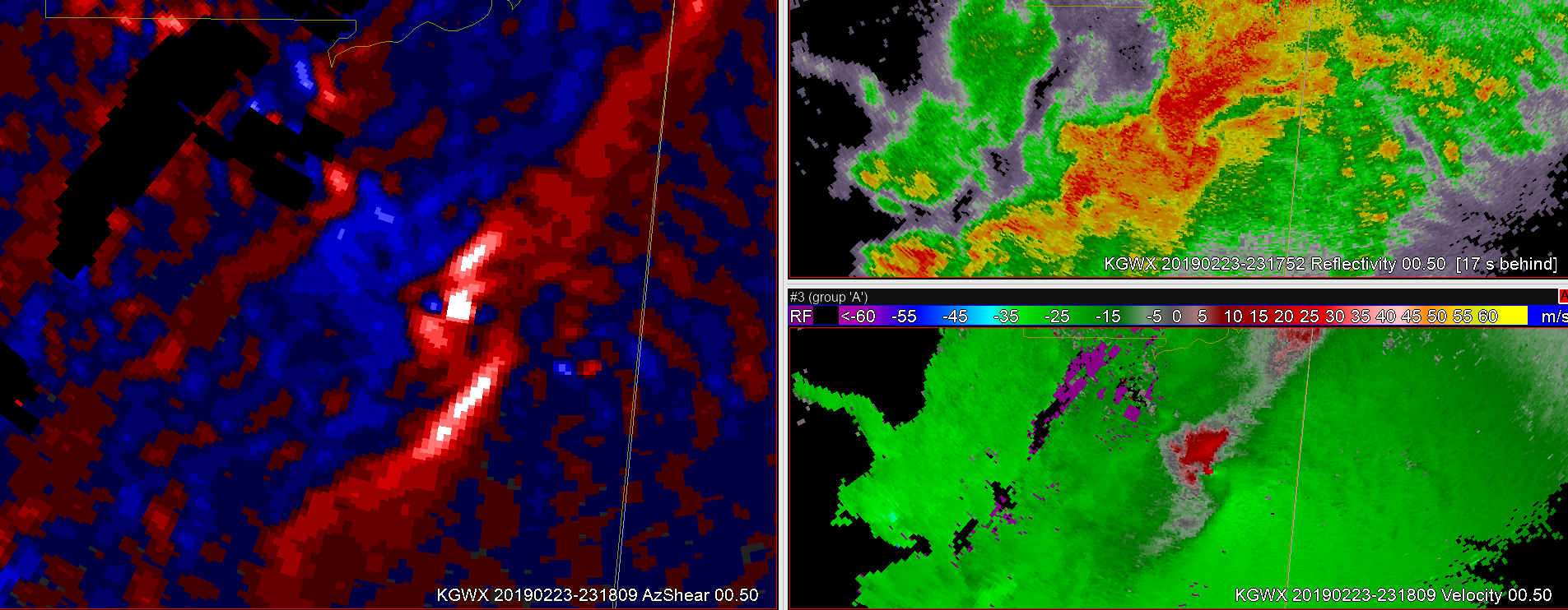
The merged AzShear is quite useful in this case of a large convective system moving through the region. While single radar is useful, the merged product provides a much better overview of the region. Areas of highest shear are readily identifiable and can then be interrogated further with reflectivity and velocity data. My confidence in the existence of a tornado where the merged AzShear is showing white & yellow on the left image is solidified with the corroborating details in the reflectivity and velocity data.
South of the main tornadic signature in velocity, adjusting the velocity for SRM indicates 2 other weak couplets, neither of which I have high confidence are tornadoes on the ground based on the AzShear products.
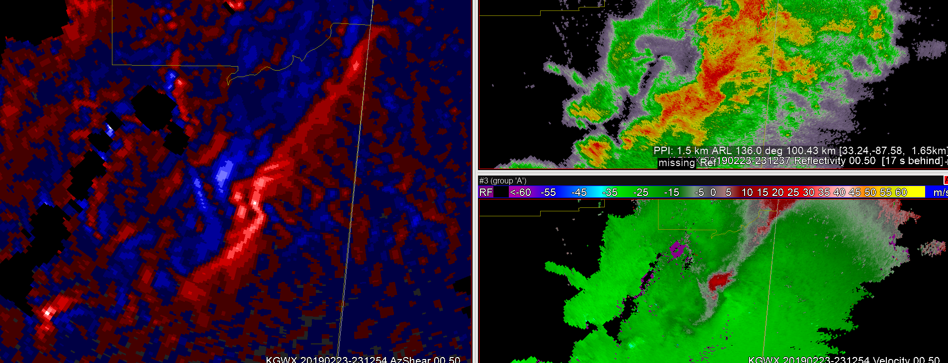
At first exposure the single radar AzShear product appears to highlight mesoscale regions of interest. Looking at the 2/23/19 ern MS/wrn AL case beginning around 2308z there is a broad area of reflectivity with some evidence of an embedded supercell in east-central MS. The AzShear product shows a linear region of positive values with enhanced values around the potential circulation. Advancing to 2312z the linear AzShear feature has now taken on an S-shape, with enhanced values immediately northern portion of the S. At this time there is a broad low-level circulation.
S-shape beginning to appear within the strong reflectivity region at 2312z.
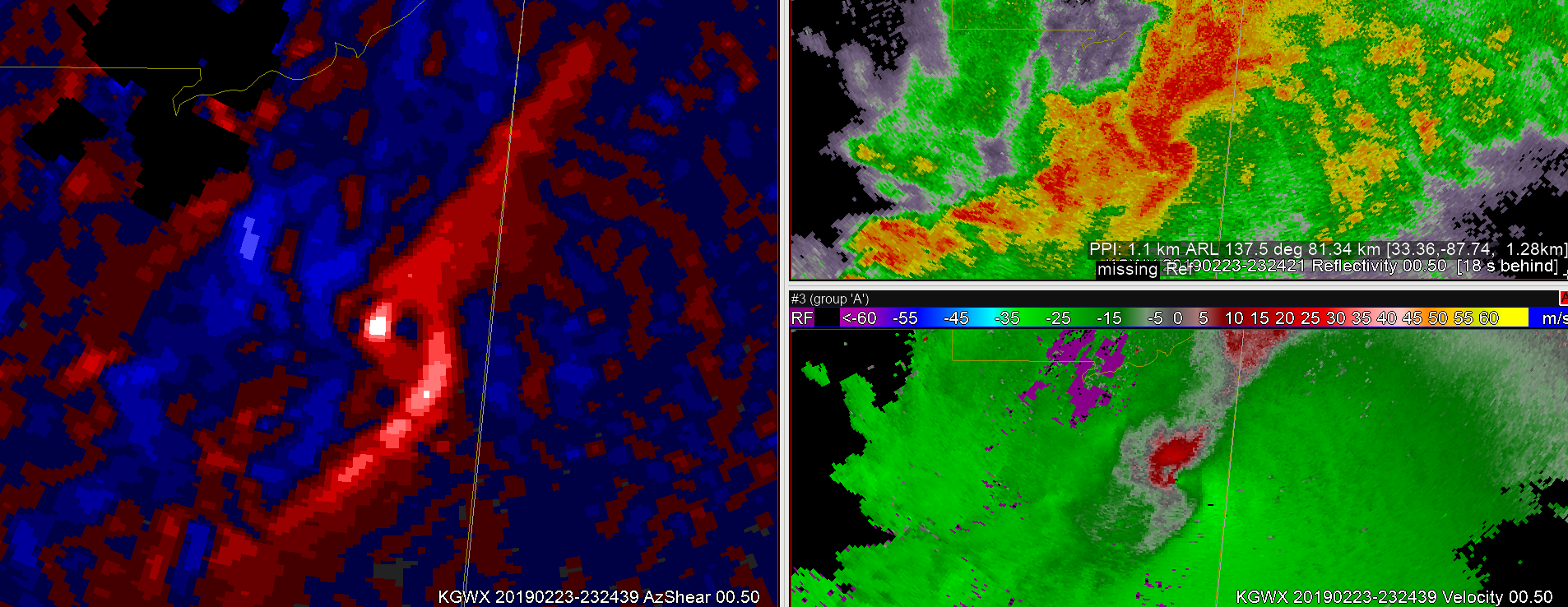
By 2316z, there is now a break in the ‘S’ in the AzShear, and at this time the low-level circulation is tightening as a supercell is apparent in the reflectivity.
2316z break in the ‘S’ in the AzShear
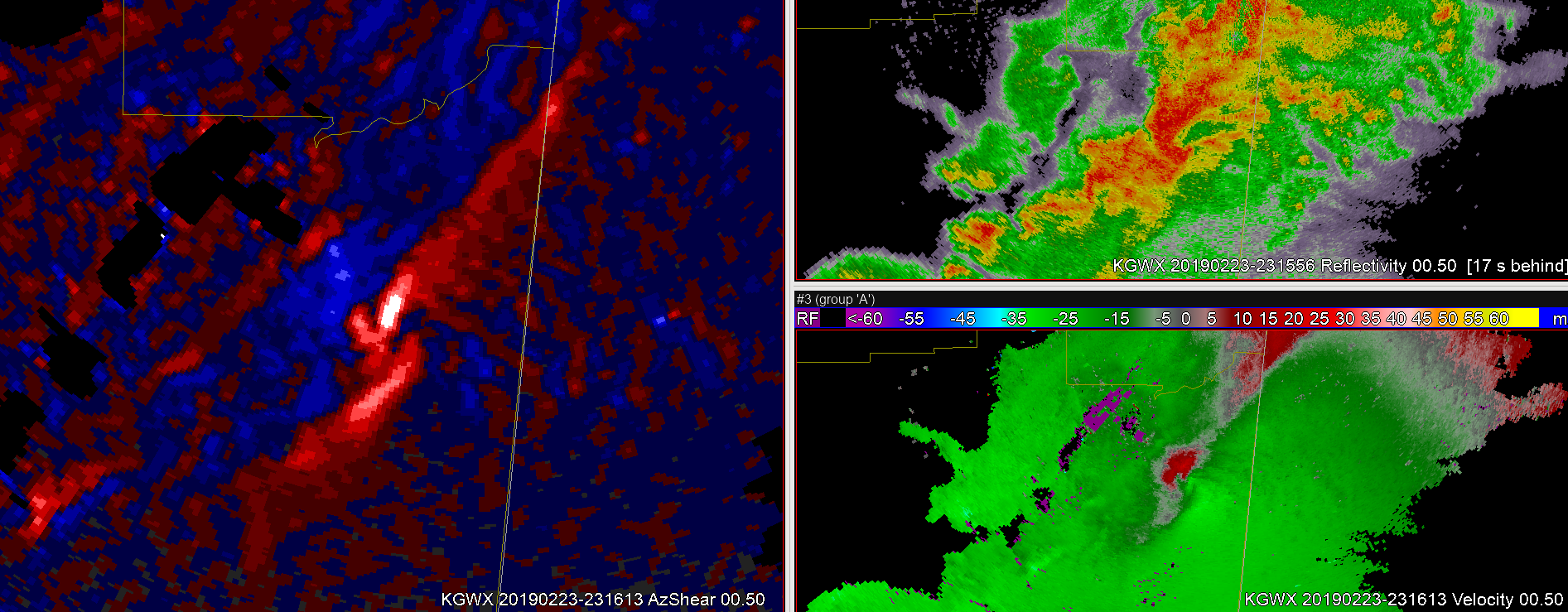
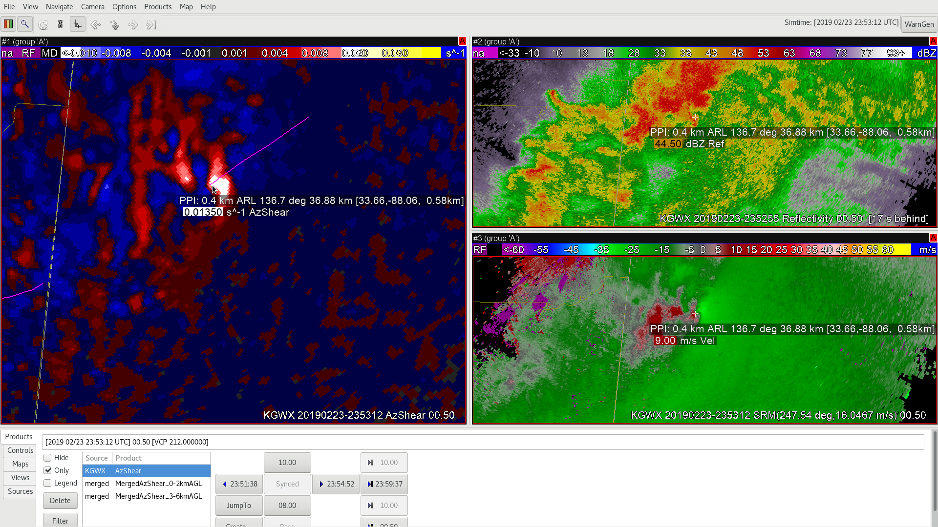
About two minutes later the low-level 0.5 degree circulation is now gate-to-gate. AzShear values are high at the circulation, but also highlight shear along the interface of the FFD and the inflow, as well as along the RFD region.
2318z
This same general pattern would continue for the next several minutes. However, by 2324z the trailing RFD or mesoscale cold front pushes ahead of the main circulation and merges with the FFD/inflow interface as the storm appears to mature and the main circulation becomes occluded.
2324z
After this time the main circulation fades and the convective organization appears to either transition or recycle. In summary, the single radar AzShear product appears to highlight other regions of interest where shear is present outside the main circulation. These features are important in tornado development and supercell life-cycle, but are not always apparent in reflectivity or in velocity. Of note, the detail in the single radar product has a tendency to become lost or muted in the merged product.
One challenge would be color scales for different portions of the country. Would a color scale for the southern plains be sufficient for the mid-Atlantic, or would smaller weaker features be less noticeable?
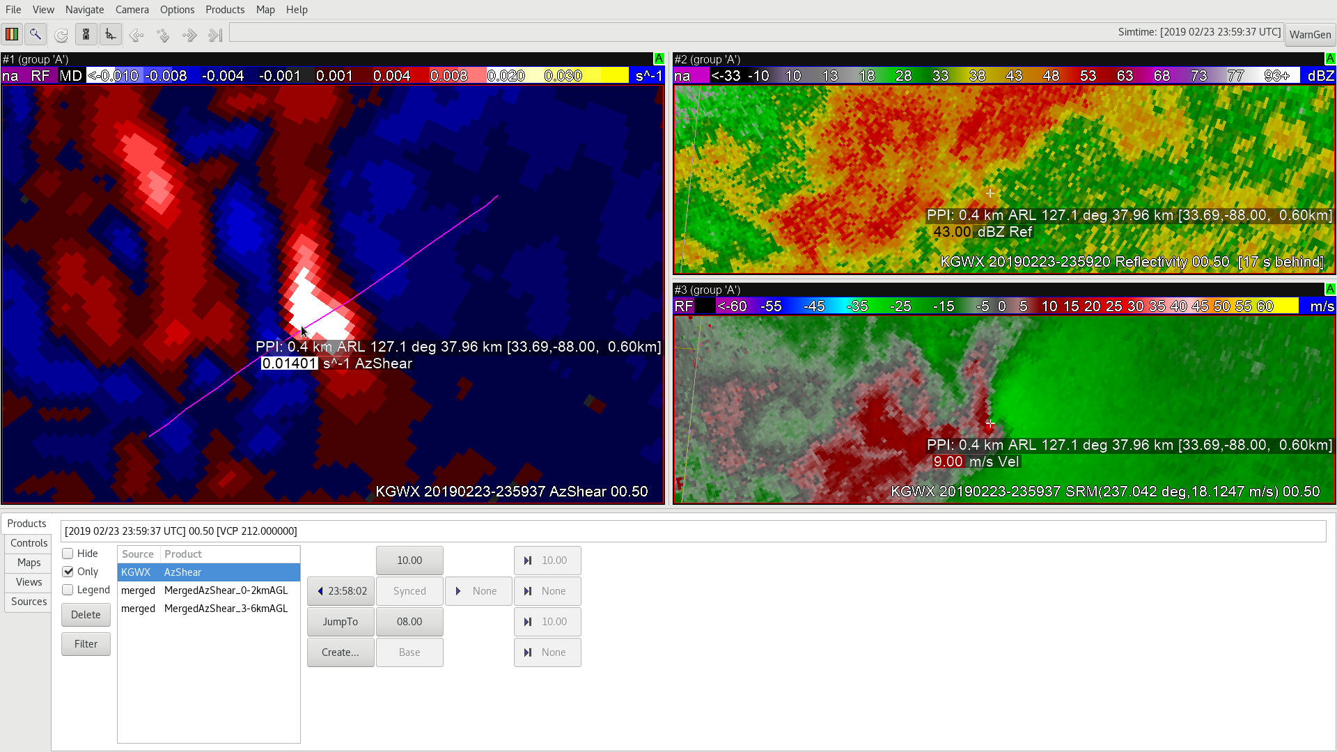
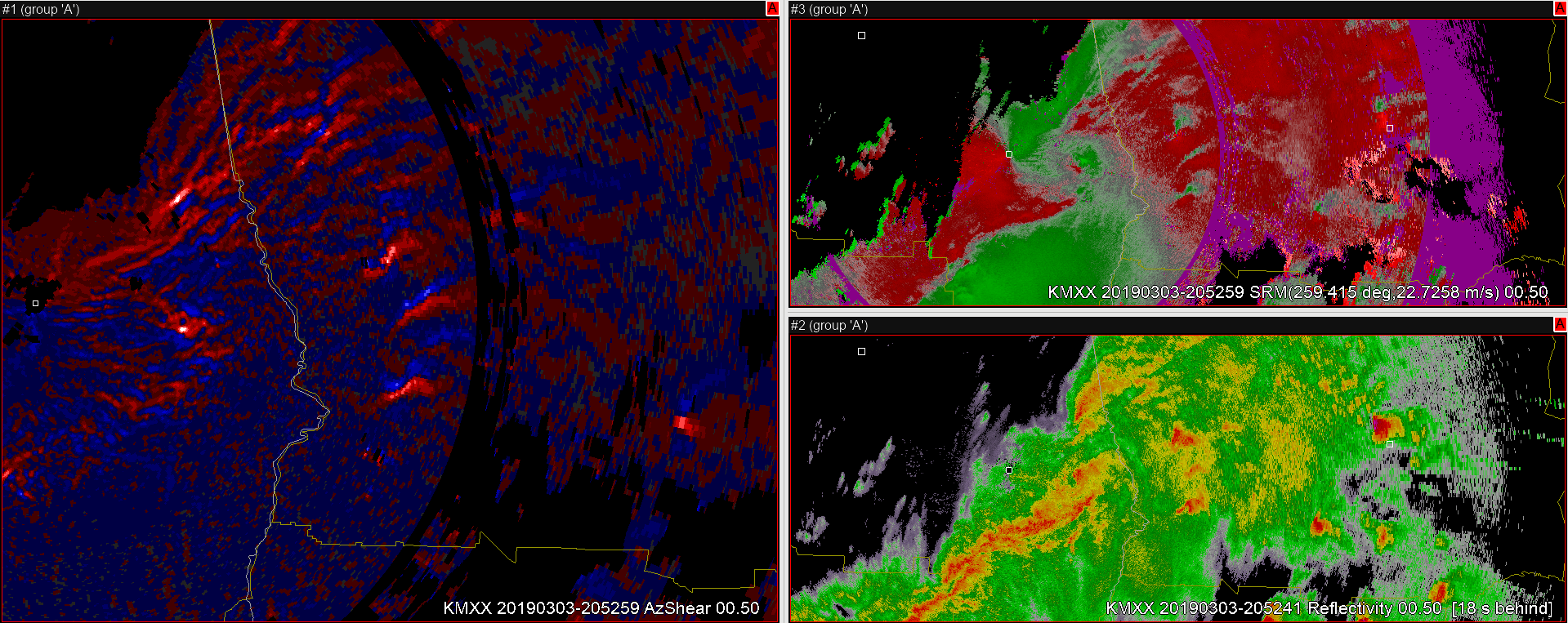
The single-radar AzShear product is quite useful in grabbing my attention to areas of high shear that could indicate the presence of tornado or higher level rotation. While not the best in indicating the location of the tornado (Velocity provides more precision), the AzShear helps identify those areas within the storm cell with strong shear, see Fig 1 below.
Figure 1: Single radar AzShear on left, Reflectivity top right, Velocity bottom right. The cursor indicates the center of the tornado based on Vel, but is more in the center of the highest shear on the AzShear product. Other ‘hotspots’–whites/light blues in the AzShear product may send forecasters on wild-goose chases, looking for tornadoes, but having velocity data on hand quickly helps toss out the non-tornadic areas.
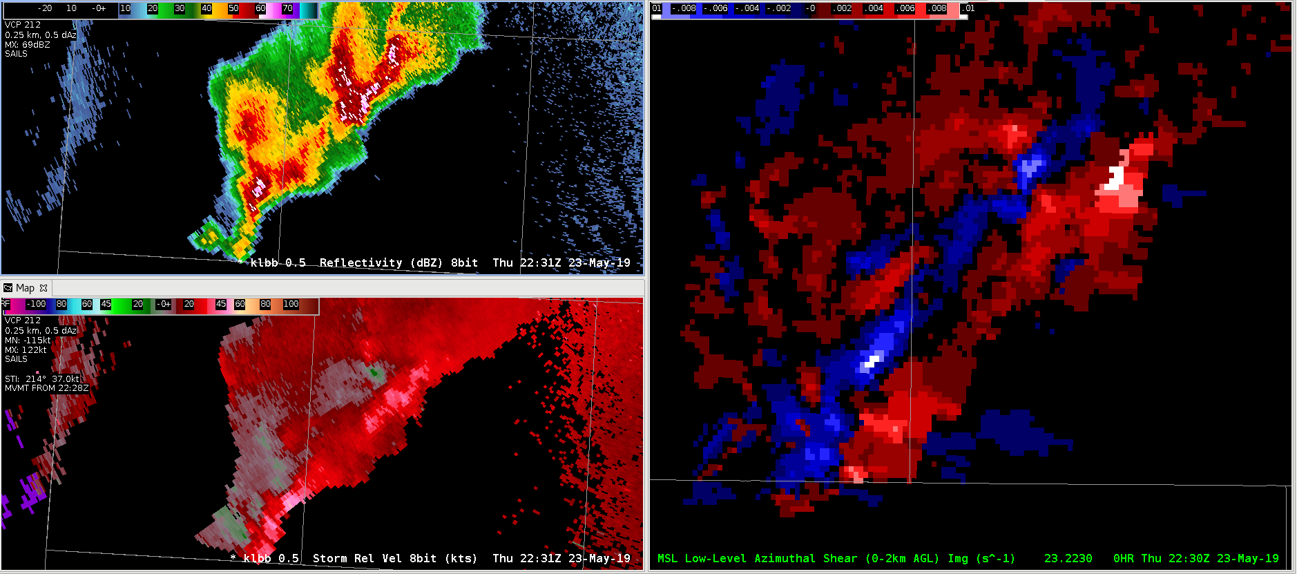
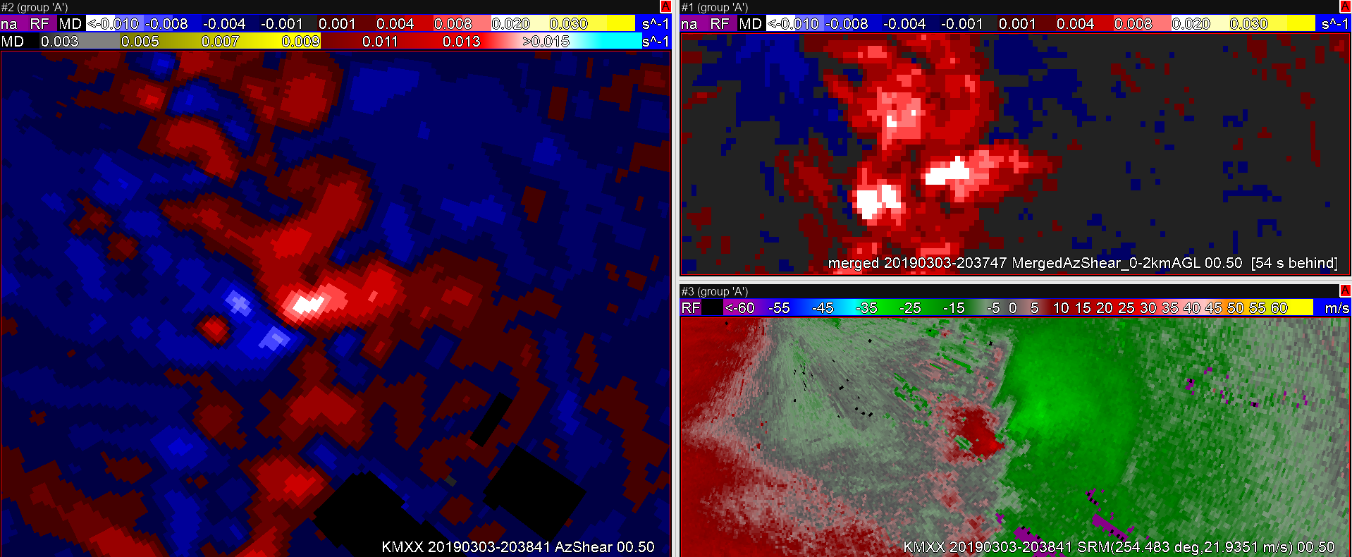
The MergedAzShear (MAS) product is useful in a broader sense of scale, but probably not as useful as the single radar AzShear. An MAS couplet often becomes distorted with the blending of multiple radar cuts from different radars. Sometimes a single couplet could show 1 or 2 echoes that will resolve into 1 couplet after another scan. For short-fused monitoring of a tornadic storm cell, its position could be misleading. Higher-level MAS, while useful in a broader storm environment seems less likely to depict a tornado, although it will indicate a broader area of high shear and changes in the wind fields. (See Fig. 2).
Figure 2: MergedAzShear (MAS) 3-6km AGL on left, Reflectivity on top right, Velocity on bottom right. The computer cursor is placed near the center of the Velocity-indicated tornado center.Ultimately, the AzShear is a good tool to use along with Velocity data to get an overview of what is going on within the atmospheric layer (0-2km or 3-6km), even when there is no tornado on the ground, but should be used in tandem with other radar data to help weed out false signals that may be due to ground clutter, etc.
For the first HWT exercise, I’ll be taking a look at the AzShear products, including a single radar AzShear product and two (MRMS) merged radar products at the ranges (0-2km) and (3-6km). This is my first time as a forecaster seeing/evaluating these products, and the case was mainly used as to build knobology on the local evaluation platform while also discussing potential conceptual uses for said products. Thus far, the single radar AzShear product seems to help illuminate areas of enhanced rotation nicely in an easily depict-able manner. It doesn’t, however, seem like it should be considered as a replacement for a velocity/SRM display in the near-term environment. This was proven true in several cases where it was hard to pinpoint exactly where the center of rotation was in the display (See image below).
(Left) AzShear product using a single radar site; (Top Right) Reflectivity; (Bottom Right) Storm Relative Motion; (Purple Line) Confirmed Tornado Track.
If I was a forecaster trying to draw a tornado warning polygon, I wouldn’t necessarily want to do so using the AzShear product alone, the use of SRM/BV would allow for a more finite tornado warning polygon to be drawn, which would result in a lower FAR with respect to those within said area who have the best chance of encountering a tornado on the ground. Also, I feel that this product will need a rather extensive color table to make it useful, and I’m just not convinced that there is enough precision to allow that to be possible knowing the resolution and reliability of the input.
With that being said, I do see some utility in this product, specifically as a supplement/tool for a radar operator in the near storm environment. Being able to pick out and follow areas of highest shear through the evolution of an event could be extremely useful, especially in linear or a cluttered storm type environment where picking out couplets using SRM/BV could be more difficult.
Briefly evaluated were the merged AzShear data-sets within the case. Generally, even more features which would be beneficial to a warning forecaster are being lost in the process of creating this product. On a CWA scale, the primary benefit for this would be for situational awareness purposes, or possibly through the use of the (0-2km) product in a tropical-type environment where low/mid-level rotation may indicate a pre-cursor to a short-lived weak tornado. A huge downside at this point is the incorporation of the “Sails” slices, which tends to make the product rather messy in-between. A suggestion would be to try to eliminate the sails slices, even if that ultimately limits the amount of time between new data production.
Two supercells southwest of Lubbock produced perplexing base radar signatures with a clear right-mover reflectivity signature but anticyclonic rotation evident in storm-relative velocity. To its credit, the MRMS AzShear product picked up on the anticyclonic circulation effectively and should be able to detect the rare anticyclonic tornado!
None of the mesocyclone detection algorithms picked up on the anticyclonic rotation. Perhaps this is part of their design. The New MDA tried to detect a mesocyclone southeast of the main anticyclonic circulation on the gradient of the strong outbound velocities, but it is incorrect.
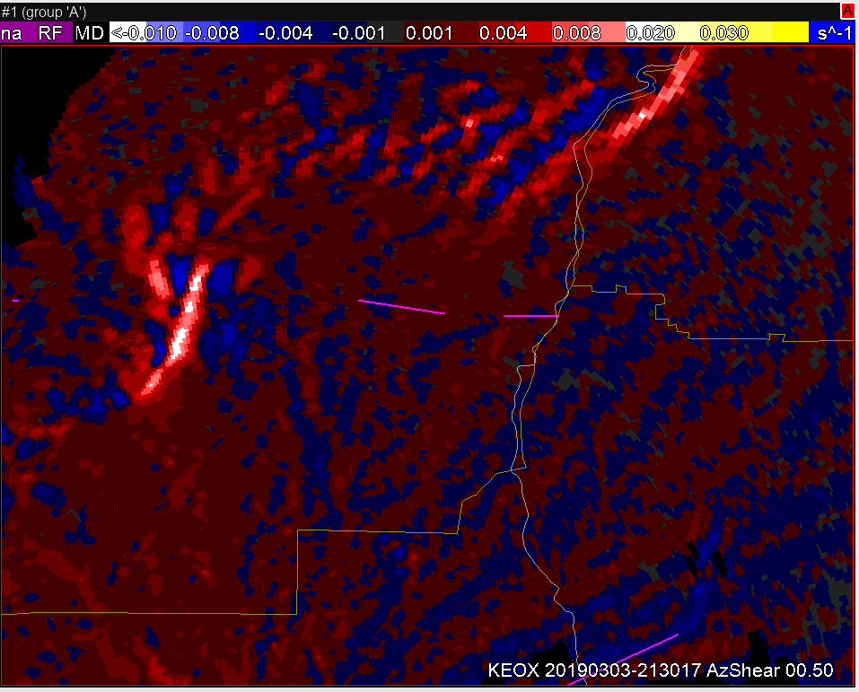
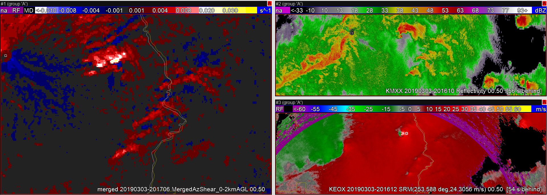
Single-radar AzShear does a really good job of identifying preferred locations of circulation along a QLCS. The bullseye started as an elongated area of enhanced AzShear and then converges into a more concentrated area. This product provides a helpful heuristic for identifying tightening circulations in the midst of noisy velocity data with less-clear signatures.
One can easily see the congealing AzShear bullseye before the circulation tightens the tornado starts.
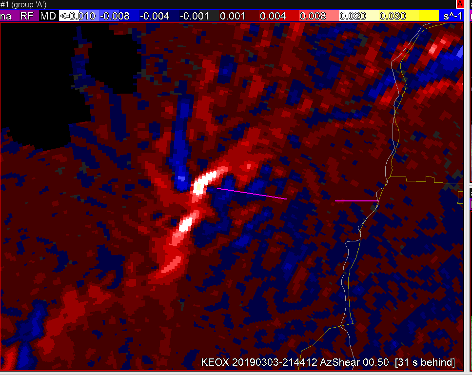
On the contrary, the Merged AzShear product demonstrated some latency issues that would lead to less confidence in circulation tightening.
This image, taken at the same time as the KEOX AzShear product, shows several unorganized areas of enhanced rotation right before the tornado started in the merged AzShear product. The tightening circulation is an important precursor to tornadogenesis and the merged product seems to struggle. -Atlanta Braves
The single-radar AzShear product shows demonstrable improvement over MRMS Merged AzShear. The spatial detail of the best circulations is much better than that of MergedAzShear, which introduces spatial discontinuity and broader areas of interest. The AzShear color table, in particular, is exceptional in highlighting developing areas of rotation along with locations of convergence along bowing segments. In the example below, you can see the rotation signatures from several discrete supercells, an embedded supercell along the line, and a couple areas of convergence associated with the QLCS. For each of these cases, the AzShear performs well and gives a representative view of the severity associated with each circulation. -Atlanta Braves
The single-radar 0.5 degree AzShear (left pane) shows a coherent area of high values associated with the velocity couplet (bottom right pane). Compare this with the merged product (upper right pane). The merged product shows a few different maxima in AzShear which is probably associated with the multiple radars and beam heights that are used to make the product. The single radar product also tracks the velocity couplet better in real time and is not subject to the lag in the merged product due to the multi-radar processing.
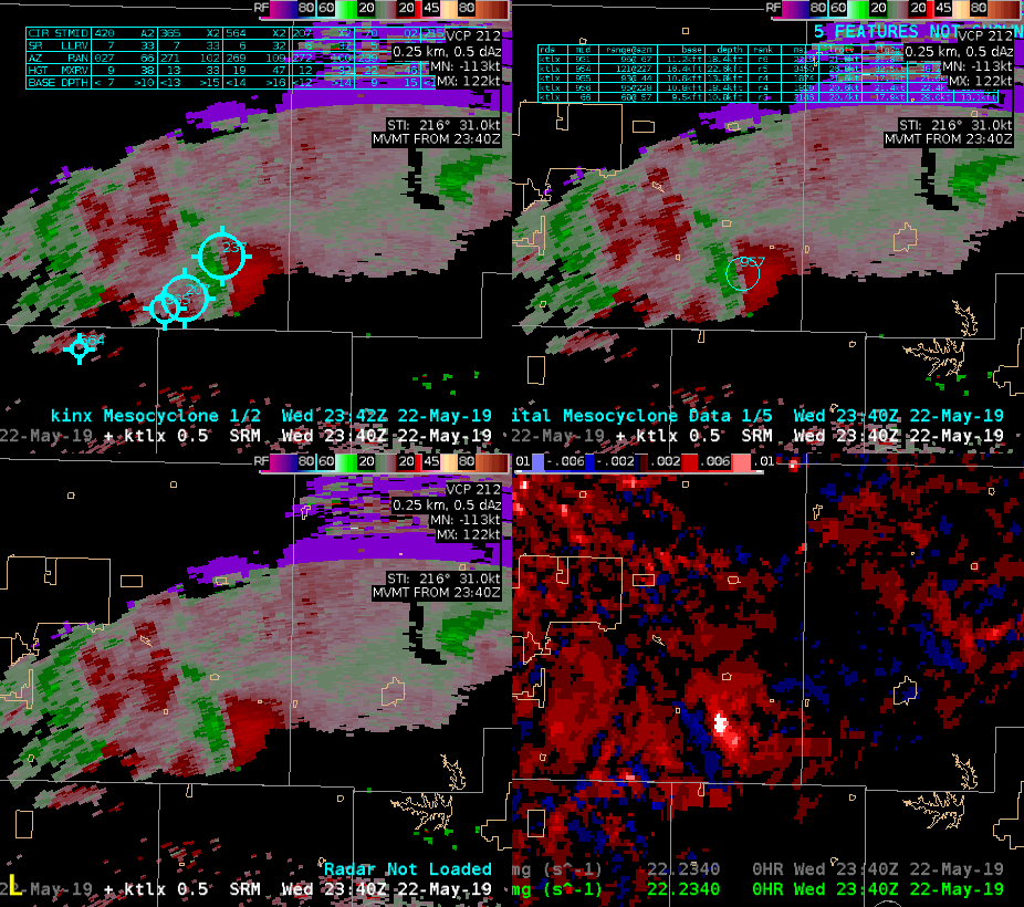
A cluster to 2 merged supercells traversed across northern Oklahoma this evening. The loop below shows the performance of all three mesocyclone detection algorithms.
The legacy MDA performed the most poorly of all 3 detecting several inaccurate mesocyclones with inconsistent tracking. The DMD performed remarkably well in both tracking and intensity on the main meso The NMDA experienced occasional dropouts where data was unavailable, but also performed pretty well on this storm. It particularly detected intensity well through the lifecycle of the meso. The AzShear product also tracked the main mesocyclone very well. The DMDA performed best of all three for this storm but the NMDA also showed promise. -Atlanta Braves


 Other ‘hotspots’–whites/light blues in the AzShear product may send forecasters on wild-goose chases, looking for tornadoes, but having velocity data on hand quickly helps toss out the non-tornadic areas.
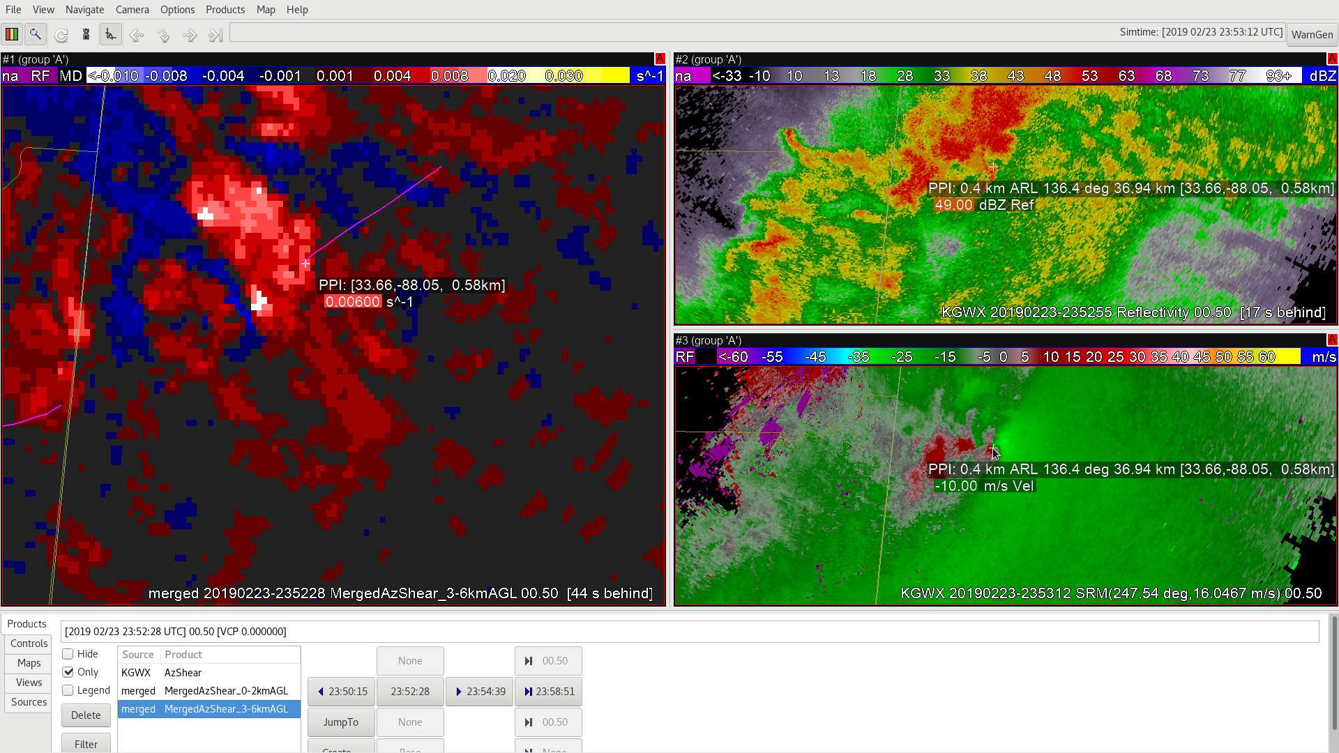 Ultimately, the AzShear is a good tool to use along with Velocity data to get an overview of what is going on within the atmospheric layer (0-2km or 3-6km), even when there is no tornado on the ground, but should be used in tandem with other radar data to help weed out false signals that may be due to ground clutter, etc.