PWAT data comparison

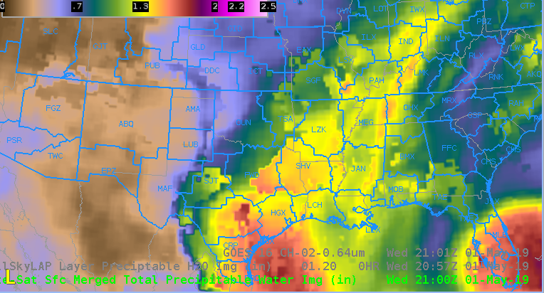
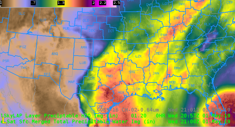
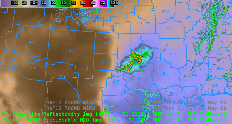
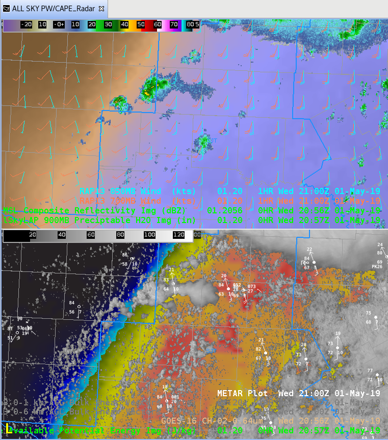
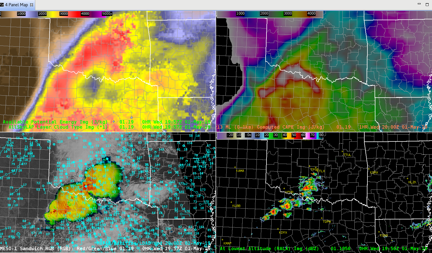
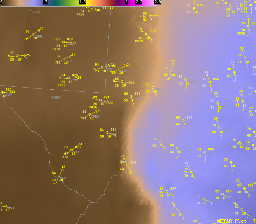
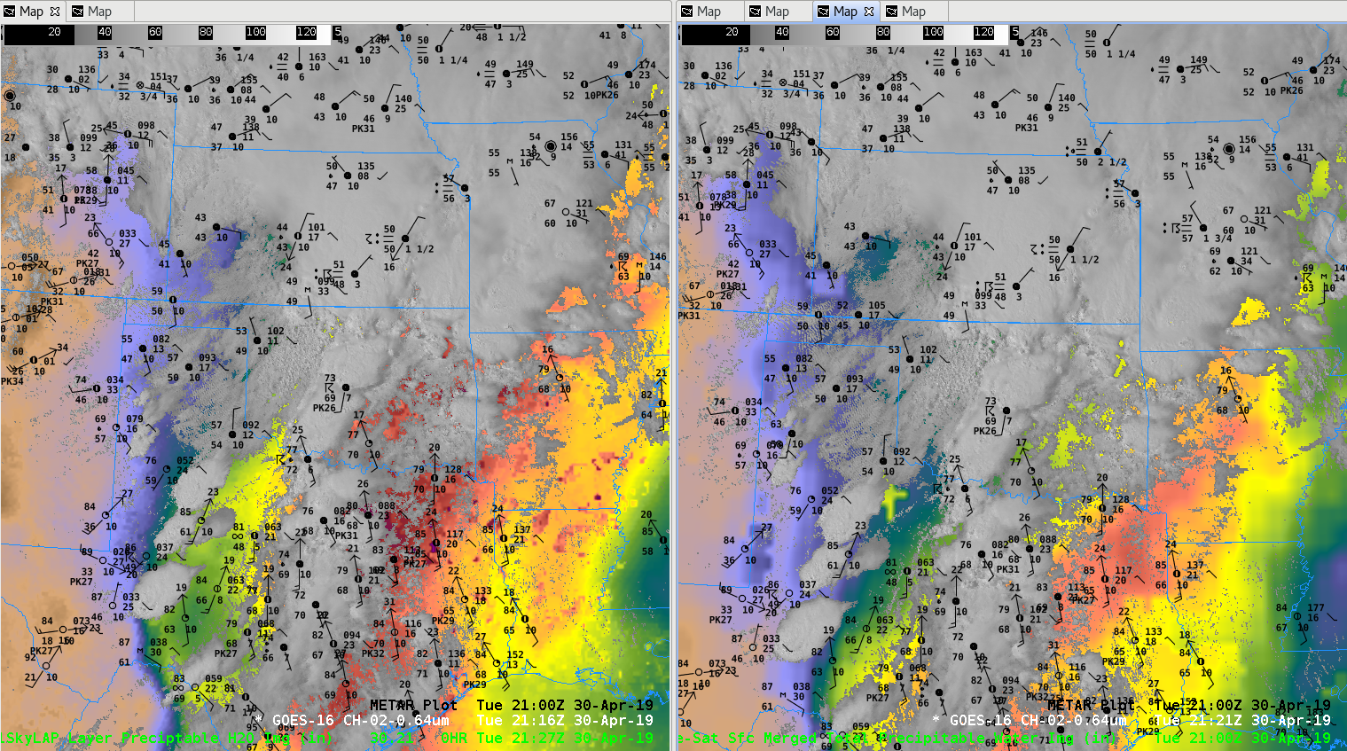
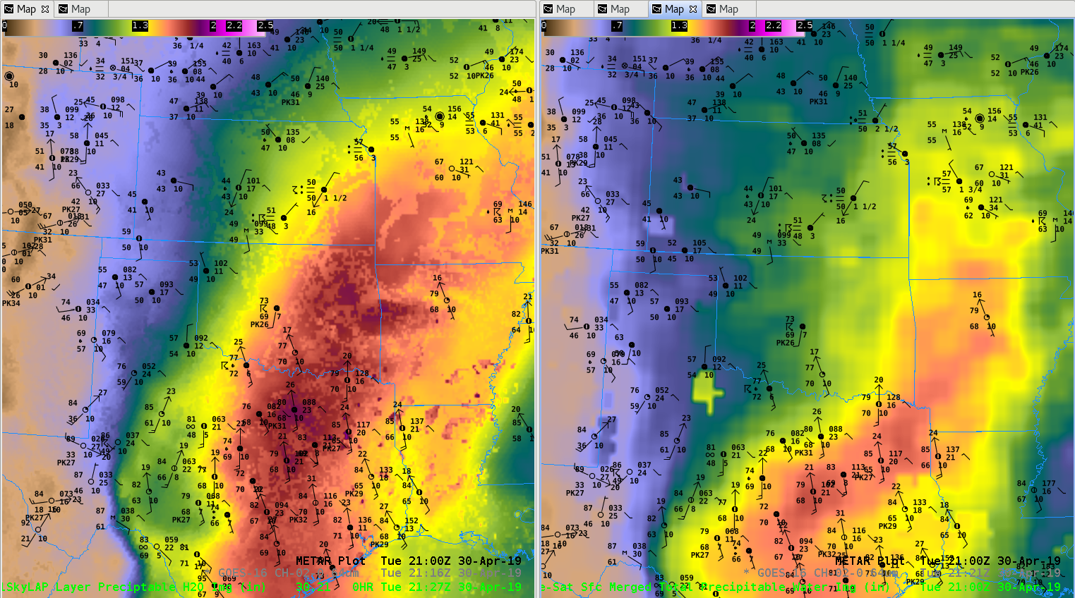
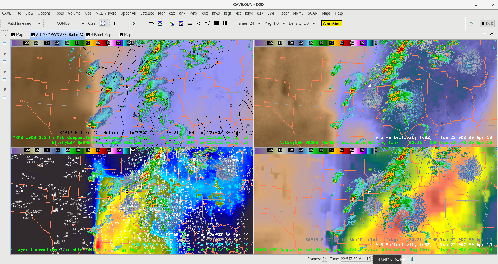
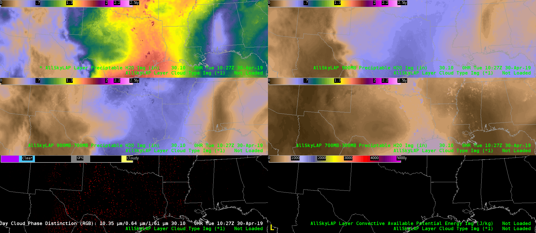
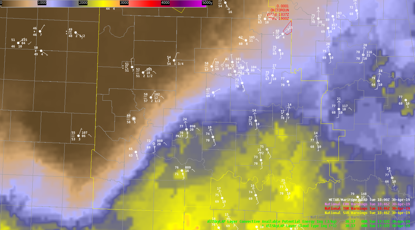
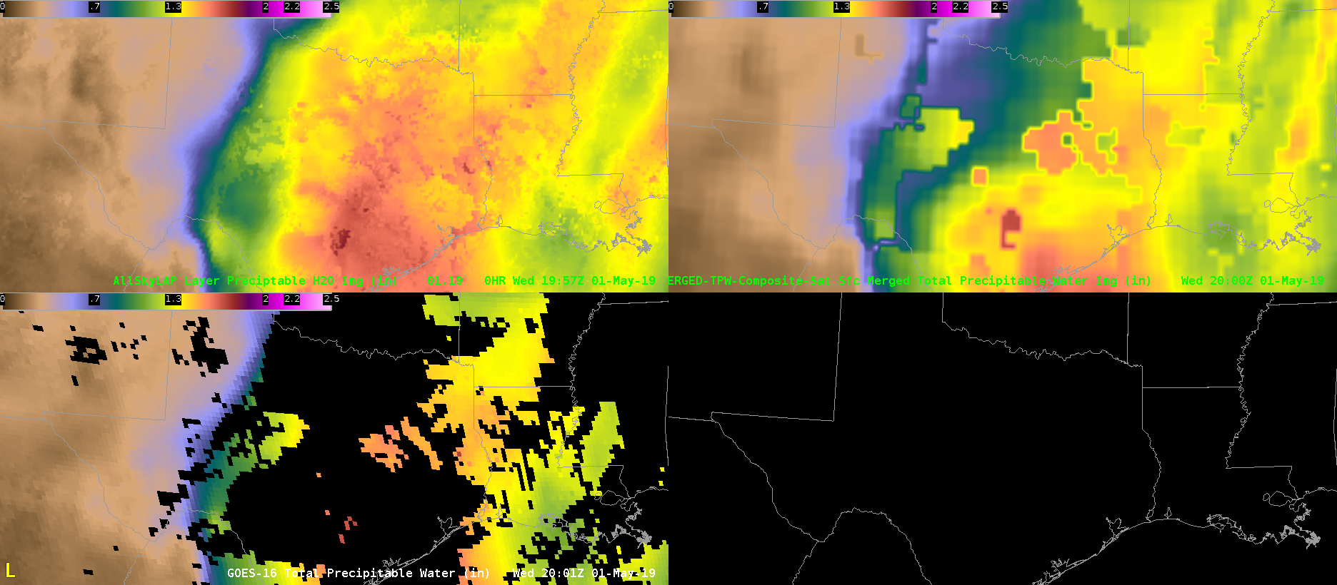
PWAT comparison. Allsky LAP is on the top left, Merged TWP is on the top right, and data from GOES that we see in AWIPS in our offices on the bottom left. The blotchyness of the merged product renders it mostly useless for operational purposes. Additionally, the Allsky LAP depicts a much more realistic PWAT spread in north central Texas where convection is ongoing.


-Dusty Davis

All Sky Total PW vs CIRA Merged PW

Figure A (CIRA Merged PW)

Figure B (All Sky Total PW)

Figure C (All Sky Sfc-900mb PW)

Notice the big difference in Figure A compared to Figure B from DFW to OUN coverage area, Figure B with All Sky Total PW was handling the plume of moisture streaming northward much better.  This also correlates well to area of deep convection in Figure C in the deeper moisture region.  -Jake Johnson

LAP all-sky CAPE hole


The LAP all-sky CAPE developed a min over north TX during the late afternoon. The RAP 0-1km MLCAPE had a similar min. Convection was struggling to develop in this region giving support to the lower derived values. CAPE was overall much higher across the warm sector and into central OK for LAP when compared to the RAP although the RAP had a ring of ~4500 J/kg CAPE around the relative min (~3300 J/kg).

All Sky Severe Environment

Mesoscale analysis is MUCH improved with ALL SKY products. It gives the forecaster a great visual of where moisture advection is occurring in the layered products.  In addition, CAPE and Total PW highlight the more unstable regions with intensifying storms from overlaid region radar data.   -Jake Johnson

Meso-analysis for CI

Figure A

Figure B

Watching for new storm development in SW Oklahoma with GOES-16 Vis/IR showing a new storm developing in Figure A.   Area of interest will be in southwest Oklahoma with frontal boundary stalled out and high CAPE from All Sky Layer in Figure B(left image) meanwhile right image shows All Sky Layer PW with RAP13 0-3km CAPE in black contours.  This environment would be favorable for severe weather and possible tornadoes if storm can remain on the frontal boundary.    -Jake Johnson

All-Sky LAP CAPE and Boundaries

The All-Sky LAP CAPE product is rather useful as a quick and dirty SA tool to quickly identify boundaries and their approximate location/orientation. While the actual CAPE values given are not as important (perhaps better to rely on obs, mesoanalysis, and short-term models for that), the LAP product does very well with identifying the key location of the gradient and subsequent boundary. The boundary location in today’s case is rather obvious, but this product will likely prove useful in more diffuse situations.

–Stanley Cupp