AllSky CAPE high in one place low in another

cells persisting in far western CWA has high CAPE on latest AllSky product.  However, the line of storms that moved through the middle of the CWA is now in the eastern part and into ARX’s area.  Line continues to look severe, with AWOS in northwest ARX gusting to 52 knots, but CAPE not as high.

CHARLEY

Tags: None

LSX Warning 1 (Mountain Bone)

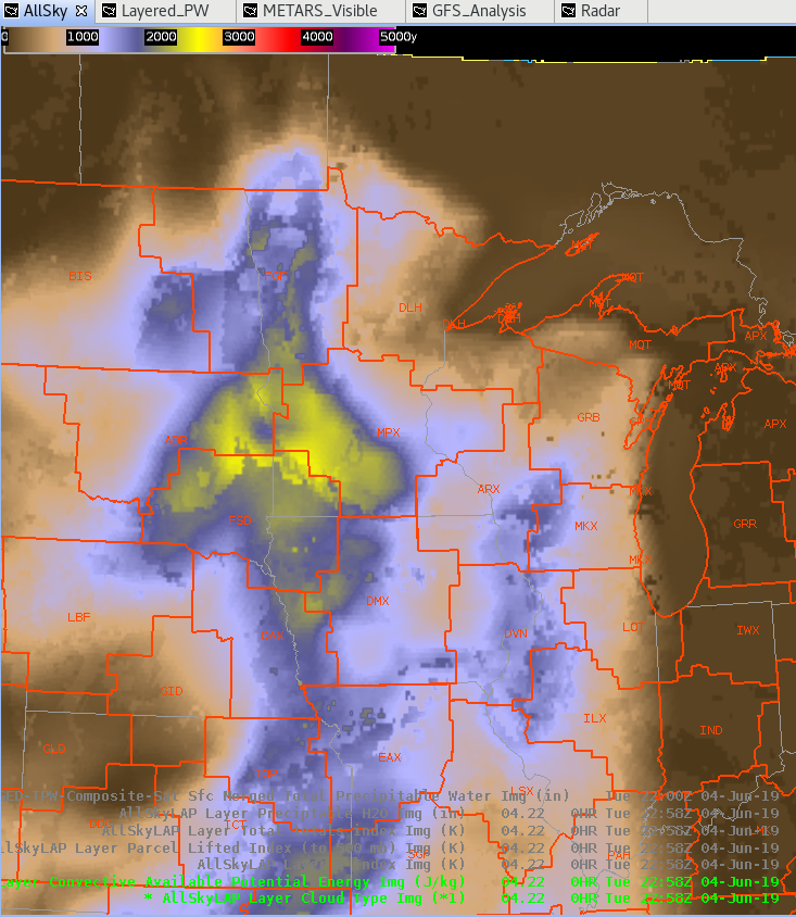
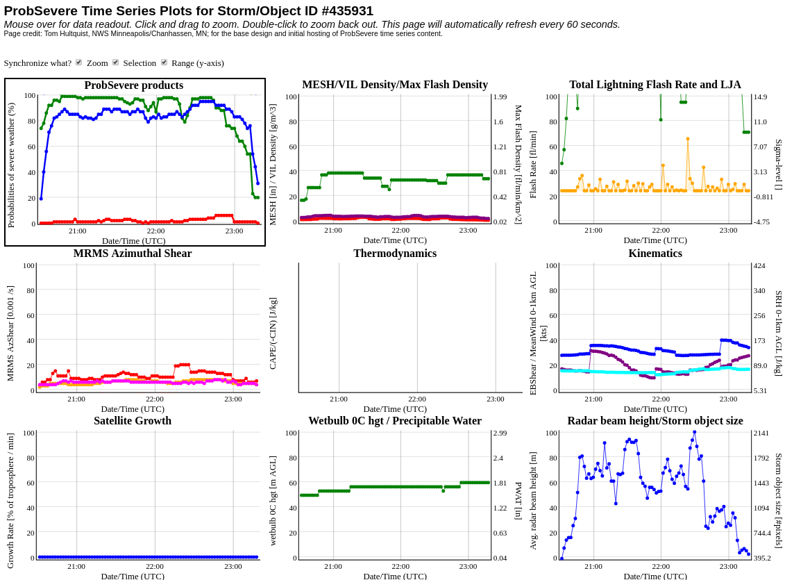
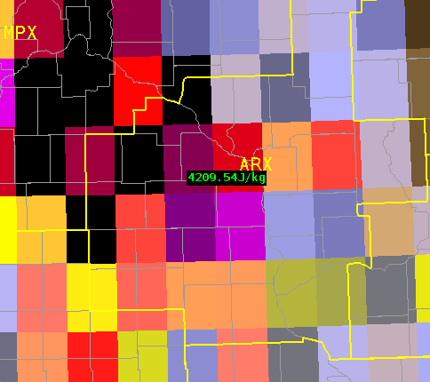
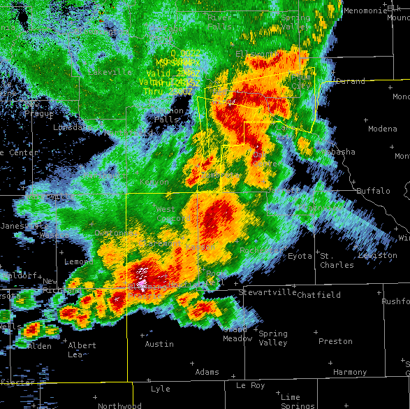
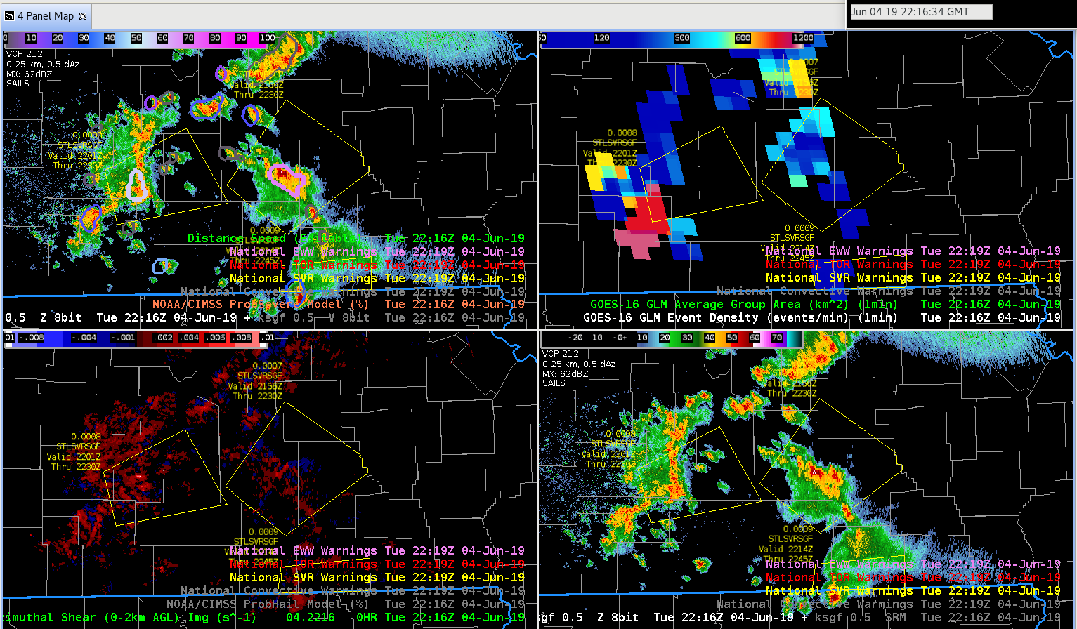
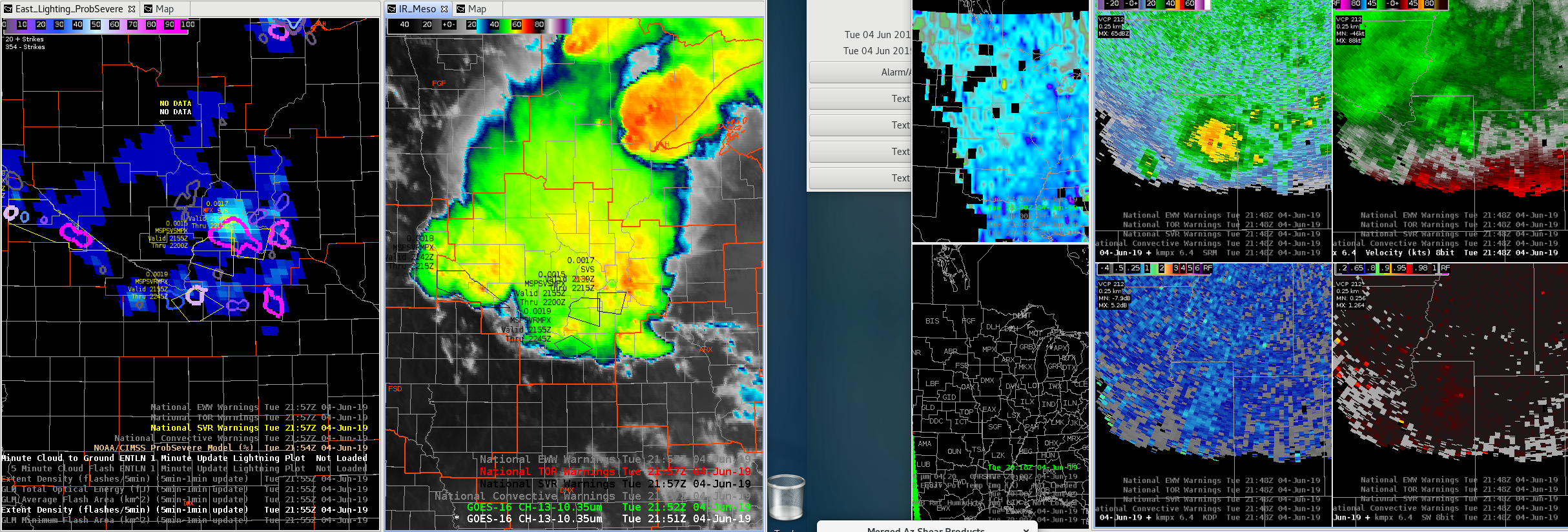
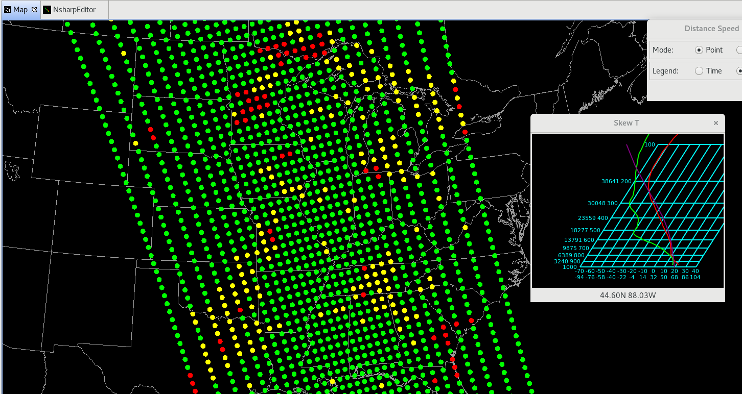
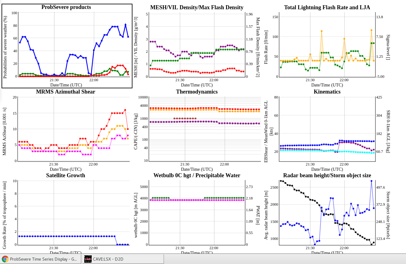
SPS’s have been upgraded to a warning due to some interesting velocity couplets. At the time of the warning, the new Prob-Severe model had (ProbHail: 5%, ProbWind: 56%, ProbTor: 2%). At the storm’s severity peak, the new Prob-Severe model had (ProbHail: 8%, ProbWind: 78%, ProbTor: 17%). While the warning decision was made based on the velocity signature showcasing 30+ kts inbound with some broad rotation, the added confidence of the Prob-severe model assisted in “pulling the trigger” and likely provided several minutes of added lead-time in this scenario. Also taken into account was the understanding that it was the northern-most cell in a line that is moving into a favorable environment charactarized by ML CAPE values near/above 2000 J/KG based on the All-Sky LAPS analysis. A bit disappointed with the data latency of the new MDA product on this cell, with little to no MDA information available. The digital MDA has done a good job tracking the feature with only one hit available on the old version.

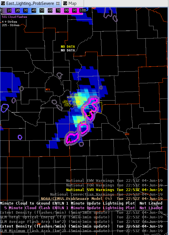
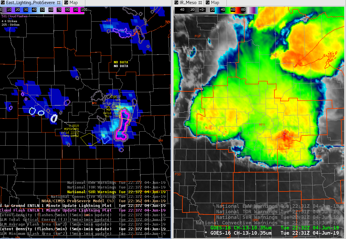
There was also a considerable lightning jump that occurred in this cell as it underwent strengthening.

Tree damage was reported within the warning shortly after it was issued.

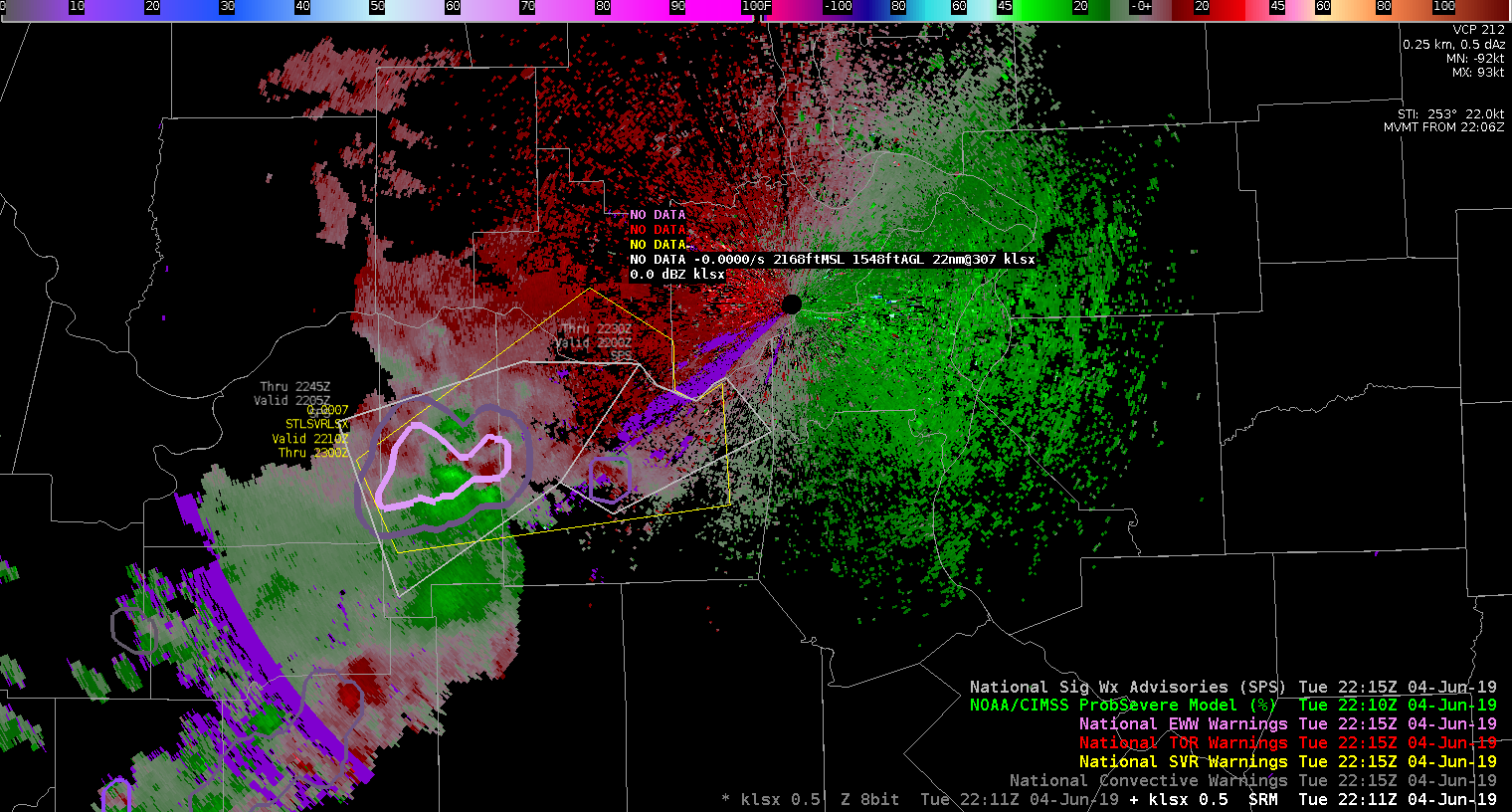
22:34z: Due to persistent cycling and broad rotation, a “tornado possible” tag was added to the warning. This rotation is likely being spurred on by a combination of a cell merger and boundary interaction.

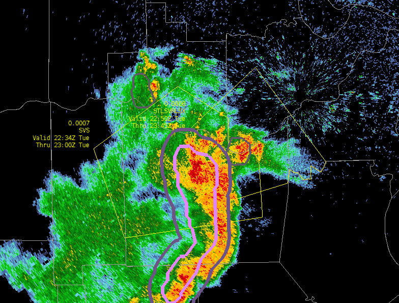
2250z: Warning continued upstream continuing the “tornado possible” tag. Still some broad rotation from boundary interaction. No gate-to-gate, but I feel that the Prob-Tor model is underduing things a bit. Possibly because the environment isn’t condusive to Tornadoes? At the time of issuance, the Prob-Severe model was showcasing (ProbHail: 9%, ProbWind: 68%, ProbTor: 3%). My forecaster prob-tor would be closer to 15% at time of SVR T-Storm issuance.

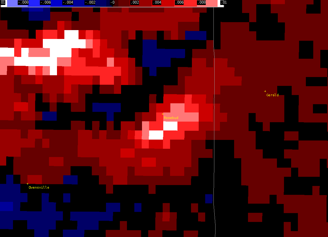
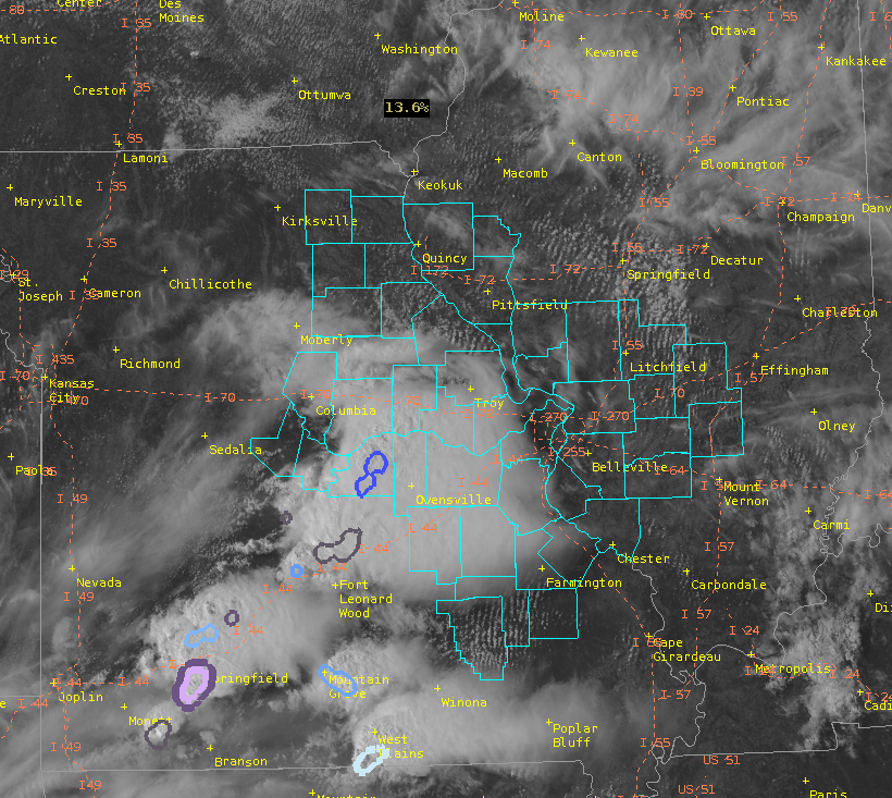
~2215Z: Spotter reported a brief tornado touchdown in a field on the east side of Rosebud, MO. Still trying to confirm the authenticity at this time. Screenshot above of possible Tornado spinup from the area of the spotter report.

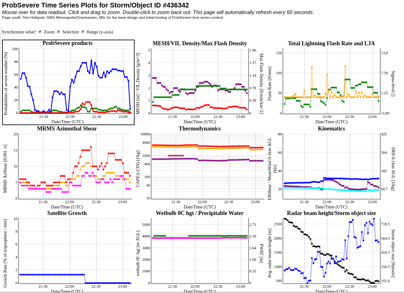
Storm has weekend and become primarily a wind threat which should be coverable with an SPS. Will allow the warning to expire on-time.


Tags: None

All Sky LAP CAPE and NUCAPS forecast contrast

A vigorous line of storms was moving into the NW corner of the ARX CWA prior to 23z.  The All Sky LAP CAPE showed decreasing values (~1100 J/kg) heading into this region.  In contrast, the NUCAPS forecast (un-interpolated image shown) depicted values of ~3000-4000 J/kg.  Based on the initial behavior of the storms, the higher instability values in the NUCAPS appear to have better verification.

Tags: None

ProbTor seemed a bit high

Had a few instances this afternoon where ProbTor seemed a bit high (the extra layer of ProbSevere added on).  NUCAPS soundings showed high LCLs (2-3 km), whereas SPC meso page was on the order of 1.5 km…still pretty high.  Had rotations aloft, and the lowest we saw a rotation was at a point where 0.5 tilt was around 5 kft.  We issued a couple of SVR’s with TOR possible but no TOR warnings.

CHARLEY

Situational Awareness Graphics

While monitoring convection across southern Missouri, the merged AzShear and ProbSevere have been great tools in diagnosing the primary severe threats: wind and hail.

AzShear has shown a few areas higher in shear, yet the ProbTor has been very low and V data has been unconvincing of the presence or threat of a tornado. ProbSevere has been useful in indicating the severe storm hazards that would be the most probable, and when compared with other data: GLM event density / avg group area, and V data, I’ve been able to issued warnings with higher confidence. GLM data will be increasingly useful with better understanding of what the different data sets mean in relation to convective development or decay.

Tags: None

LSX Mesoscale Discussion (Mountain Bone)

Ongoing sub-severe convection continues to develop along a decayed MCS boundary. This convection is primarily located along and south of the I-70 Corridor as of 2130z, but continues to press east into a favorable environment for continued/sustained convection, characterized by modest Instability (1400 – 2000 J/KG ML CAPE) according to All-Sky LAPS derived CAPE values and near 70 degree dewpoint temperatures. Kinematics continue to be unimpressive, with the majority of the forecast area remaining in an area characterized by sub-40kt bulk shear values with little to no sfc-1km effective shear layer. A stray embedded strong to supercellular storm will remain possible this afternoon and evening as the multicell cluster continues to fill in and push east, especially with the arrival of a weak LLJ feature which may help to organize/ strengthen the area of convection by 00z/7pm CDT. PWATs (1.5 to 1.75inches) continue to increase, especially across the low to mid-levels, which could support some isolated heavy downpours which may lead to additional flooding. Primary threats: Strong winds, small hail, and flooding rains.

—————————————————————————————————–Mountain Bone

Tags: None

NUCAPS Updating in NsharpEditor

The pop-up skew-T is useful for a quick cursory look at sounding profiles, but I noticed that when clicking on the data points, when the NsharpEditor opened up it never updated for the new data at subsequent points. For a new skew-T in the NsharpEditor, one has to close the original NsharpEditor before clicking on a new one.

Tags: None