
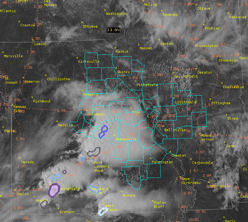
Ongoing sub-severe convection continues to develop along a decayed MCS boundary. This convection is primarily located along and south of the I-70 Corridor as of 2130z, but continues to press east into a favorable environment for continued/sustained convection, characterized by modest Instability (1400 – 2000 J/KG ML CAPE) according to All-Sky LAPS derived CAPE values and near 70 degree dewpoint temperatures. Kinematics continue to be unimpressive, with the majority of the forecast area remaining in an area characterized by sub-40kt bulk shear values with little to no sfc-1km effective shear layer. A stray embedded strong to supercellular storm will remain possible this afternoon and evening as the multicell cluster continues to fill in and push east, especially with the arrival of a weak LLJ feature which may help to organize/ strengthen the area of convection by 00z/7pm CDT. PWATs (1.5 to 1.75inches) continue to increase, especially across the low to mid-levels, which could support some isolated heavy downpours which may lead to additional flooding. Primary threats: Strong winds, small hail, and flooding rains.
—————————————————————————————————–Mountain Bone