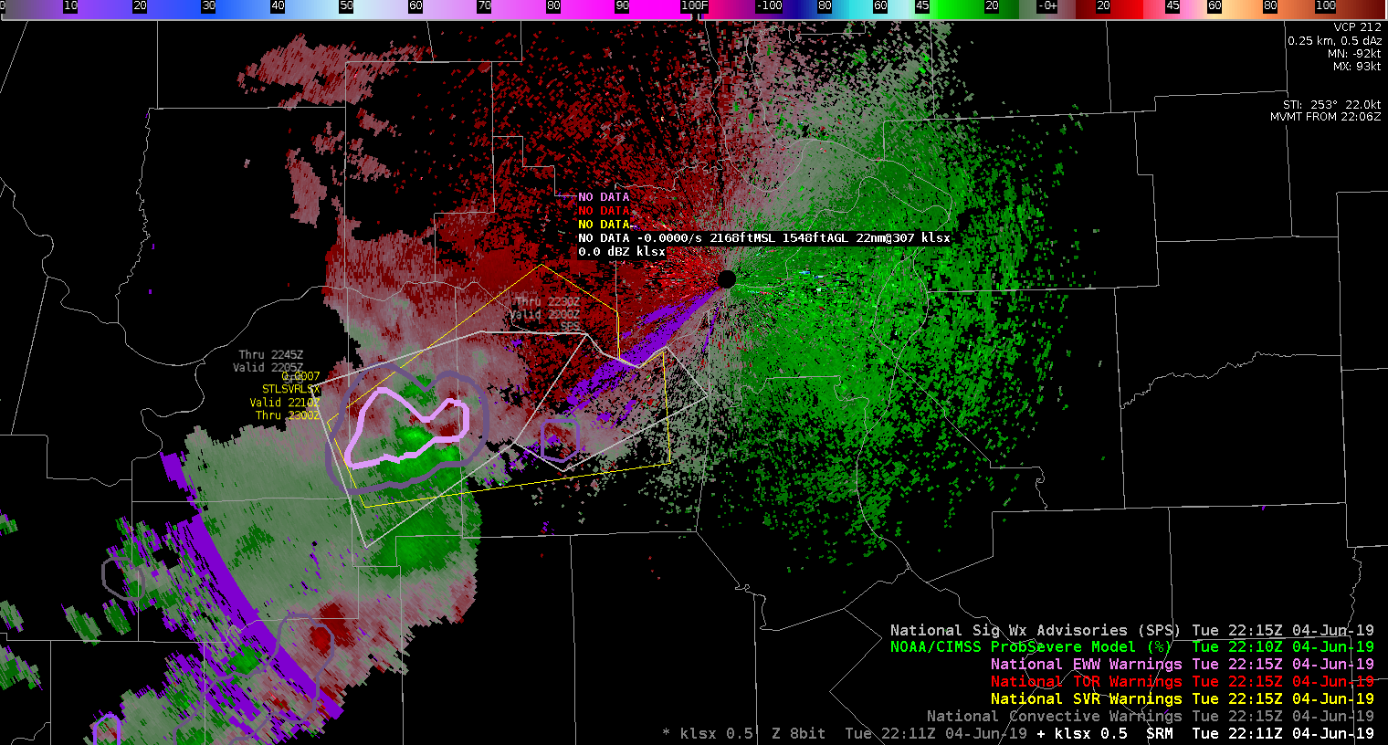
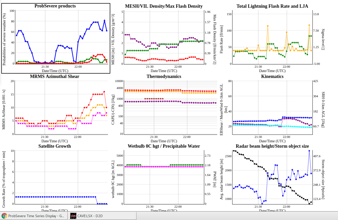
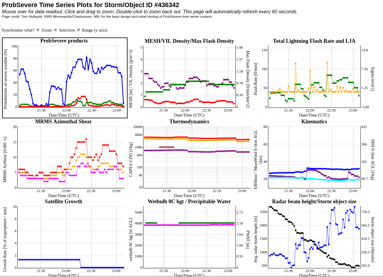
SPS’s have been upgraded to a warning due to some interesting velocity couplets. At the time of the warning, the new Prob-Severe model had (ProbHail: 5%, ProbWind: 56%, ProbTor: 2%). At the storm’s severity peak, the new Prob-Severe model had (ProbHail: 8%, ProbWind: 78%, ProbTor: 17%). While the warning decision was made based on the velocity signature showcasing 30+ kts inbound with some broad rotation, the added confidence of the Prob-severe model assisted in “pulling the trigger” and likely provided several minutes of added lead-time in this scenario. Also taken into account was the understanding that it was the northern-most cell in a line that is moving into a favorable environment charactarized by ML CAPE values near/above 2000 J/KG based on the All-Sky LAPS analysis. A bit disappointed with the data latency of the new MDA product on this cell, with little to no MDA information available. The digital MDA has done a good job tracking the feature with only one hit available on the old version.
There was also a considerable lightning jump that occurred in this cell as it underwent strengthening.
Tree damage was reported within the warning shortly after it was issued.
22:34z: Due to persistent cycling and broad rotation, a “tornado possible” tag was added to the warning. This rotation is likely being spurred on by a combination of a cell merger and boundary interaction.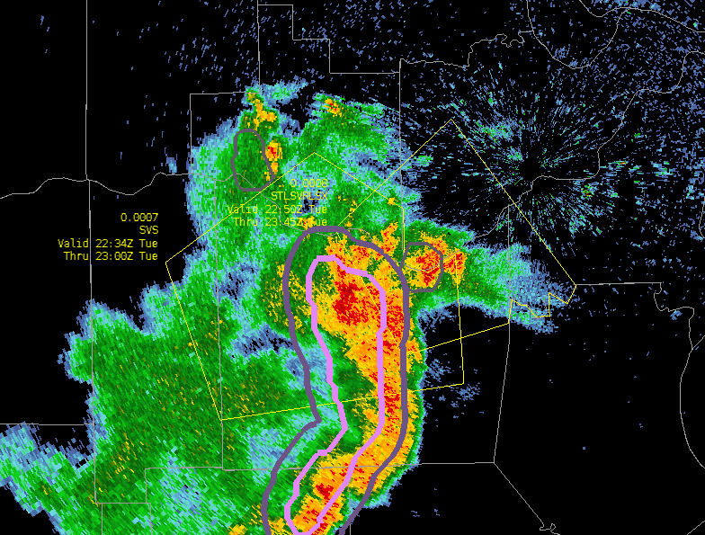
2250z: Warning continued upstream continuing the “tornado possible” tag. Still some broad rotation from boundary interaction. No gate-to-gate, but I feel that the Prob-Tor model is underduing things a bit. Possibly because the environment isn’t condusive to Tornadoes? At the time of issuance, the Prob-Severe model was showcasing (ProbHail: 9%, ProbWind: 68%, ProbTor: 3%). My forecaster prob-tor would be closer to 15% at time of SVR T-Storm issuance.
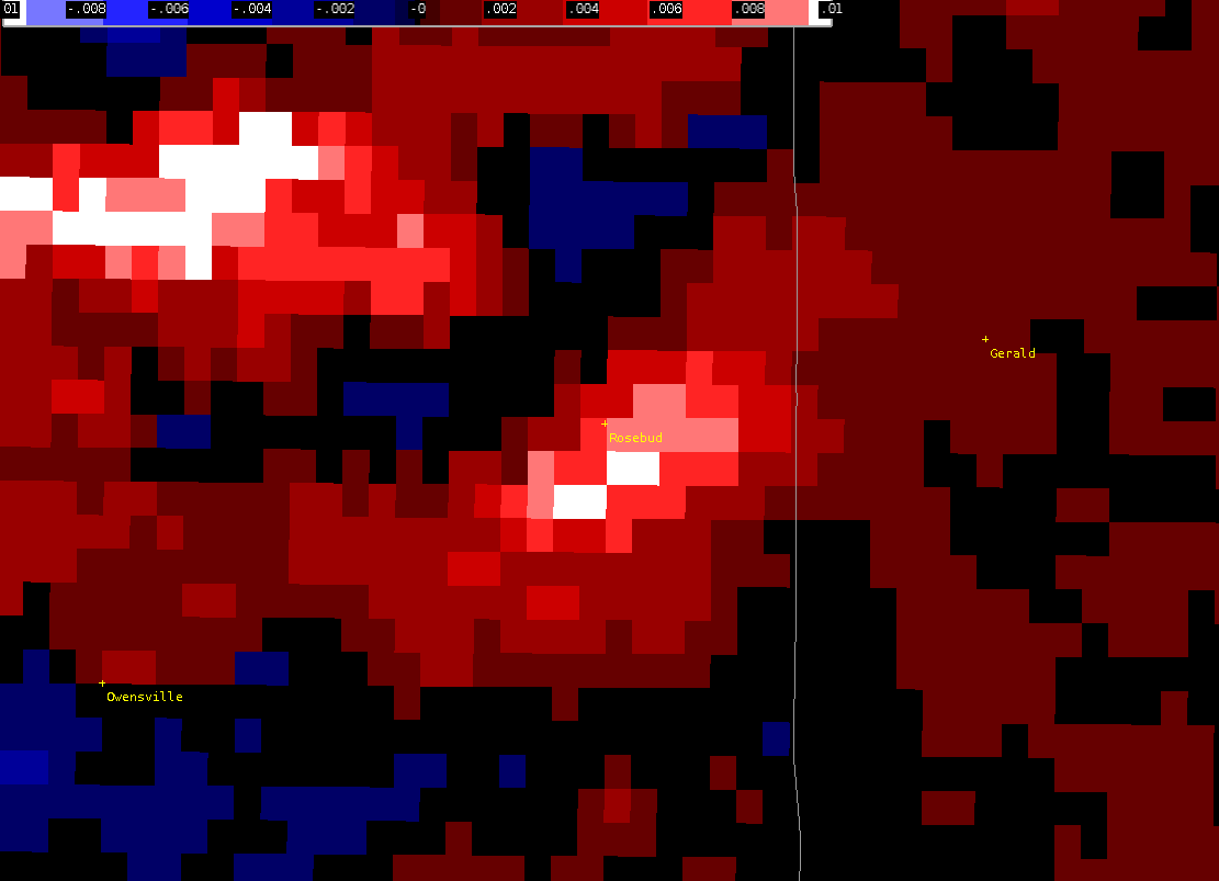
~2215Z: Spotter reported a brief tornado touchdown in a field on the east side of Rosebud, MO. Still trying to confirm the authenticity at this time. Screenshot above of possible Tornado spinup from the area of the spotter report.
Storm has weekend and become primarily a wind threat which should be coverable with an SPS. Will allow the warning to expire on-time.
