Monday: 04/28/08
Started the day with a weather briefing and overview of the warning program. This was followed by a tour of the National Weather Center, which houses both OU and NOAA components.
A severe weather event was already in progress in the eastern portion of Virginia and North Carolina. Instead of getting formal training on the probabilistic warning software, we jumped right in to take advantage of the situation—especially since it was obvious that the severe weather was moving offshore and out of our data domain. Afterwards, we reverted back to the more formal training of the WDSSII software.
The software is pretty amazing in that we can view data from any radar in real time using standard tilt sequences, CAPPIs, and cross sections. It is similar to GR2AE but can combine multiple radars.
Tuesday: 04/29/08
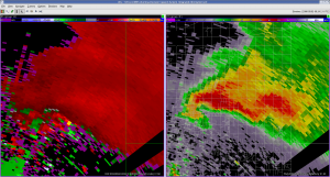
After the briefing (no convective/severe weather expected today), we broke into groups. I worked on a CASA case. Volume scan data was updating at less than 1-minute intervals. Also, the data resolution was higher than WSR-88D data and the nearness of the storm to the radars allowed an exceptionally detailed view of the evolution of the supercell, hook echo, TVS, and TC. We were able to see the “debris ball†and weak echo center of the tornado circulation. The “knobology†of the WDSSII system, however, was frustrating and we spent too much time trying to understand how to view the data instead of analyzing the data.
We viewed and analyzed a second case using PAR data. This data was similar in azimuthal and radial resolution to the WSR-88D data but its temporal resolution was much higher with volume updates every 45 s or so. This was a low-topped, low-CAPE tropical environment and most of the relevant data was contained in the lowest two to three tilts so it wasn’t necessary to step through an entire sequence.
Both the CASA and PAR cases released a torrent of information at us and it become evident that more automation would be required to free the warning meteorologist from the mundane tasks so that he can focus on the meteorology and science of the evolving situation.
The next case was a ProbWarn situation for a severe thunderstorm that was capable of producing both large hail and tornadoes. The goal was to assign threat areas and probabilities and update as required. This case used WSR-88D data so the data flow was more typical of an operational warning environment. The “knobology†of the software again got in the way of the science.
All forecasters agreed that this would be an easier task if the radar data were integrated into AWIPS/D2D so that we could use a more familiar environment. Maybe next year.
Wednesday: 04/30/08
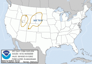
Once again no significant convective weather is expected across the CONUS today with the possible exception of late evening initiation in western Nebraska. We break into groups for additional training on both CASA and PAR cases.
The PAR case is done with Les Lemon as the facilitator. It is a near-tropical environment with weak shear and only modest CAPE. Most likely threat is hail. Data volumes update frequently and this makes it easy to see the development of high reflectivity cores aloft. The cross section tool is also useful once I get the hang of how it works. It becomes fairly easy to monitor the upper levels of the storm and to issue “warnings†for large hail. Using WSR-88D data would result in 4.5–6 minute update times for volumes and it would be easy to miss important details in the evolution of these storms. I did, however, miss the strong surface winds and possible microburst because I was focused on viewing the higher tilt sequences for hail signatures.
The CASA case was a southward moving squall line with very strong winds located some distance behind the initial gust front. We were able to resolve the evolution of various “swirlies†on the leading edge of the convection, some of which developed moderate rotational velocities. None, however, had significant updrafts overhead (i.e., the updrafts tilted upshear which is not atypical for a mature squall line) and would not be considered tornadoes. We agreed that a high wind warning was appropriate.
Behind the squall, a Rear Inflow Jet (RIJ) was developing. The nearness of the radars to the convection allowed a detailed examination using RHI cuts through the system and we were able to see a classic RIJ structure behind the convection underneath the mesoscale anvil shield. This RIJ was nearly quasi-horizontal as it flowed under the anvil shield but tilted down sharply at the back edge of the convective line impacting the surface underneath the convective line. The RIJ was likely a significant source of the strong surface winds associated with the squall line.
In summary, the rapid update of both the PAR and CASA allowed us to monitor the evolution in a way that WSR-88D cannot. In addition, the four CASA network allowed at least one radar—and often two or three—to have a close look at the system so that we were able to resolve small-scale features.
Late in the evening convection developed in extreme eastern Wyoming and western Nebraska but it was too late in the evening to use it as a ProbWarn case.
Thursday: 05/01/08
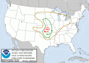
The convective outlook for today was favorable and plans were set up for an IOP in the evening. Additional cases were viewed this afternoon and we reviewed a CASA case from a few weeks ago. This year’s data is much less noisy than data collected last year. The case we examined developed a convective line with “book-end vortices†that were well resolved in both reflectivity and velocity.
We went into IOP mode around 5 p.m. with both CASA and PAR. The southernmost storm was just barely in the northeast lobe of the CASA array and it became obvious that we would not be able to follow the evolution of the system with these radars. We switched to PAR which was ideally suited to view the storms.
Because the storms formed on the dry line they were oriented NE–SW. Initially this meant the northern storms were to our north and the southern storm was located to our west. It was close enough to the radar that it was partially in the “cone of silence†which is much larger for PAR than for WSR-88D. As the storm moved to the northeast, we had to update the viewing sector so that we could continue to monitor the storm. This sectoring problem will go away once the PAR has all four faces running; for now, only one face is available limiting the viewing angle to 90 degrees.
Later, all storms were located to our northeast and were essentially along the same radials from the radar resulting in velocity range folding (i.e., the “purple hazeâ€). We also had some velocity dealiasing problems with some of the higher velocities in the mesocyclone. Consequently, it became difficult at times to get clean velocities from the storms. KTLX did a much better job on some of the storms. We also viewed KVNX for the northern storms since it had a better viewing angle.
In addition, the data refresh rate overwhelmed the WDSSII software and we struggled to view the data. In hindsight, this was almost certainly a result of having two WGs (WDSSII-GUI) running on the same workstation, which quickly consumed the available memory and cache.
Mike and I worked with Pam and Les on the PAR. Because this was a live case nobody yet knew the outcome. It was useful to have Les looking at the data and make suggestions on where to focus our attention and to point out features in the data that might be important.
Summary: an excellent case within the PAR domain but software issues prevented us from fully utilizing the data. If PAR and CASA data were integrated into AWIPS/D2D this would not be an issue since we would be using familiar software. WDSSII is research software and is not always adequate or appropriate for real time viewing of massive amounts of data.
Friday: 05/02/08
Last day of Week 1 and we spend much of it in a round-table discussion of what worked, what didn’t work, possible ways to mitigate the problems, and general suggestions. We also reviewed some of the data from last night’s supercells plus the cold frontal squall line that marched across the state overnight. The squall line move through both the CASA network and within range of the PAR (but because of sectoring issues, PAR had to choose whether to look at the northern end or southern end of the line).
We challenged the systems with the tremendous amounts of data flowing into the software and fully stressed it to the point that it was difficult to use. Our comments to the facilitators made it clear that some changes may be required with the most obvious being to run fewer instances of WG on a workstation and to load fewer windows. Instead, spread the WGs and windows across a multitude of workstations to reduce the load on any machine.
I’m excited about the future possibilities of PAR and CASA radars in an operational and warning environment. The improved spatial coverage offered by CASA and the increased temporal updates from both CASA and PAR means we will be better able to monitor the rapid evolution of severe storms. CASA also holds tremendous promise of filling in areas that have poor coverage at this time. That, of course, includes much of the western United States.
I’m less certain of the ProbWarn experiment. I’m a long time advocate of probabilistic warnings and was eager to try to issue warnings using this tool and philosophy. It is still in its early stages and much needs to be done. One of the biggest issues is how to calibrate probabilities for various threats. Different forecasters will issue different probabilities for the same threat. Another issue, albeit minor, is to distinguish these probabilities—which are really threat probabilities—from our traditional warnings. There will be some evolution in how the software works, how forecasters issue threats, and how to calibrate these. There will also be substantial training required of forecasters since this will be a paradigm shift in how we issue warnings to the public.
David Blanchard (NWS Flagstaff AZ – Week 1 Participant)


