Summary – 15 May 2008

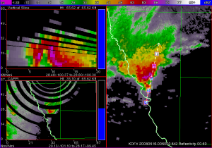
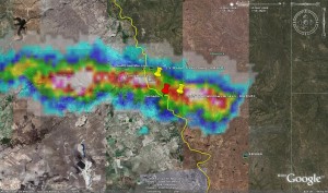
We did a probwarn mini-IOP on a supercell (and a few other storms) crossing the Rio Grande near Eagle Pass, TX. The storm had an unconfirmed report from law enforcement of a tornado after it crossed into the US, but a chaser on the scene we called from the HWT could not confirm it. This provided an interesting decision by our forecasters on how much confidence they put in the law enforcement report for their initial tornado probabilities. What was more certain to the forecasters is the large hail threat was very high, given the well-defined bounded weak echo region (below). Later, a 2.5″ diameter measured hail report was received from near Eagle Pass, along with downed trees.

Kevin Scharfenberg (EWP Backup Weekly Coordinator, 12-16 May)

Tags: None

Outlook – 15 May 2008

… Not so good.

The system that we worked at the end of 14 May 2008 has translated eastward along the Gulf Coast States and is ongoing at the time of our 1 pm briefing. As the day goes on, the upper level trough that has been the “weather maker” the past day or so, will lift out to the NE. This takes the deeper (0-6km) shear with it, though the ongoing convection has developed an MCV and low-level shear should be good. The atmosphere is not terribly unstable though, so the existing and diminishing threat is most a tornado/wind threat for any convection that survives the day. There is a small spot in S TX that might allow us an IOP, and Dan M. also has suggested MN as an area with non-severe, but “popcorn” thunderstorms that would make for an interesting case to watch. This leaves us with nothing to work in the CASA / PAR domains.

We’ll do the PROBWARN archive case and perhaps another CASA / PAR case. If there is time and weather, we’ll try a realtime IOP later in the day.

Kevin Manross (EWP Weekly Coordinator, 12-16 May)

Tags: None

Summary – 14 May 2008

Today we ran a PROBWARN IOP for the area of W to C Texas, primarily using KMAF, KDFX and KSJT, as well as the SC_Multi gridded data. We ‘sectorized’ putting DanM. and Ron P. on the northern part and Dave H. and Dan P. on the southern. Storms had begun about an hour prior to our starting time of 2130z.

The southern group spent most of their time (if not entirely) on storms forming off of “Old Faithful” on the Mexican side of the US border west of Eagle Pass, TX and moving into US territory. These storms trained, and provided some difficulty to Dan P. and Dave primarily in how best to handle trending given that some storms would increase in severe potential and others would die out.

Dan M. and Ron worked on at least one storm that transitioned from an HP supercell with primarily a hail threat to a tornado threat.
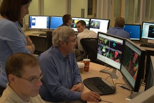
Dan P. sneaks a peek at the other team's warnings

Dan P. sneaks a peek at the other team’s warnings…

We ran until 7:30 pm and had some brief discussion before letting the forecasters take a look at some convection that moved into the CASA domain around 8 pm.

A few comments regarding the IOP follows:

  • It had been considered a couple of times that sectorizng based on threat type would be an iteresting exercise. I.e., one forecaster analyzes/warns on hail, while the other focuses on tornado/wind threats.
  • Workload issues were again brought up. Some had a hard time keeping multiple treats on the same storm (effectively tripling their warning issuance). And even those who were keeping up were losing situational awareness due to a “round robin” type of approach where the forecaster was going from storm to storm to nudge and move on. Main loss of S.A. in this case is in the vertical structure of the storm.
  • Comment was maid regarding a forecaster worrying or not completely feeling comfortable with providing the trend info. Perhaps a better tool for providing this info would help. Dan M. suggests starting with something like the GFE temporal editor.
  • Other software suggestions were having a transparency slider for the ProbGrid output. having the option to sync all the threat grids for the same storm to that storm’s motion

In the discussion that followed the exercise, some time was spent considering “exceeence thresholds” for different threats. For example, issuing a high probability for hail, but a low probability for hail larger than [golfball, baseball, etc.]. This adds another degree of freedom which A) allows the forecaster to provide greater detail, but B) adds another task for the warning forecaster and (potentially) increases workload.

Other concerns were the potential/likely inconsistency between forecasters and their probabilities. Should be an interesting discussion during the debrief.
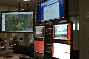
Eve was impressed at the ability to

Eve was impressed at the ability to “Virtual Storm Chase”

Kevin Manross (EWP Weekly Coordinator, 12-16 May)

Addendum:

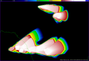
Here is the first attempt at an “accumulated” ProgGrid for yesterday’s event. Later, I’ll divide these grids into storm type and compare to Rotation Tracks, Hail Tracks, LSRs, and NWS warnings.
Greg Stumpf (EWP Operations Coordinator)

Tags: None

Live Blog – 14 May 2008 (8:10pm)

Gridded Warning Discussion:

We sectorized warnings in TX–north (Ron and Dan M.) and south (Dan P. and Dave). Both groups focused on all three threats (wind, hail and tornado), targeting 2-4 storms each.

Would like to sync multiple threat types for same storm, such that if storm motion is changed for the hail threat and then update (if chosen) coincidently for wind and tornado for that storm. (Could try on a case such as Greensburg where you have to separate tornado threats with different storm motions.)

Felt like lost concentration as moved in ’round-robin’ from storm to storm. Possibly focused on too many storms.

Sig hail, Sig Wind options–on top of other three threats–add to the amount of data a forecaster must maintain, but seem necessary. 100% pea-sized hail or 100% baseball hail or possibility instead state for exceedance of a level: e.g., 100% prob of nickel size, 40% prob for > golf ball.

Pulsing storms for group 1 caused constant updates in trend, sometimes trends would be changed quickly from one update to the next. *Do the forecasters worry about continuity or accuracy more? * Second group dealt with storms that maintained more continuity and followed conceptional model of HP storms, so confidence in hail and wind threats especially was particularly high.

In terms of software, would like interface such that forecasters could draw trend in line graph (e.g, bell shape or up and then flatten).

Kristin Kuhlman (PAR Cognizant Scientist)

Tags: None

Outlook – 14 May 2008

Quick review of the outlook for 14 May 2008.

Not expecting SVR in the PAR / CASA domain, though there should be some convection. We’ll focus our efforts on PROBWARN due to this, and the fact that we haven’t done a PROBWARN IOP yet this week.

Location will likely be W / C TX where return flow is best.

Kevin Manross (EWP Weekly Coordinator, 12-16 May)

Tags: None

Summary – 13 May 2008

Well, we tried really hard to get something in CASA, but, alas, the atmosphere didn’t want to cooperate with us.

We had Dan P. and Dave H. work with CASA and Dan M. and Ron P. worked again with PAR. This configuration was suggested so that we have an experienced user during realtime ops. (These same forecasters worked the same respective stations last night).

Regarding the weather scenario – we had a few attempts at initiation in the extreme Ern part of the CASA domain, but that was the best we saw. Storms initiated along the cold front to the NE of the OKC area and the PAR remained focused on those storms during the duration of the evening. These storms moved very slowly – remaining anchored to the front. There were a number of severe warnings and one storm near Prague that had some broad low-level rotation (which tightened up from time-to-time) but never drew a warning.

One of the interesting things we tried tonight was to issue PROBWARN on PAR. (Dan M. is an old pro with both) Should be an interesting case to review from that sense.

As I type (~0110z), we have legitimate echo on the edge of the CASA domain.

Speaking of CASA, Dan P. offers part of a discussion (while waiting for *anything* to happen in CASA) regarding Three-Body-Scatter-Spikes (TBSS). Given the low-level area of focus of CASA, TBSS will be rarely, if at all, seen on this network. This, of course is an often-used indicator for severe hail.

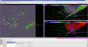
Here is a snapshot of our PAR/PROBWARN exercise

And this is the best we could get for CASA (after 3 hours of staring intently at the screen). Actually, this also shows the 3DVAR Wind analysis product (on the left).

Kevin Manross (EWP Weekly Coordinator, 12-16 May)

Tags: None

Live Blog – 13 May 2008 (8:02pm)

Could note better convergence signature in PAR data with faster updates.

Ron P. has taken over warning contour operations attm. Updating threat area in Okuskee Co. to cover growth of storm. Has higher threat embedded within lower threat.

Kristin Kuhlman (PAR Cognizant Scientist)

Tags: None

Live Blog – 13 May 2008 (7:29pm)

ProbWarn Software: Would like function for probabilities such that you can set an initial and a final probability to ramp up to at a certain time and maintain throughout the warning time.

Also, with a high number of warnings in close proximity need to be able to hide threat area contours that are not currently being worked on. Quite frequently will accidentally move or highlight wrong contour while updating a different one.

Kristin Kuhlman (PAR Cognizant Scientist)

Tags: None

Live Blog – 13 May 2008 (7:01pm)

Issuing first tornado warning for threat in Pott. Co. panhandle, with evidence of rising motion from helicopter and rotation (vel: 30 out, 15 in) and notch in reflectivity in both PAR and KTLX. Going with low probs now, but expect increase in chance based on environment and beginning evidence of storm motion to the right. Discussion of whether or not deterministic tornado warning would be issued at this point–for this day and in this environment would go with “No” at this time.

Also updating storm motion for hail grids. And updating larger threat area to account for single core that has developed in SE Cleveland Co, smaller area higher probs.

*Software: would like to be able to toggle reflectivity while viewing warning contours as top source

Kristin Kuhlman (PAR Cognizant Scientist)

Tags: None

Live Blog – 13 May 2008 (6:32pm)

Testing very low (0%) prob for storms initiating in so Cleveland Co. and moving into Pottawatomie. Using probwarn to communicate expectation of increase in prob (to 40%) in central Pott. Co. in ~45 min. Uncertainty in storm motion and speeds puts warning grid covering almost all of Pott. Co.

Storms continue to back-build along front making it difficult to maintain coverage of threat areas.

Within probwarn software, would like clicking on slider bar able to move # one at a time instead of jumping to a random #.

Kristin Kuhlman (PAR Cognizant Scientist)

Tags: None