Daily Summary – 2012 May 14

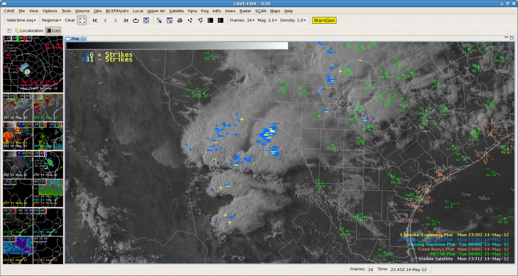
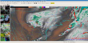
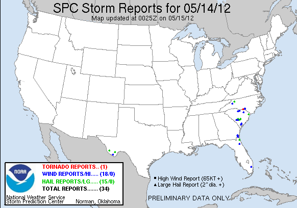
We started today in Wilmington, NC and San Antonio, TX.  However the CI products were having issues with dense high clouds in NC and we subsequently shifted focus to Melbourne, FL to track convection approaching Orlando.  As we shifted, two supercells formed near Myrtle Beach, SC.  We were initially frustrated but a new tornado warning was issued west of Palm Beach, and the far southern county of Melbourne’s CWA.  Unfortunately the storm evolved into a nonsevere state before we shifted localizations there.  Meanwhile strong supercells developed west of Del Rio and tracked southeast on the Mexican side of the border.  As the thunderstorms grew upscale in Mexico  a spectacular haboob evolved that caused the UAH CI product to track a few cold pixels.  Some were cumulus above the haboob while one of the tracks may have been triggered by the dust as it swept over a mountain range or by a cumulus cloud.  Elsewhere, storms north of San Antonio were too weak to issue warnings.

Thus with the lack of warnings, the teams concentrated on inspecting the products and writing blog entries.

Jim LaDue, EWP2012 Week#2 Weekly Coordinator

Tags: None

EWP STATUS FOR 15 MAY 2012: 12-8pm SHIFT

EWP STATUS FOR 15 MAY 2012:  12-8pm SHIFT

Based on the available 15 UTC SREF guidance, two areas will be in play for a 12 – 8 pm CDT shift.

The first is along a northern stream wave cold front in WI to MI where instability may result in thunderstorms.  Thunderstorms are likely to develop between 2 and 4 pm CDT.

The second area will be along the slow moving eastern trough where a continued feed of deep moisture intersects a front from VA north to NY.  Both areas appear to be conducive to generate diurnal convection.  In fact the eastern play may develop convection relatively early in the day given the lack of CAP and near saturation in the lowest few hundred mb.  Shear may be strong enough for more supercells or organized bows. Expect convection to develop at 12 pm CDT or perhaps even earlier.

Jim LaDue, EWP2012 Week#2 Weekly Coordinator

Tags: None

EWX 00UTC

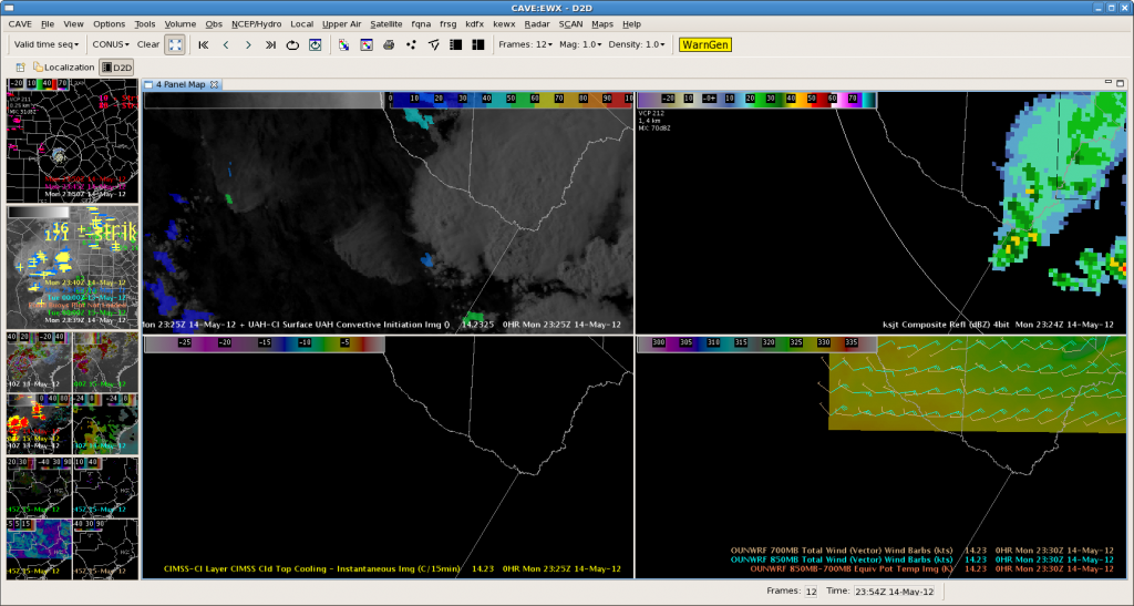
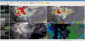
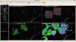
While most of the action is currently taking place south of the Border, it is close enough to be detected on radar and simulated by the 3DVAR WoF model. The Simulated Composite Reflectivity image (lower left) did a nice job of depicting the actual reflectivity (lower right) for the same time.

EWX 2345 – International Watch

Not much going on in EWX as accurately portrayed by nearcast (theta e difference product) showing max instability just across the border in Mexico.  Very nice looking convection over there and an outflow boundary over there kicking up quite a bit of dust.

The boundary/dust storm did trigger a tracked object on the UAH CI product.

Tags: None

Lightning Jump Project: Status Update & Summary (so far)

It has been unseasonably quiet in all of the LMA networks the past few days; unfortunately, the upcoming week does not look too promising either.  In the meantime, below is a summary of severe/near severe activity in any of the networks during the project so far including the date/time & corresponding networks…

Note: No systematic verification of jumps has been processed for any of the cases.

April:

4 Apr 2012 – NALMA: approx. 2300 UTC  (possibly out-of-range).

5-6 Apr 2012 – NALMA: 2300-0100 UTC.

9-10 Apr 2012 – WTLMA / OKLMA: 2100-0200 UTC (possibly out-of-range for both networks).

12 Apr 2012 – WTLMA: 0100-0500 UTC.

13-14 Apr 2012 – OKLMA: 1900-0500 UTC.

15 Apr 2012 – WTLMA: 0300-0500 (& 14 Apr OKLMA, 2100+ UTC, likely out-of-range)

17 Apr 2012 – NALMA: 1900-2100 UTC (possibly out-of-range)

20 Apr 2012  – WTLMA/OKLMA: 0000-0300 UTC

20 Apr 2012 – FL-LDAR: 1900-2300 UTC

22 Apr 2012 – FL-LDAR: 0700-0800 UTC.

25 Apr 2012 – WTLMA: 0000-0300 UTC (possibly out-of-range).

26 Apr 2012 – WTLMA: 2200-2300 UTC (possibly out-of-range).

27 Apr 2012 – NALMA: 0000-0100 UTC (possibly out-of-range).

29 Apr 2012 – WTLMA/OKLMA: 0000-0700 UTC.

29-30 Apr 2012 – WTLMA: 2300-0500 UTC.

30 Apr / 1 May 2012 – WTLMA/OKLMA: 2100-0500 UTC.

May (as of 2245 UTC on 14 May 2012):

2 May 2012 – DCLMA: 2000-2230 UTC.

3-4 May 2012 – DCLMA: 2100-0200 UTC.

4 May 2012 – DCLMA: 1600-1700 UTC.

6 May 2012 – NALMA: ~1100 UTC.

6-7 May 2012 – NALMA: 1700-0100 UTC.

7 May 2012 – NALMA: 1900-2100 UTC.

8 May 2012 – NALMA: ~1800 UTC (possibly out-of-range).

14 May 2012 – FL-LDAR: (likely non-severe and under jump threshold; HWT Spring Experiment/EWP operating in domain).

MLB: 2100_05142012…CI and CTC

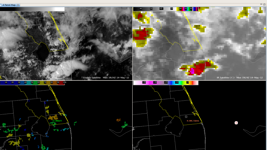
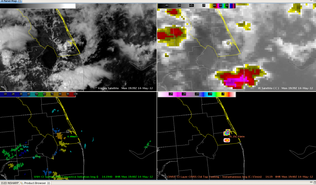
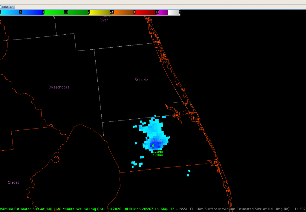
As we were getting started looking at weather in Florida, a good case for the Convective Initiation and Cloud Top Cooling algorithms took place over the southern county of MLB’s CWA.  Convective Initiation gave first indication of developing convection at 1925z.

Cloud Top Cooling gave a strong signal at 1940z and 1945z.

Max Estimated Hail Size (MESH) indicated Hail at 1.1 inch at 2026z.

A combination of the Convective Initiation and Cloud Top Cooling used together could have raised awareness of a possibly severe storm up to 45 minutes ahead of time.  TCD/BC

EWX: 2047UTC

Currently watching the IR(actual) vs IR(synthetic).  The synthetic image did a good job indicating where the convection would initiate, but the thunderstorm canopies are underdone.

The CI product indicated it well with a strong red signal.  As of this frame, radar detected a 65dBZ core in this storm (not shown here).  The theta-e diff product earlier indicated high potential for severe storms in this area.

2012 May 14 2020z update

Team 1:  Brian and Todd will be shifting to Melbourne FL due to more convection than earlier expected headed into the CWA from the west.  While the severe weather prospects remain low, the storms are headed into the LMA.

Team 2:  Stephen and Julie will stay in San Antonio to monitor CI.

Jim LaDue, EWP2012 Week#2 Weekly Coordinator
Tags: None

Outlook: 2012 May 14

For the week of 14-18 May, our distinguished NWS guests will be Brian Carcione (WFO Huntsville, AL), Todd Dankers (WFO Boulder/Denver, CO), Stephen Kearney (CWSU Memphis, TN), and Julia Ruthford (WFO Charleston, WV).  Other visiting participants this week will include Dave Carlsen (Environment Canada), Bob Aune (UW-CIMSS), Jordan Gerth (UW-CIMSS), Lori Schultz (UAH), and Chad Gravelle (GOES-R NWSTC liaison).

The pattern at upper-levels features a large ridge in the western US and a weak but large trough in the eastern third of the CONUS.  Two areas of potential severe convection exists in the CONUS, along the Rio Grande valley in TX and the southeast Atlantic coastal states.

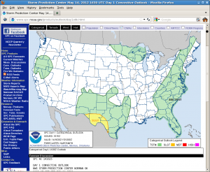
SPC day 1 categorical outlook

The southwest TX threat area comes in response to one weak short-wave trough embedded in northwesterly flow east of the ridge settling southeastward from NM yesterday.  This trough is phasing with a low-level front along the Rio Grande river from south of Marfa to near Del Rio and eastward.  However the moisture has been scoured a bit from an overnight MCS that passed southeast from Del Rio.  We expect diurnal heating and moisture return from the east to destabilize the atmosphere and allow new diurnal convection to form from the Big Bend region, east.  There are factors limiting potential severity of convection including uncertain amounts of destabilization and weak low-level shear.  Nevertheless, supercells  producing large hail and some damaging winds are possible in this threat area.

The second area in the southeastern Atlantic coastal states is already active with convection.  A QLCS is progressing across the central Carolinas while more isolated convective forms are developing all the way down into FL.  The deep layer shear is a modest 25-30 kts/6km in the Carolinas, and weaker further to the south.  The QLCS should continue moving eastward with a small threat of damaging winds while isolated downbursts and marginally severe hail is possible down into FL.

A forecast team is already monitoring Wilmington, NC’s area (Brian Carcioni and Todd Dankers) and the second team is monitoring San Antonio’s area (Stephen Kearney and Julia Ruthford).

Jim LaDue, EWP2012 Week#2 Weekly Coordinator
Tags: None