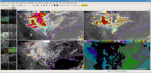
Currently watching the IR(actual) vs IR(synthetic). The synthetic image did a good job indicating where the convection would initiate, but the thunderstorm canopies are underdone.
The CI product indicated it well with a strong red signal. As of this frame, radar detected a 65dBZ core in this storm (not shown here). The theta-e diff product earlier indicated high potential for severe storms in this area.

