


Near Henrietta, TX. Take appropriate shelter now if you live across northern Clay Co, TX.
Golfball (1.75″ dia) Hail In Wichita Falls, TX
Occurred at 4:45 pm cdt.
Rotational Track Moore
 The rotational track product did a great job really highlighting the Moore tornado start to finish. The white to blue values around 19 s-1 seemed like the point that if you didn’t have a warning out you should have, but you likely would have no lead time if you waited for 19 s-1.. The red values 11 s-1 on the sfc rotational track would have given you some lead time on this tornado and were a little easier to view than the 0.5 and 0.9 base data at this time. The mid level rotational tracks were more of a mess but the white/blue 19 s-1 in the mid level rotation would have given some lead time. This strong mid level rotation was present near Bridge Creek prior to tornado genesis.
Wesely
Tornado On The Ground 4 mi E of Payson(Lincoln Co, OK).
If you live between and Sparks and Prague, OK, take cover now as a strong stovepipe tornado has been reported ON THE GROUND.
Tornado Moving Toward Talala in Northeast OK
Take proper shelter and precautions now if you live in Talala, OK. Spotter report a tornado is ON THE GROUND!
Dangerous Tornado NW of Vera, OK
If you live between Ramona and Vera, OK, you need to be in a place of shelter in an interior room on the lowest floor, or in a basement right now! This tornado will likely be moving into northern Rogers county and towardd Talala within the next half hour to 45 minutes. Prepare now ahead of this very dangerous storm.
Another Tornado 4 miles ESE of Bray, OK
Tornado Bray, OK is now headed toward Foster And Antioch in the next hour. Tornado is rain-wrapped and very dangerous. Do not come out to view the tornado. Find shelter now! If in automobiles, try to find a sturdy building with a safe area to take cover in immediately!
Funnel cloud reported 3 miles SW of Moore, OK
If you live in the Newcastle and Moore OK areas, you need to be taking shelter now and preferrably in an interior room on the lowest floor, or if able to get underground, one should do so now across these areas! This is a life-threatening situation!
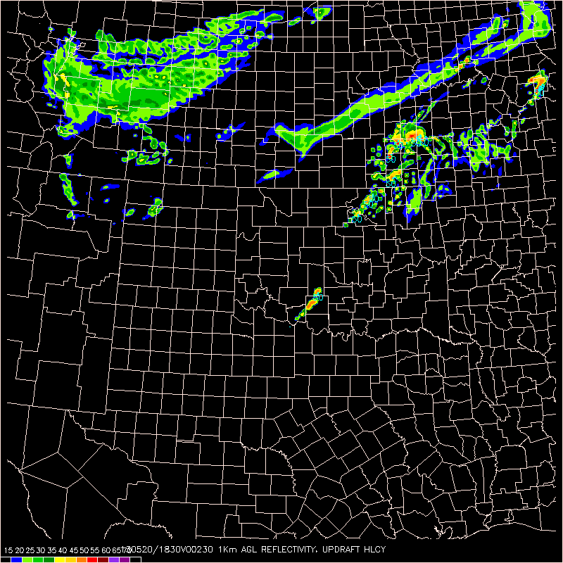
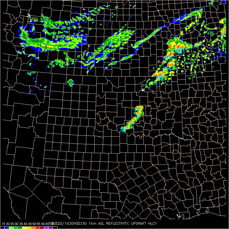
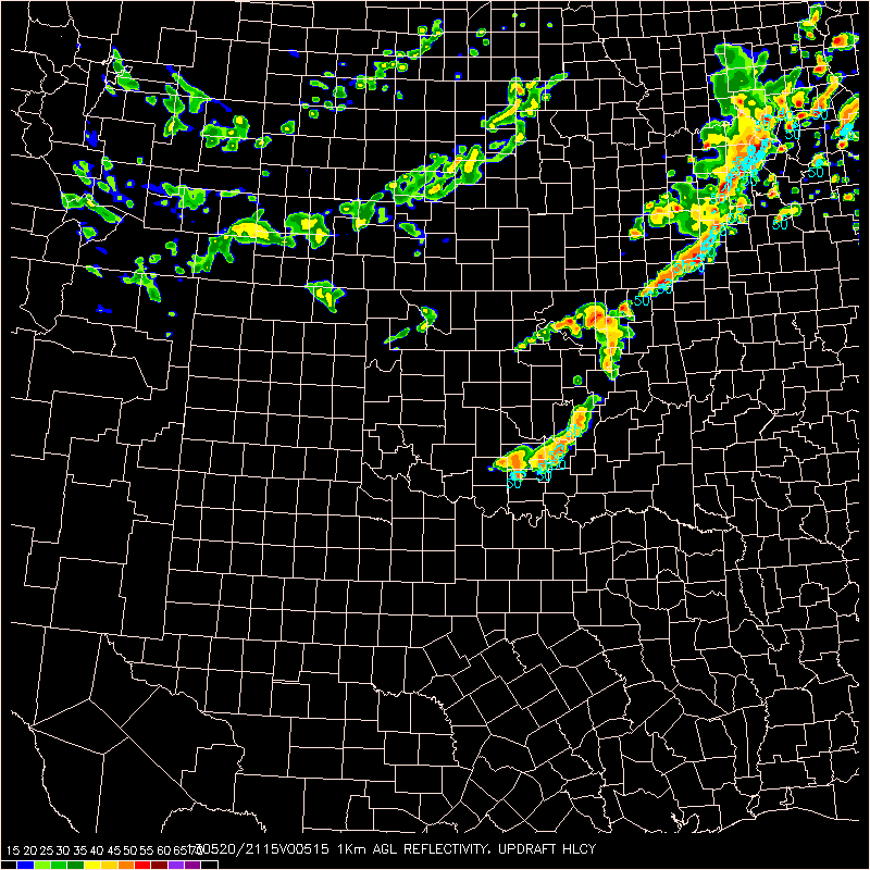
May 20 2013 Early Afternoon Discussion – Focus OK
Sct TS development over south central OK as of 19z. Tor watch issued for most of eastern OK to account for expected development this afternoon. Latest obs indicate cold front draped over central OK with dry line extending back into SW OK with upper level low over Dakotas. Strong southerly flow over eastern OK pushing dew pts well into the 70s as of mid day, with sharp contrast west of dry line, with dew pts remaining in the 50s over the pan handle of OK. MU CAPE over eastern OK around 4000 j/kg already and blk shear around 75 kts. 17z OUN sounding shows deep low level moisture with capping around 850mb, which should weaken within the next couple of hours. 16z OUN WRF indicates development to close proximity with on going convection attm, with further super cell development this afternoon as the current cells push east and north into the more unstable atmo.
Forecaster Thoughts – Rebecca Mazur (2013 Week 2)
The Experimental Warning Program provides an invaluable opportunity to test the utility of new products and methods in an environment that mimics standard severe weather operations. In no other way can newly developed products be assessed properly to identify strengths and weaknesses in such a fast paced and high stress environment. From my experience and hearing from other forecasters and researchers involved in the EWP, it was a truly invaluable experience not only to help research meteorologists transition their products to warning operations, but for forecasters to see the future of warning operations.
The products we tested include high resolution mesoscale and storm scale models to analyze the near storm environment, and new storm interrogation products to diagnose storm severity. Many of the products proved extremely useful to understand and forecast storm behavior from the ambient conditions. In particular, utilizing OUN WRF and LAPS high resolution fields of instability gave good indications of why some storms intensified, while others weakened or remained unchanged. Also, these products helped the forecaster to quickly adjust their mindset from thinking it would be a fairly marginal severe weather day, to being on high alert for potential dangerous storms. In regards to certain storm interrogation products, MRMS rotation tracks were very useful in making warning decisions during the supercell cycling process and when analyzing cyclone strength, moreso than just utilizing base radar products alone. In addition, MRMS echo top heights increased situational awareness for rapidly developing thunderstorms likely to produce large hail. Based on personal experience working in a WFO with not-so-ideal radar coverage, the echo top heights product will be extremely useful as it is imperative to utilize multiple radars for proper storm interrogation. This product will be a sort of “one stop shop” for large hail diagnosis in a storm, rather than constantly trying to keep up with all-tilts and mid/upper max reflectivity products from multiple radars. Of particular use will be the identification of potential large hail producers within storm clusters in a low shear, high instability environment common in the high plains mid to late summer.
One final suite of products to mention is the GOES-R products. We looked at convective initiation and growth potential, in addition to GOES-R airmass product. Incorporating these products into the EWP gave the forecasters hands-on involvement with the future of satellite data. Some forecasters had not had much experience with the GOES-R products, compared to folks like myself whom are heavily involved in the Proving Ground. Therefore, the EWP provided them the ability to see what the future of satellite meteorology will entail, which falls in line with the GOES-R Proving Ground objectives.
Not only was the opportunity to test new products and methods a gratifying experience, interacting with other forecasters from various parts of the country, in addition to the EWP facilitators, proved invaluable as well. In our agency, it’s a rare occasion to actually spend time with or work with other meteorologists within NOAA/NWS to share forecast tools and methodologies, and to discuss agency-related topics and the current/future state of the science. There is much to be gained by sharing ideas and tools across WFO boundaries, in addition to developing new relationships within the agency. For me personally, I was able to gauge where myself and my office stood against other WFOs in performance and involvement with emerging technology. I learned a lot during my week at EWP, and was able to bring back some new ideas and concepts to my office to better serve the people of southeast Wyoming and the western Nebraska panhandle.
Thank you for giving me the chance to participate in the 2013 EWP!
Rebecca Mazur
General Forecaster
NWS Cheyenne WY
2013 Week 2 Evaluator