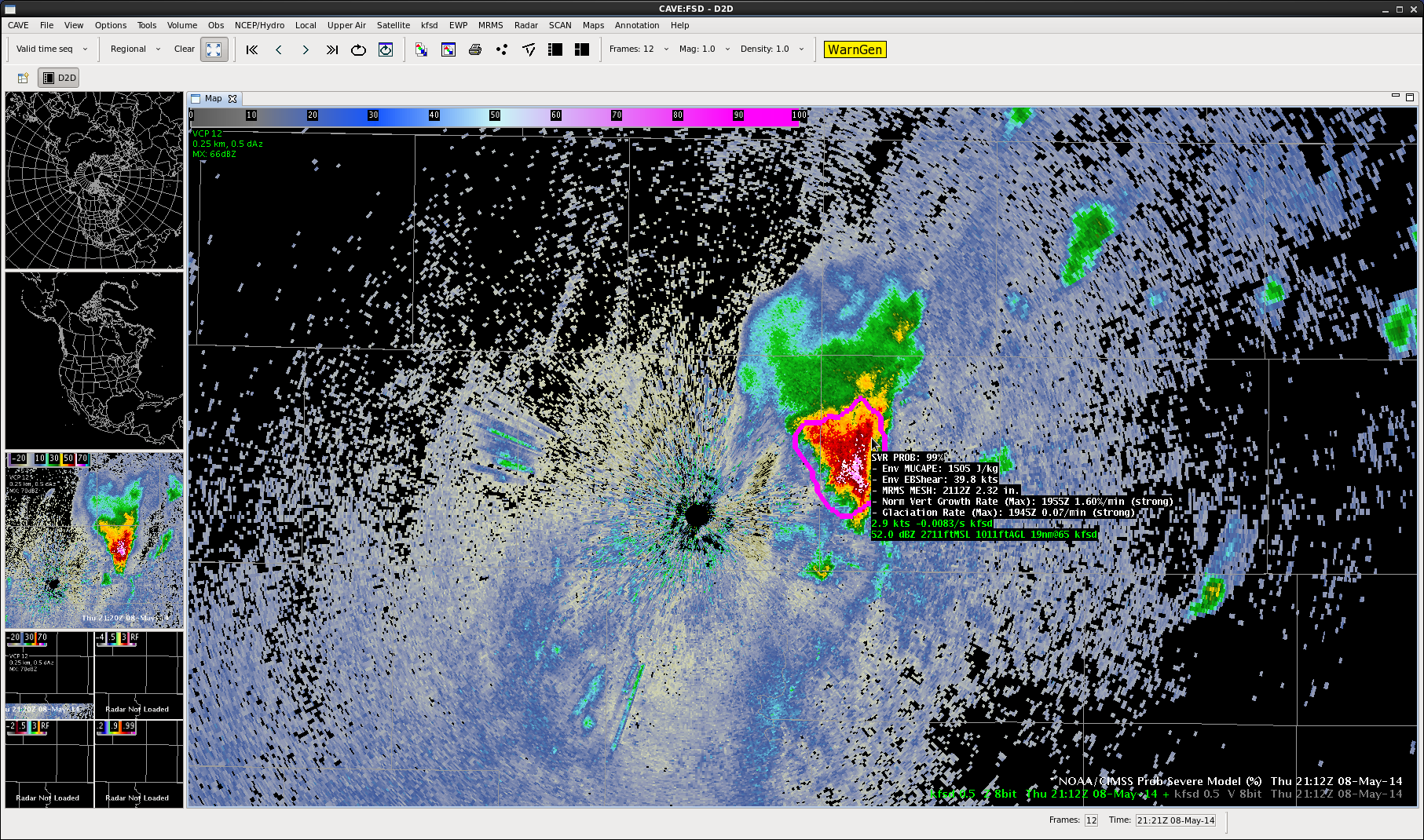
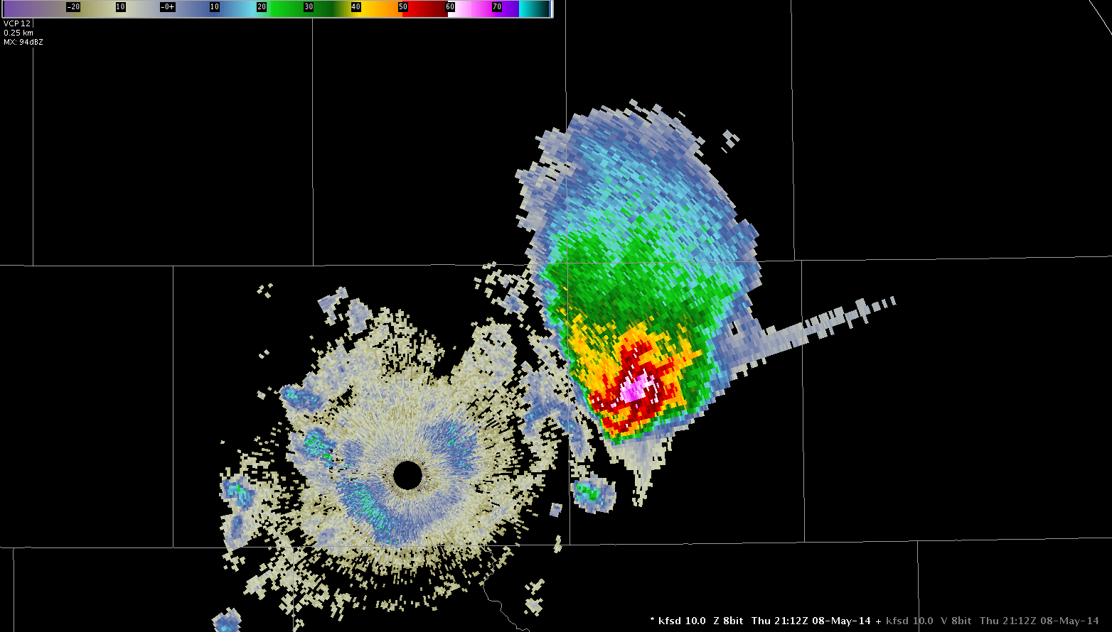
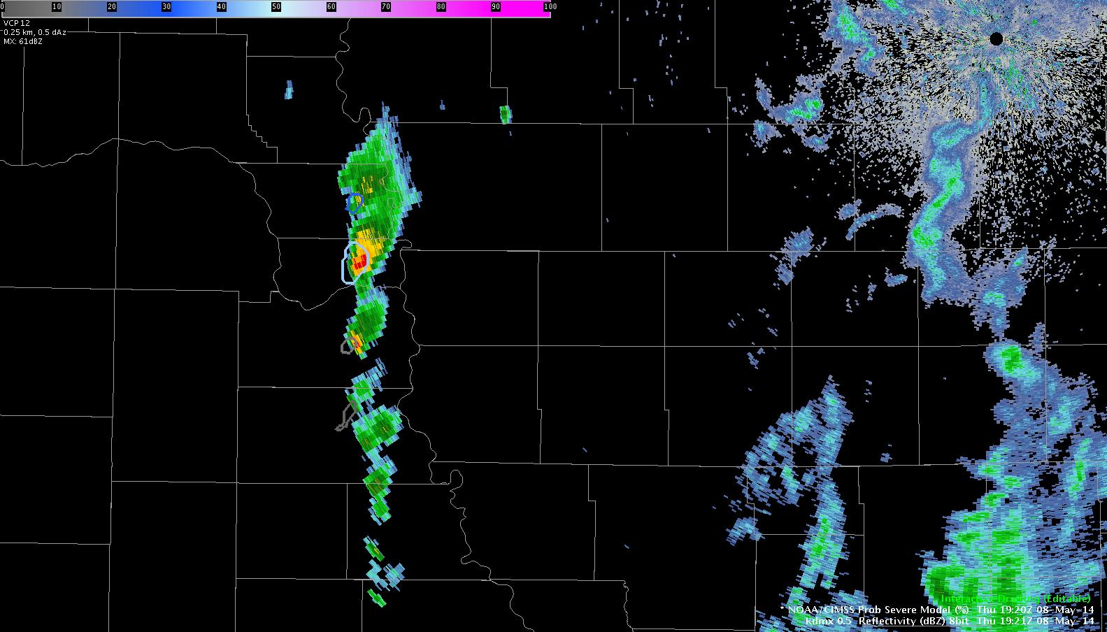
Prob Severe of 99%…Three Body Scatter Spike

8May14 Prob Svr TBSS 8May14 Three Body Scatter Spike

While monitoring the Souix Falls radar this morning, this storm developed just east of the radar site. The Prob Severe Model jumped to 99%.The hail size was predicted by the tool to be over 2 inches in diameter. A short time later a nice three body scatter spike appeared. We are still awaiting any reports from the area.

Jared Maples

Tags: None

Operations Update: Day 4 @2115 UTC

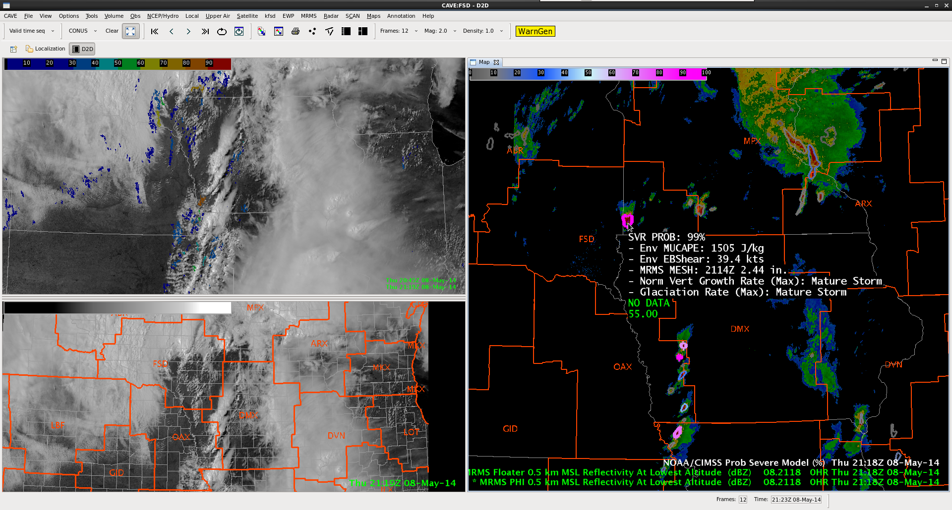
While ICT still has the possibility of severe convection later this afternoon / evening (a severe thunderstorm watch was recently issued), due to the limited operational time left today that team is moving to the Souix Falls (FSD) CWA which is covered by the tornado watch.  Severe convection is already ongoing in the region (note the 99% probability of severe in the next hour in the ProbWarn Product in the image below).  Meanwhile a line of storms are about to move into the DMX CWA.

Top left: Visible Sat / UAH CI. Bottom Left: Visible Sat / CWA borders. Right: MRMS Reflectivity at lowest altitude and ProbSevere at 2115 UTC.

-K. Calhoun, Week 1 Coordinator


Tags: None

LAPS and DSM

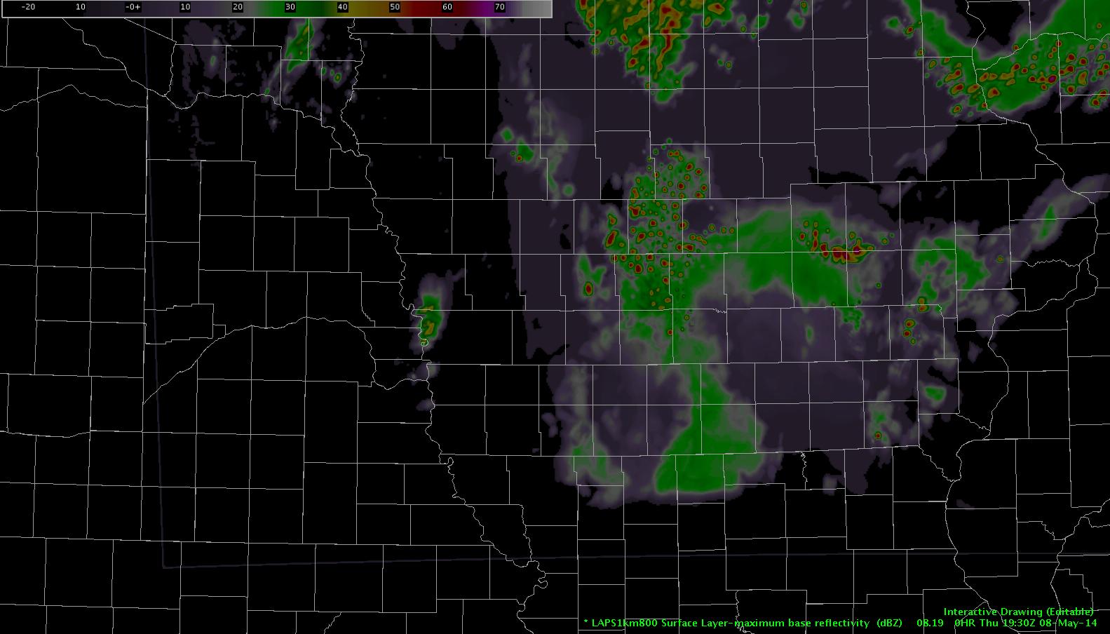
LAPS has finally caught up a bit.  Seems to be struggling a little with the line of storms crossing the IA/NE border.  Here’s LAPS forecast 1930Z column max reflectivity

laps1930Drawing

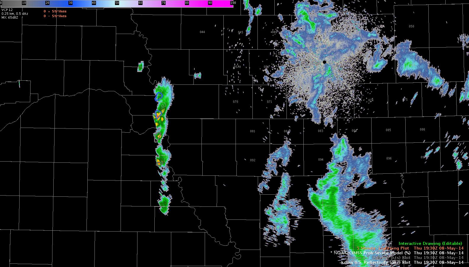
Here’s DMX-88D from 19:30.  Notice model underestimation of developing line.

rad1rawing

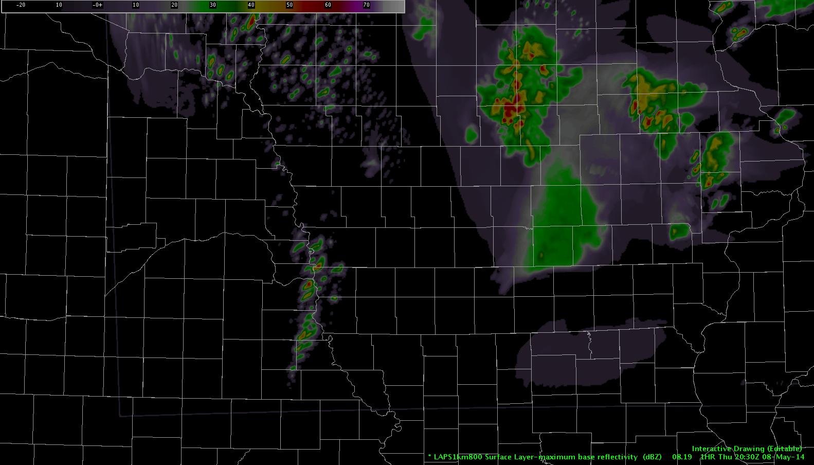
Jump ahead to 2030Z.  LAPS had that initial cell move no the NE and dissipate completely, then rapid redevelopment of convection between 20:15 and 20:30Z near the IA/NE border again.

laps2rawing

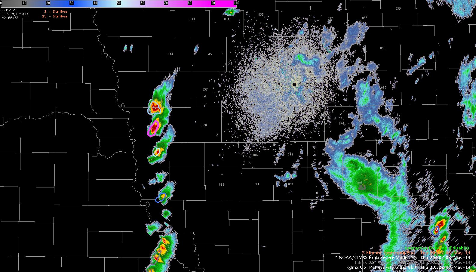
That initial line of convection never quit, though…and by 20:27Z a much stouter line of convection was continuing and farther east than what LAPS has indicated.rad2Drawing

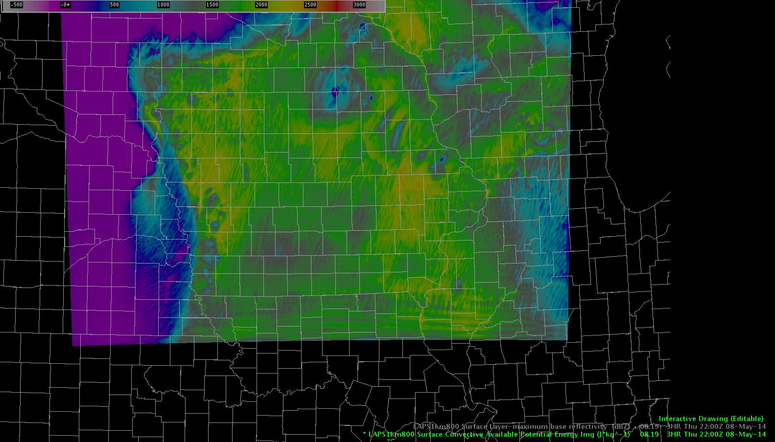
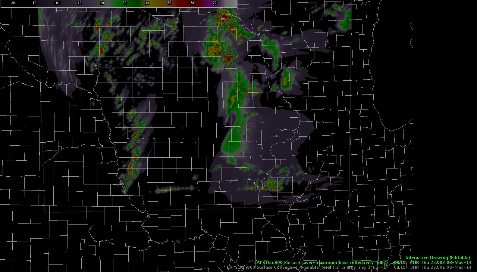
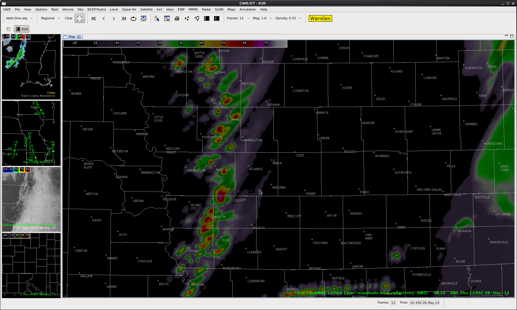
What remains to be seen…here’s the LAPS forecast valid 2200Z.  Line of convection continues…what seems odd is the east/west line of something that develops near the IA/MO border and is moving northeast. Also of note…an east/west, wave-like formation in the CAPE forecast that drifts in from the south.  Anomalous CAPE ridges spurring on a convective response in the model?  Is this a model issue near the domain edge or is there a process that the model is trying to pick up on?  someone remind me to check at 22Z!  db

CAPE rad3


Update: it’s a boundary condition issue.


Tags: None

1 Minute Satellite Feed

8May14 Wichita Reflectivity 2052z 8May14 GOES-14 2052z

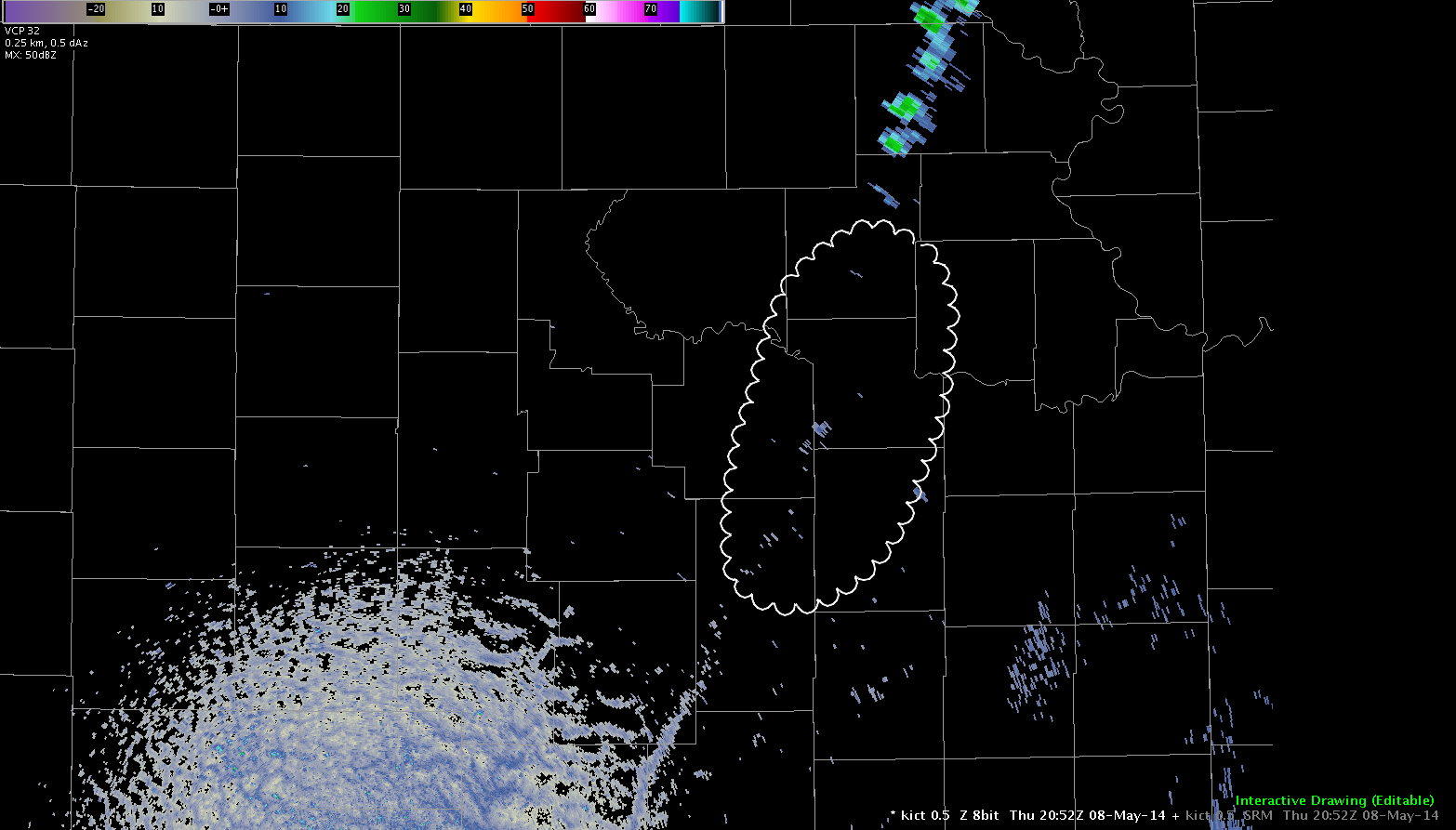
Today the GOES-14 SRSOR is updating at one minute intervals. This provides an excellent opportunity to see how quickly cloud tops develop, even well before the radar updates. In the first image you can see the void in the circled area. This general area is the same area in which clouds have already developed and are beginning to can upper level winds.

Update: Showers and thunderstorms have initiated in the same area that satellite feed was showing the high tops. The one minute feed gave great lead time in this instance.

Jared Maples

Tags: None

OUNWRF Fires Convection in Kansas, Northern Oklahoma

8May14 OUNWRF Ref 1915z8May14 OUNWRF 2015z8May14 OUNWRF 2145z

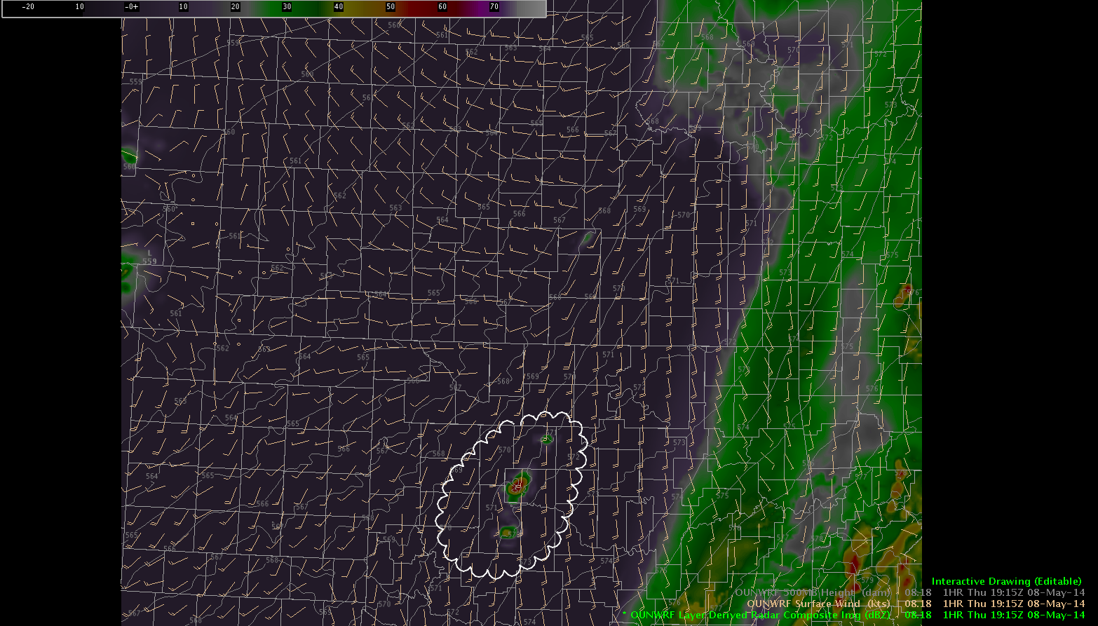
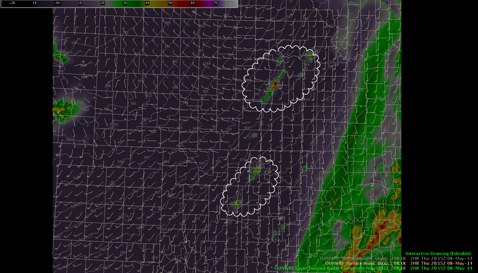
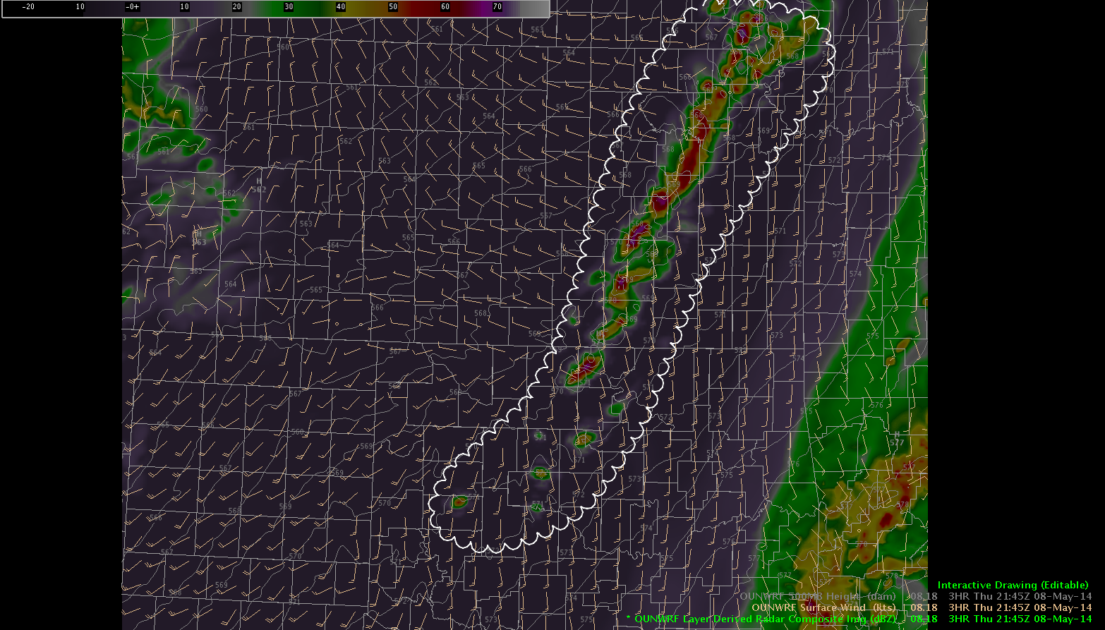
So far all has been quiet in the Central Plains. The OUNWRF would believe otherwise. It has bee more robust in developing showers and thunderstorms early this afternoon  through this evening. The top frame shows what it was forecasting for 1915z, the second frame is 2015z and the final frame is 2215z. The model would suggest that most convection would be limited to Oklahoma City and points north and east, especially into Eastern Kansas. As the front continues to push east through Kansas, winds have switched to the northwest as far east as Downtown Wichita and dewpoints have dropped in the 40s…and eventually into the 30s just a little further west. Stay tuned…

Jared Maples

Tags: None

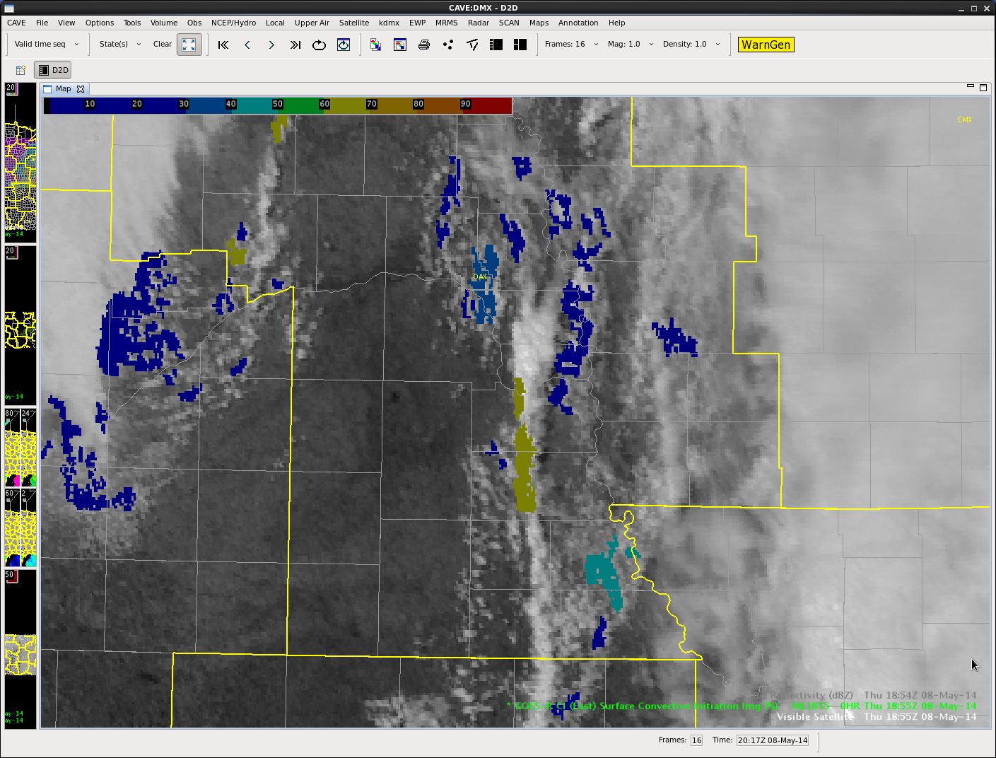
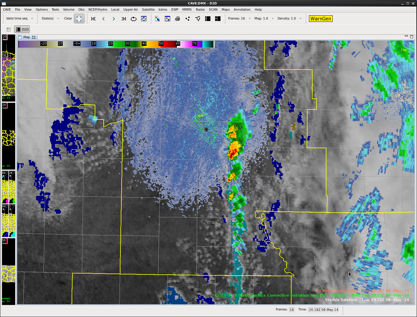
CI picks up on line of initiating convection

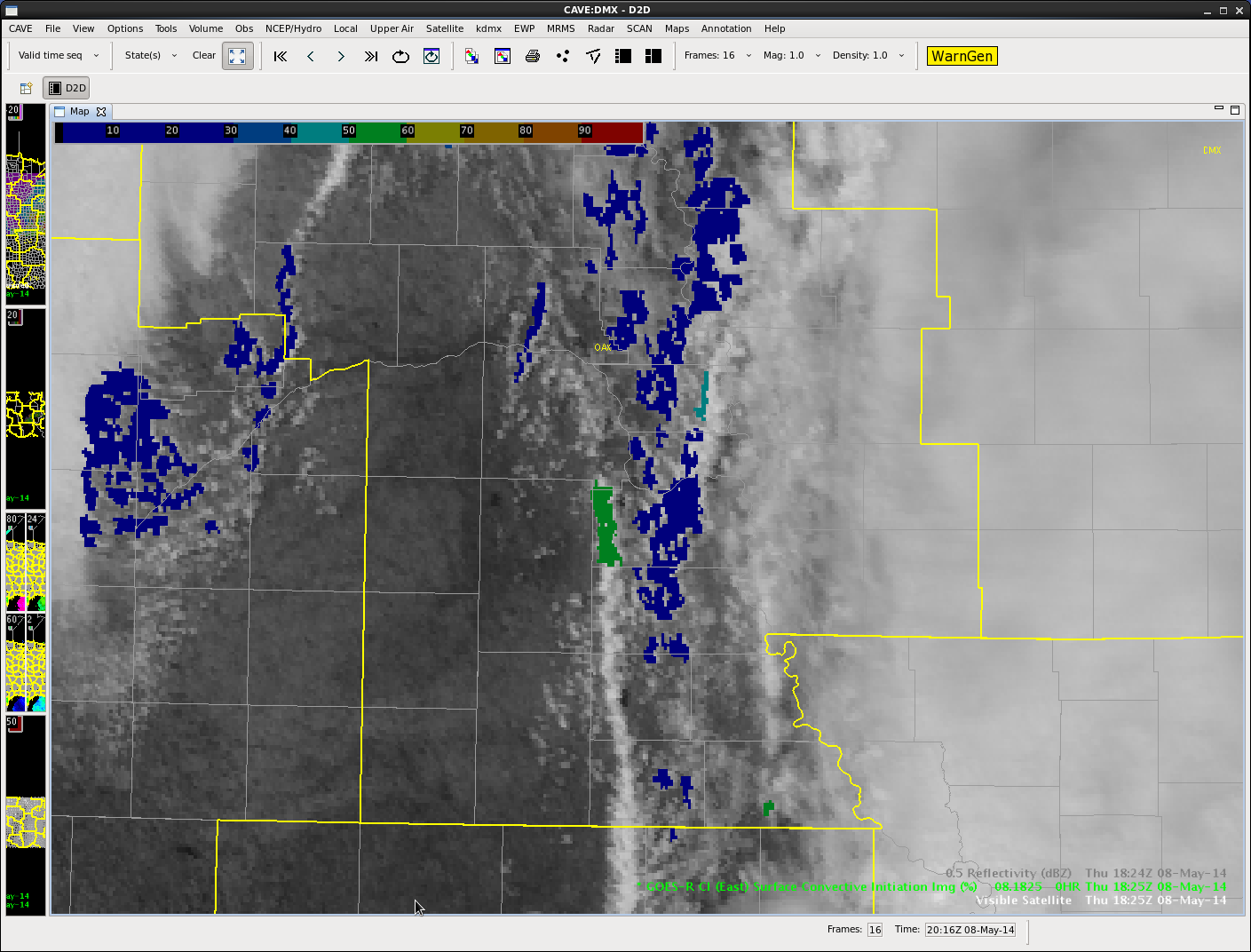
Line of convection working through Omaha’s CWA. Initial CI hits 50-60% at the northern end of a line of cumulus at 1825Z.

ciLine1

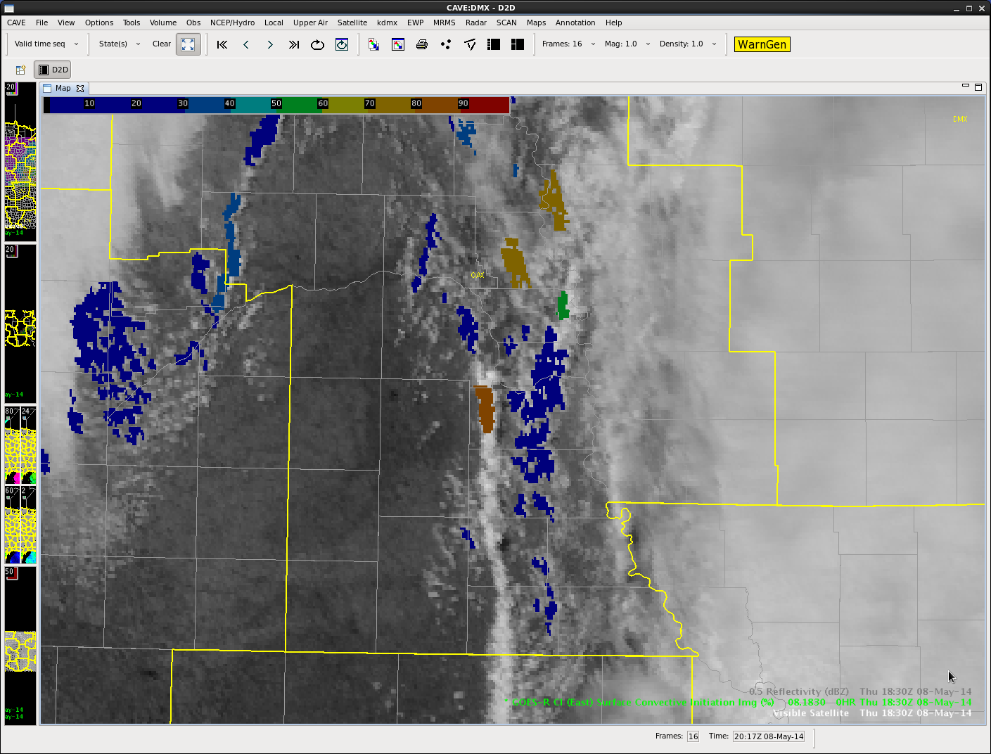
At 1830Z CI probs increase to 80-90%. Weak reflectivity is evident at this point.

ciLine2

At 1855Z cumulus further south along the line shows CI at 60-70%. The northern portion of the line has developed into a strong shower/minimal thunderstorm.

ciLine3

At 1915Z the CI probs have verified – the line of developing cumulus is now a line of showers and thunderstorms.

ciLine4


Scott Rudge.

Tags: None

DSM area analysis

Models agree on low pressure lifting NE or NNE form eastern NE into MN through the afternoon.  As of 19Z, all of IA was in the warm sector, with a cold front expected to cross form the west during the afternoon/early evening.  the 12 Z NAM puts the front near DSM at 0Z; the 12Z GFS still has it just to the west.

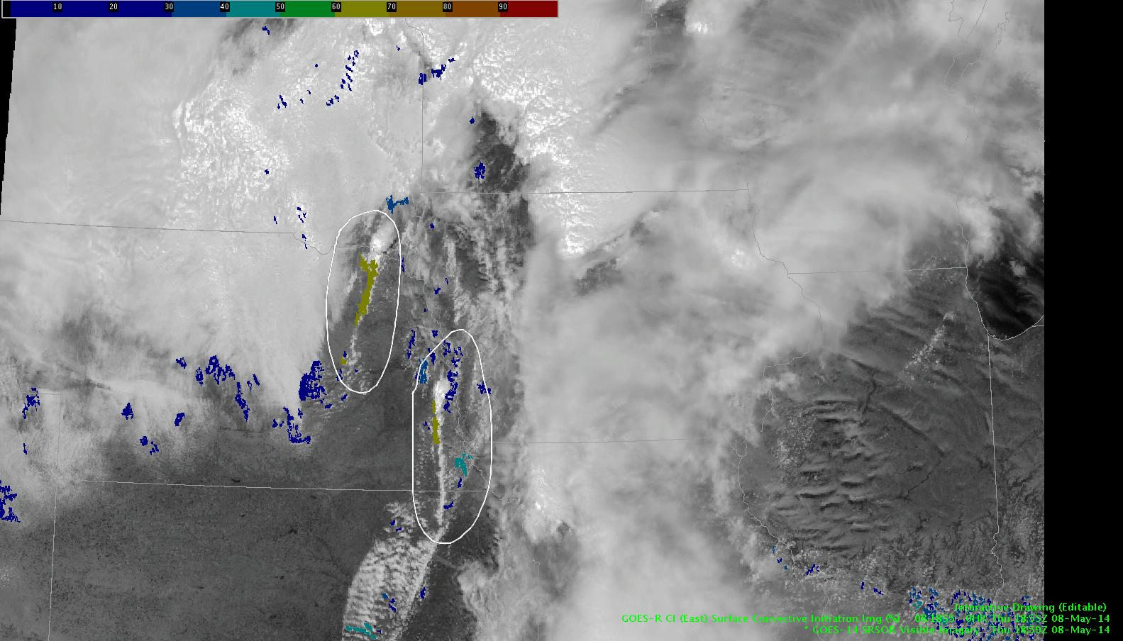
Earlier convection is exiting stage right, and some clearing is taking place in western IA.  We’re getting rapid scan GOES data today, so we’ll be monitoring the boundary structures that are evident on the imagery.  Below is the CI product superimposed over the visible image…we’re seeing 67% probability of development of 35 dbz returns in the next hour or so along these boundaries.

SatDrawing

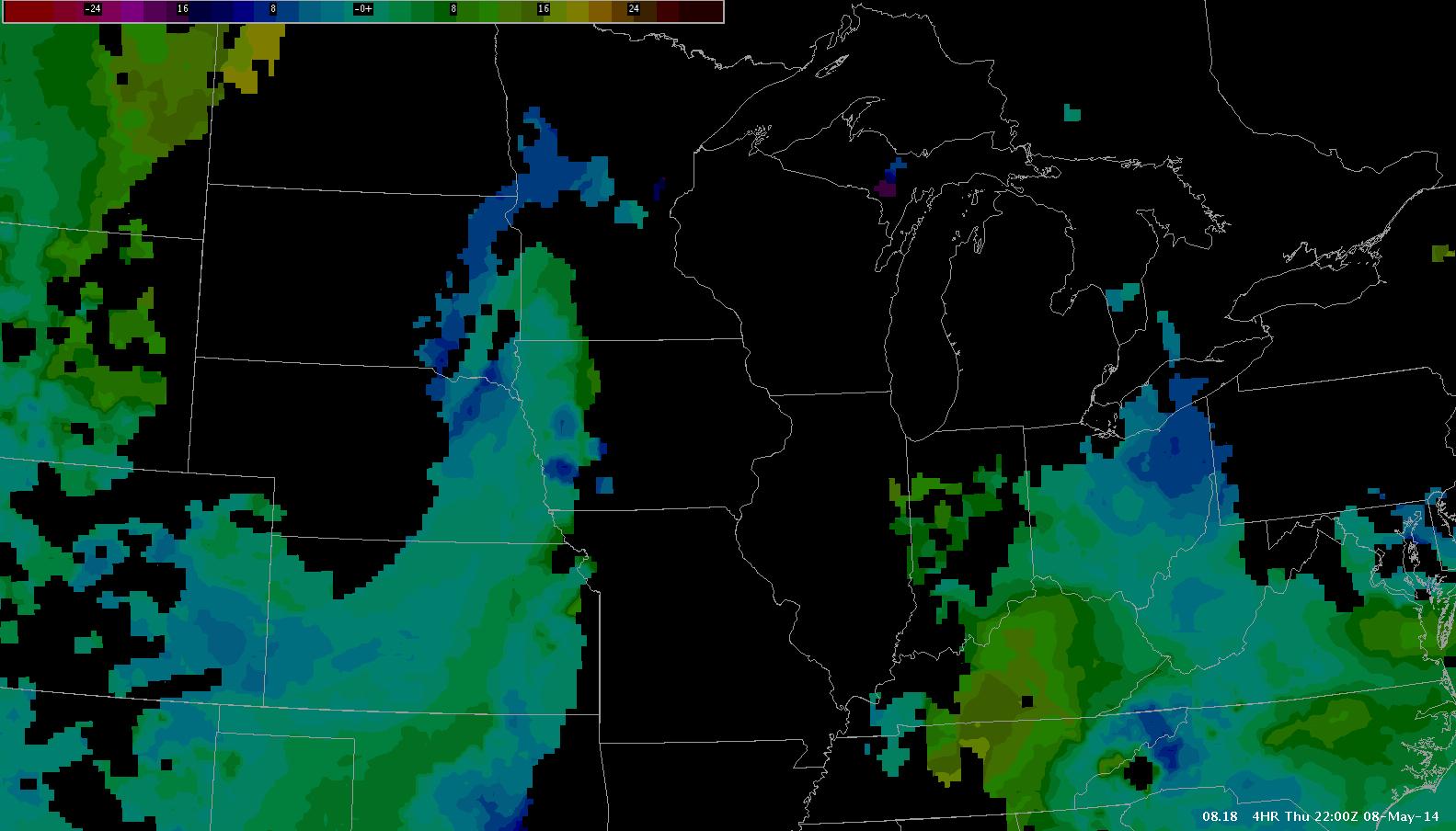
As this activity develops and moves eastward, Nearcast forecast theta-e difference by 22Z would indicate pockets of instability (in an area of closer to neutral stability) moving in over the next few hours from the west.  Will be interesting to see how this translates into storm coverage, or even storm mode, as the front moves in.

eekDrawing

And in the time it’s taken me to work on the above…we’re seeing gradually developing convection marching to the NE/IA border in an area marked by the CI earlier.  Only low to moderate hits on ProbSevere (45% or less by 1930Z).

arghdrawing

Do have LAPS data today, but a late realignment of the domain has the model playing catch-up.  Will comment later.

Wx briefing indicated increasing chances of UH tracks in our area, especially in our northeastern counties…watching for supercells with tornadoes and hail…and some severe wind

db


Tags: None

2.5km LAPS Hot Spots

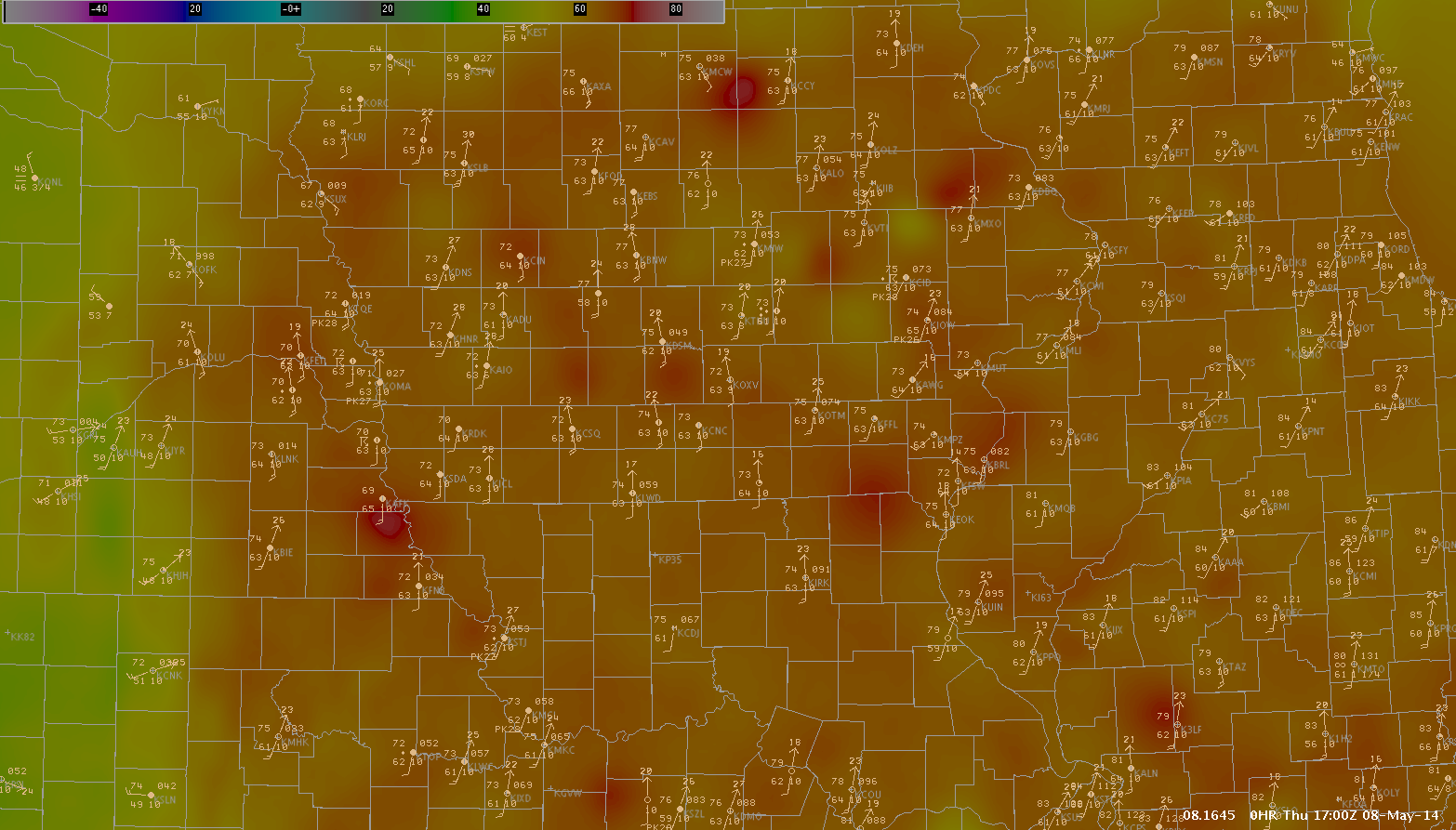
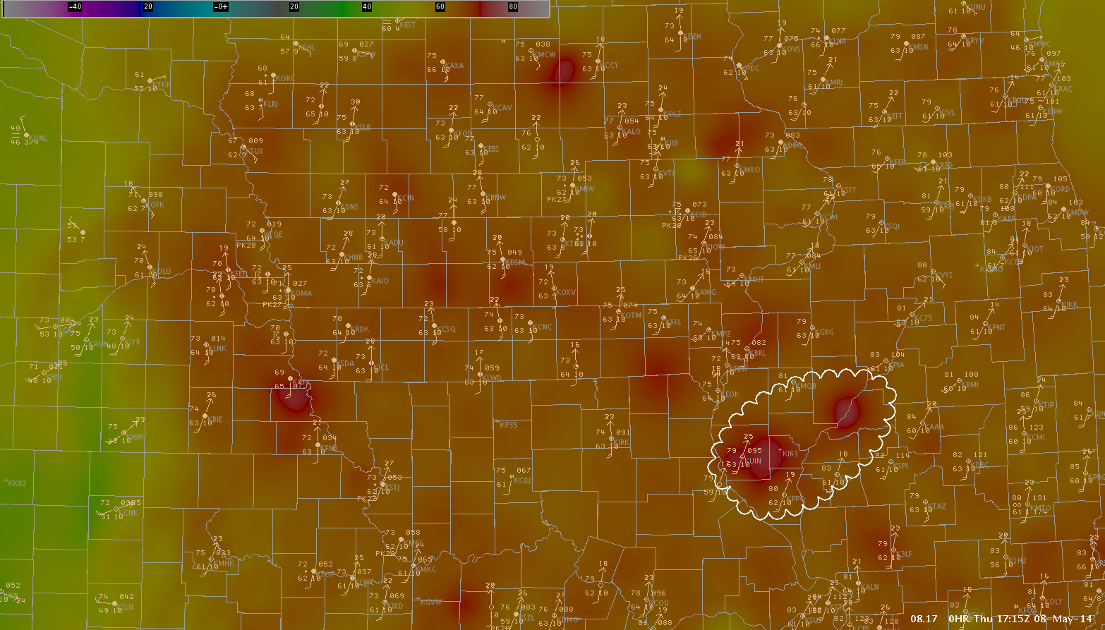
8May14 2-5km LAPS 1700z8May14 2-5km LAPS 1715z

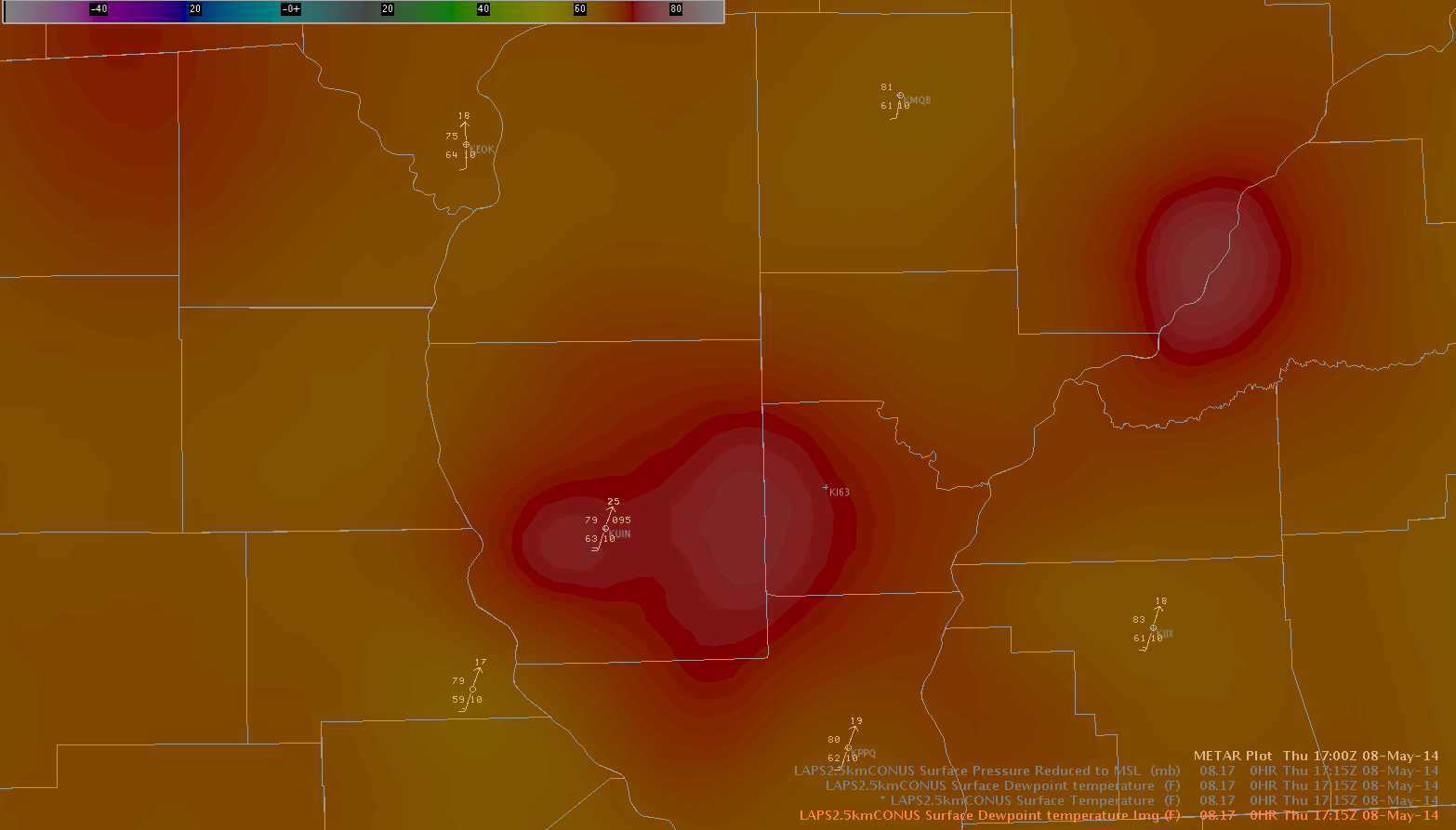
8May14 2-5km LAPS 1715z2

The images above are 2.5km LAPS taken at 1700z and 1715z, respectively. The third image is just zoomed in to the area of interest.

Station observations were overlayed onto LAPS model data to compare the model performance. A general bias of about 1-3 degrees existed in the LAPS data through the region. However, there were more notable departures in portions of Iowa and Illinois. The second image illustrates two of these locations in West Central Illinois, just east of Quincy and southeast of Macomb. In these areas, the model data departed from the station plots by about 8 degrees.

Jared Maples


Tags: None

EWP Day 4: Operations Update

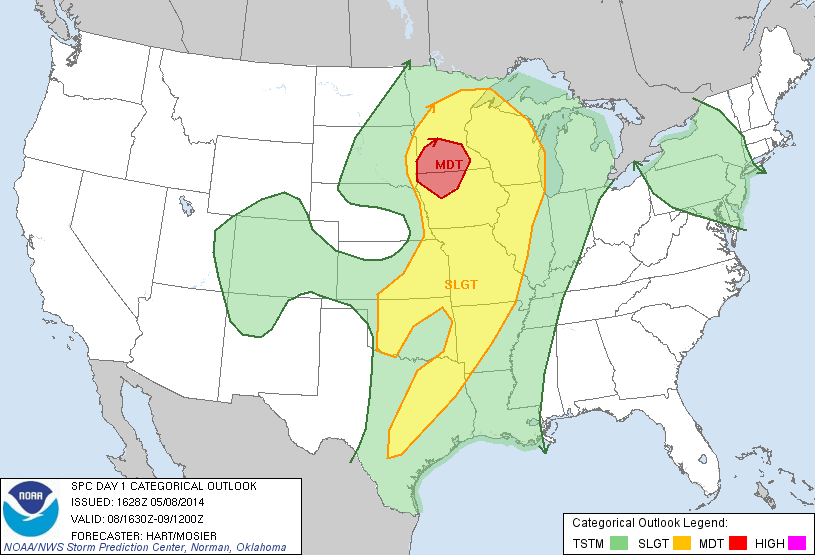
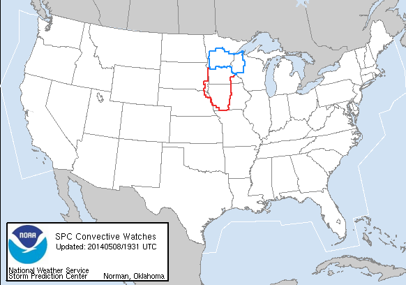
The final day of week 1 is already in progress and a complicated forecast it is (due primary to overnight convection).  Our initial thought was to play in the moderate risk associated with the low pressure and warm front, but with the presence of ongoing convection and the desire to utilize many of the GOESR products meant for the pre-CI and CI environment we decided to shake it up. One group of forecasters (Rudge/Bickford) remains in the moderate risk in Des Moines (DMX) CWA while the other pair (Maples / Thoren) is operating in the Wichita (ICT) CWA and looking for possible development ahead of the surface cold front/dryline.  While some convection is already ongiong in the north and eastern DMX CWA, expectation is that supercell storms (and tornadoes) will develop in the area clearing farther west.  Severe activity in the ICT CWA is a bit more uncertain and timing is likely a later this afternoon and evening if it were to occur.

SPC Day 1 Outlook
SPC Day 1 Outlook
Current Watches over operation domain
Current Watches over operational domain

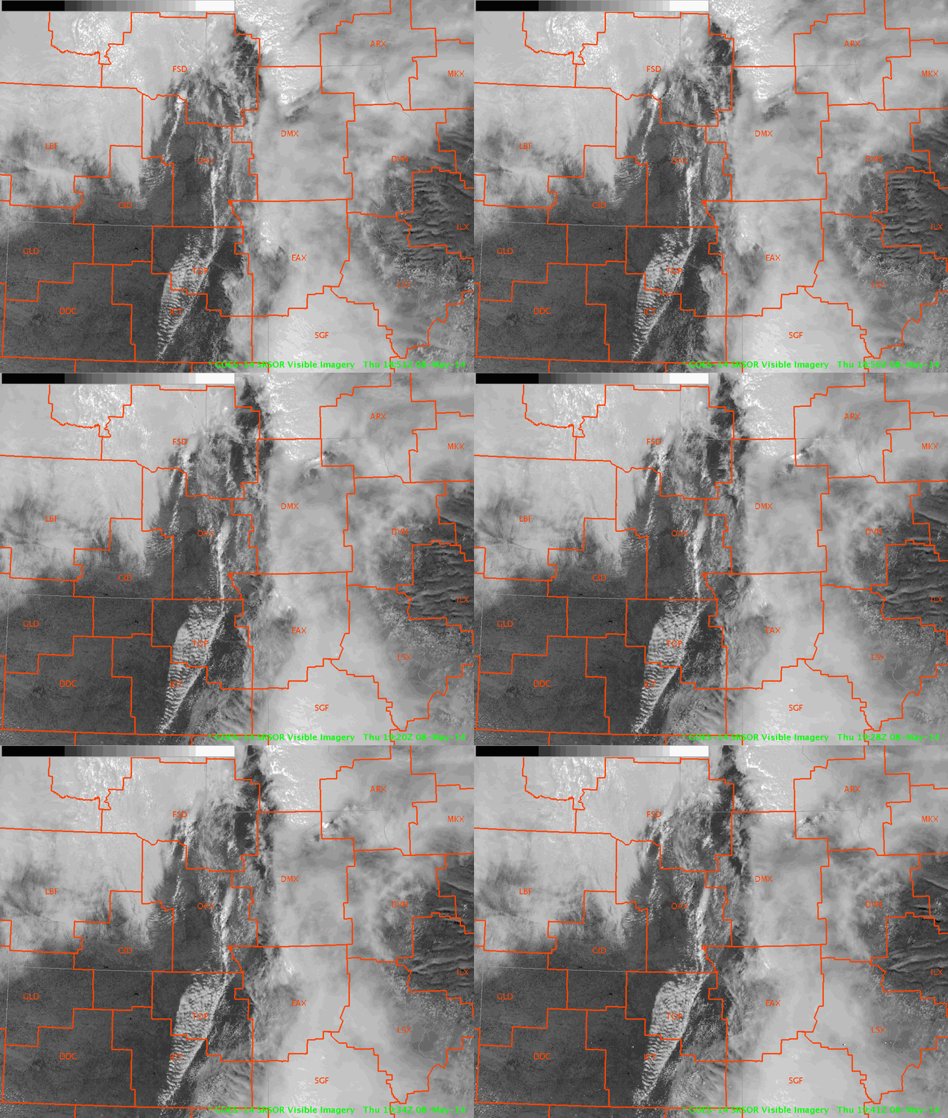
Super-Rapid Scan (1 min imagery) is in it’s first day of operations.  The animated gif (click to show animation) below shows the Cu development along the cold front into the ICT domain and clearing in the western DMX domain.

Super-rapid scan visible satellite on 8 May 2014

-K. Calhoun, Week 1 Coordinator

Tags: None