
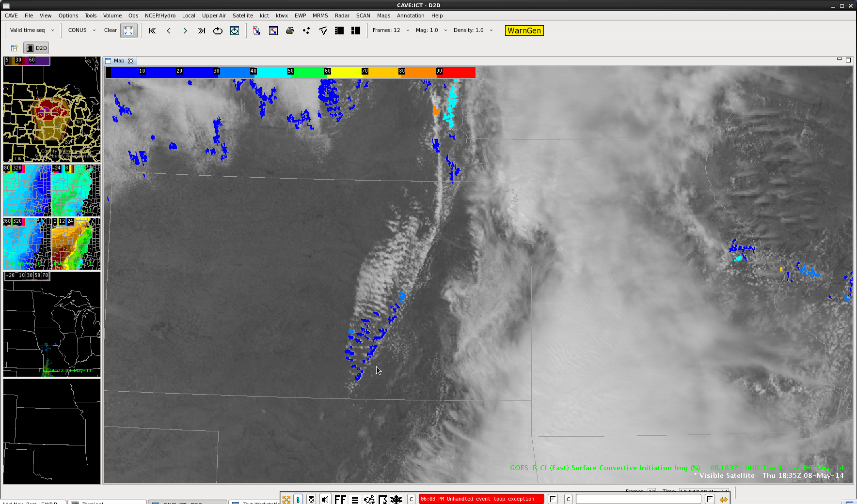
CI product not very excited about convective develop (0-2hrs) with cu forming along frontal boundary at ~19z.
Official websites use .gov
A
.gov website belongs to an official government
organization in the United States.
Secure .gov websites use HTTPS
A
lock (
) or https:// means you’ve safely connected to
the .gov website. Share sensitive information only on official,
secure websites.

CI product not very excited about convective develop (0-2hrs) with cu forming along frontal boundary at ~19z.
The forecasters were able to complete something more of a stress test on Wednesday, May 7th. We started the day in both the Norman (OUN) and Cheyenne (CYS) county warning areas (CWA) with the CYS team transitioning to the North Platte (LBF) CWA before the end of the operational period. Both teams put together forecast discussions before transitioning to warning operations.
Almost all of the products were evaluated. Blog posts specifically examined the CI algorithm, overshooting tops, pGLM and lightning jump, and ProbSevere.
-K. Calhoun, Week 1 Coordinator
Storms initiated across far western OK along and near a Theta E Difference boundary.
At 20Z

At 21Z

At 22Z

At 23Z

At 2330Z – Henrietta Storm quickly developed a hook with a report of a rapidly rotating wall cloud.

Scott Rudge.
The line of storms that has produced a TOR in NE CO and SVRs in our CYS area has shown a slow weakening trend. Many of these cells are now outside the CO total lightning coverage area so we can not view this.
Of interest is an area of stronger storms with multiple SVR and TOR form NE CO into the North Platte, NE CWA…

These cells developed in a much more favorable environment…heating into the 60s and 70s today. Areas under the “old” convection in WY/CO are in the 40s and 50s.
Also of interest:

The deeper Nearcast instability is now mainly centered in NE. Best threat for further convective development and more strong to severe storms looks like it will be mainly focused just to the east (and to some extent southeast into NE CO) of the CYS CWA for the duration of the afternoon/evening.
db


I am watching a void area on the radar (bottom image) to see if there is any additional development northeast of Denver. CI values have picked up a bit (top image) in this general vicinity with some 70% probabilities. In that last few minutes probabilities have dropped. Waiting to see the outcome…
Update…Radar did not fill in at all here. The earlier probabilities did not translate into any additional rainfall/development.
Jared Maples
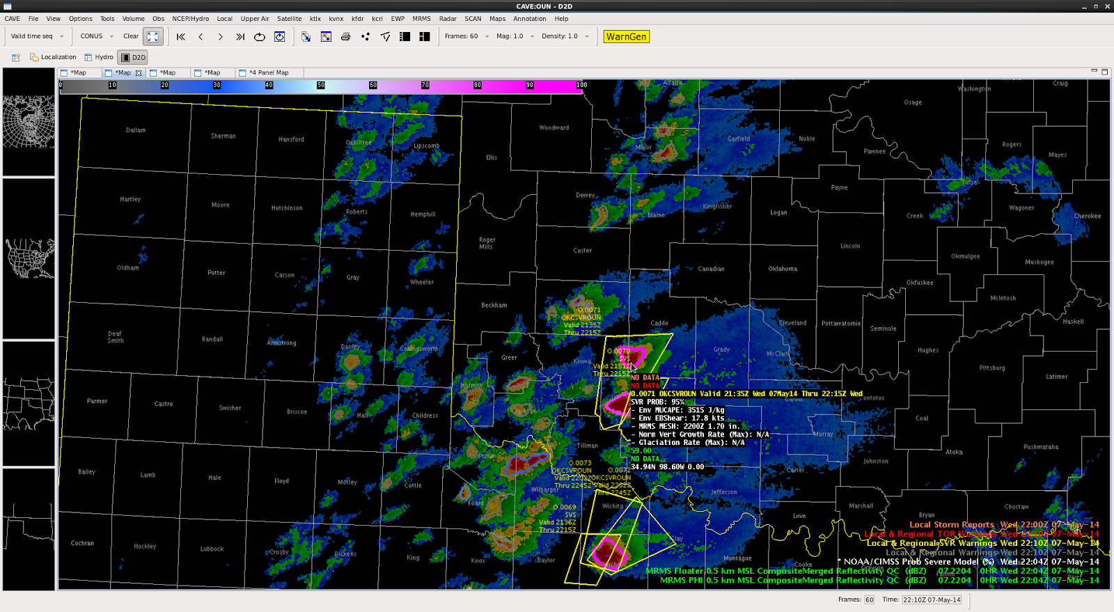
The storms over southwestern Oklahoma have recently increased in intensity and have warranted NWS and EWP severe thunderstorm warnings, with multiple reports of quarter to golf ball sized hail. The ProbSevere values for these storms with golf ball sized hail are well in excess of 90%–even some at 100% for times. The evolution of these storms and the generation of severe thunderstorm warnings is demonstrated in Figure 1.
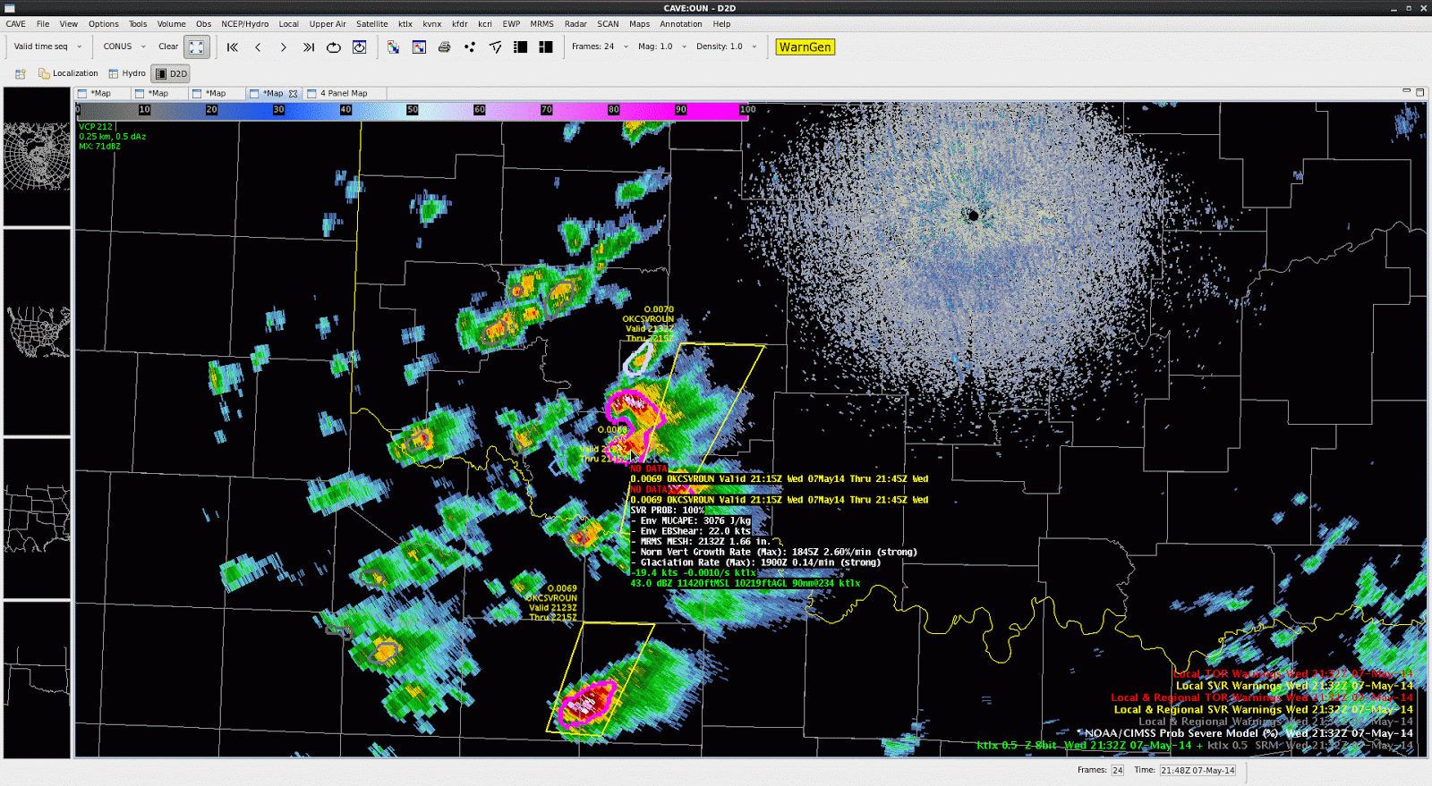
A question was posed to the forecasters on the KOUN desk within EWP today, “There have been a number of storms with ProbSevere values in excess of 50% today, some of which seem to be false alarms, is this hampering the use of the product?” The forecasters replied,
“No I like that the storms with the highest ProbSevere probabilities are in excess of 90% and these are the ones producing golf ball sized hail–these are not marginal hail stones. The ProbSevere is drawing me to which storms are likely to need severe warnings in the near future. The false alarm storms, while they have high probabilities today, are in the 70-85% range–which makes them different than these with 90+% probabilities. I’ve easily been able to adjust to the probabilities and use them appropriately. Also I know the ProbSevere model has not been validated as a tool to reissue severe warnings, but I like how the probabilities diminish a bit when the radar intensity decreases and then come back up if the storm re-intensifies. If you look at this display (Figure 2) it has high probabilities on the right storms, but the ones further west are only (correctly )10-20%”
-Sieglaff, Week 1 ProbWarn PI
A wider look at the lightning jump grid at 2234 UTC of the NE Boulder CWA… All tracked storms (with greater than 10 flashes per min and within the 150 km LMA domain) are shown. Three tracked cells show some type of sigma jump at this same time. Two in green – 1-sigma (or standard deviation) and one smaller cluster, orange, with a 3-sigma jump.
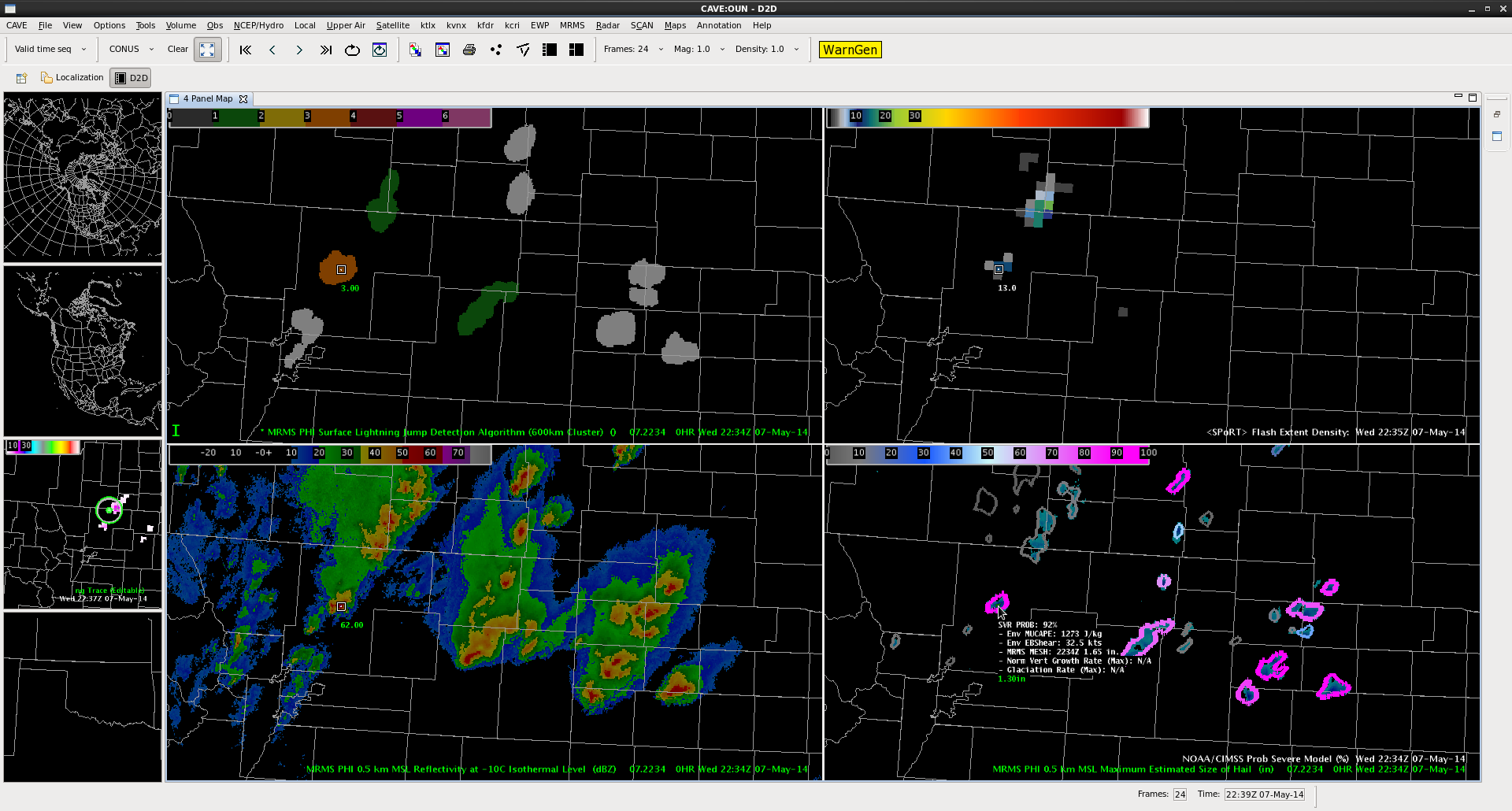
The three-sigma jump storm corresponds with a ProbSevere 92% and MESH of 1.65 in.
-K. Calhoun, Week 1 Coordinator & Lightning Jump PI
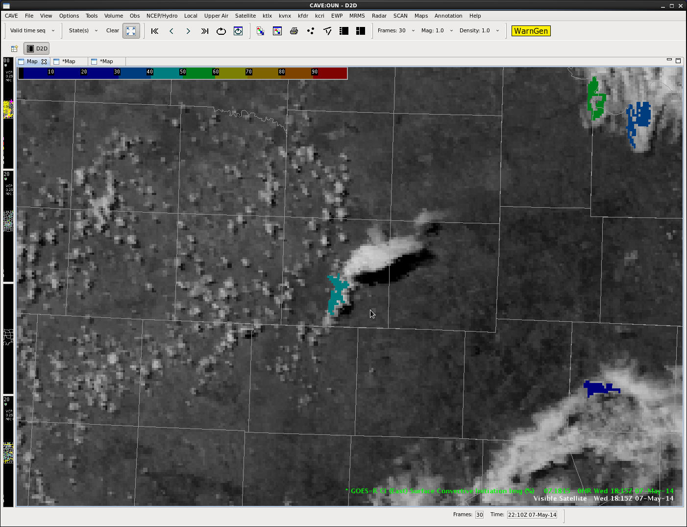
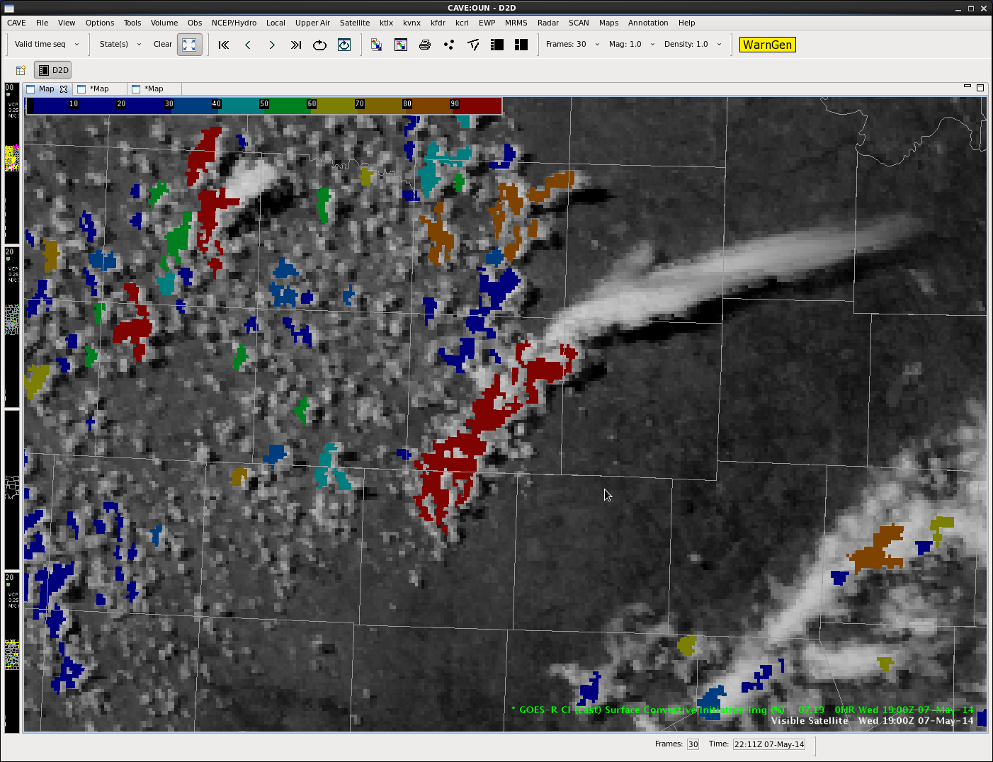
First isolated cell builds with a CI of 40-50%.
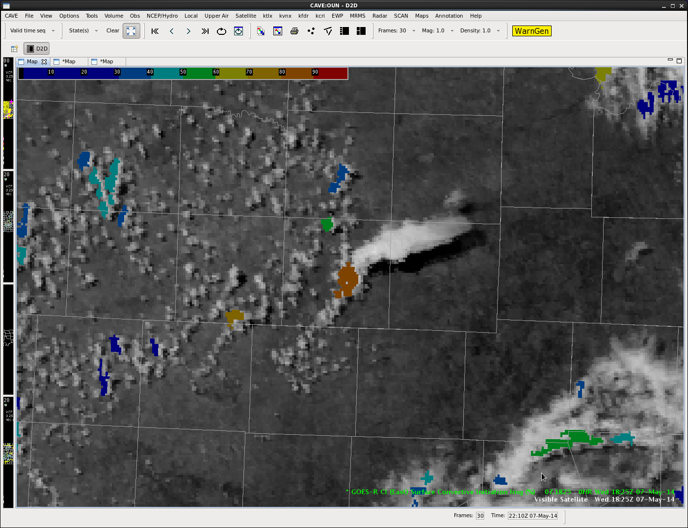
Initial cell continues to grow with a CI of 80-90%.
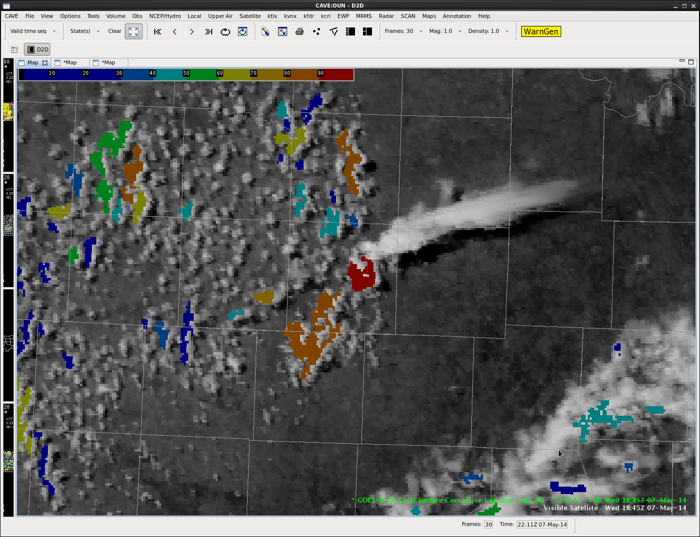
Initial cell reaches a CI of >90% with a new cell developing to the southwest showing a CI 80-90%.
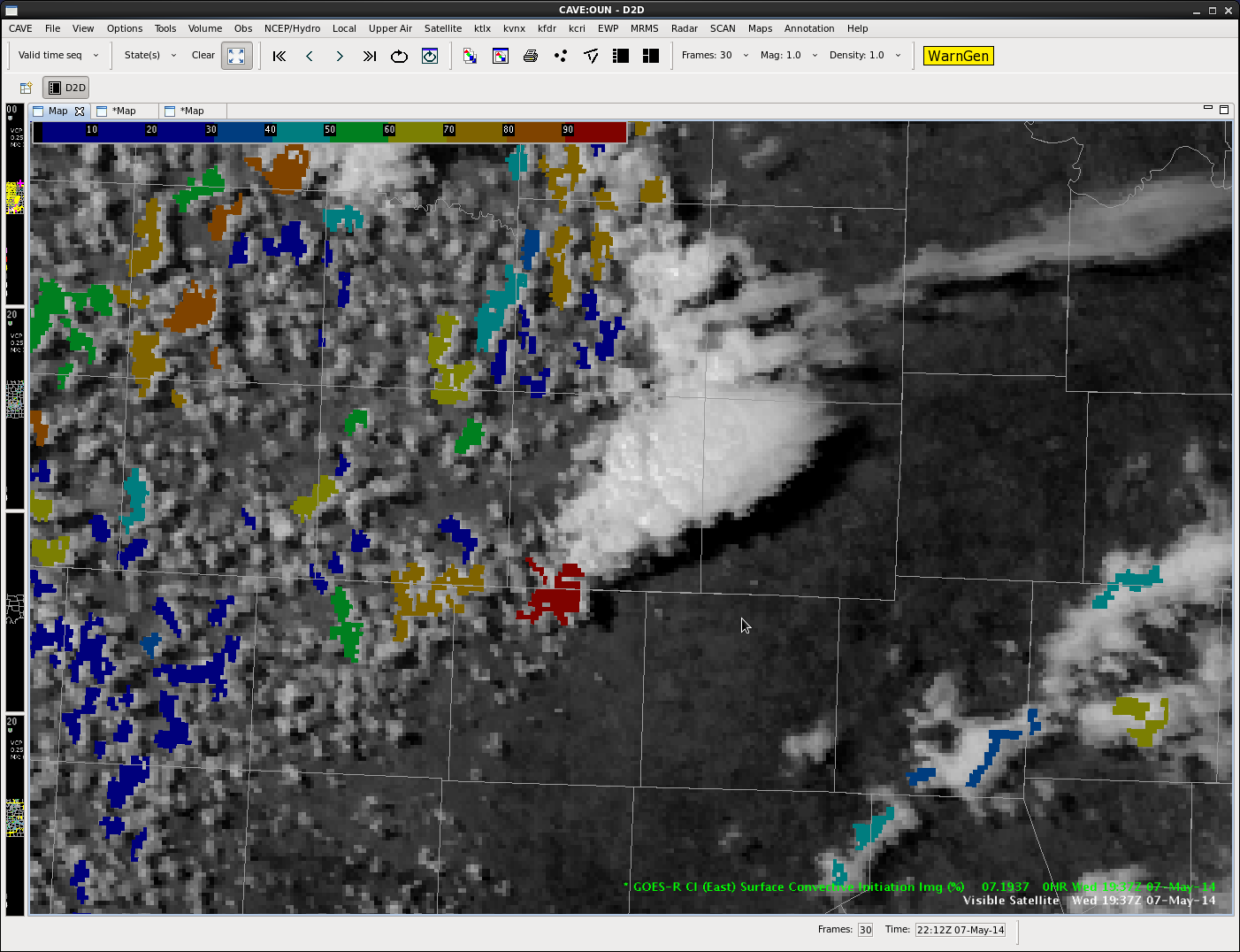
Initial cell eventially goes “poof”, with secondary cell continuing to grow and show a CI of >90%.
Second cell continues to grow with CI still >90% on the southwest flank.
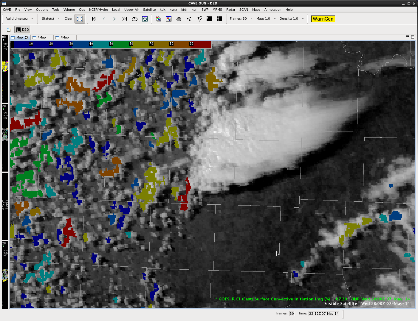
Second cell continues to grow. A warning was eventially issued for this storm.
Scott Rudge.
Convection in CO, NE, WY has exhibited persistent (30 min) OTs as of the 22:15 vis sat pic.

These have been over persistent strong…and at times severe…storms. OTs have not always meant the storms were severe…and have seen SVR and even TOR under cells that have not had OTs detected.
db