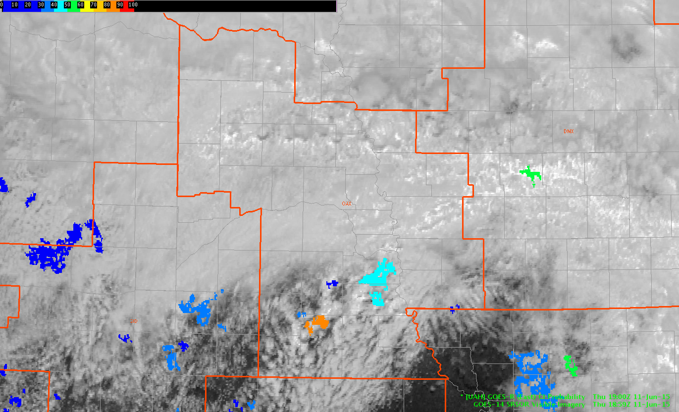
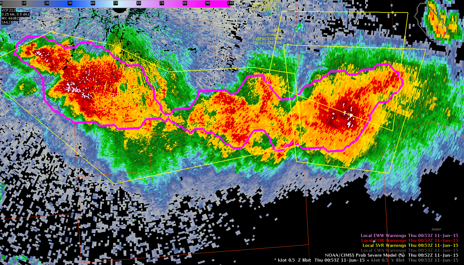
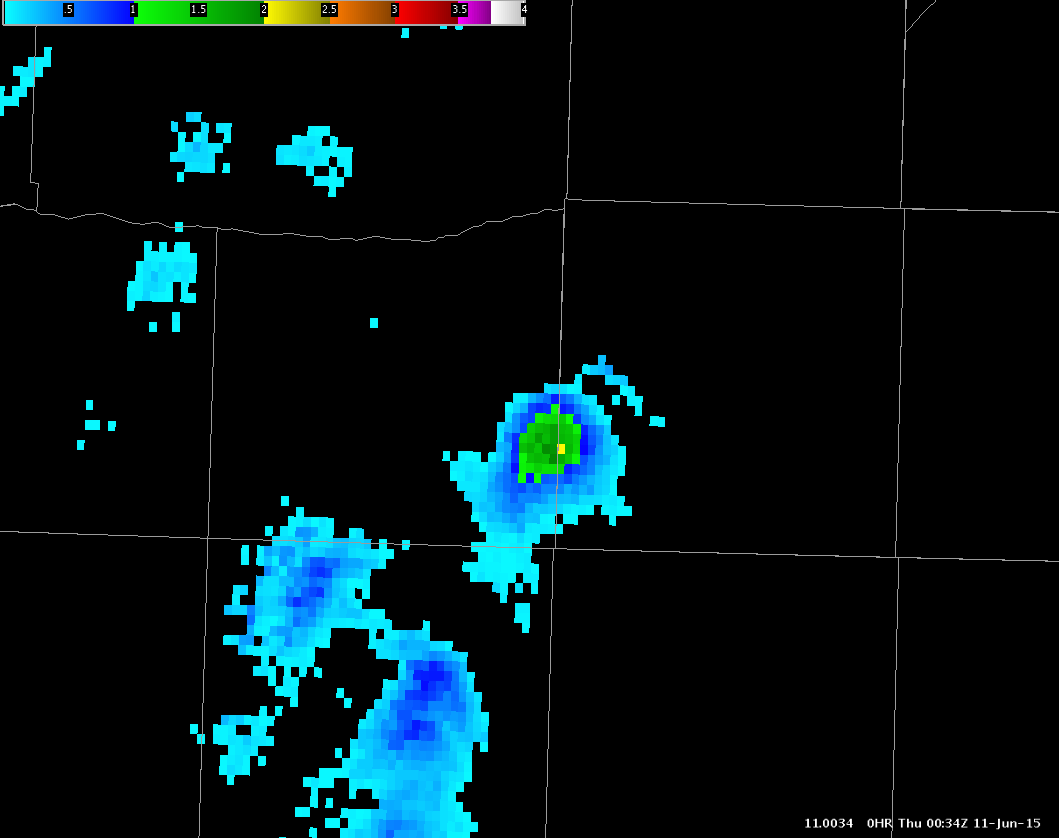
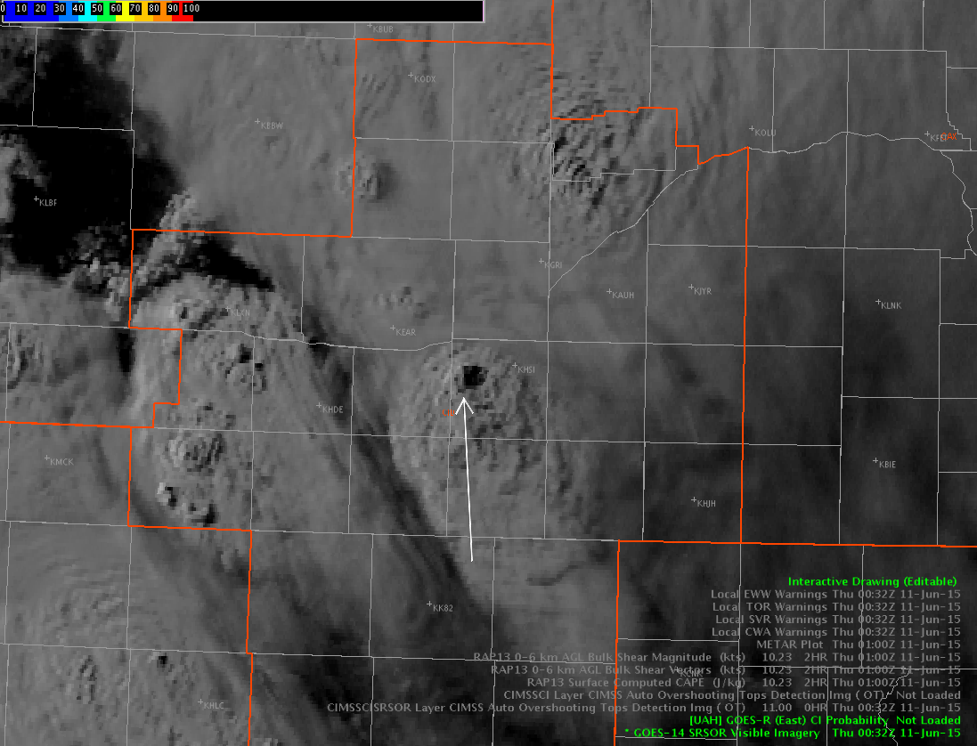
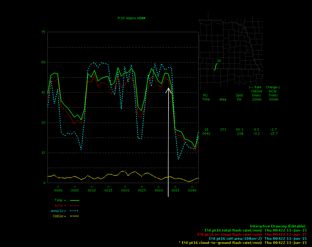
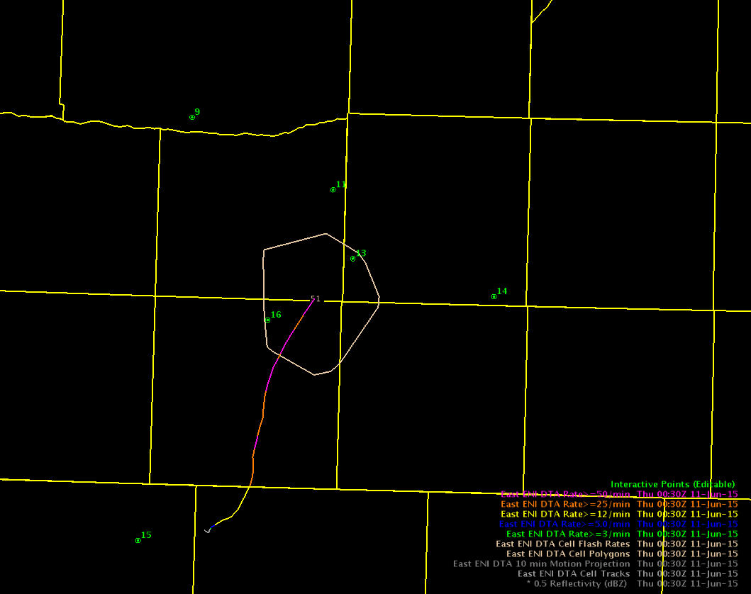
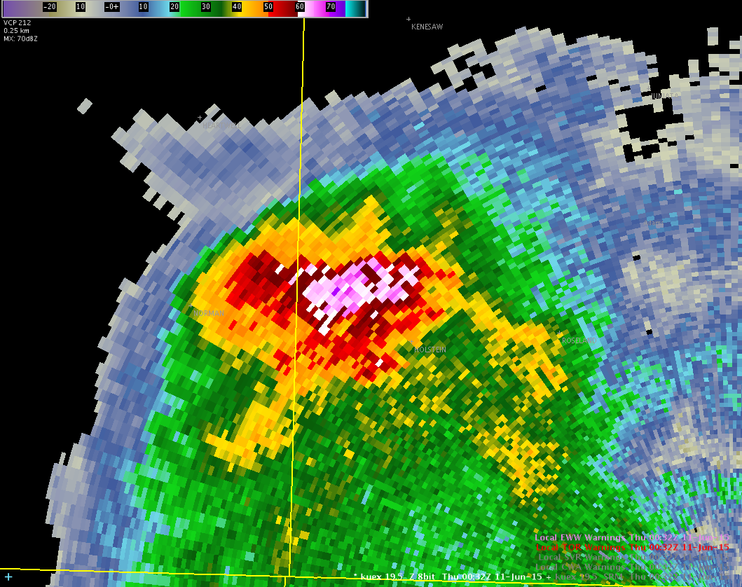
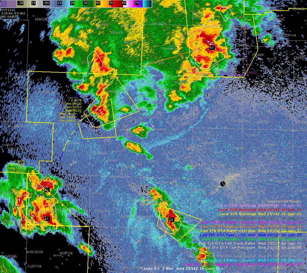
We’re trying to see some convection across our northern most counties (TOP). Mean flow is quick to the NE so most of this development will quickly exit our area. Lightning data shows a few flashes on the fringe. I have 5 and 1 min data loaded in a 4-panel view. I think I’m leaning towards using the raw data more compared to the grid. However, I do like looking at the 1 and 5 min data together to get an idea of intensification (or not). -BT
Lincoln County, CO Severe
A couple of storms developed off of the high terrain south of the palmer divide near Pueblo’s forecast area. One even registered a +16 sigma jump. Although looking at the raw data, the drastic jump was probably because the relative sample size was quite small and any strong jump would be portrayed as impressive. Also of note, the +16 sigma occurred just as the updraft split occurred and the cell divided.
The eastern storm did show high sigma gains and the raw data went along with that. The strong lightning jump with 4 sigma occurred just before there was a strong jump in ProbSevere from 75% to 93%. The storm was already warned on based on base reflectivity data, but, it helped confirm that there was, in fact, a warnable storm.
-Shasta and Mr. Snow
Prob SEV and DTA product working well
Downstream OAX SVR Charley
Severe Omaha Charley
Meso Discussion Omaha Charley
Have a strong gradient of temperatures across the region this hour, with upper 50s in the north and mid 80s in our one clear spot in the southeast forecast area.
Surface low is to the southwest with a frontal boundary extending northeast into our southern CWA. Quite a bit of shear aloft, with SRH from the SPC mesoanalysis in the 200-300 range across the south, higher in the southeast and 0-1 km bulk shear 10 in the west and 25 in the east. These would lead to potential for supercells to develop in the warmer air, and perhaps allow for tornado development close to the frontal boundary.
LAP sounder data is not too high for TT, with CAPE and LI more indicative of storm potential in the south and southeast. Have a PW gradient with higher values to the east.
CI product
Does this justify our warnings?
A very strong cornfed storm
Just after 7pm a monster storm developed southwest of Hastings, NE. At 732pm the storm intensified to near 70 dbz up to 32kft! The MESH product showed just over 2″ hail and the RSO showed nice bubbling of the overshooting top on visible satellite. This was definitely picked up by the overshooting top algorithm. Ironically, the lightning was never really all that impressive, but did hold steady. The lightning level really dropped by the time the maximum storm strength was reached.
-Shasta


