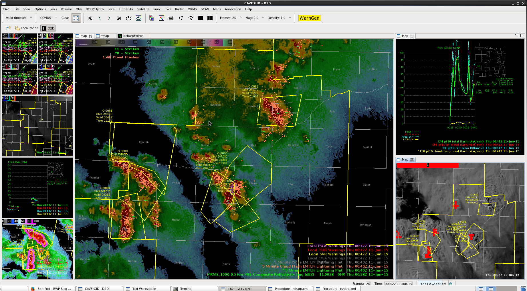
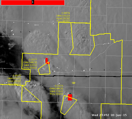
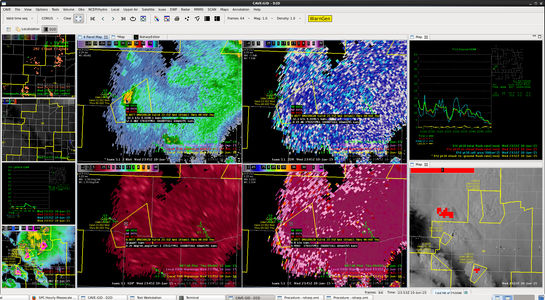
line of storms moving north from Gospar county. DVIL high again, not a good angle to see wind speeds. Would guess the primary issue would be hail here.

Official websites use .gov
A
.gov website belongs to an official government
organization in the United States.
Secure .gov websites use HTTPS
A
lock (
) or https:// means you’ve safely connected to
the .gov website. Share sensitive information only on official,
secure websites.

line of storms moving north from Gospar county. DVIL high again, not a good angle to see wind speeds. Would guess the primary issue would be hail here.
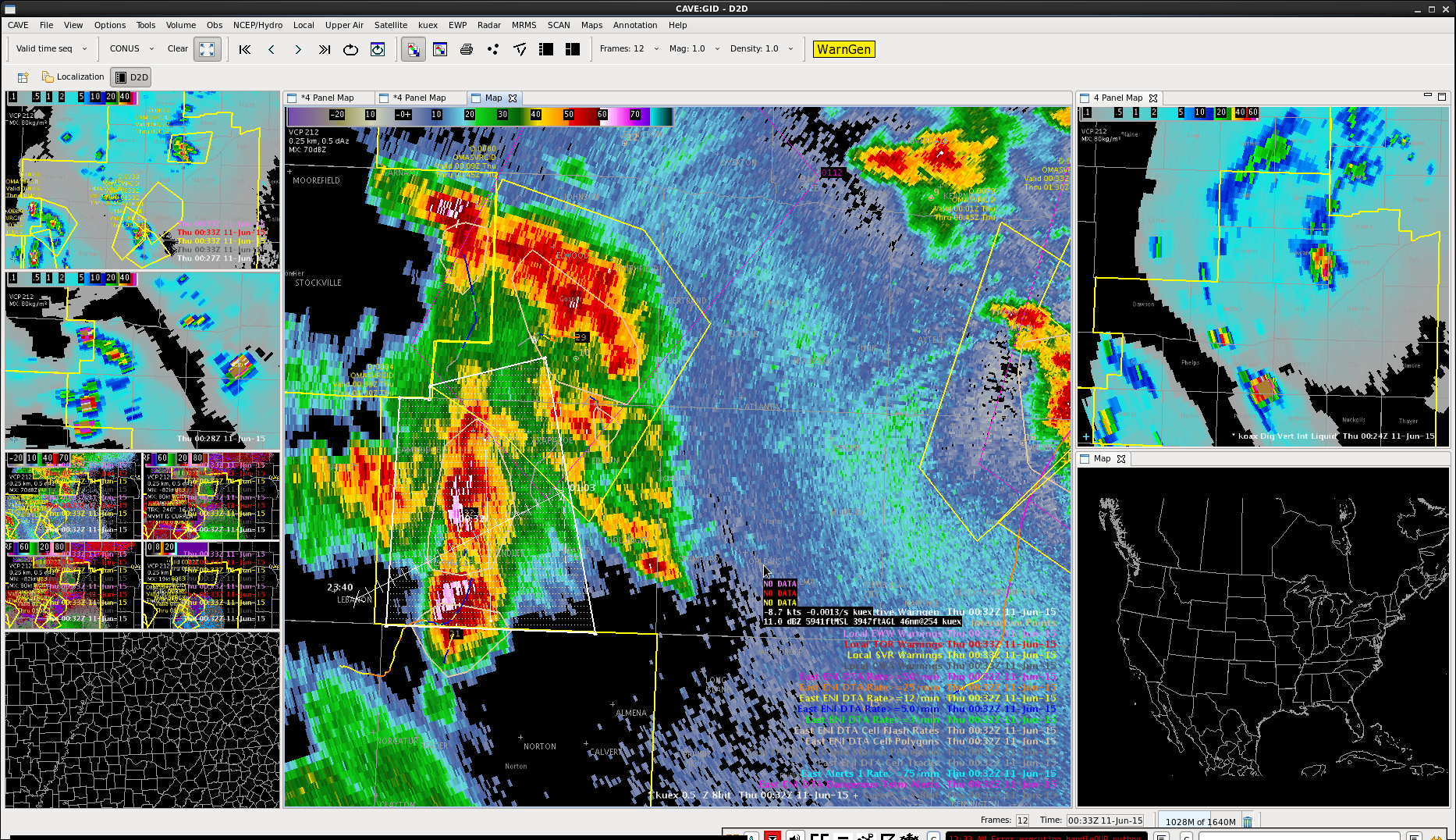 More cells developing behind the line we originally warned for in Furnas county.
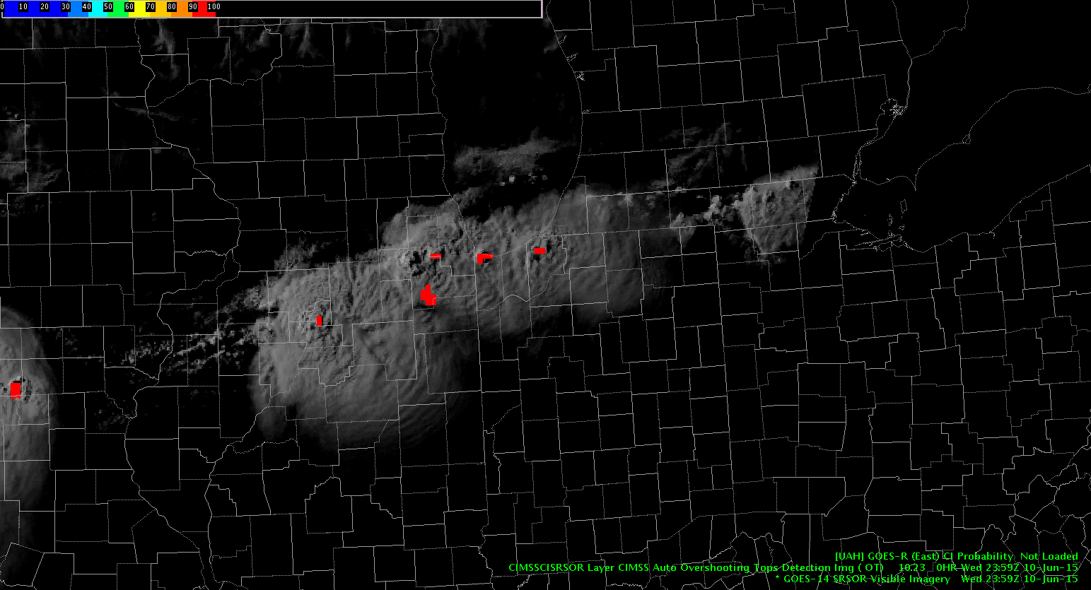
Overshooting top signal and concentrated lightning flashes.
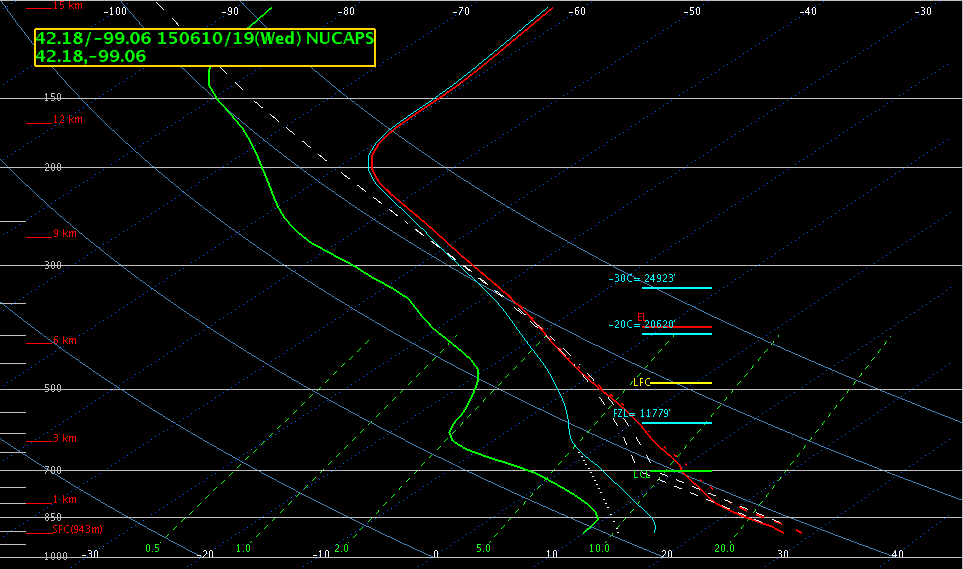
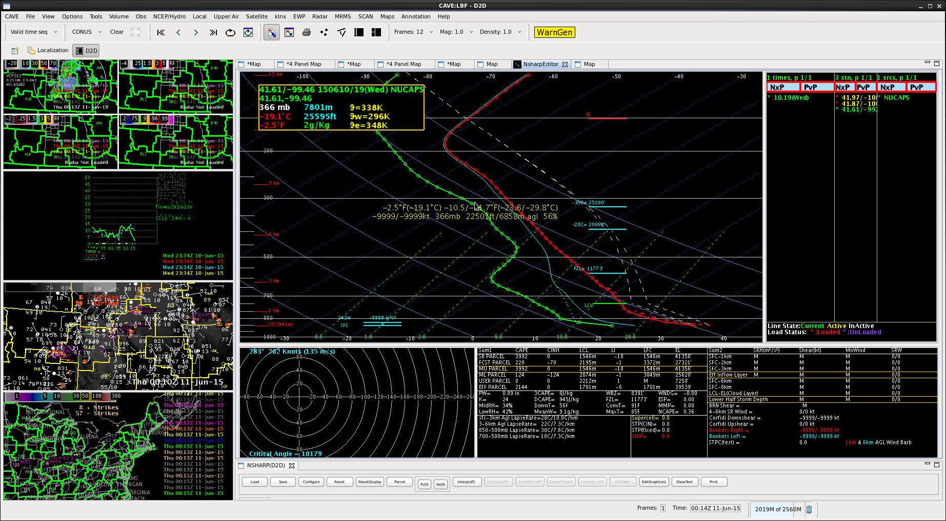
Pardon my puns. Mr Snow and I were testing out the NUCAPS product now that things have settled down in our DMA. We selected different locations and got different results.
Compared to surface obs, the NUCAPS temperature did not need to be altered, but the moisture did, by about 6 degrees Celsius. This change took my MU parcel cape from 15J/kg to ~2000J/kg. SPC meso had it closer to 1500J/kg. The EL also doubled from 6 to 12 km.
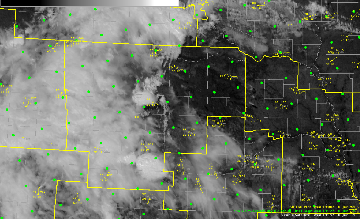
We did have storms just SW of this area, however, as they lifted NE, they weakened.
-Brick Tamland
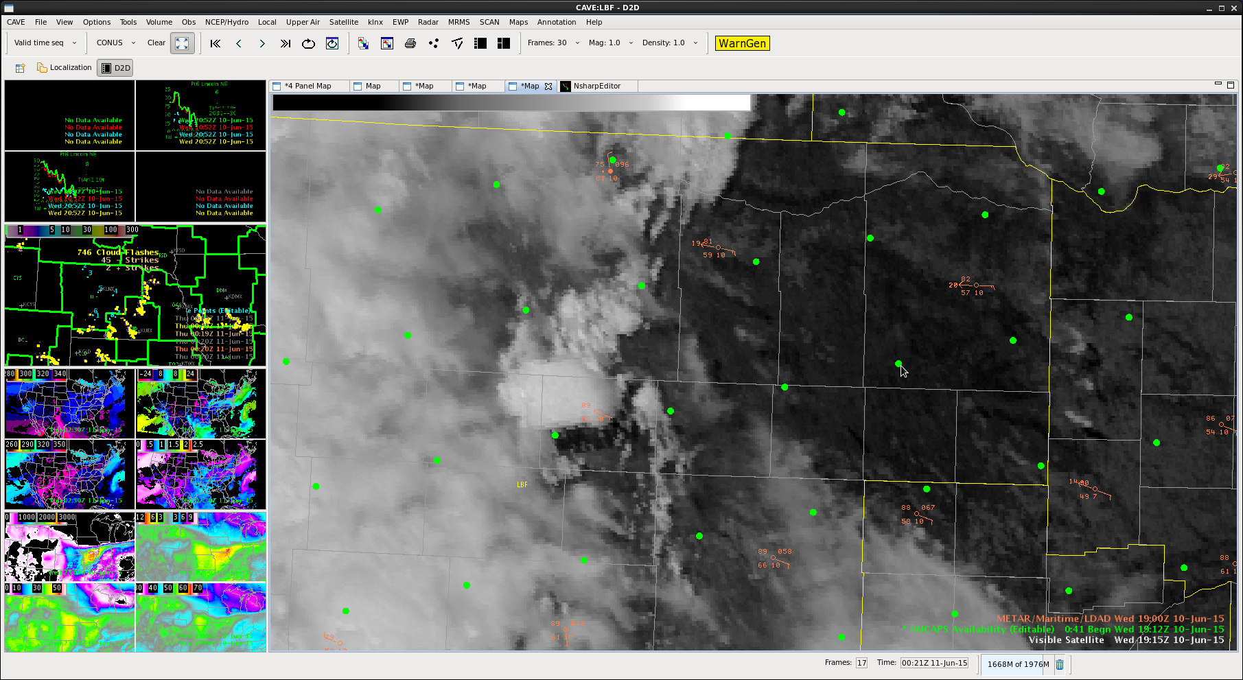
Checked NUCAPS sounding at 19Z just east of LBF and used T/Td of 89/66 to modify the surface and got around 4000 J/kg CAPE. Initially NUCAPS near the surface was much too cool and dry (80/54), so the modification was necessary. It did agree better with the SPC mesoanalysis and RAP which showed values over 3000 J/kg and much better than the LAP CAPE. MrSnow/BT
Decided against going for another wide warning, focusing more on the part of the storm with the highest DVIL. Had another overshooting top in that area as well.
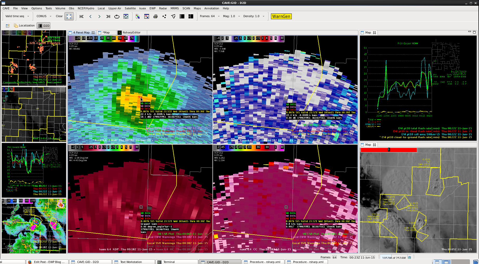
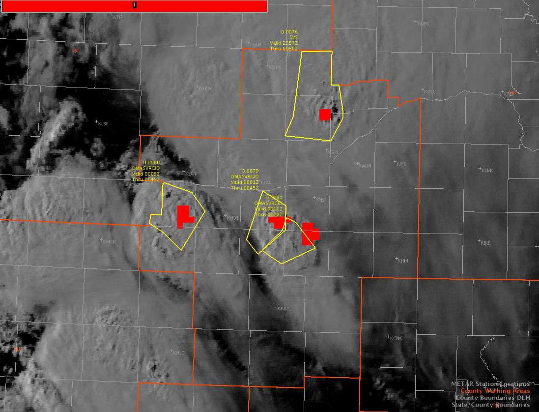
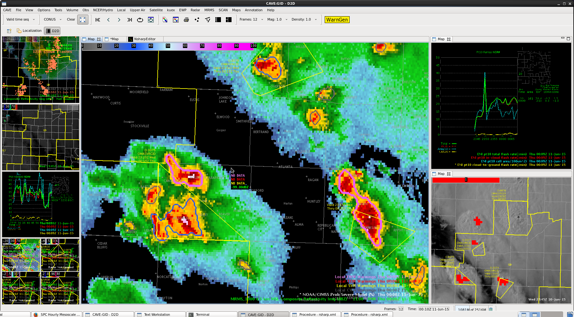
Multiple severe thunderstorms in the Hastings CWA. The algorithm lines up very well with where overshooting tops are observed on the visible and with our current SVR Warnings.
-Shasta
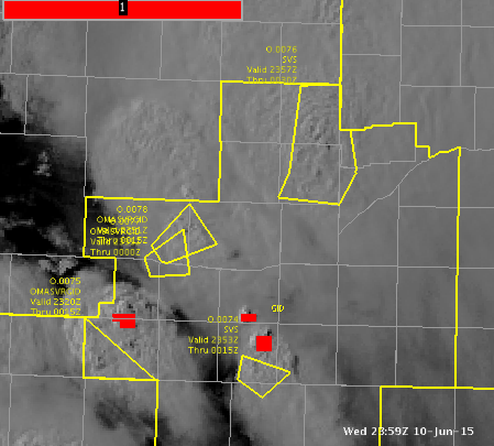
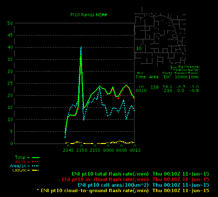
 Had a cell form north of previous warning in Furnas county. DVIL going up and time series lightning showed that cell contracting some (area went down with lightning holding steady). Had an overshooting top few pixels in there as well.
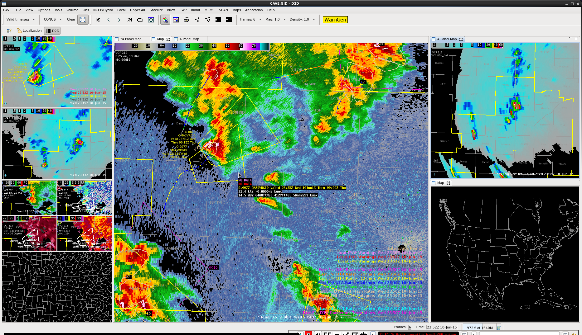
Initial thinking from radar data is that cell is starting to die down, but did have a few more upticks in overshooting top product. Cell is no longer deviant in motion and got a new warning out to cover its trip back to the northeast.
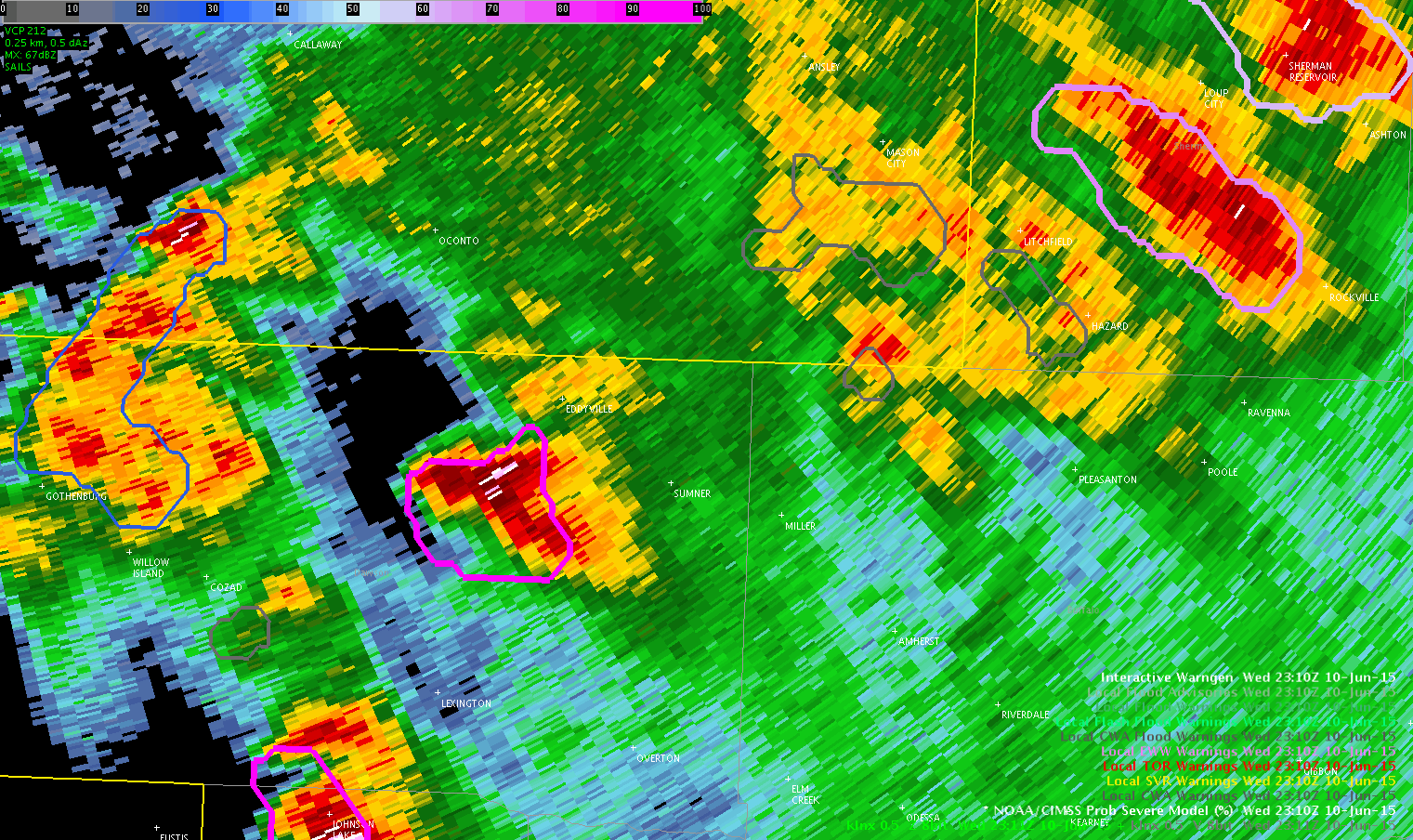
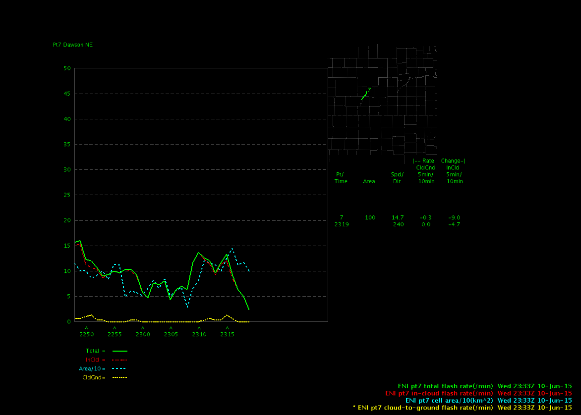
We held off on issuing a warning for a cell moving into our CWA from Dawson County to the south where it produced 3″ diameter hail at 2305 UTC. For 3 reasons we held off.
1. the near storm environment had already been worked over by previous storms and radar showed stratiform rain falling in our area.
2. Prob Severe dropped from 96% at 2316 UTC to 41% at 2326 to 5% at 2330.
3. Lightning was not very impressive and diminished to near zero in the time series plot.
MrSnow/BT