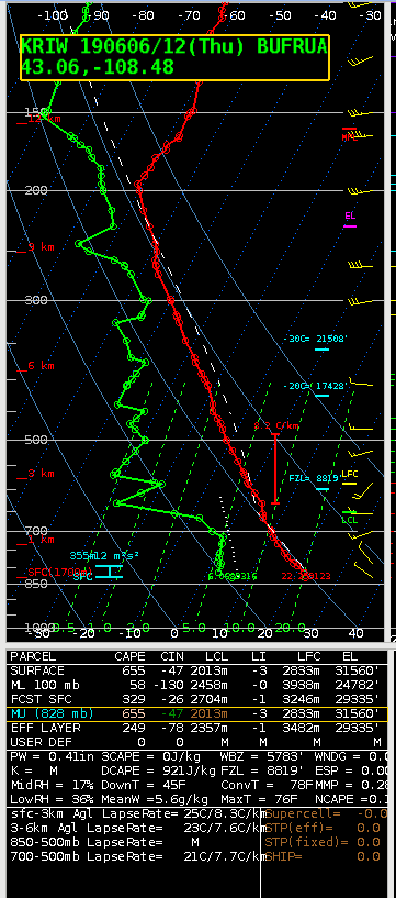
Modified the RIW 12Z sounding for low 70s over around 40 in the southwest WY area, and got an MUCAPE of 655 over A little higher than what AllSky is showing there…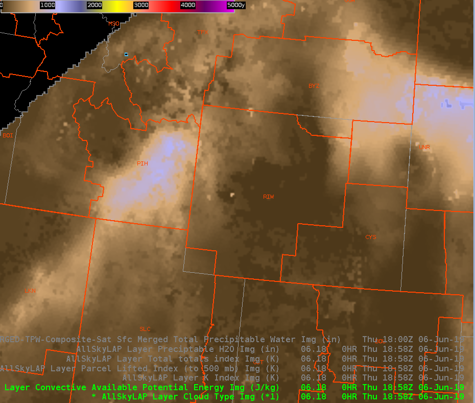
…around 200 in the image above.
Charley

Modified the RIW 12Z sounding for low 70s over around 40 in the southwest WY area, and got an MUCAPE of 655 over A little higher than what AllSky is showing there…
…around 200 in the image above.
Charley
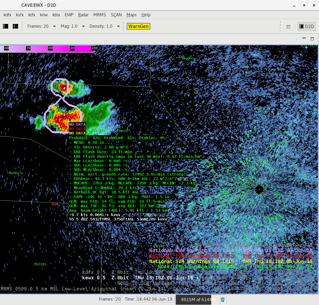
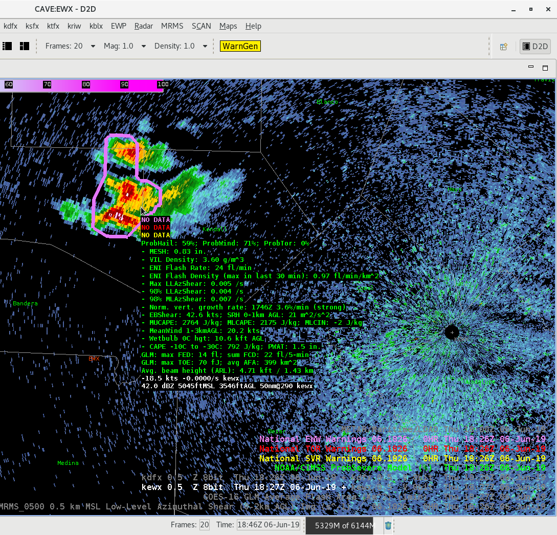
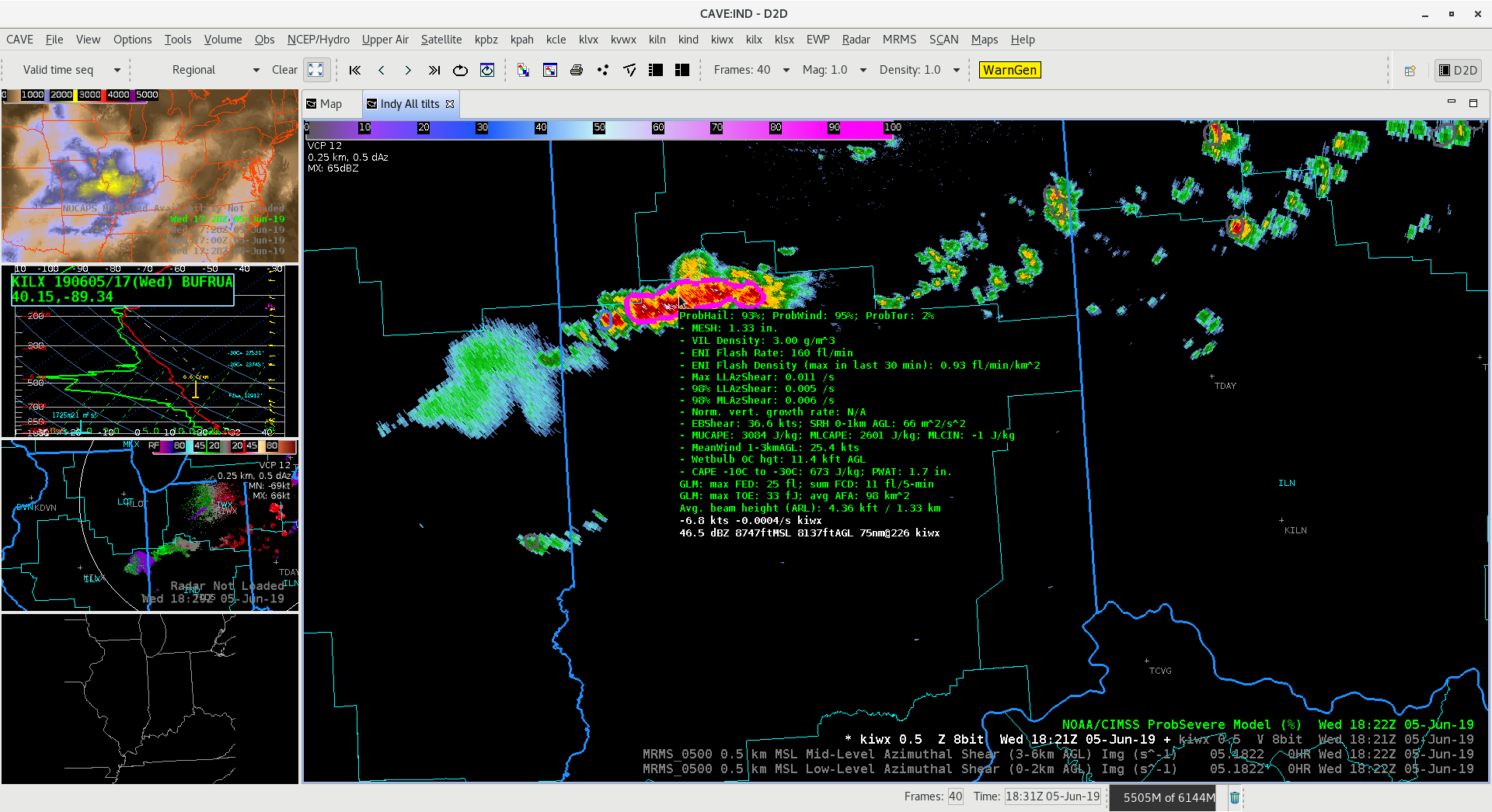
The following series of images shows the change in ProbHail/ProbWind values based on the size/shape of the polygon area. Initially, at 1806Z, ProbSevere was targeting the stronger cell to the south, indicating Hail/Wind 78%/85%. (At this point V was indicating around 20kt). At 1818Z, the northern cell intensified and ProbSevere grouped the two cells together, as a result, Hail/Wind both fell to 42%/61%. At 1827Z, after the southern cell split, the ProbSevere polygone became more filled with deep convection, thus Hail/Wind values increased to 59%/71%. Soon after, around 1834Z, ProbSevere polygons split and then indicated increased probs on the southern cell back to 69%/75% (Hail/Wind).
Incidentally, the larger the polygon, it becomes increasingly likely that ProbSevere values will decrease. 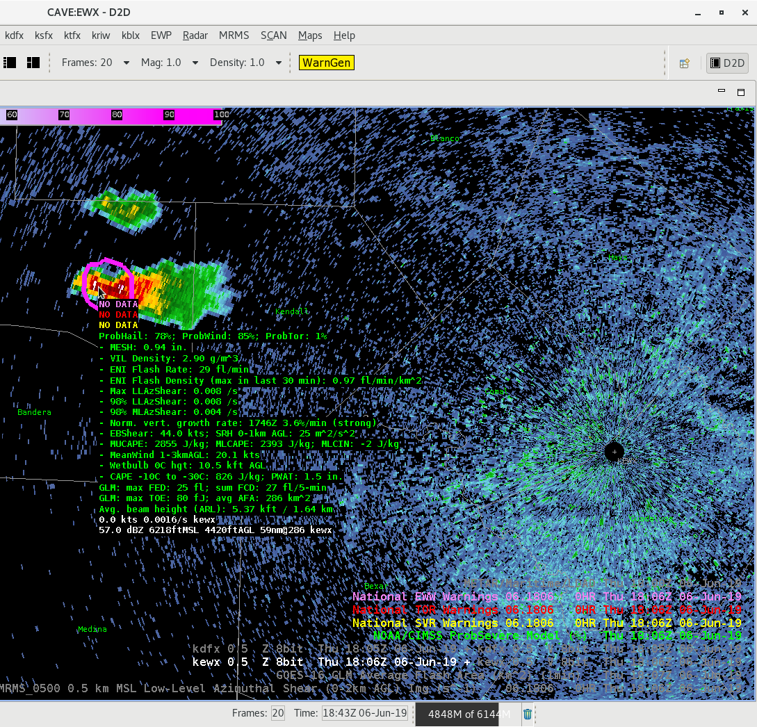

75-90 knot upper jet from morning raobs over the northwest US. Shortwave trough moving ashore this afternoon with a small area of divergence moving into western WY.
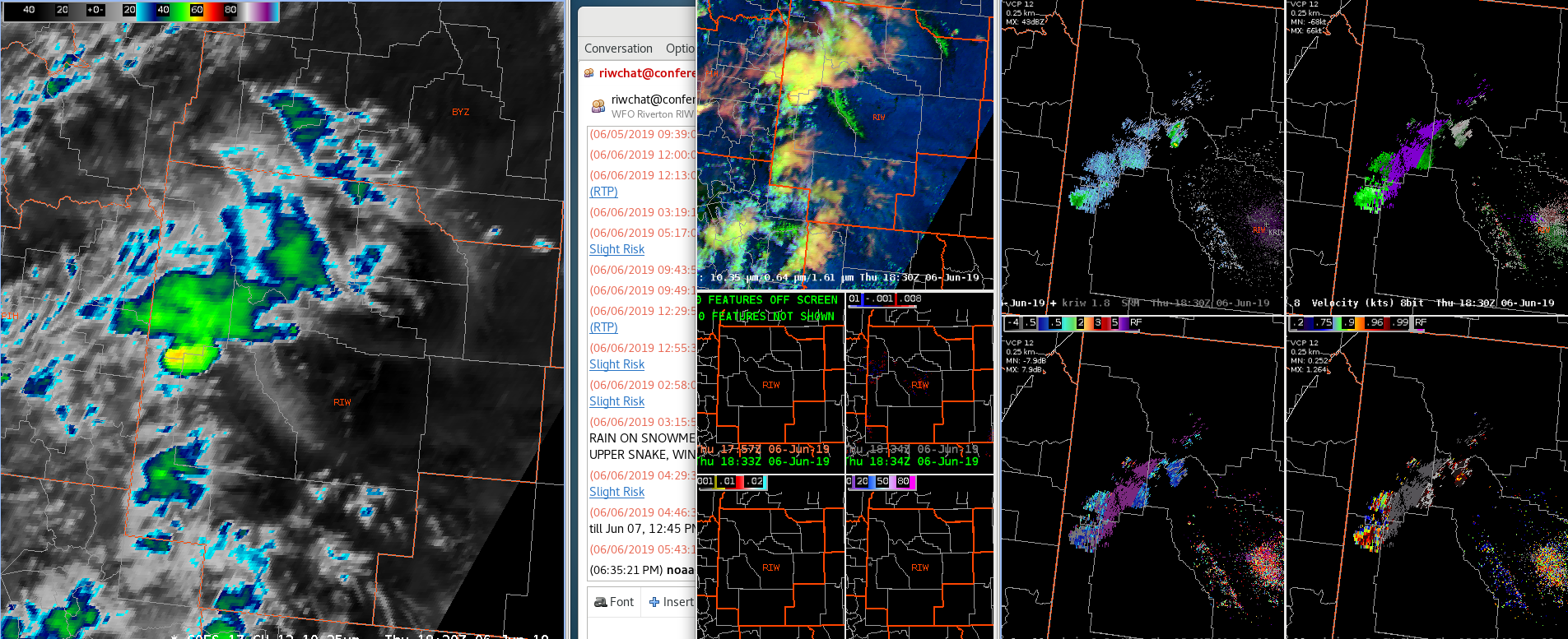
IR imagery showing a taller/colder cell in western Wyoming. KRIW radar just switched from VCP 35 to 12. Peak Z aloft now only around 30. Lightning data, below, shows relatively low FED, but higher TOE, with peak values in the 300’s, similar to some of the storms we saw yesterday.
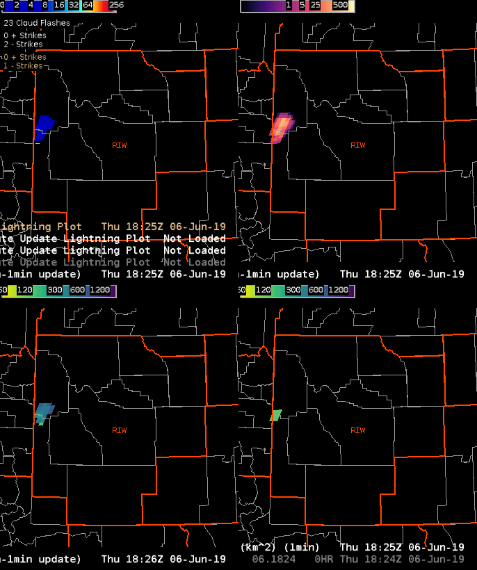
One other thing to note in these, is the relatively low FED and number of ENTLN/NLDN flashes. That doesn’t mesh with the brightness of the TOE.
Charley
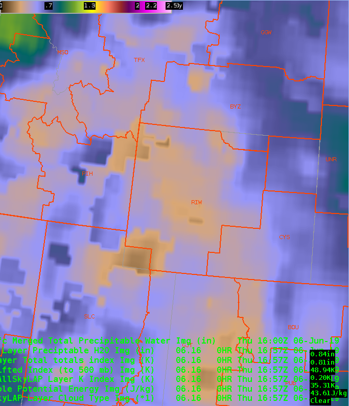
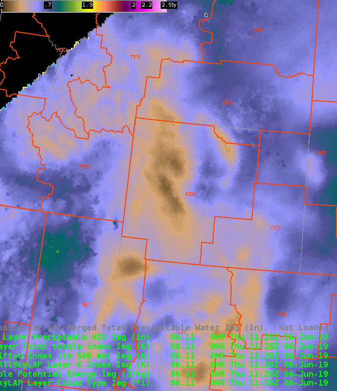
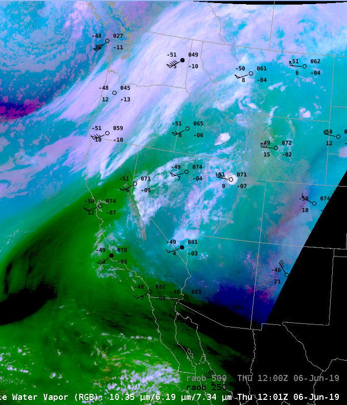
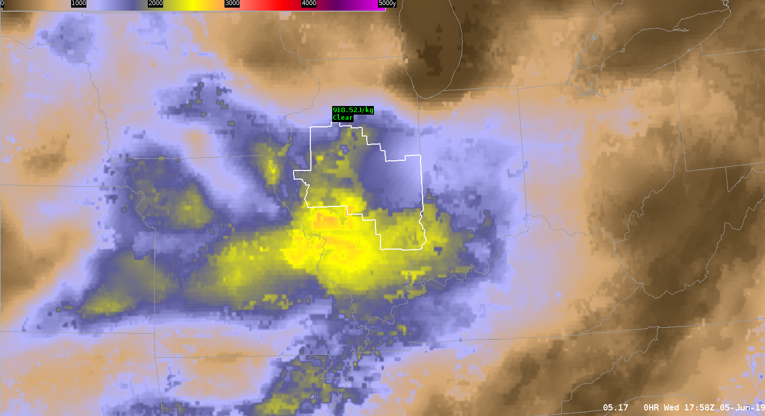
Merged TPW, image above showing an area of higher TPW, 0.5-0.6 in PIH’s area, with values of 0.25-0.4 more over RIW. AllSky product shows a little more variation, with a drier airmass, 0.15-0.25 inches moistening up over the course of a few hours, over the western border to 0.5″. Also seeing those values in the far eastern part of RIW’s area.
Total Totals are ramping up over time in the AllSky product, from around 40 to a more severe 55. LI’s also are going negative. K index also going for some storm activity, getting to the mid 30s. CAPE’s are higher over PIH, but likewise rising across the region…with a similar max in the eastern RIW area.
Charley
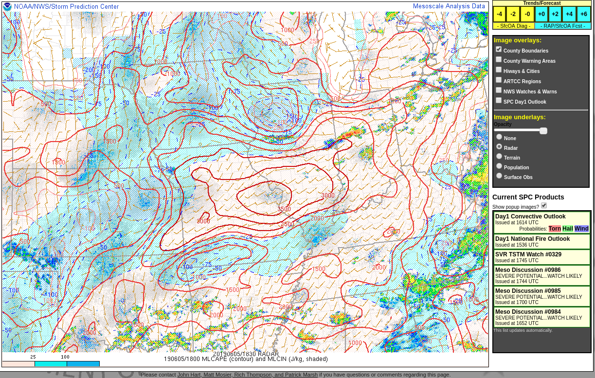
The gridded NUCAPS forecast indicates higher CAPE values moving east into the southern IND area the next few hours. Will be expecting severe thunderstorms to develop later today.
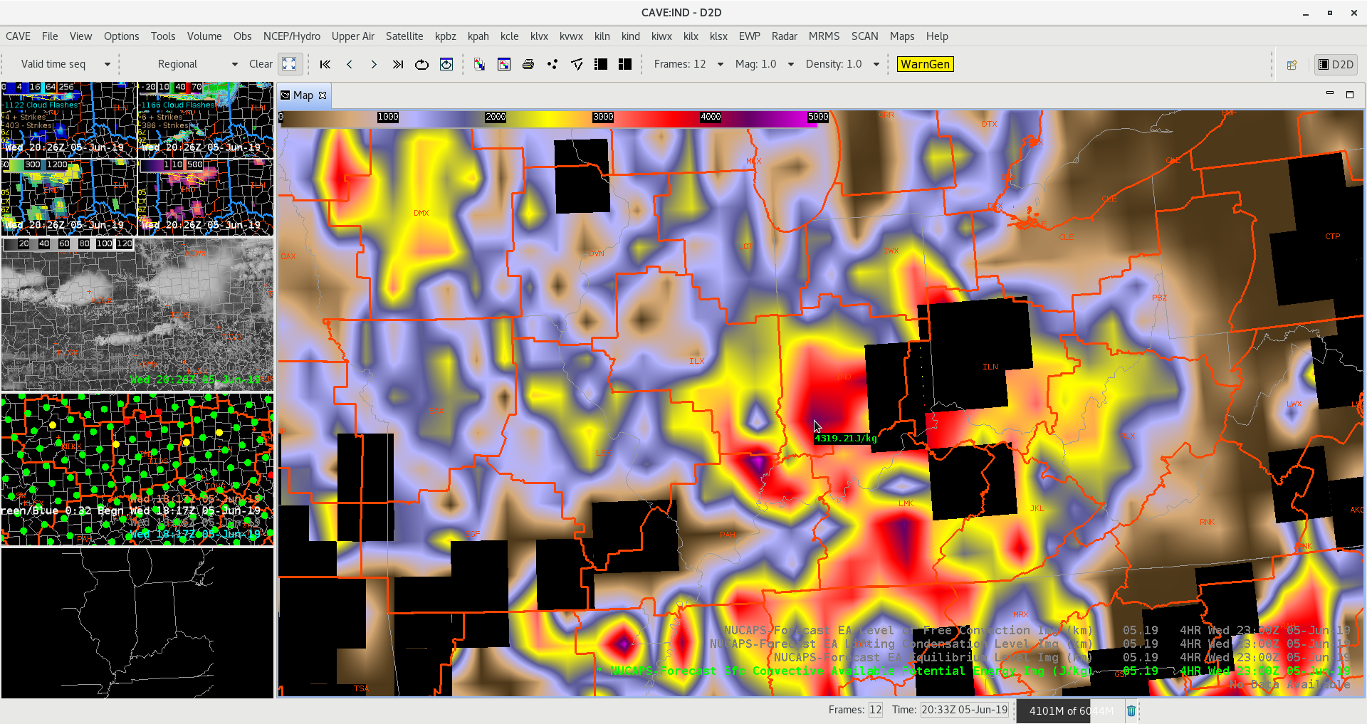
The All-sky CAPE product has shown a pool of lower CAPE values (1200-1300), probably a result of earlier collapsed convection. However, values of CAPE farther down in the southern IND CWA are a little higher (1800-2200), as would be expected. More interesting is the latest modified NUCAPS pass with soundings indicating much higher CAPE values on the order of 3500-4000 in the south and 1800-3500 elsewhere in the central and northern IND area. Based on this information, I’ll be expecting to see convection flaring up in the south in the next hour or so.
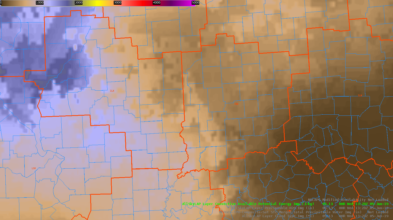
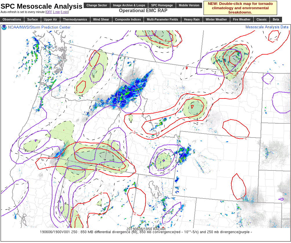
Taking a look at a quick comparison example of when the model fill-in of the All_Sky CAPE product may not be the best solution. In this example, an ongoing MCS was diving south through north central IL earlier this morning before it dissipated rapidly over the central part of the state. The GFS model struggled depicting the rapid de-escalation of said storms, and attempted to stabilize much of the ILX CWA in its wake. Unfortunately, this led to quite the gradient between areas where clouds prevented in-situ satellite observations to be utilized in the All_Sky CAPE product. Taking a look at the SPC Mesoanalysis (RAP) output in image 2 for comparison, the more accurate CAPE values across eastern IL should be closer to the 2500 – 3000 J/KG range while the ALL_Sky CAPE layer (Image 1) is showing 1000 – 1500 J/KG tops. A suggested best practice to overcome this discrepancy is to include the AllSkyLAP Layer Cloud Type Image underneath any AllSkyLAP product so you can easily depict what is sensor derived and/or model output.
—————————————————————————————————Mountain Bone
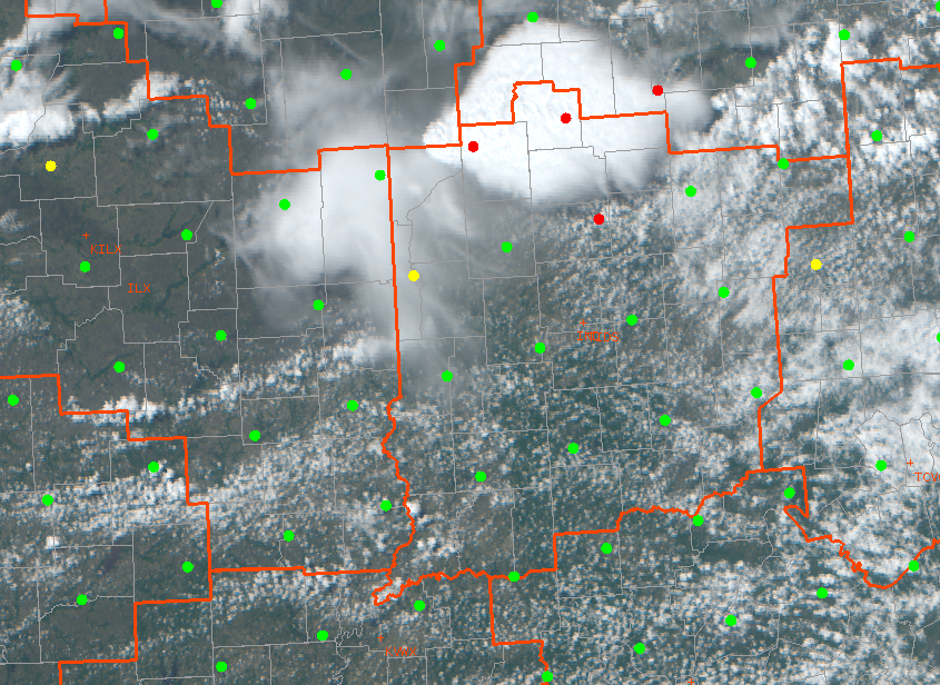
While getting set up on D2D, storms are entering the IND area from the NW. ProbSevere is a great tool for a quick analysis of the primary concerns arising from this line of storms and gives a great starting point for how to further interrogate the system for warning issuance.
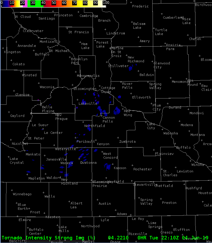
Saw some low percentages in the strong category. Tried to make a color table to pull up those lower values.
Charley