

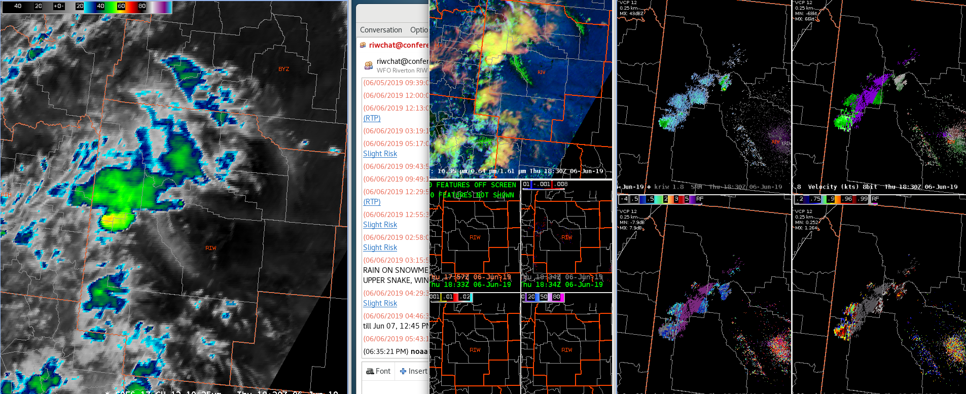
IR imagery showing a taller/colder cell in western Wyoming. KRIW radar just switched from VCP 35 to 12. Peak Z aloft now only around 30. Lightning data, below, shows relatively low FED, but higher TOE, with peak values in the 300’s, similar to some of the storms we saw yesterday.
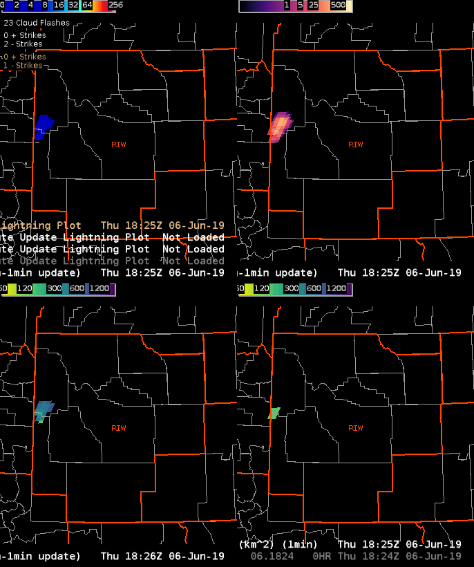
One other thing to note in these, is the relatively low FED and number of ENTLN/NLDN flashes. That doesn’t mesh with the brightness of the TOE.
Charley