NUCAPS comes in more unstable

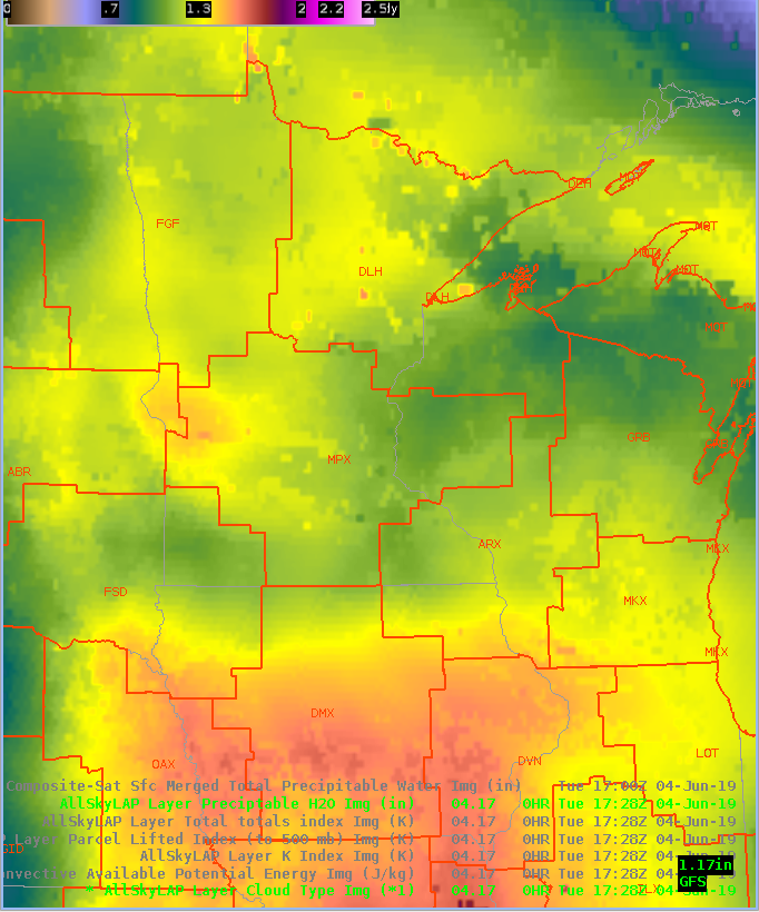
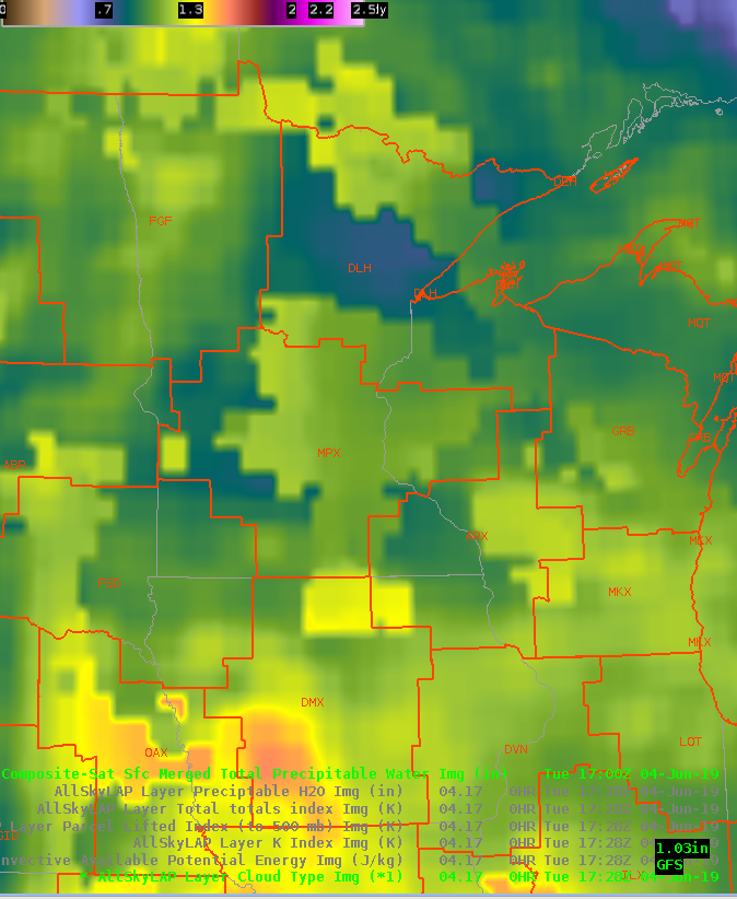
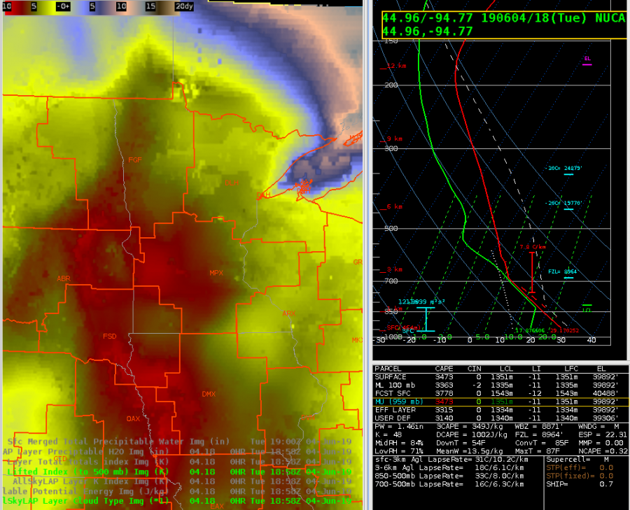
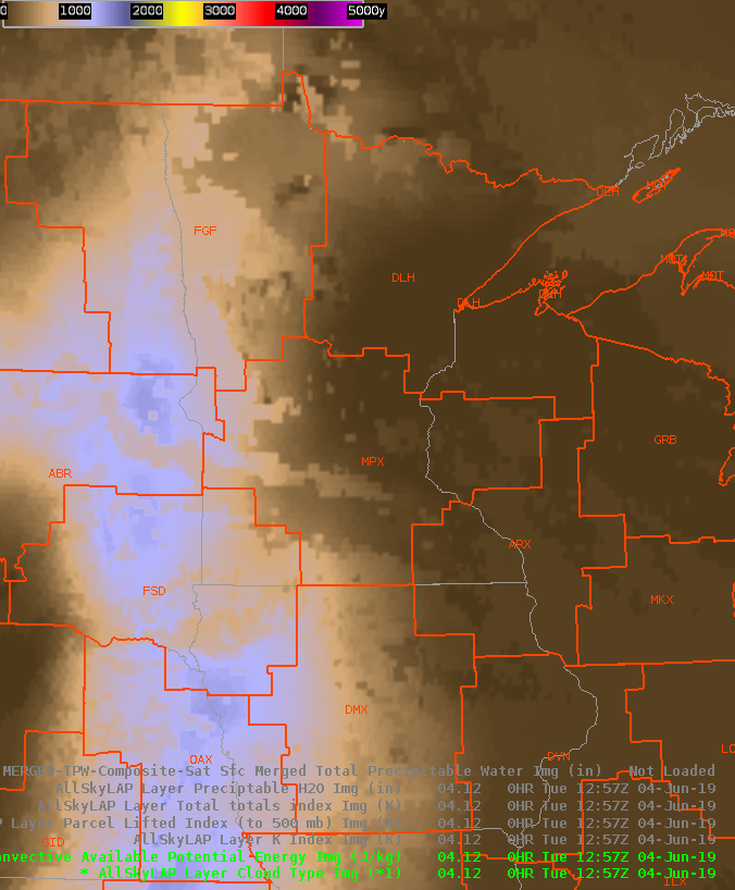
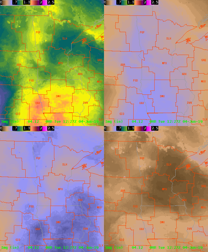
AllSky LI is dropping over time…with the peak red color above being around -8.  Modified NUCAPS sounding came up with -11…whereas non-modified was -6.  CAPE also is more unstable in new sounding…whereas AllSky is in the mid 2000s, NUCAPS was mid 3000s…non-modified in the mid 1000s.

Tags: None

Bowing Segment moving toward Wright Co., MN

A bowing segment heading toward Wright Co., MN initially showed diminishing convective trends.  However, some drying in the wake of the line combined with strong wind speeds within the lowest tilts of the radar depicted some concern for severe wind gusts, and after a diminishing trend ProbSevere did begin to increase again.  Looking at the All Sky LAP CAPE, instability increased from ~960 J/kg at 1627z to ~1650 J/kg at 1828z, so the All Sky CAPE product showed some utility of assessing the downstream convective environment.

Tags: None

DMD only one to find a meso

Storm riding between two warnings was anticyclonically rotating through several radar tilts.  NMDA not supposed to pick up on those, and it didn’t. DMD only one with a meso in the line of storms, but more on the edge of that rotation.

Tags: None

All Sky LAP CAPE and convective trends

Thunderstorms continued to strengthen in the MPX CWA after 18z.  The All Sky LAP CAPE indicated instability building over Kandiyohi County as of 1728z (note some latency).  There is a line segement of tstms moving into this area, and a SVR has been issued as of 1821z for the SW part of the line as it moves into the region of higher instability.  Note, this development likely triggered along outflow from an earlier complex.  The SVR polygon was edged to the SW closer to the higher instability. 
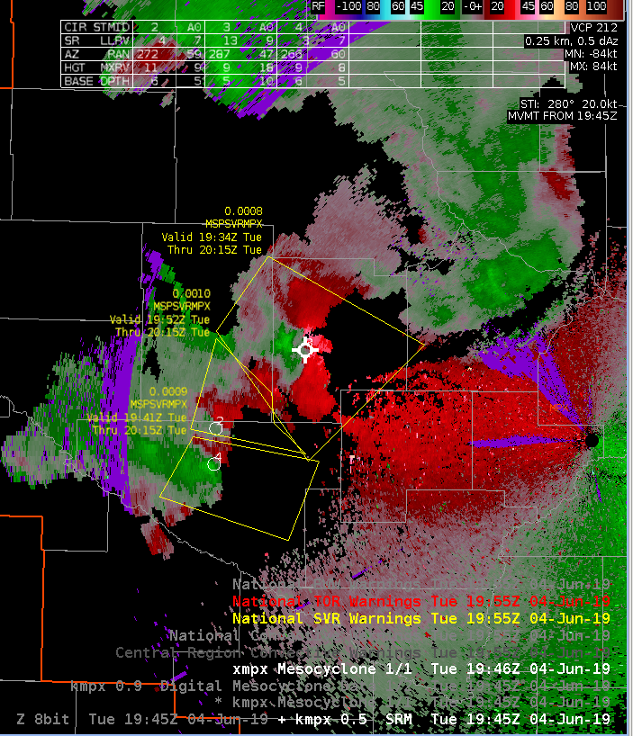
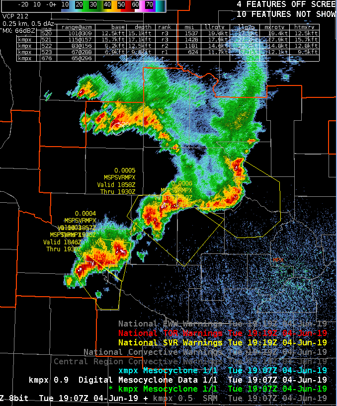
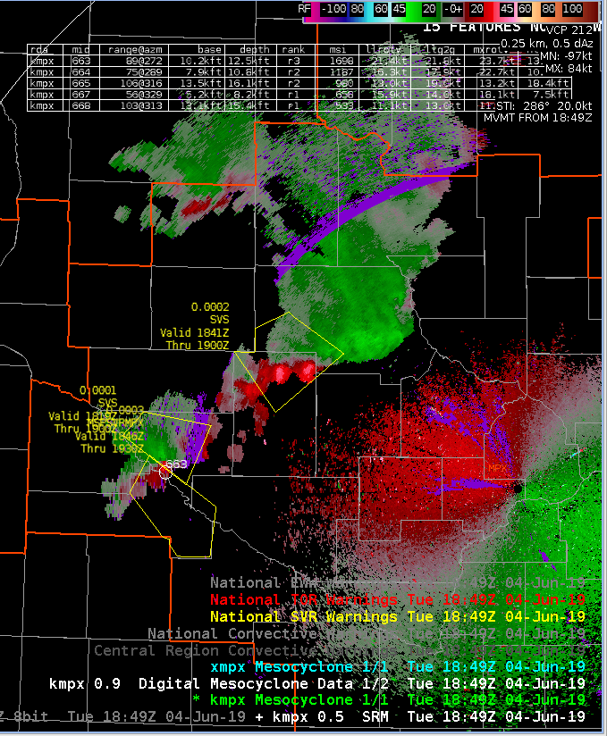
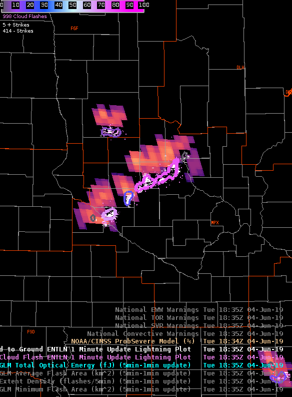
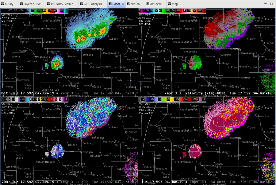
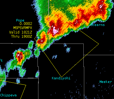
As of 1834z (not shown) the updrafts on the SW flank of the line continue to become dominant, and ProbSevere has increased to 76%.

Tags: None

AllSky TPW better feel for moisture in atmosphere

Noticed the AllSky TPW had a seemingly better handle on moisture over western MPX area than the more blotchy Merged TPW.   Looking at other instability parameters, the TT were in the mid 50s over western MPX, lifted index, K index upper 30s, CAPE mid 2000s.  Eastern storm following the gradient of the CAPE to the southeast.  AllSky has shown the CAPE increasing rapidly ahead of our storms.

Tags: None

Hail moving into Chippewa county

50 dbZ hail core up to 40 kft growing with that southwest cell, along the old outflow and in the high CAPE environment.  Donavon heights are around 30 kft, so issued a SVR for this cell for hail to half dollar size.

Tags: None