Thunderstorms continued to strengthen in the MPX CWA after 18z. The All Sky LAP CAPE indicated instability building over Kandiyohi County as of 1728z (note some latency). There is a line segement of tstms moving into this area, and a SVR has been issued as of 1821z for the SW part of the line as it moves into the region of higher instability. Note, this development likely triggered along outflow from an earlier complex. The SVR polygon was edged to the SW closer to the higher instability. 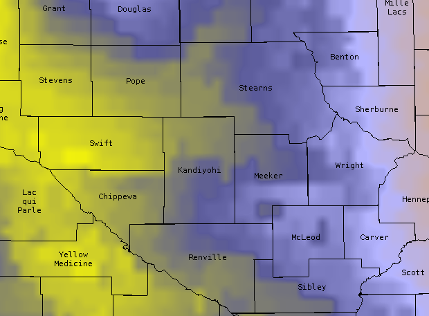
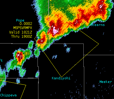 As of 1834z (not shown) the updrafts on the SW flank of the line continue to become dominant, and ProbSevere has increased to 76%.
EWP Blog
Spring Experiments & Beyond
