
We’re analyzing data from March, 2nd 2019 using AzShear along with the typical products used during severe weather. There were multiple tornadoes this day with various types of convective modes. I found Azshear was helpful in identifying tornadic storm that might not have been as easy to spot with conventional methods.
The northernmost storm that had the longest track that started in Macon county Alabama was easy to spot due to it’s structure. It was a discrete cell with a clear couplet and a debris ball. The AzShear max lined up very well with the center of circulation.
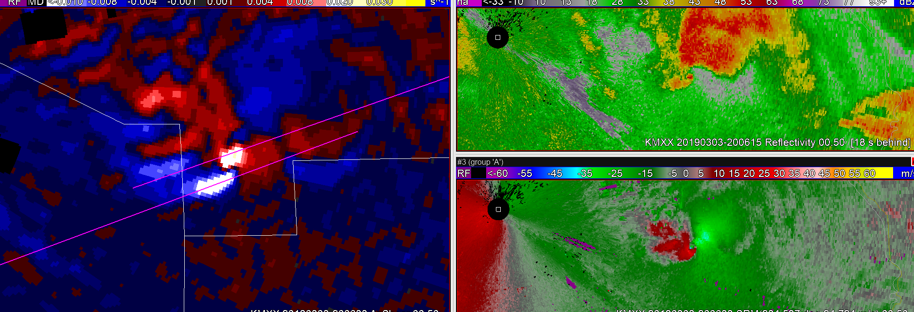
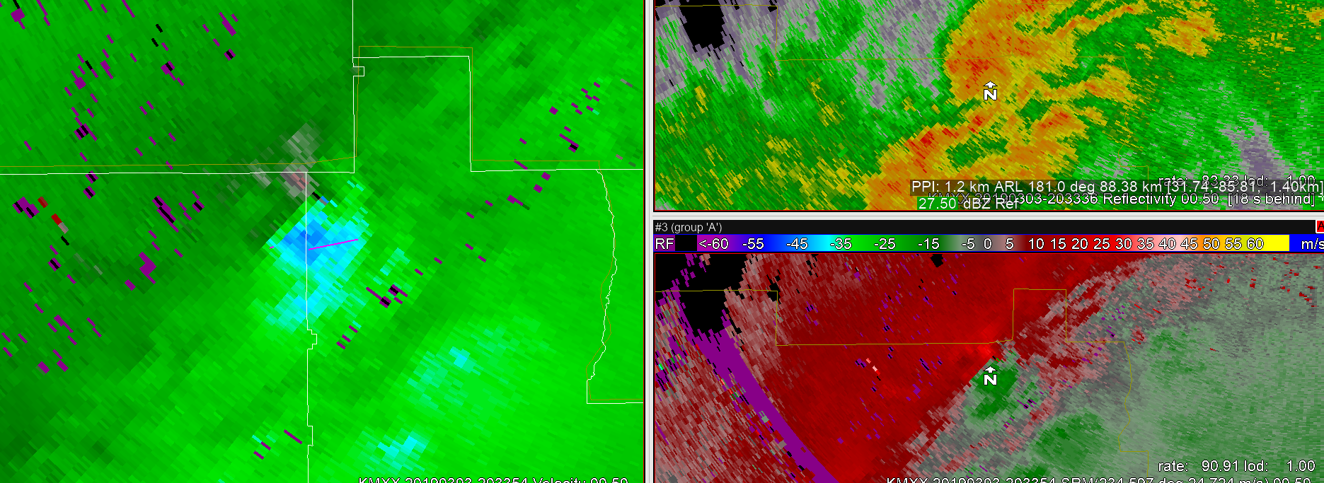
There was also another long track tornado that touched down in central Macon county Alabama and moved into southern Lee county. This cell was embedded in a cluster of storms so it didn’t stick out as much on reflectivity, but the rotation was easy to spot early on using SRM velocity.
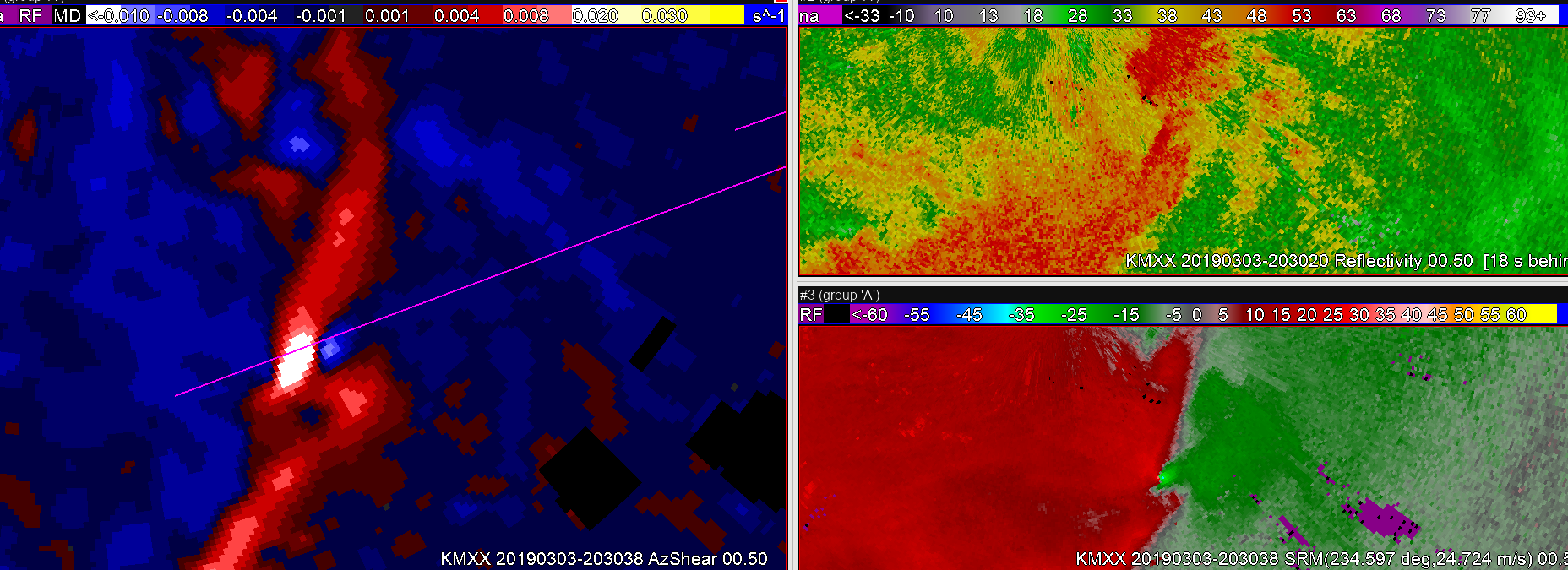
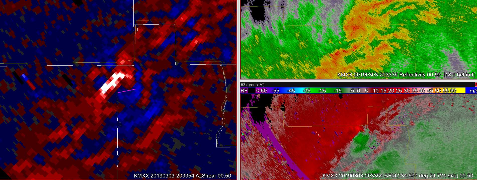
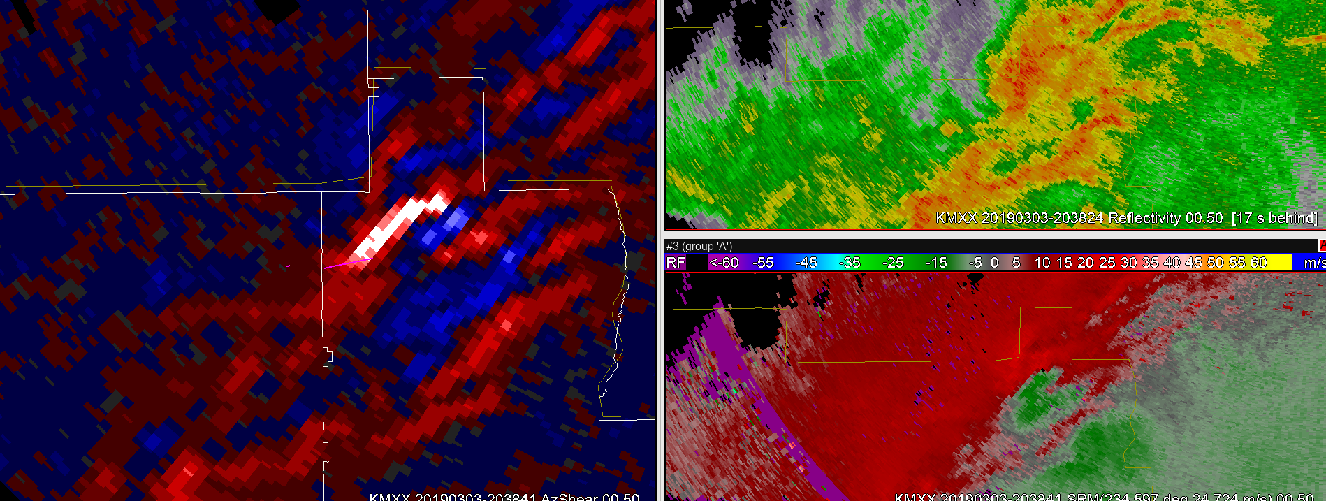
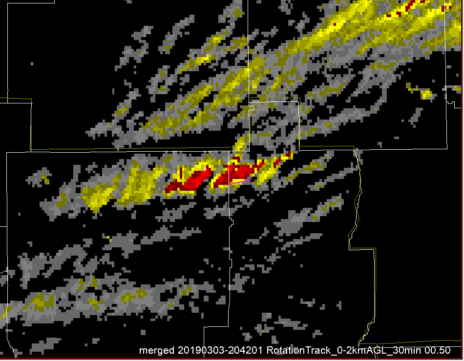
As the cell moved northeast, a bit further from radar, the velocity signature wasn’t as pronounced. However, the AzShear value stayed very strong. It stayed pronounced even going up in elevation scans compared to SRM velocity. 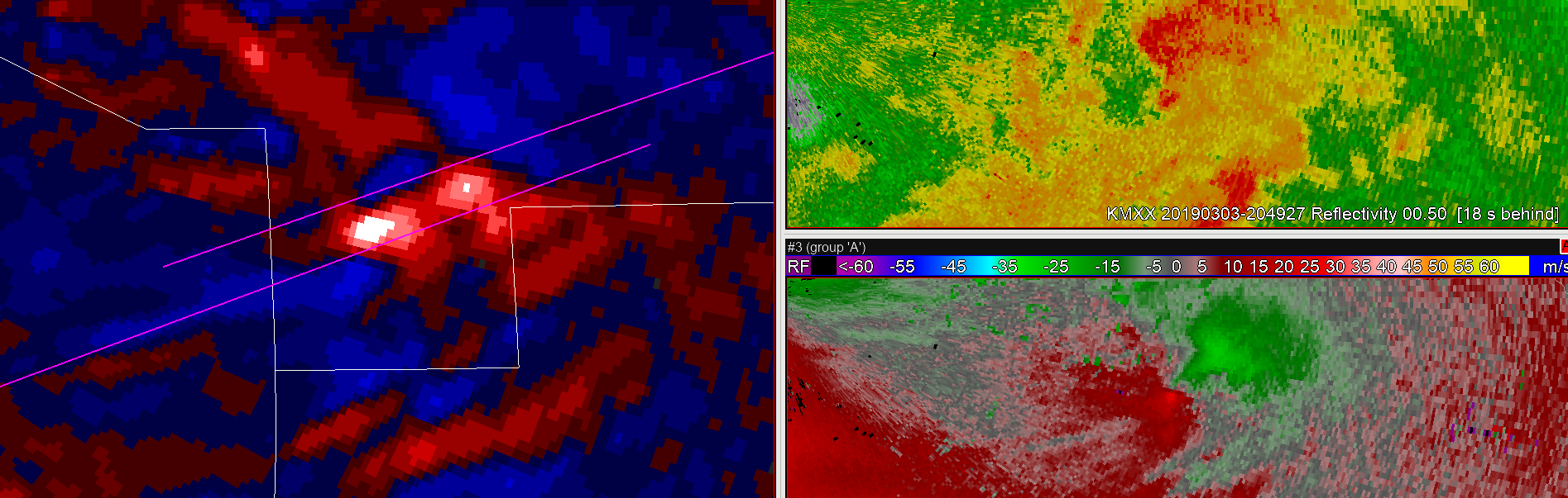 There was a pronounced max in the merged AzShear 0-2km as well.
There were also two touchdowns from one cell in Butler and Crenshaw county. Using the KMXX radar the rotation was clear using base velocity, but the reflectivity signature wasn’t as clear.
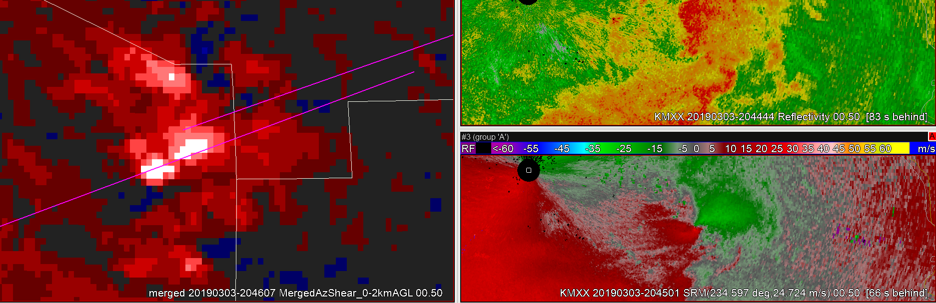
The AzShear signature was very apparent from KMXX along with the 0-2km merged shear.
That max stayed strong through the second touchdown in Crenshaw county.
The rotation max also aligned with the tornado patch. Increasing confidence during now casting that there was likely a tornado on the ground. That would be helpful since there wasn’t a TDS with this particular cell.
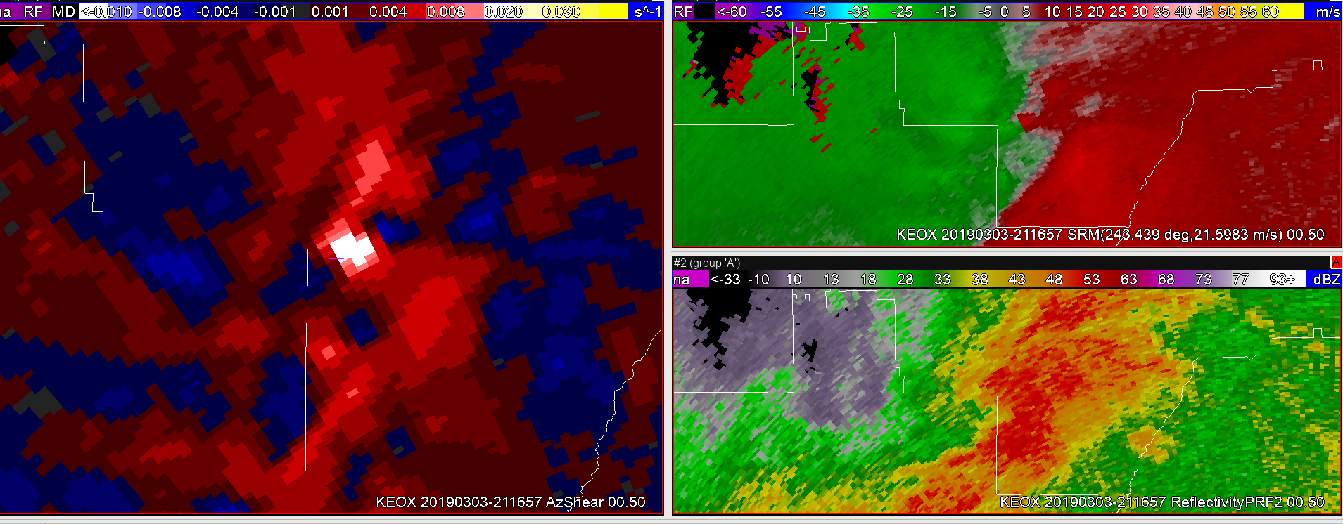
Farther south there was a quick touchdown in Bullock county. The velocity couplet was apparent from the KEOX radar, but not very strong. The cell was a part of a larger line with “messy” convection. However, there was a clear spike in AzShear as it moved into Bullock county. The negative value wasn’t as high as well and that made it easier for me to spot the area that had a likely touchdown.
Overall, given the other products that I normally use the AzShear was most helpful in situations where convection is in a linear mode or if you have a cluster of storms. It also made it easier to pinpoint rotation when the velocity signature wasn’t as strong due to the distance from radar or other factors. It added another layer of confidence to decision making if I had to cover this warning.
Yesterday I had a problem understanding the difference between the positive spike and the negative spike. However, working with it more today in this particular environment made it easier to understand the product. I would probably adjust the color table to make the negative values less apparent to make the positive gradient stand out more.
-Taylor Johnson