OUTLOOK: 11 June 2012

For the week of 11 June – 15 June, our distinguished NWS guests are Tim Tinsley (NWS WFO Brownsville, TX), Michael Dutter (NWS WFO Marquette, MI), Ty Judd (NWS WFO Norman, OK), Steve Nelson (NWS WFO Peachtree City, GA), Randy Skov (NWS CWSU Atlanta, GA), and Jeff Garmon (NWS WFO Mobile, AL).

Today, we are focusing on two areas: one is associated with the ongoing mesoscale convective system in the lower-middle Mississippi Valley; the other is in the Southern Plains, where strong heating may be able to overcome a substantial cap.  The former environment is characterized by strong instability, weak low and deep-layer shear, and a weak cap.  The latter environment is characterized by strong to extreme instability, weak deep-layer shear, and a formidable capping inversion.  The plan is to start two groups of forecasters (2 in each group) in the eastern target, and one group in the western target.  The initial CWAs will be Memphis (for strongest convection), Huntsville (for LMA considerations), and Tulsa (for convective initiation considerations).

-G. Garfield, Week 5 Coordinator

Tags: None

A Classic Lemon Deep Convergence Zone (DCZ)

Note, a DCZ is not the DCVZ!

Here’s a velocity cross section from the Four-dminesional Stormcell Investigator (FSI) of the supercell near Byers, CO perpendicular to the convergence boundary.  This is a classic Les Lemon Deep Convergence Zone, transitioning to a storm summit divergence.

Greg Stumpf, EWP2012 Operations Coordinator


Tags: None

TFX: 3D-Var Works in Montana too!

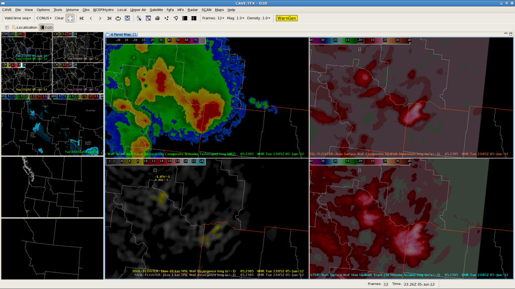
With limited areas favoring severe convection, we’ve moved to TFX to the lee of the Montana Rockies. Despite somewhat limited radar coverage, 3D-Var has performed very well with the supercells ongoing across the CWA. The right-most panels in the image above depict Max updraft and accumulated max updraft. The greatest magnitudes are co-located with a tornadic supercell in Judith Basin county. 3D-Var analyses appear to work relatively well even with sparse radar coverage.

Tags: None

OUN: 3DVar Locates Strongest Storm/Strong Winds

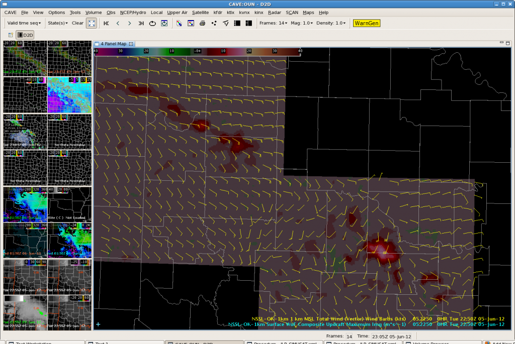
After a significant period of marginal convection, the 3DVar data picked up on a stronger updraft, and subsequently, a very strong outflow boundary. It is very easy to pick out the strongest storm amongst the broken line of convection in the Max Updraft Composite imagery.  Updraft values of 17 m/s noted at 2250z, with values as high as 23 m/s at 2230z in McClain County.  Elsewhere, updrafts in the line were less than 10 m/s.

Max Updraft Composite at 2250Z

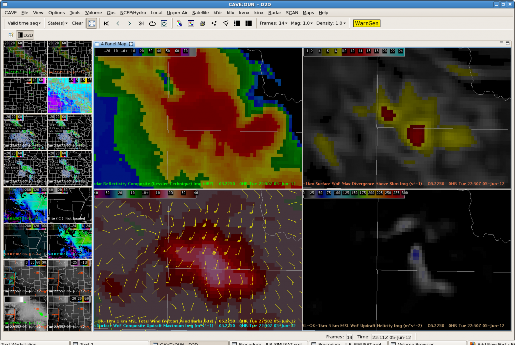
Zooming in, the 3DVar 1 km total wind vectors clearly pick up on the strong outflow winds at 2250z.

3DVar data at 2250z

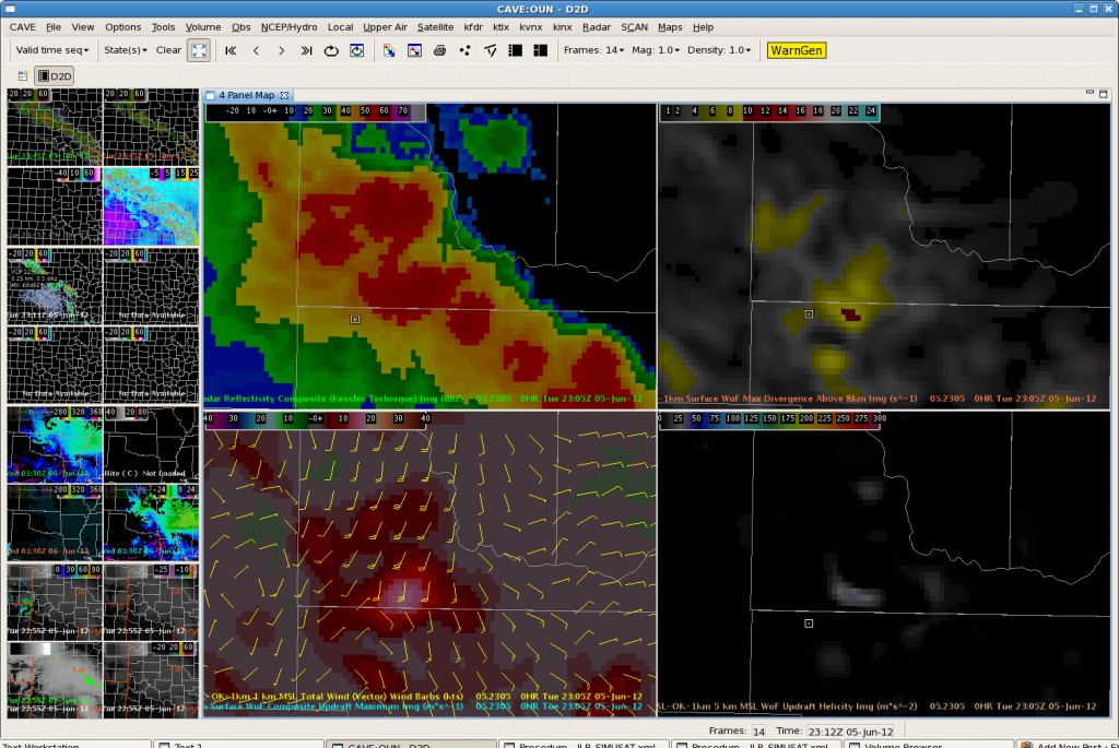
At 2305Z, it is clear that the spatial extent of the intense updraft is decreasing. 1 km winds are also decreasing which matches well with radar data. Thus will not extend severe thunderstorm warning.

3DVar Data at 2305z

OUN: An Aviation Perspective…

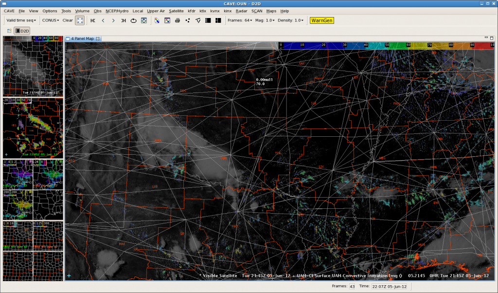
The image below (Figure 1) illustrates the potential for convective initiation, using the UAH-CI tool. The high altitude jet routes overlaid with the CI and latest satellite data show the potential impacts to aviation. I expect that the CI tool will be very useful in operations – especially at the CWSUs.

Figure 1: Convective Initiation Impacts on Aviation

TMU is always asking about timing and location of convective development. Things become problematic when routes need to be changed at the last second as a result of developing thunderstorms. If we have more tools to provide a larger lead time, TMU personnel can plan farther in advance – which leads to saving money and time…and stress!

Tags: None

OUN (LBB): CI with Boundary Interaction?

Agitated cumulus on visible satellite noted over Childress County.  UAH CI values currently at 53, but have been steadily increasing the last few volume scans. Outflow boundary from western Oklahoma storms continues to push southwestward.  Watching to see if storms will develop if the boundary helps initiate convection. 21Z OUN WRF now showing a second line of convection developing along the southwest boundary. Stay tuned.

Agitated Cu over Childress County. UAH CI values at 53.

Latest run of the OUN WRF….

2 hour forecast of the OUN WRF. Second line of convection develops.
Tags: None

JAX:Marine supercells

The MRMS algorithms have done well in depicting large hail and moderate storm rotation with supercells over the marine area. The first 4-panel image above depicts a cross-section through a supercell northeast of Jacksonville. A pronounced BWER is evident and correlates well with the MESH/rotation tracks panels in the bottom image.

Tags: None

JAX:Using 3D-VAR for lead time

The above image illustrates the use of 3d-Var as a potential enhancement in warning lead time. In assessing the Maximum updraft intensity in the upper right panel, we noticed a rapid increase in the magnitude of the storm updraft. MESH at this time was generally sub-severe…but an uptick in MESH is expected as analyses show increasing upward motion on the northern edge of the line segment. As an experiment, we opted to issue a severe warning based mostly in this increase in updraft speed. In retrospect, updrafts of similar magnitude have already produced hail to the size of quarters and larger, so we’re crossing our fingers.

Tags: None

OUN: Don’t put all your chips into one [or two] products…

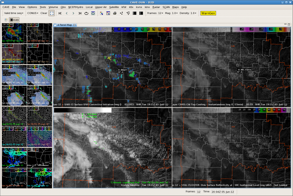
One thing I’ve begun to wonder is will there be a loss of SA when a forecaster sees an area of “potential development”. The image below (Figure 1) illustrates the UAH-CI in the upper-left panel, while the upper-right panel shows the UW-CTC. My concern is that someone might see a CI area in the 60-70% confidence range and lose their sense of SA as they wait for further development…and the CTC algorithm to hopefully pick up on the developing storm.The UW-CTC product is designed to only pick up on the stronger development…which could easily lead to missing weaker convection. Not only that, but if any bit of the anvil goes near another developing cell…the algorithms will not pick up the newly developing thunderstorms…could end up to missing a warning.

Figure 1: convective initiation tools
Tags: None

OUN: GOES-R Proxy Miss!

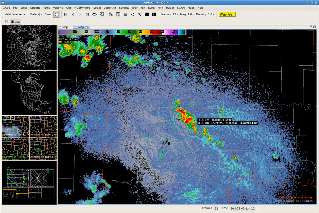
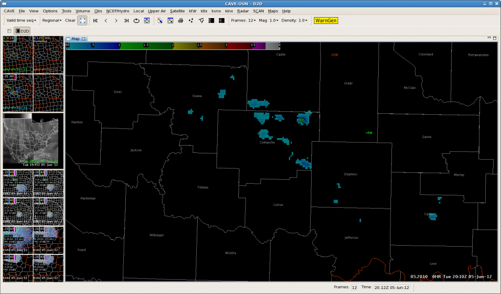
UAH Convective Initiation images showed a brief value of 65 in northeast Comanche County but the UW_CTC product never showed a cloud top cooling value.  This seems to be due to the proximity of the cluster of cells to the west. The cell in northeast Comanche County was very slow to develop, but did become very strong and actually produced a 62 mph wind gust.  Additionally, the MESH showed hail sizes of over one inch.
UAH signal at 1915z in NE Comanche Co.
Cell first noted at 1925z

One inch hail detected 45 minutes after initial reflectivity blob on radar, and 55 minutes after UAH signal.
Tags: None