Blog 7 Day 4 on 5 June

Still watching storm over Jackson AL 4 sigma lightning jump. Reflectivity not all that impressive. but flash extent density and light jump are really popping.

prob Severe 84% but env shear weak.

MESH is at 1 inch. Hoping to get some spotter reports.

D Satterfield

jackson 2100 sigman* Flash extent density jackson Z on jackson 2100 Jacskon Severe 2059


Tags: None

Blog 6 Day 4 on 5 June

Suggestion on light jump usage.

Each to hi sown but I have found that putting light jump below Radar data works well. Spatial extent of Light jump covers larger area in smaller cells. Will not always work but on cells in which it does it seems handy. Example below. Basic suggestion here is to play around with hour you layer and display these tools.

The cell in Jackson cty AL has a 3 sigma jump and strong flash density.

DSatterfield

light jump Jackson Cty

Tags: None

No good way to annotate a 4 panel

The annotation tool only works on single pane images, but will not work with any or all images loaded in a 4 panel. This creates problems, in that comparing images side by side is useful in many instances. In addition, the GNU program that we have to use if we want to annotate a 4 panel is really difficult to work with and doesn’t do a lot of the things that I would like it to do, very easily. Paint would be better. If there is a way to get the annotation to work on a 4 panel that would be ideal.

-KP

Tags: None

Blog 5 Day 4 on 5 June

Warning issued by HUN on storm in Jackson County AL. We also issued warning on it just before based on Lightning Jump/Prob Severe and flash extent density. These new products in my opinion really were valuable in knowing that this storm was likely to become severe. One of the best examples I have seen all week.

I suspect we were watching it sooner than even HUN was because of our experimental tools.

Light Jump Jackson Flash ExtJackson Radar Jackson

Tags: None

Blog 4 Day 4 on 5 June

Monitoring radar and lightning jump -Flash Density over North AL and south TN.

Also using Prob severe. We already issued a warning for NC and NW AL. Having worked as a broadcast Met in this area for 17+ years it is very familiar to me. Unique experience to evaluate these products in an area where I’ve done many hours of severe now-casting.

Lightning jumps are going off on cell in Lincoln (already warned) and prob severe on line appr. NW AL is now at 82%. Also prob severe high on cell now in Jackson Cty. Prob severe rising rapidly

Am finding combo of flash and light jump very helpful in watching these cells which are developing rapidly. Almost seems as if it would be valuable to have one person doing traditional radar analysis and another using these tools over the same storms.

D Satterfield Radr2033*

Tags: None

Blog 3 Day 4 on 5 June Warn for North AL

060514_19Z_HUN_simSatCompInitial2

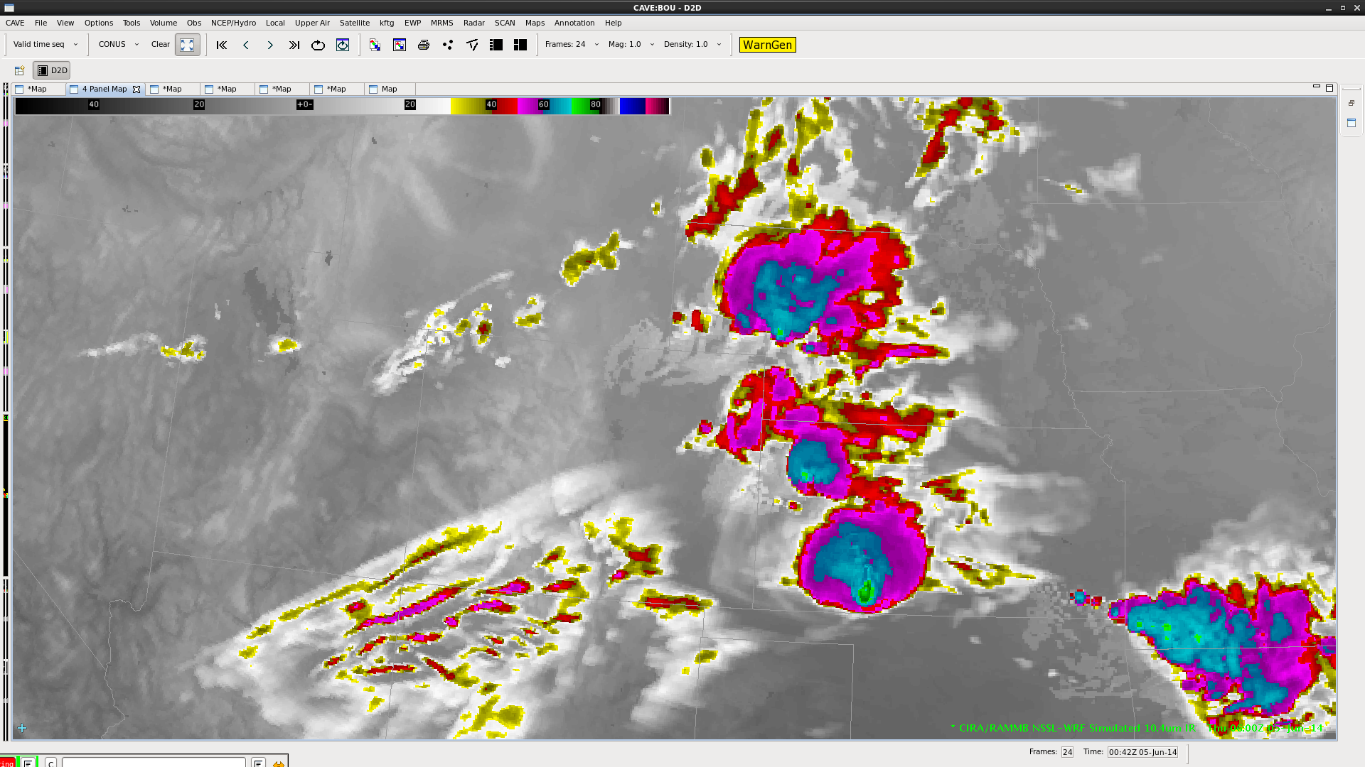
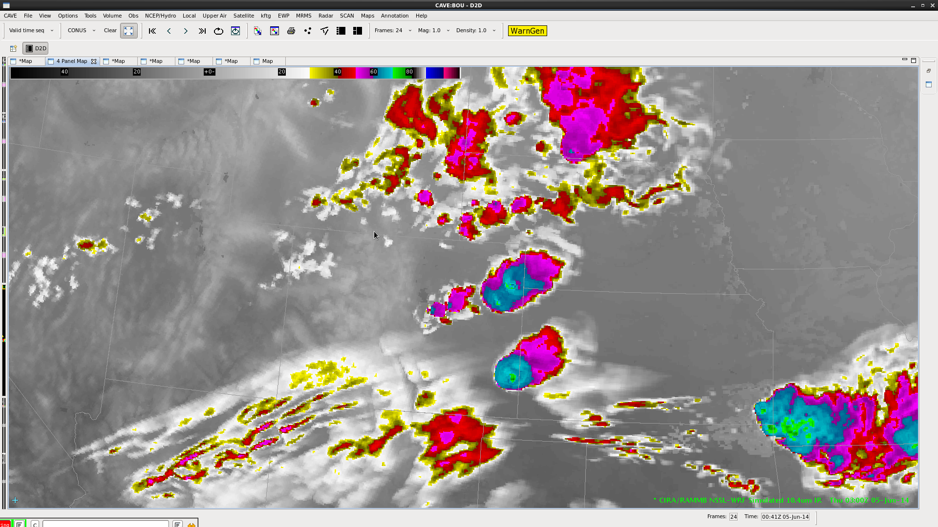
Have issued a warning for North AL ahead of he MCS in North AL based on past history, flash extent density and MESH indicating large hail NQA Nexrad shows strong inflow winds in mid levels which should reach surface ahead of the line.

BULLETIN – IMMEDIATE BROADCAST REQUESTED
SEVERE THUNDERSTORM WARNING
NATIONAL WEATHER SERVICE HUNTSVILLE AL
306 PM CDT THU JUN 5 2014

THE NATIONAL WEATHER SERVICE IN HUNTSVILLE HAS ISSUED A

* SEVERE THUNDERSTORM WARNING FOR…
LAUDERDALE COUNTY IN NORTHWEST ALABAMA…
COLBERT COUNTY IN NORTHWEST ALABAMA…
NORTHWESTERN MORGAN COUNTY IN NORTH CENTRAL ALABAMA…
LIMESTONE COUNTY IN NORTH CENTRAL ALABAMA…
NORTHERN LAWRENCE COUNTY IN NORTHWEST ALABAMA…
NORTHERN MADISON COUNTY IN NORTH CENTRAL ALABAMA…
LINCOLN COUNTY IN MIDDLE TENNESSEE…
MOORE COUNTY IN MIDDLE TENNESSEE…

* UNTIL 345 PM CDT

* AT 305 PM CDT…DOPPLER RADAR INDICATED A LINE OF SEVERE
THUNDERSTORMS CAPABLE OF PRODUCING HALF DOLLAR SIZE HAIL AND
DAMAGING WINDS IN EXCESS OF 60 MPH. THESE STORMS WERE LOCATED ALONG
A LINE EXTENDING FROM 11 MILES NORTHWEST OF LAWRENCEBURG TO NEAR
LAGRANGE…AND MOVING EAST AT 65 MPH.

* LOCATIONS IMPACTED INCLUDE…
HUNTSVILLE…DECATUR…MADISON…FLORENCE…ATHENS…MUSCLE
SHOALS…SHEFFIELD…TUSCUMBIA…FAYETTEVILLE…MOORES MILL…
LYNCHBURG…MERIDIANVILLE…J P COLEMAN STATE PARK…REDSTONE
ARSENAL…HAZEL GREEN…TRINITY…ROGERSVILLE…ARDMORE…KILLEN
AND TOWN CREEK.

PRECAUTIONARY/PREPAREDNESS ACTIONS…

IN ADDITION TO LARGE HAIL AND DAMAGING WINDS…CONTINUOUS CLOUD TO
GROUND LIGHTNING IS OCCURRING WITH THIS STORM. MOVE INDOORS
IMMEDIATELY. LIGHTNING IS ONE OF NATURES LEADING KILLERS.
REMEMBER… IF YOU CAN HEAR THUNDER…YOU ARE CLOSE ENOUGH TO BE
STRUCK BY LIGHTNING.

&&

LAT…LON 3501 8820 3499 8684 3526 8683 3525 8675
3533 8660 3537 8659 3532 8642 3541 8625
3539 8628 3532 8624 3515 8633 3479 8635
3455 8713 3458 8814 3489 8810 3492 8816
TIME…MOT…LOC 2005Z 279DEG 58KT 3534 8752 3503 8925

$$

DS

Tags: None

Blog 2 Day 4 on 5 June

Have switched to the HUN CWA as of 1930Z.

Discussion of NSSL WRF sim sat with IR and water vapor.

Large MCS to the NW of the CWA moving into it. The NSSL WRF shows the MCS but is far less robust on the eastern end of it than is apparent in the IR imagery. Also strong cirrus shield is present east of the MCS which is not present in the NSSL WRF. This will have obvious impacts on model performance because of insolation issues etc.

Over the Carolinas we have some convection developing ahead of a surface cold front.. the NSSL WRF is to robust on the convection esp in KGSP area. Although it is doing quite well but a bit fast (by 100km) over the outer banks of NC.

Talking with KP about carolinas and the spatial errors may be due to model limitations on depicting the Appalachians.

060514_19Z_HUN_simSatCompInitial2DSatterfield & KP


Tags: None

Blog 1 Day 4 5 June Sythetic Sat Comparison

1916sat compsComparing NSSL Wrf Sim 10.4umk IR with 19Z IR and also W Vapor data as well. Very good agreement today between the NSSL WRF and IR/WV at 19Z. MCS over SE MO and Arkansas is in exc. agreement.

In NE NM there is a developing thunderstorm well east of Tucamcari. The NSSL WRF is not picking it up but is showing a cell a bit farther south and is indicating cells firing over the foothills. subjectively i think this is actually not bad- see image. In Colorado (we are working the Pueblo CWA today) there is exc. agreement….impressive actually. Has good aligment on some cirrus streaks as well.

One last note that in SE KS NSSL wrf has very good accuracy on a cell behind the big MCS to the east.

Will be watching an area in southern TX Panhandle where NSSL WRF Imagery shows development. Only the slightest hint of some enhanced cu on IR there. WIll be interesting to see if anything goes there. NSSL WRF thinks it will!

D Satterfield WBOC from KSBY MD.

Tags: None

June 4/5 MCS and Overshooting Tops

An MCS originating in eastern Colorado Wednesday evening (06/04) traversed the southern Plains into the southeast by Thursday (06/05) afternoon. This system had many overshooting tops associated with it, highlighting the locations of the strongest updrafts (and associated hazardous weather) within the massive cloud shield. The overshooting top detection algorithm gives forecasters a tool to easily monitor locations of overshooting tops and trends in detection’s over time. It is an especially beneficial tool to have at night (as with this case) in the absence of visible imagery. Below is a loop of IR satellite imagery with overshooting tops overlaid from 0345 through 1845 UTC on the 5th.

*** Click image to view animation ***

OTD_20140604

SPC storm reports for the 4th and 5th show that the occurrences of severe weather matched up with the locations of the overshooting tops.

yesterday_filtered1 today_filtered2


– Bill Line, SPC/HWT Satellite Liaison

Tags: None

One last satellite comparison and forecast

The first two images showing the simulated satellite imagery (left) and the real-time satellite imagery (right) reflect the overly rambunctious coverage in the simulated imagery earlier in the day (1st image), however the latest images (2nd image) shows the simulated imagery underestimating the intensity with the storm in CO. Looking at the last two images, forecast imagery for 03Z and 06Z, they imply that perhaps the simulation is just lagging behind with generating the intense storms in eastern CO. Based on this simulation, and the fact that it has performed well all day, I would expect additional storms to develop in eastern CO/western KS over the next several hours…moving east thereafter.

060414_2115Z_satCompare 060414_0015Z_satCompare 060414_06Z_satIR_fcst 060414_03Z-satIR_fcst-KP

Tags: None