

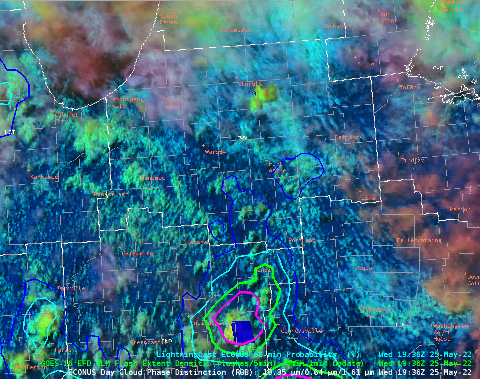
I decided to submit a quick DSS briefing for the Fort Wayne Tin Caps with DCPD indicating glaciation and weak echoes on radar. LightningCast was starting to increase over northern IN for that weak developing convection. Additional convection is spreading in from the south, and higher LightningCast contours are also spreading in. PHS shows increased CAPE over the next hour.
Left: DCPD with GLM and LC. Right: Base reflectivity with LC
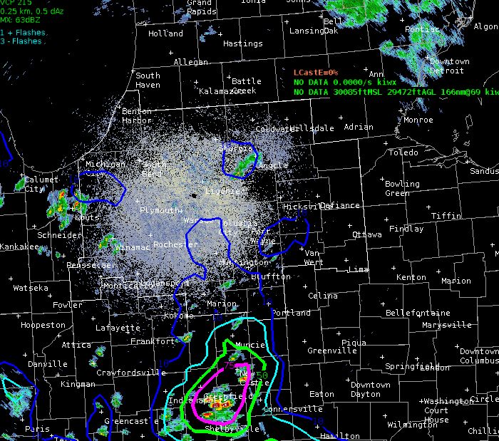
Loop of base reflectivity and LC from 1938 to 2014Z:

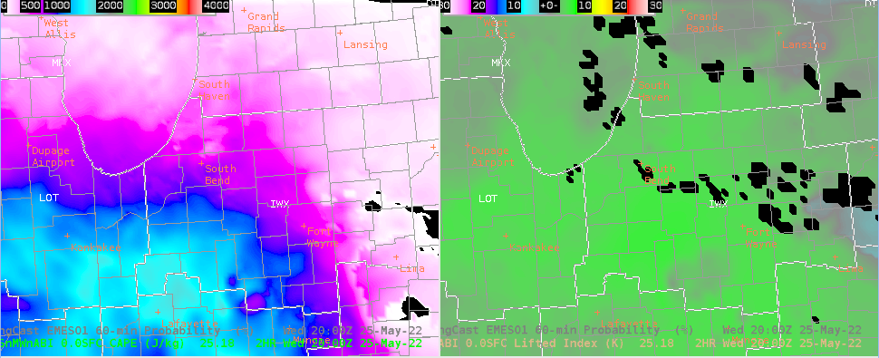
Left: PHS forecast CAPE at 20Z. Right: PHS LI at 20Z
First GOES flashes a little after 20Z. DCPD with GLM FED and LC

However, by 21Z, lightning is limited pretty much to cells to the northwest and E/NE of Fort Wayne.

Happily, LightningCast called the lightning flash east of Fort Wayne about 10 minutes out (small pink circle east of Fort Wayne)

Why is barely anything happening? Convection looks to be “firing” now on an instability gradient. Indicated by PHS at 21Z:
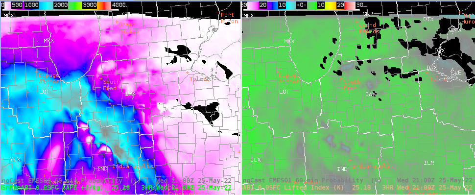
Am I confident that things will ramp up at all for our area within the next couple of hours? So-so. Here is PHS CAPE and LI for 21Z.

And gridded NUCAPS 850-500mb lapse rates at 1730Z, ranging from around 4.5-6C/km

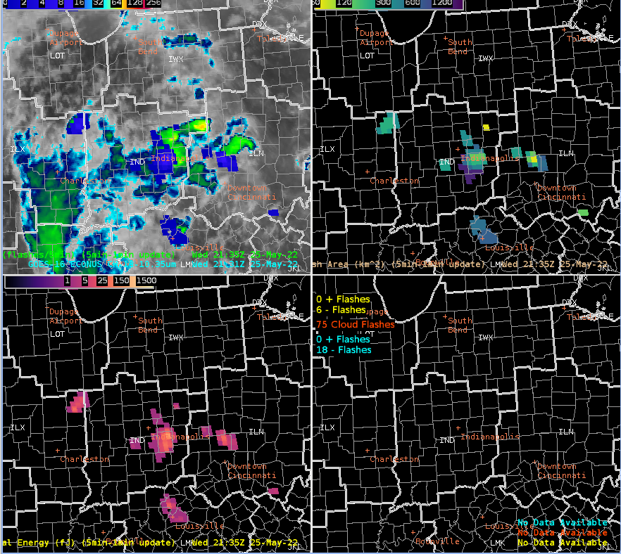
However, zooming out, there is an area of convection across central IN that should begin approaching our southern CWA boundary within the next half hour. Here is the GLM 4 panel with GOES clean IR underlaid with the FED, at 2130Z.
– PoppyTheSmooch