
I decided to look at the various parameters prior to storm initiation. When looking at PHS, it appeared our prime time for storm activity was going to be 21-00Z, when SBCAPE was forecast to be high, along with low LIs. I noticed that the STP was also elevated, upward of 3 as the activity moved northward into the southern portion of our CWA.
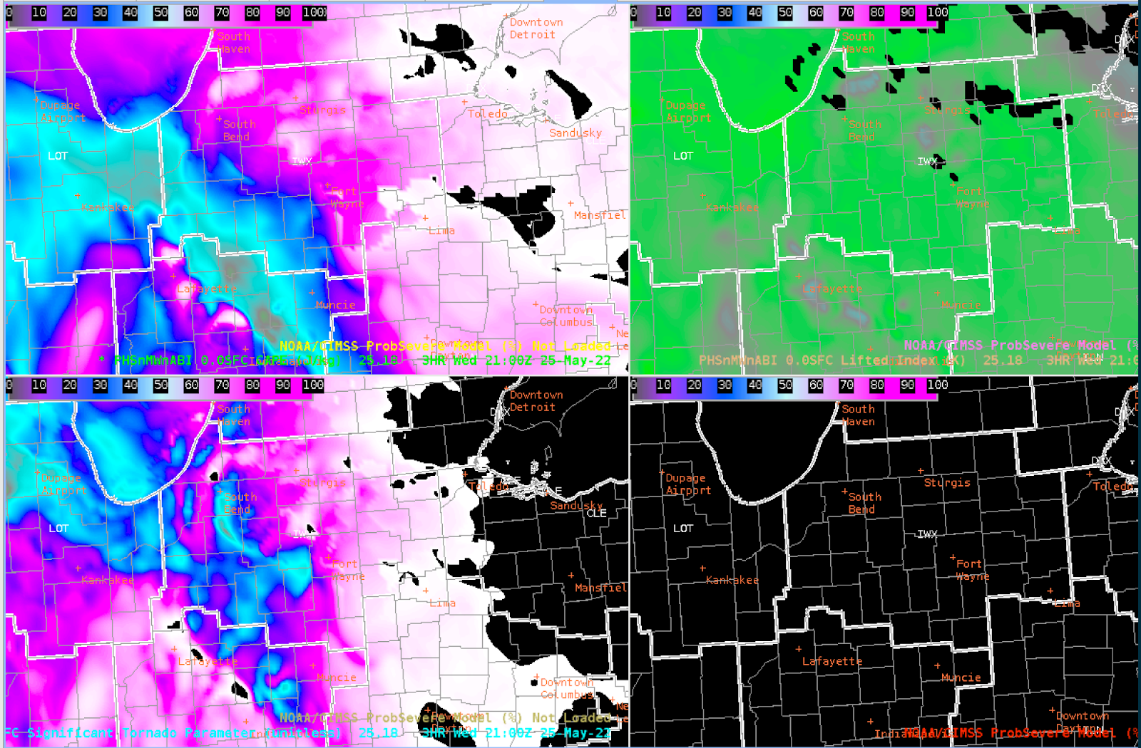
When comparing this to the SPC mesoanalysis page, the parameters from PHS seemed to agree fairly well with the mesoanalysis. It did appear, though, that the STP was a tad faster than what the mesoanalysis page showed. And the PHS decreased the instability an hour or two prior to 00Z, whereas the SPC page showed that instability remained elevated up to 00Z. The STP parameters in the PHS were a tad higher than the mesoanalysis page as well, with the meso page only 0.5 to 1.
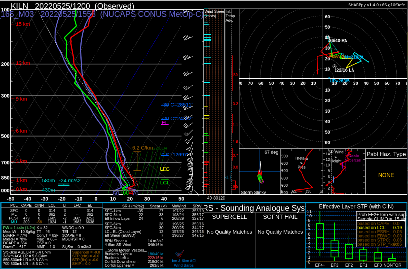
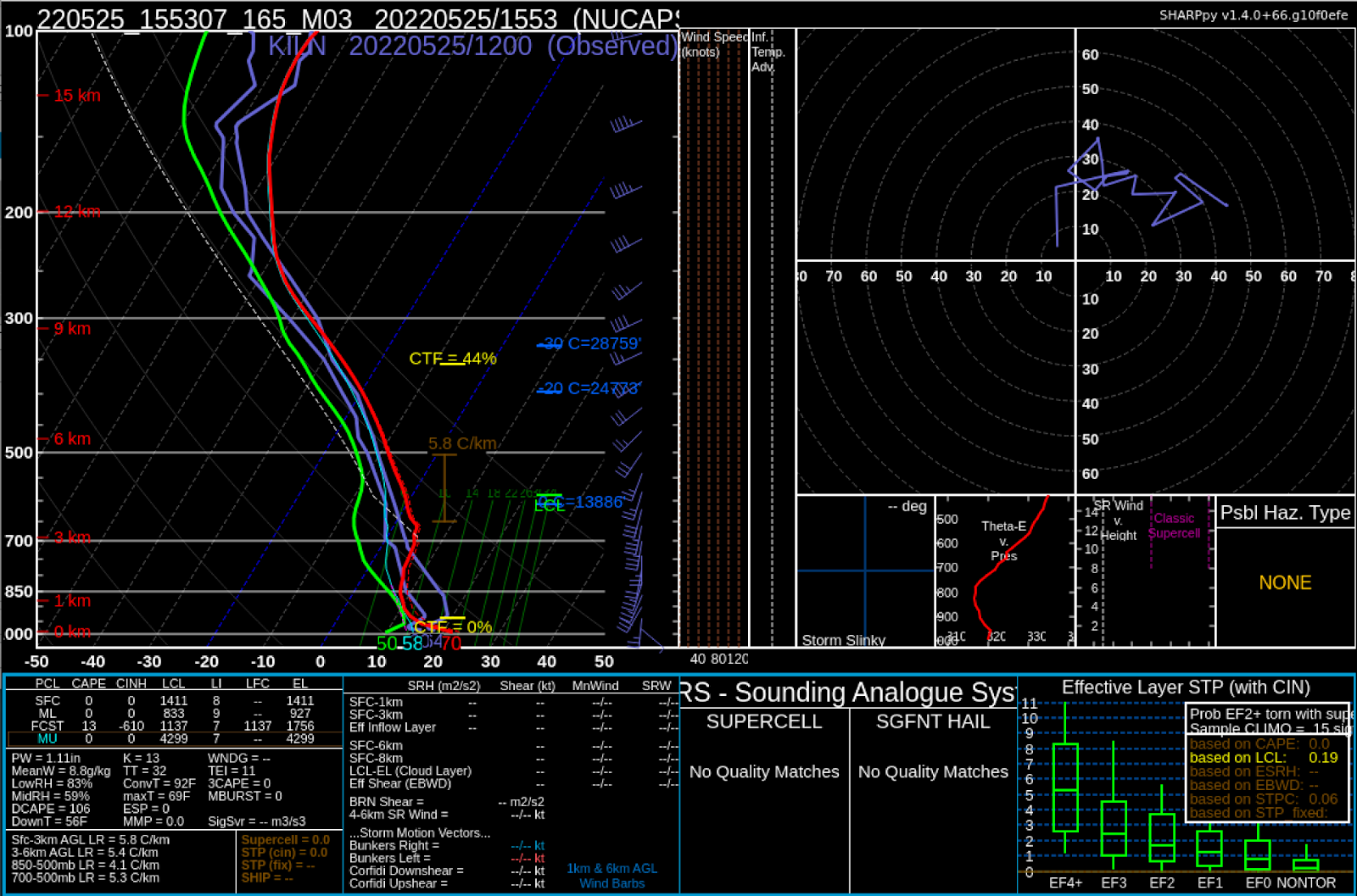
A look at the NUCAPS soundings in SharpPy showed a relatively stable surface layer in observations at 12 UTC. By 1550 UTC, NUCAPS showed the surface layer to heat up from insolation but still remain largely stable.
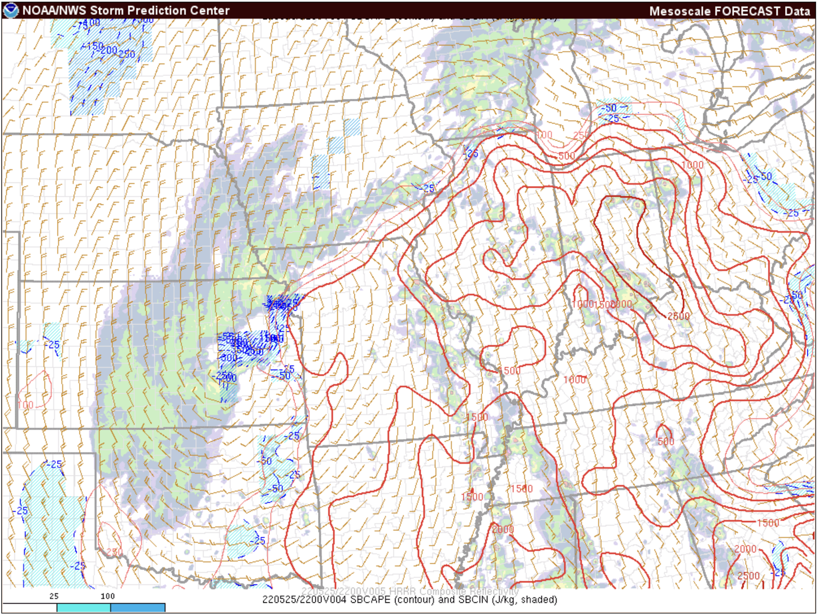
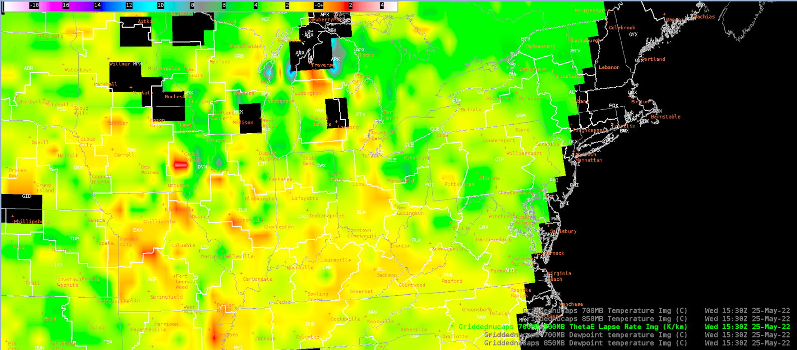
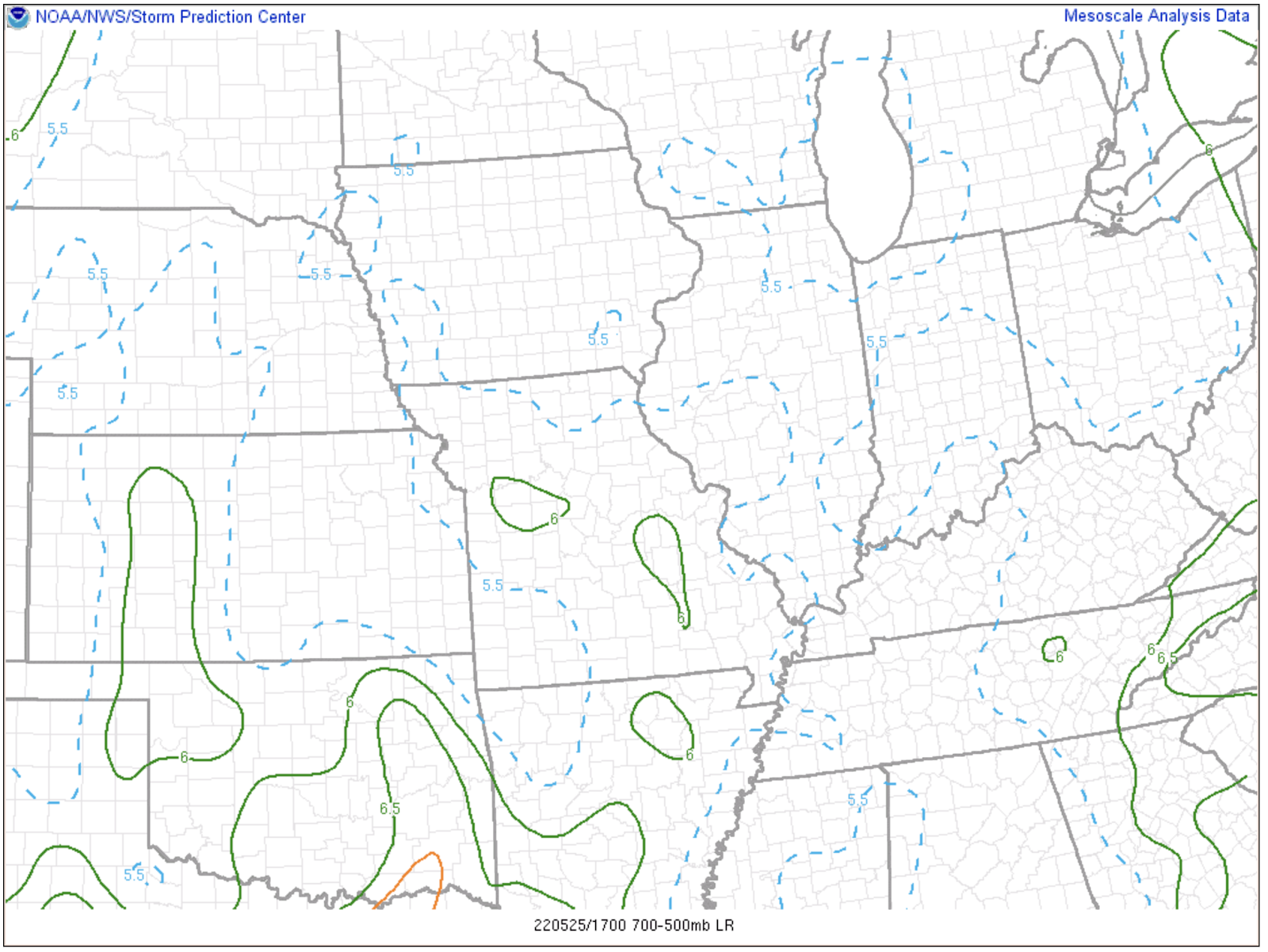
Looking at NUCAPS gridded data, specifically for mid-level lapse rates, while the gridded data was noisy with some bullseyes, it did show the environment between 3 to 5 degC/km lapse rates, consistent with the SPC mesoanalysis page (which showed around 5.5 degC/km).
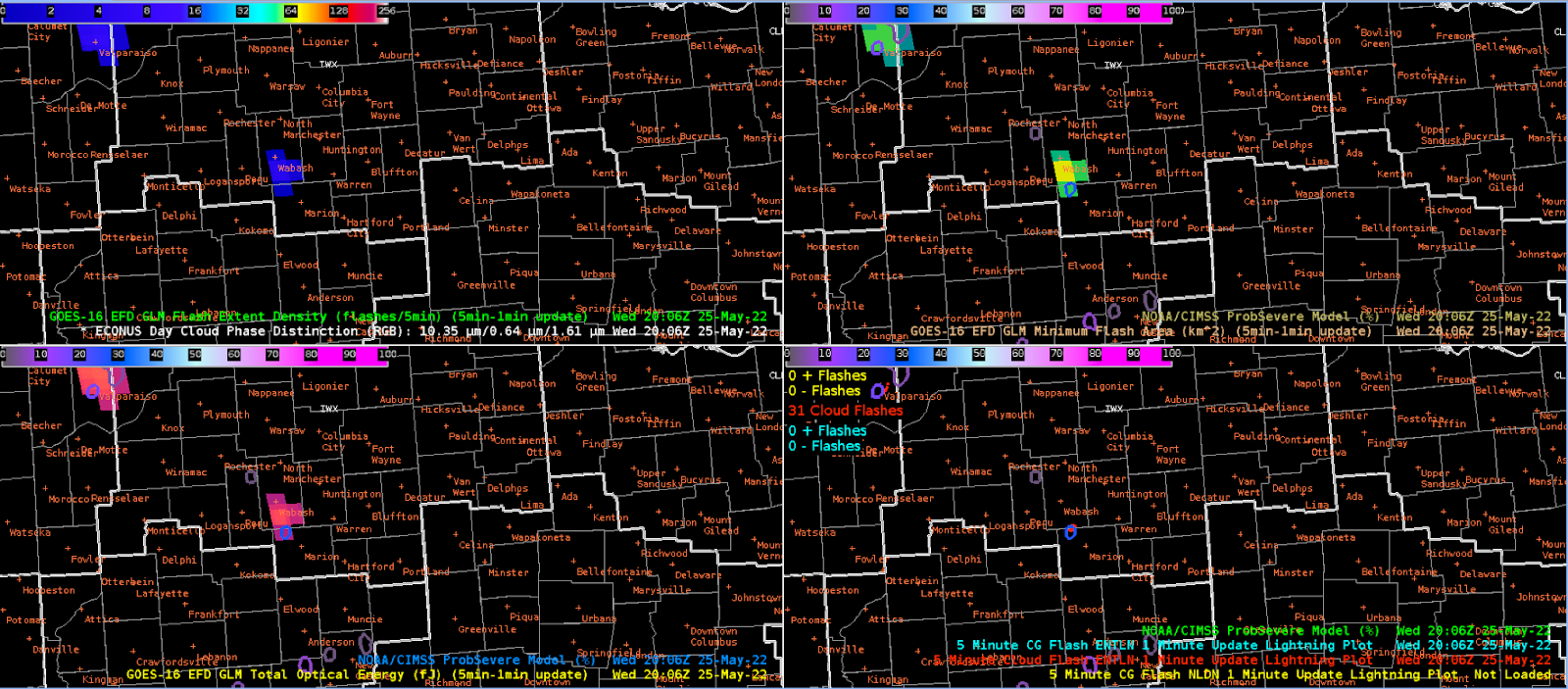
Just prior to more storm activity, GLM was picking up on a cell moving north into Wabash County, where a spike in MFA and decrease in TOE was evident. This storm was eventually warned on, where the radar showed a TBSS with a ProbSevere threshold for wind near 28%.
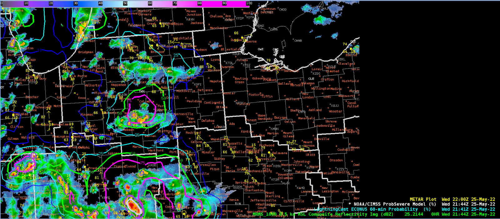
The lightningCast model, at least for KIWX, appeared to do better today in terms of the advection component, with the lightningCast downstream of the cells depicted in MRMS.
This time period was at 21:44Z, showing again how lightningCast was showing better predictive capabilities downstream of current convection.
Snowfan