Severe storm near KSJT (J-Money):
Lightning jump product gave a nice heads-up (on the order of about 10 minutes) to developing severe storm. Prob Severe values were also fairly high and steady-state leading into rapid intensification.
Official websites use .gov
A
.gov website belongs to an official government
organization in the United States.
Secure .gov websites use HTTPS
A
lock (
) or https:// means you’ve safely connected to
the .gov website. Share sensitive information only on official,
secure websites.

Severe storm near KSJT (J-Money):
Lightning jump product gave a nice heads-up (on the order of about 10 minutes) to developing severe storm. Prob Severe values were also fairly high and steady-state leading into rapid intensification.
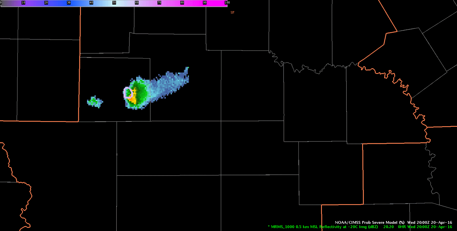
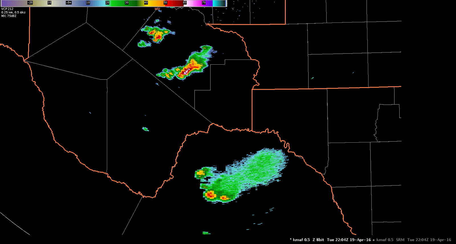
A thunderstorm developed along a residual outflow boundary/stationary front southwest of San Angelo Wednesday afternoon. The forecaster group issued an experimental severe thunderstorm warning based on lightning jump data, ProbSevere output, and all radar tilts examination. Figure 1 below shows a loop of 0.5 degree KSJT reflectivity and ProbSevere contours. ProbSevere first exceeded 50% at 1952 UTC, 60% at 2002 UTC, and 80% at 2012 UTC. The experimental data along with all radar tilts analysis helped forecasters increase lead-time and confidence in issuing a severe thunderstorm warning. After the warning was issued the storm again experienced a lightning jump and ProbSevere values maxed at 100%, with MRMS MESH over 3.00″.

-Sieglaff
J-Money Mesoscale Analysis as of 1830z:
Two regional short-wave features to note in the 700-500 mb layer this afternoon, as per water vapor imagery and meso-analysis data. The leading system was near the TX/LA border and pushing east, with associated storms being heavy rain producers, given saturated, weakly sheared environment. Houston LMA and flash rate density products show a fair amount of lightning as well.
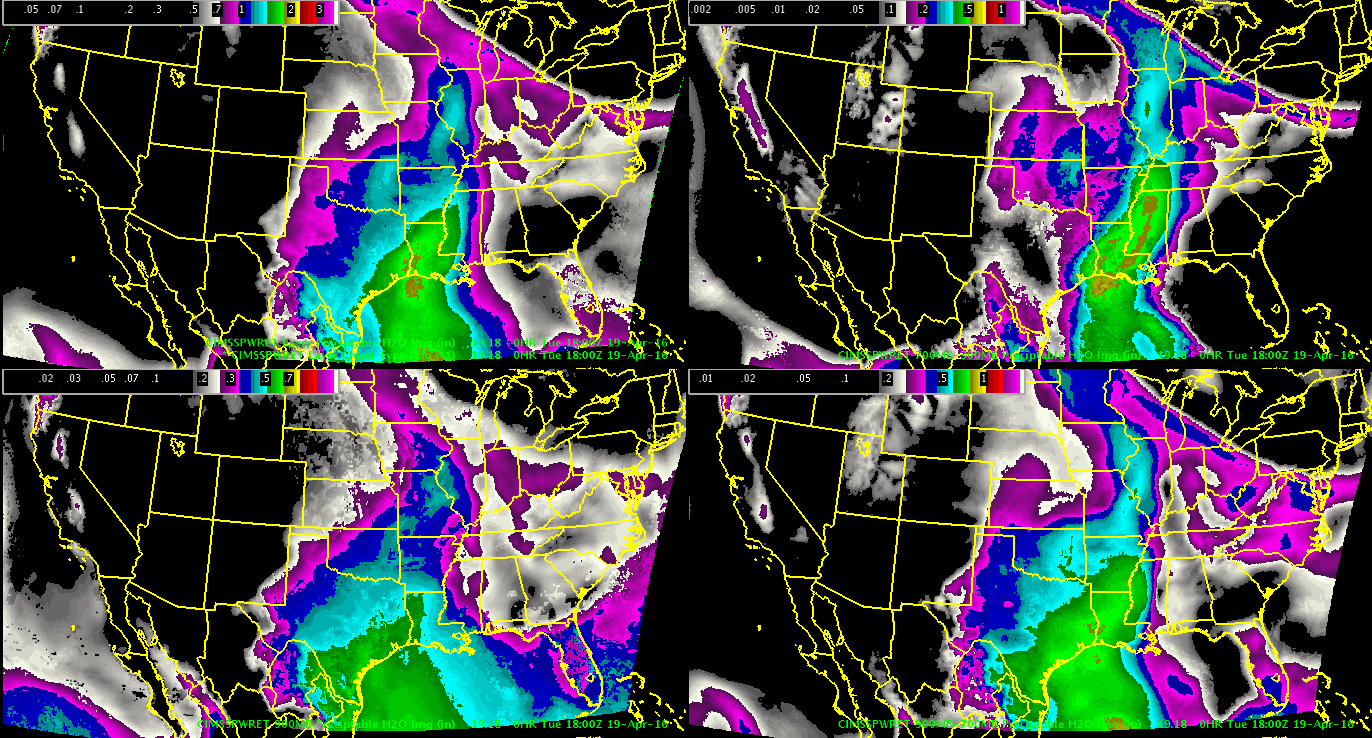
Through 19-22z, better convective potential may shift to central/south TX, as a subtle 700 mb short-wave over west TX moves in. This may interact with a decelerating outflow boundary in the vicinity. Layered PW data depicts the leading edge of mid-level dry air and presumably steeper lapse rates as well. Main question is can strong 700 mb cap shown on 12z KDRT sounding be overcome. Time will tell. Maybe 19z NUCAPS could help later today?
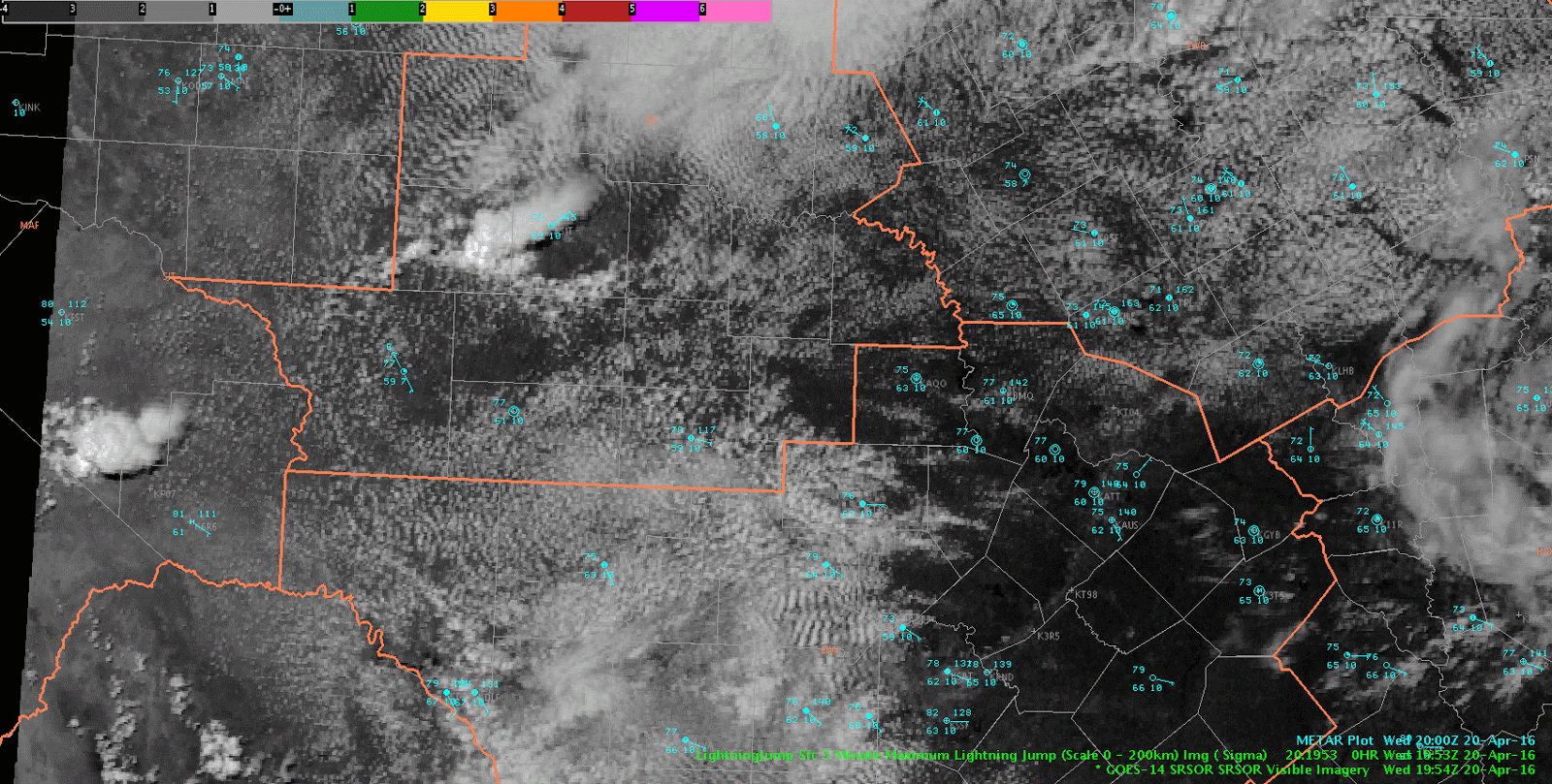
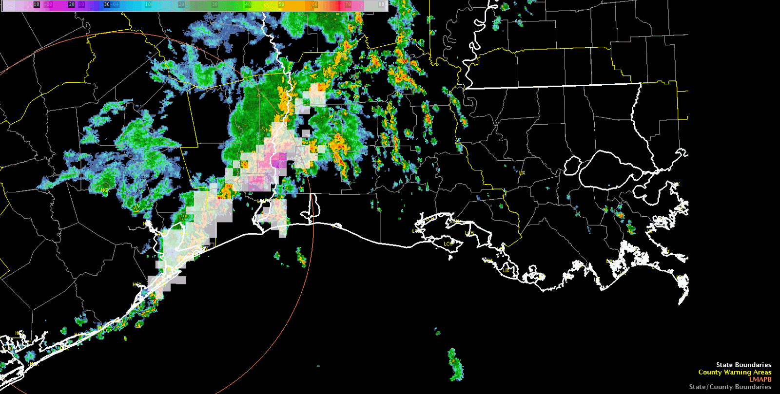
Large-scale upper low continues to spin across the Central Rockies this afternoon with broad cyclonic flow prevailing over much of the Southern Rockies. On the mesoscale, latest data from the SRSOR 1-km visible satellite imagery shows along diffuse outlow boundary remnant of last night’s convection slowly sagging south across southern Texas. To its north, notable clearing ongoing this hour across much of central Texas into the Texas Hill County. Prevailing through with respect to today’s convective potential involves to possible areas, with the first likely kicking off sometime around 21z as isolated cells begin to develop across the Hill County in aforementioned clearing, while another round of shwrs/storms is expected to develop across the northwestern TX panhandle after the 02z time frame as shortwave energy slides across the region. After development, high-res models to include the HRRR and 3km TTU-WRF show this secondary area of convection congealing and forming into a forward-propagating MCS as it dives southeast across the Red Rvr Vly into northeastern TX during the early morning hrs.
In terms of severe potential for the experiment, the prevailing through going forward has been swayed to the Texas Hill Country area as latest rapid-refresh soundings show a gradual erosion of the cap by mid-afternoon as shortwave energy approaches and boundary layer heating continues. If cap is able to erode, effective bulk shear of roughly 40-45 kts will support supercell structures with large hail and damaging winds being the main threats. Latest All-Sky LAP layered precipitable water data showing low-level moisture surging westward into the Hill County and Concho Valley regions of central Texas this afternoon. Combine this increased low-level moisture along with better forcing for ascent and the gradual erosion of the capping inversion, this region should see an increased liklihood for developing convection later this afternoon.
torman1
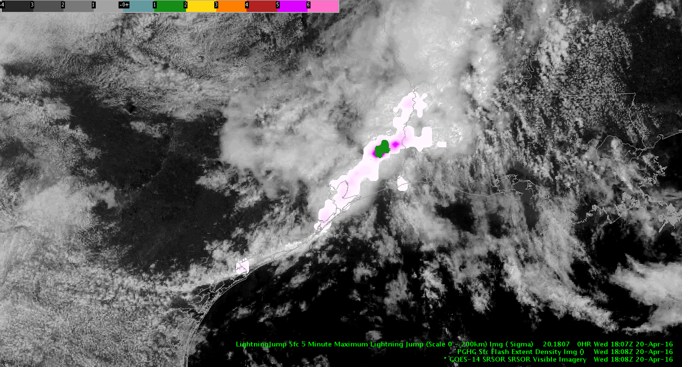
Latest IR loop shows a tendency for warming tops through mid morning in the MCS followed by a reinvioration of convection with cooling cloud tops evident over the past hour. This is occurring as the convective complex moves toward a low-level theta-e axis evident in RAP mesoanalysis and Layer PW extending from Southwest Louisiana north-northeastward into Central Louisiana. As diabatic heating continues over this area an increasingly unstable enviornment is developing with MLCAPE ~1,000 J/KG as of this writing. Convection has developed in this area east of the MCS this morning so far. The severe threat will be limited given loose storm organization at best due to weak deep layer shear. Isolated marginal damaging wind events may occur, but significant hail size will be difficult to acheive given tendency for short duration updrafts, limited CAPE in the hail growth zone, and limited complex storm interactions/mergers. For this experiment we will be particularly interested early on PGLM lightning data from Houston, CG lightning probability, and lightning jump since severe thunderstorms may be hard to come by. A move to another area is being discussed for later this afternoon once we examine lightning for a little while longer in Lake Charles’ area.
-dryadiabat
ProbSvr at 99%/ Radar showing 70% DBZ, in twin storms south Pecos co. Radar jump 2 sigma.
Decided to warn on both storms with two separate warnings.
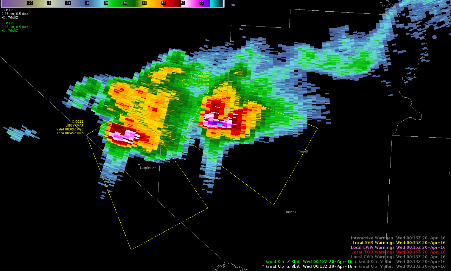
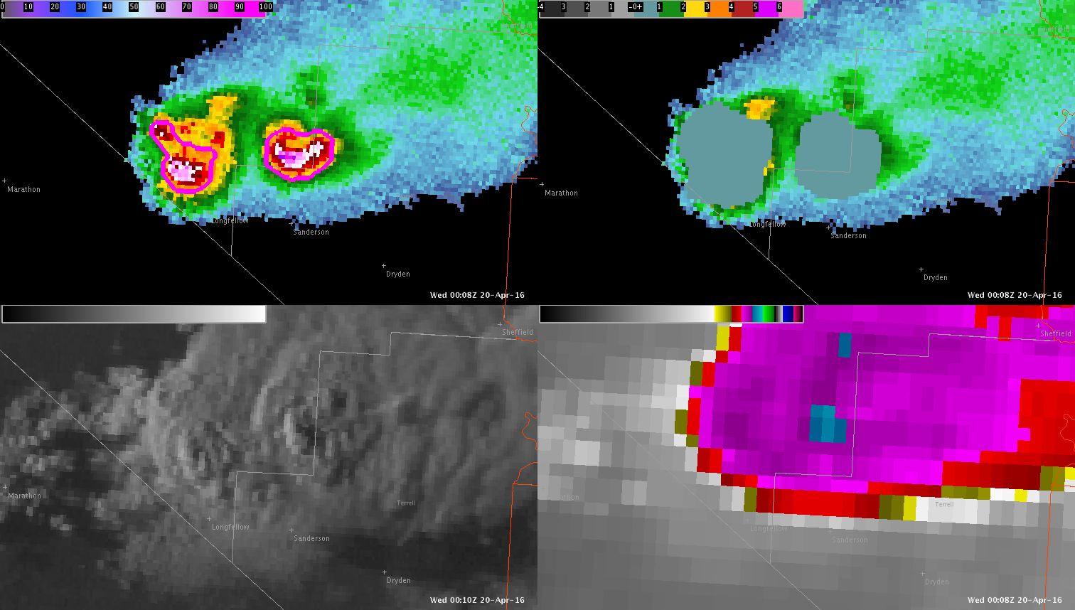
-dryadiabat
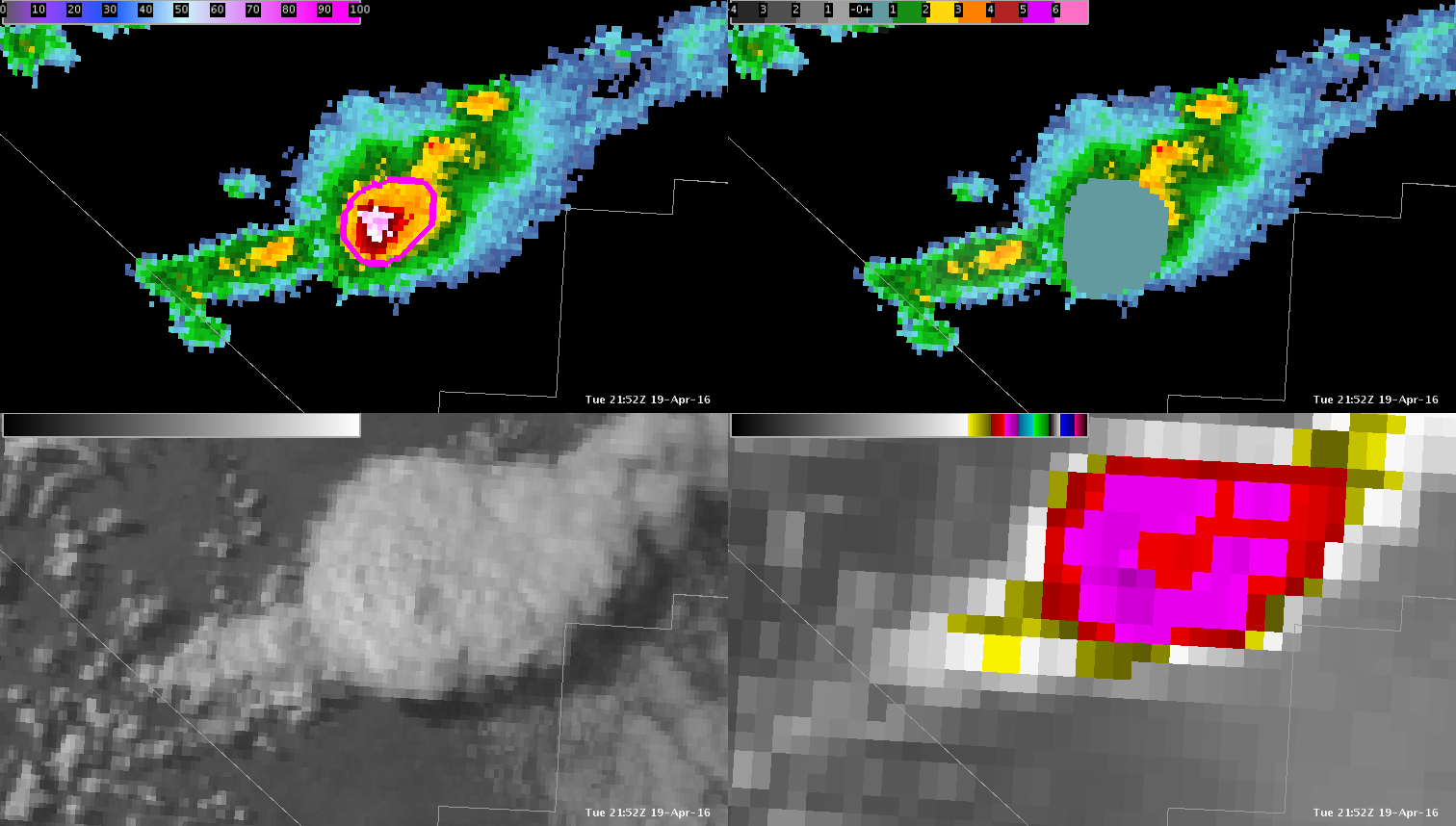
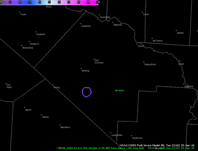
Just to the northwest of the today’s first big storm, another storm developed in Pecos County, TX. The NOAA/CIMSS ProbSevere model provided a large amount of lead-time and the forecasters said, “…we were looking a suite of experimental products and had we been more focused on ProbSevere, we would have likely issued the warning even earlier…” Below is a loop of select times between 2134 and 2224 UTC 19 April 2016 (Figure 1).
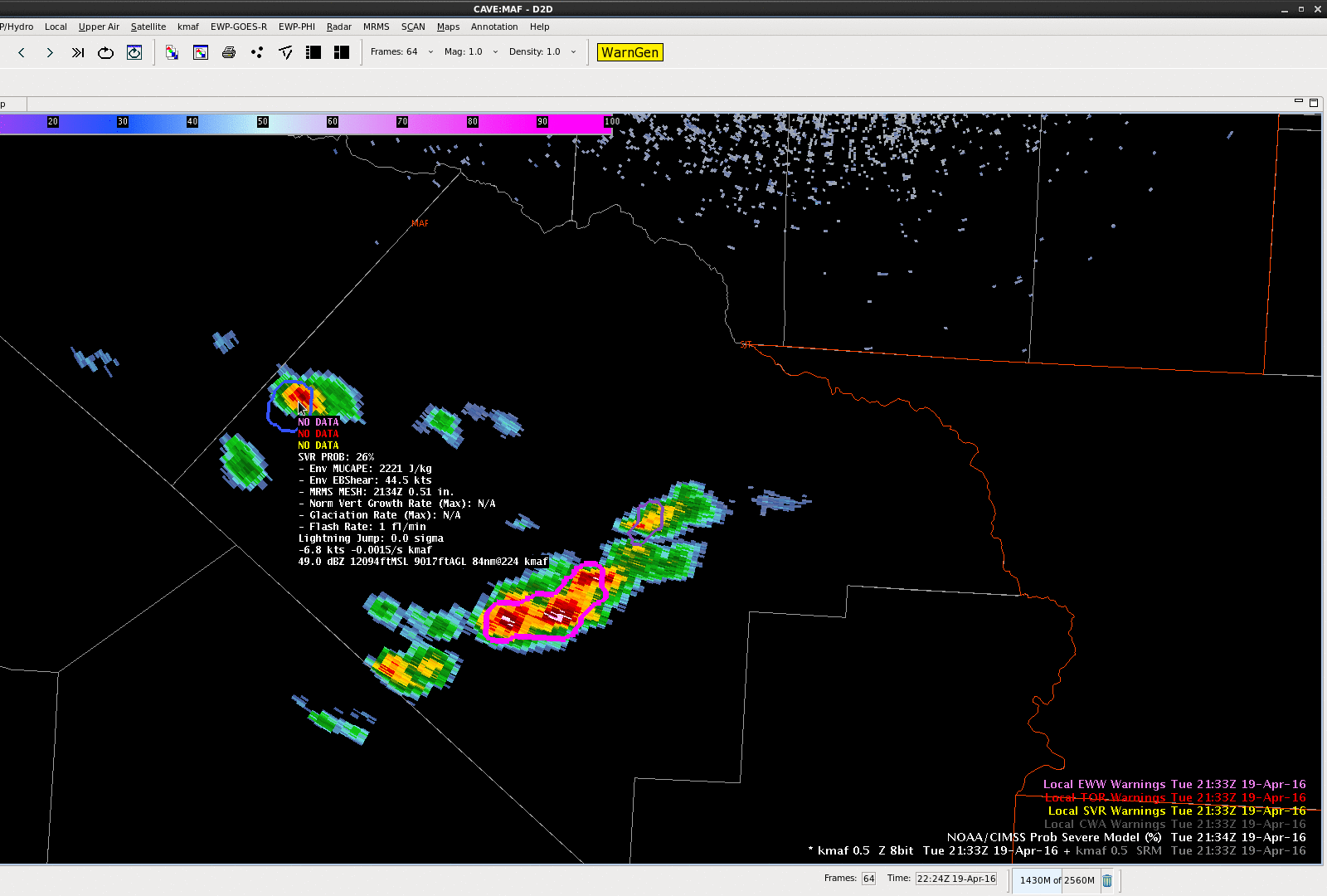
UPDATE: Despite the very rural region, a golf ball sized hail report was received at 2250 UTC with this storm.
-Sieglaff
Storm splits are occurring at this time in MAF’s CWA and also south of the Rio Grande in far northern Mexico. Radar and 1-minute satellite images are attached.
Analysis of storm at 21:32z shows 86% svr prob, growth moderate, glaciation weak. Lighting jump was huge at 8!
DBZ reflectivity is at 63. Even though glaciation is weak. Storm shows characteristics of large hail. Decide to issue warning for hail at 21:52z. Beat actual CWA warning by a few minutes.