
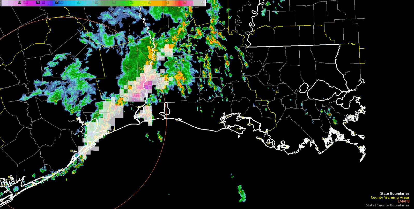
Latest IR loop shows a tendency for warming tops through mid morning in the MCS followed by a reinvioration of convection with cooling cloud tops evident over the past hour. This is occurring as the convective complex moves toward a low-level theta-e axis evident in RAP mesoanalysis and Layer PW extending from Southwest Louisiana north-northeastward into Central Louisiana. As diabatic heating continues over this area an increasingly unstable enviornment is developing with MLCAPE ~1,000 J/KG as of this writing. Convection has developed in this area east of the MCS this morning so far. The severe threat will be limited given loose storm organization at best due to weak deep layer shear. Isolated marginal damaging wind events may occur, but significant hail size will be difficult to acheive given tendency for short duration updrafts, limited CAPE in the hail growth zone, and limited complex storm interactions/mergers. For this experiment we will be particularly interested early on PGLM lightning data from Houston, CG lightning probability, and lightning jump since severe thunderstorms may be hard to come by. A move to another area is being discussed for later this afternoon once we examine lightning for a little while longer in Lake Charles’ area.
-dryadiabat