
Just to the northwest of the today’s first big storm, another storm developed in Pecos County, TX. The NOAA/CIMSS ProbSevere model provided a large amount of lead-time and the forecasters said, “…we were looking a suite of experimental products and had we been more focused on ProbSevere, we would have likely issued the warning even earlier…” Below is a loop of select times between 2134 and 2224 UTC 19 April 2016 (Figure 1).
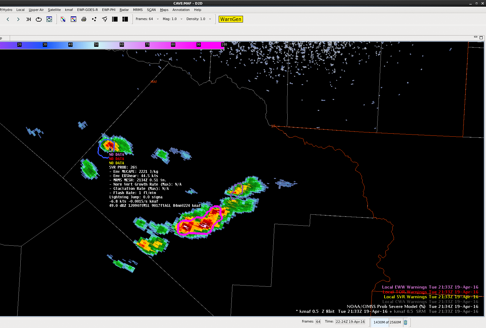
At 2136 UTC the ProbSevere values jumped from 26 to 63% due to strong satellite normalized vertical growth rates and increase of MRMS MESH from 0.51″ to 0.75″. The ProbSevere values fluctuated slightly, largely in the 60%s until 2210 UTC when the probability then increased over 80%. By 2224 UTC ProbSevere was 97% for this storm and an experimental severe thunderstorm warning was issued.
UPDATE: Despite the very rural region, a golf ball sized hail report was received at 2250 UTC with this storm.
-Sieglaff