Webb County, TX Storm Update

Overall, PROBSvr continues to show high probabilities of severe hail.  So far no reports have been received at the WFO, not surprising considering the low population density in this part of TX.  Otherwise, Lightning Jump data showed a 2 sigma increase approximately 20 minutues before warning went out the door.  Finding little utility with the Convective Initiation products so far.

3-sigma lightning jump.
Tags: None

Update

Severe thunderstorm warning issued for large hail in the NW edge of the CWA, just south of KCZT.  Strong deep-layered shear (0-6 km layer), versus weaker 0-1 km values argues for hail producing supercells and possibly isolated downburst winds, versus tornadic storms.  Reflectivity jumps in the mid-levels on the KDRT radar seemed to portend a near-future jump in ProbSevere values for this storm.

A collision of a northward moving convergence boundary with the southward moving synoptic boundary at the eastern end of the CWA has touched off additional convection.  This is near a gradient zone in stability/shear.  Lightning flash rates/overshooting tops are not overly impressive, as of yet.  We’ll continue to monitor.   – J-money

KDRX, ProbSevere approx. 1900 UTC
Tags: None

Day 1: Mesoanalysis

Today’s focus will be over extreme southern Texas as an outflow induced frontal boundary continues to sag south across the Corpus Christi and Brownsville CWAs. Ahead of this boundary, ample amounts of low-level moisture are in place with early afternoon dewpoints hovering in the lower to middle 70s. Latest 1-km SRSOR visible imagery from GOES-14 indicates plenty of low-level CU in place south of the boundary, however SPC mesoanalysis is already showing a moderately unstable airmass with MLCAPE values currently exceeding 2000 J/kg is some locations across far southern Texas.  So far, convection has been slow to kickoff in the unstable airmass south of the boundary, with the only notable convection of interest located along the Texas/Mexico border where the outflow induced front appeared to begin interacting with elevated terrain just west of the Rio Grande River.  That said, PROBSvr has been tracking this cell quite well so far, however probabilities for severe remain low at this time.  Also of interest is a northward moving outflow/differential heating boundary which will continue tracking north this early afternoon, before eventually colliding with the outflow induced frontal boundary approching from the north. As these two boundaries collide, expect developing/strengtheing convection as the airmass largerly remains uncapped per latest SPC mesoanalysis grapics.  Effective bulk shear of 40-45 kts remains more than supportive for severe development, however deep layered shear vector orientation along the effective outflow boundary may keep developing convection in linear segments.  Of interest however, Rapid-Refresh soundings from south-central Texas show deep inflow directly from the east with quick veering with height above 900-hPa. As a result…cannot rule out an isolated tornado or two, however very dry air aloft along with steep mid-level lapse rates will likely keep large hail and damaging winds the primary focus of severe weather concerns.

torman1

Tags: None

HWT 2016 GOES-R/JPSS Spring Experiment Begins Today!

The HWT 2016 GOES-R/JPSS Spring Experiment in Norman, OK begins today, 18 April, and will run through 13 May. Three NWS Forecasters and one Broadcast Meteorologist will participate in the GOES-R and JPSS product evaluations each week. Participants will utilize the experimental satellite-based products in a real-time AWIPS-II to issue experimental mesoscale forecast updates and severe thunderstorm and tornado warnings.

Products to be evaluated include:

  • GOES-R Legacy Atmospheric Profile (LAP) All-sky Thermodynamic Products
  • GOES-R Convective Initiation and Severe Convective Initiation
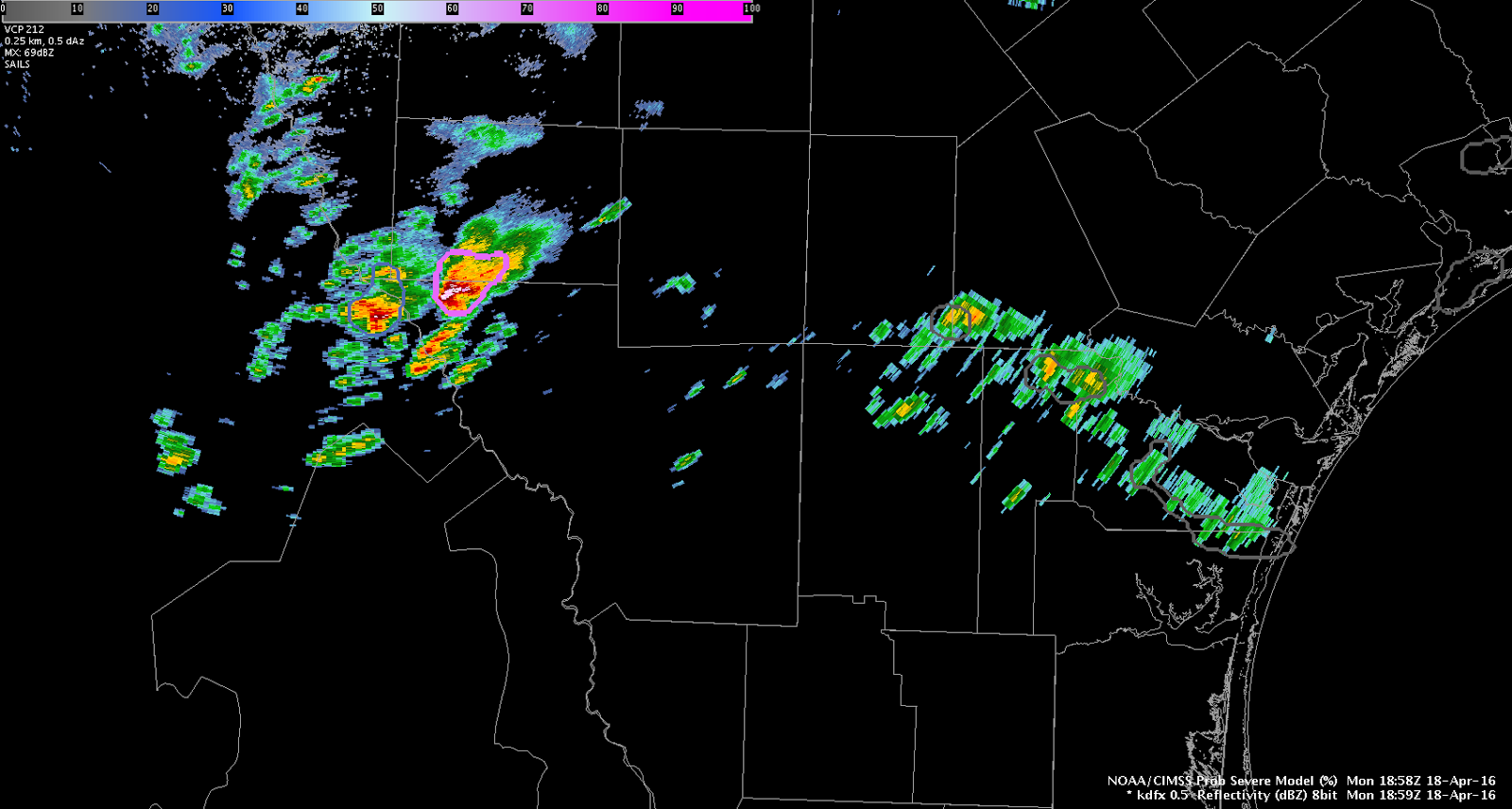
  • Probability of Severe Model
  • GOES-14 Super Rapid Scan Operations for GOES-R (SRSOR) 1-min imagery
    • Atmospheric motion vectors (updating every 10 minutes)
    • Parallax-corrected 1-min imagery
  • Total Lightning using PGLM (in LMA networks)
  • Lightning Jump Algorithm (using ENI)
  • NUCAPS Temperature and Moisture Profiles (JPSS)

You can follow this blog for live updates and forecaster posts from within the HWT.

Bill Line, SPC/HWT Satellite Liaison

Tags: None