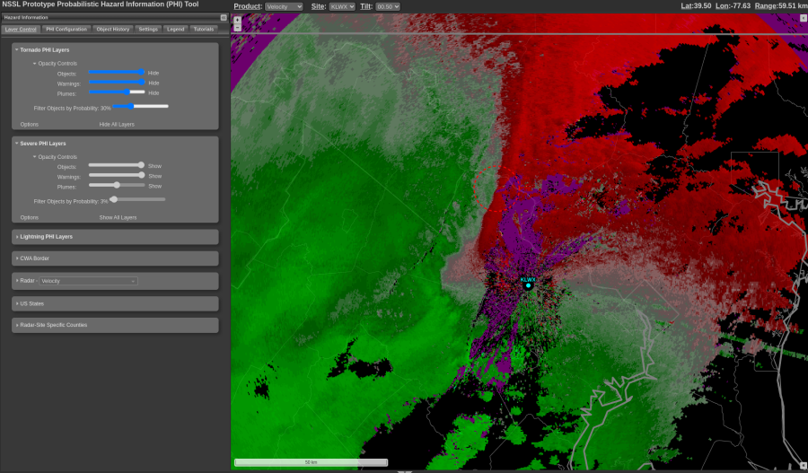
I noticed that as the northern end of the line of convection became more parallel to the radar beam, several low-probability TORP objects occurred (see below):

However, when I go back to the 30% threshold the one that is left is correlated to a deeper area of rotation using a traditional All-Tilts analysis (see below the 1.8 deg elevation angle of SRM). This was encouraging that TORP was able to identify the most legit circulation with highest probabilities.

-dryadiabat
Just re-worked every procedure to simplify my view in order to take in the TORP, Az/Div-Shear products more easily. There were time match issues, and missing data and this seems to have helped some. I’m running a simple 0.5 Z/SRM w/ TORP and 4-panel Z/SRM/Az/Div now and it seems to have helped.
Had several issues with thresholds and various settings that resulted in only seeing the TORP for the tornadic circulation after it developed with 95% prob, and no history using the PHI tool to display.
-dryadiabat
Even with the reset of procedures and time matching to TORP, still having trouble displaying TORP in AWIPS.


 Unsure what all elements in the readout for TORP are.
-dryadiabat
The AzShear product is useful for UDCZ identification. Curious to see its use in the more difficult cases where the UDCZ location can be ambiguous. Will be watching for such examples in this experiment.
 -dryadiabat
Really difficult with time match issues. Concerned I’m not getting timely velocity data if time matched to TORP.
Noticed a 25% TORP well west within the stratiform area to the west of the deeper convection, where I would’ve discounted from my manual analysis of radar data.

The Az and Div stood out with the mesovort/possible brief tornado in eastern Prince Williams County. 
Noticed a very distant TORP object from KLWX in southern Pennsylvania. Obviously there are beam height issues and the velocity is relatively low compared to earlier circulations closer to the radar. So, this is encouraging as it seems to account for the beam broadening issue with greater range.

More brainstorming, exploring, and unfiltered blogging. Noticed that once the convection moved east and the beam is more perpendicular that for the UDCZ the DivShear product really shows a strong signal, as would be expected given beam orientation. See earlier post above about AzShear showing a stronger signal when the beam was more parallel to the UDCZ.

Good example of the contrast of radar perspective, KILX vs KDOX.


Similar beam height but a stronger rotation on KDOX. Shows the value of having multiple radar TORP overlaid onto a single radar display, for situational awareness.
Monitoring another area where the line orientation should be favorable for QLCS mesovort/tornado concerns. There are areas within this segment of rotation and a slight upward trend in the latest scan as I type this. TORP has identified this area with 33% prob.


Was curious to see if anticyclonic rotation would have a TORP object. It did not in this example east of D.C.

A TORP detection along the cold front, from KDOX which is much further than KIWX. Reflectivity thresholds must have been just enough. 33% is higher than I would’ve considered from my manual assessment. 


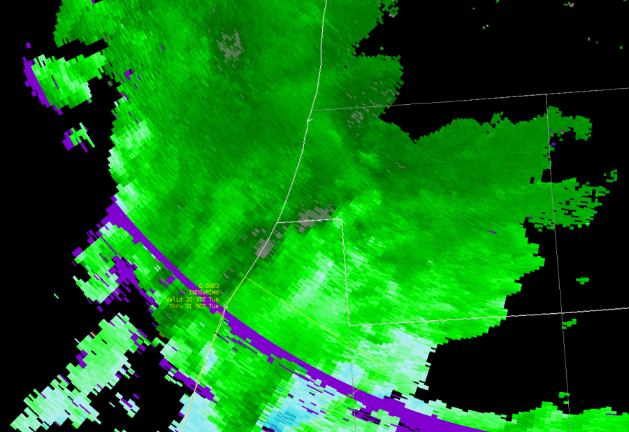


 Nice clover signature on DivShear. This appeared about 3 minutes after the original tornado report, so did not provide a lead time. However, it is good to see this signature verify.


