3DVAR: Corpus Christi 1940-1950 UTC

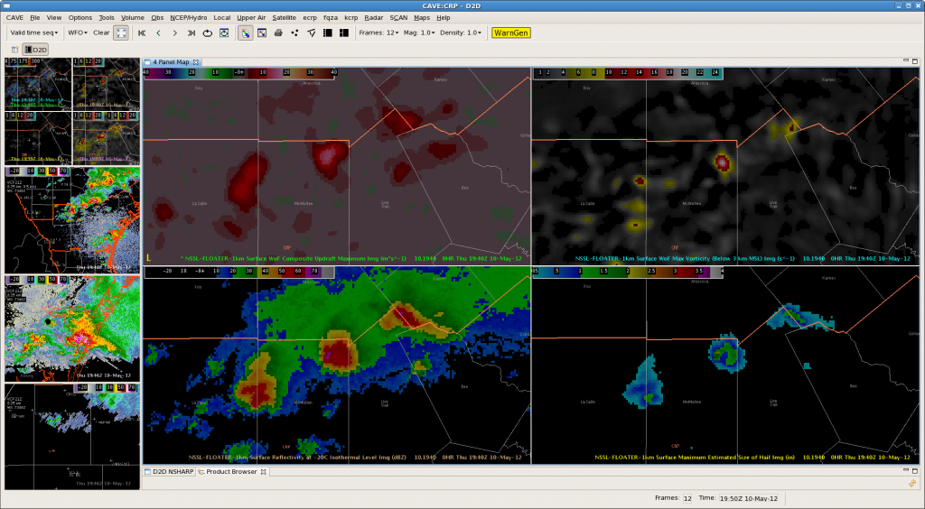
3 training supercells are currently moving across the northern counties of the CRP CWA.  Ryan & Jeffrey have issued TOR warnings on all 3 of the storms & have been interrogating a number of 3DVAR products and integrating them with base CRP radar data.

The maximum updraft product has quickly become a go-to for situational awareness and quickly evaluating which storms strengthening/weakening…

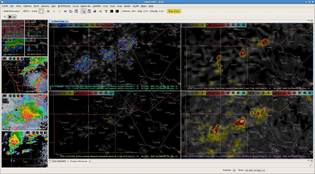
4 Panel 3DVAR at 1940 UTC
AWIPS2 forecaster display at 1940 UTC. Maximum Updraft (TL); Vorticity (TR); Refl at -20 deg C (BL); MESH (BR).
4 panel 3DVAR/MRMS at 1940 UTC
AWIPS2 4-panel display of 3DVAR and MRMS products at 1940 UTC: Updraft Helicity (TL), Max Low-level (1-3 km) Vorticity (TR), Merged AzShear (BL); 30 min track LL Vort (BR)
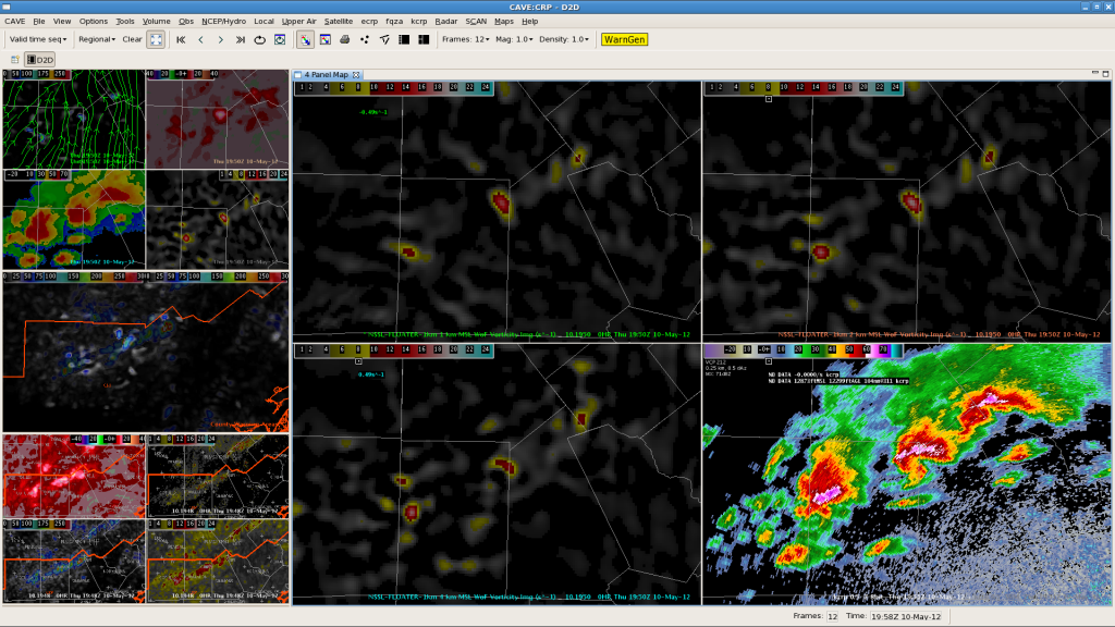
4 panel vorticity at 1950 UTC
AWIPS2 4-panel display of vorticity at 1 km (TL), 2 km (TR), 4 (BL) & CRP 0.5 deg reflectivity (BR) at 1950 UTC.

Local storm reports and trained spotters have reported a number of funnel clouds and a couple of tornadoes with the storms over the past hour.

-Kristin C.

BRO MESO Desk @ 20Z

…added Raymondville to the line position…

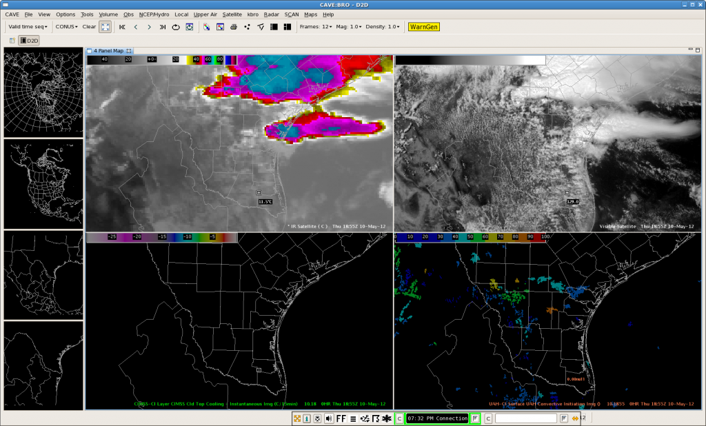
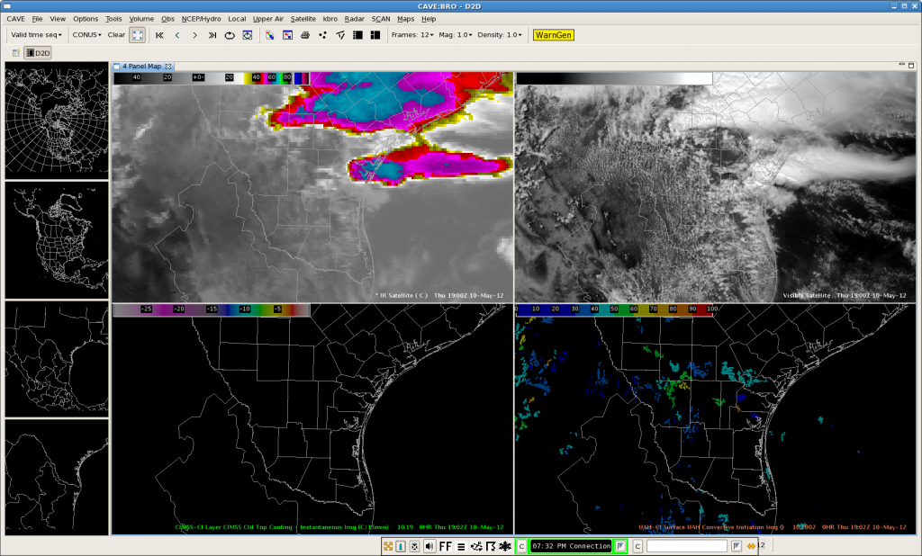
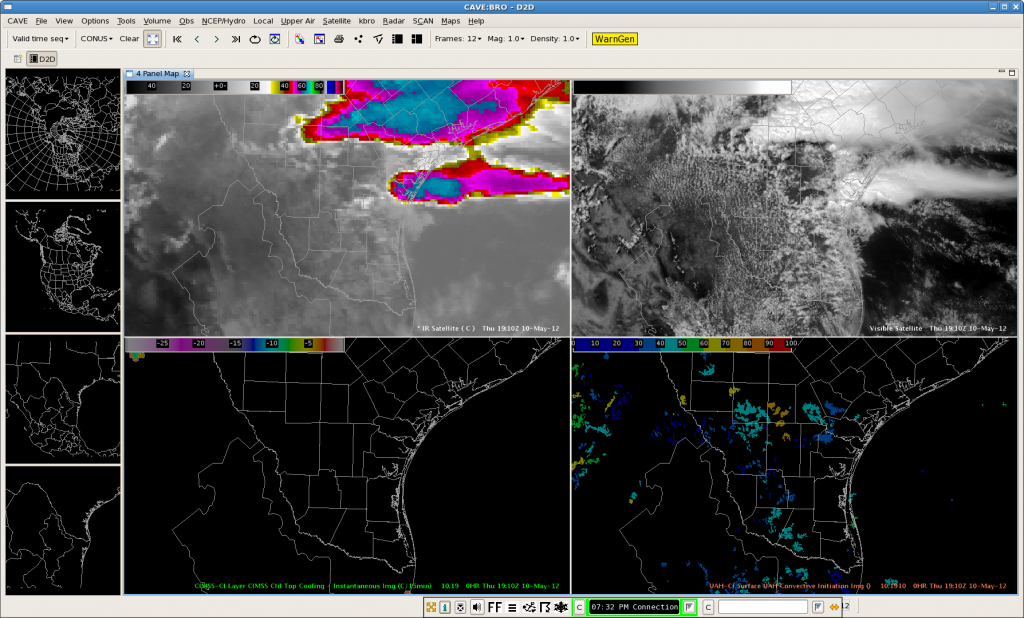
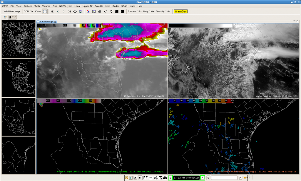
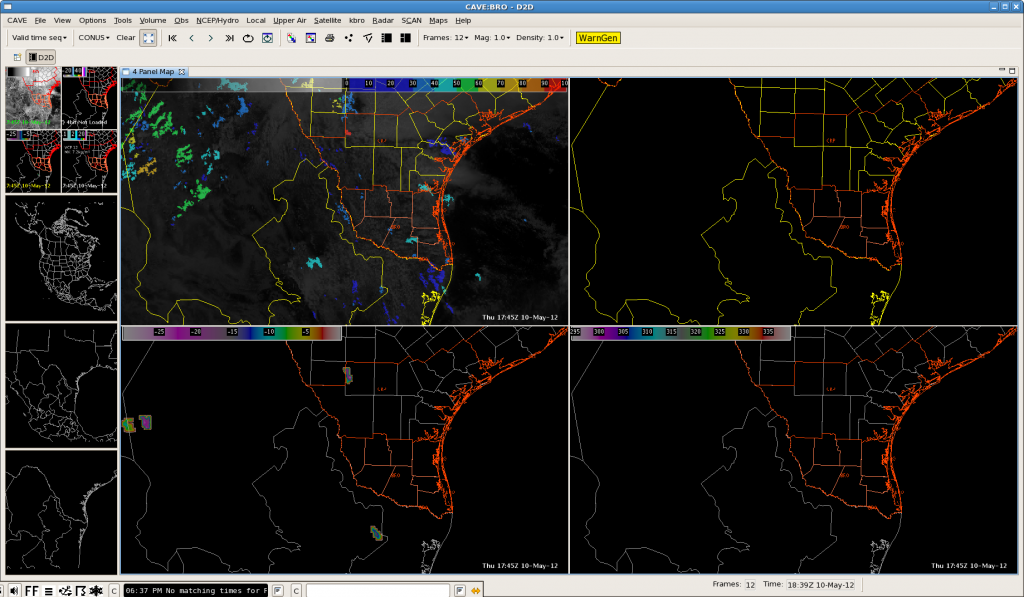
The following four screen captures depict several favored areas of UAH-CI strength of signal along the outflow boundaries that exist immediately north of CWA and north-south along a line from Los Angeles-Realitos-Encino-Raymondville.   Knowing were the boundaries were located,  UAH strength of signal allowed us to focus on the most favored areas between 20Z-21Z.   (Synthetic Sat showed the most likely CI would take place between 20-21Z, particularly with storms along the Rio Grande.  It didn’t capture any activity over the northern extent of the outflow boundary.)   Nunez

Tags: None

BRO Afternoon Forecast 1920Z

Synthetic WRF imagery was useful in making a convective forecast for Brownsville this afternoon.  At 13Z, the synthetic WRF depicted two areas of convection over TX with the south complex near Brownsville being slightly displaced to the south in location.  This convection was occurring in an area of high shear ahead of an upper level low progress slowly across the southwest U.S. (seen in synthetic and observed imagery).

13Z Synthetic:

13Z Observed IR/WV (top 2 panes):

At 19Z synthetic and observed IR/WV imagery matched up well with the southern complex, but over did convection to the south of the northern complex in TX.  Over Brownsville area, visible satellite imagery depicted a low broken cu field at 1914Z which matches low clouds in the synthetic IR imagery.

19Z Synthetic:

19Z Observed IR/WV (top 2 panes):

1914Z Visible Sat:

Conclusion:  The Synthetic WRF model seems to be doing an OK job overall so far today with a few issues.  However, it depicts the upper low driving convection today as well as 2 distinct areas of convection over TX.

For Brownsville area for the rest of the afternoon, synthetic images below predict convective initiation around 20Z with convection strengthening through the afternoon hours (22Z image), and then beginning to decrease in strength at 0Z.

20Z Synthetic:

22Z Synthetic:

0Z Synthetic:

AMS/Nunez
Tags: None

CRP Desk-Tornadic Supercells 2:08 PM

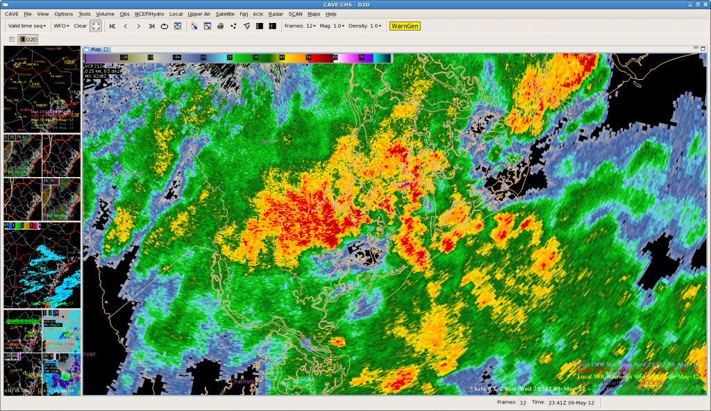
Several supercells have developed this afternoon along CRP’s northern CWA, in addition to an isolated tornadic supercell a few miles southwest of Corpus Christi.  At least 2 tornadoes have already been reported with the north eastern most storm, and the isolated storm near the coast.  The 0.5 degree reflectivity can be seen below on the left.  On the right, the top left panel shows the composite updraft maximum, the top right contains the max vorticity through the lowest 3 km, the bottom left is the reflectivity at -20C (very large hail with the one near Corpus Christi), and the bottom right the MESH.  The 3DVAR products on the right are about 5 minutes before the radar image.

Tags: None

BRO MESO desk @ 1834Z

a few towering cu were present across BRO.   CTC centriods were present in LaSalle county (CRP) an immediately south of Starr county. In fact, the LaSalle county CTC also showed a high strength of signal on the UAH-CI.  Nunez

Tags: None

CHS Meso Desk @ 2341Z

Jasper county multicellular storms should increase during recent scans with the hail algorithm showing a max of 1″.  MESH should less than 1″.  Convection is about to merge with the ongoing activity along the coast and will likely pull in rain-cooled air within the next 15 minutes.  It is likely the Jasper storms will weaken as they track ESE and no impacts are expected.  Nunez

Tags: None

CHS Meso Desk @ 2324Z

3DVAR helicity, total wind and comp. updrafts fields support the ongoing convection over southern Colleton county.  Interestingly, the simulated radar reflectivity agree with the HRRR for increasing convection on the southwest flank of the Colleton county storm, and latest total wind hint at a minor disturbance over Jasper county.  Nunez

Tags: None

CHS Meso Desk @ 2317Z

21Z HRRR 2hr projects that the newest convection south of the severe storm is expected to increase in strength and should organize into scattered coverage across Effingham and Bryan counties.   FYI, the more recent HRRR runs (1-2hr) no longer captured on the ongoing convection in Colleton county.  Nunez

Tags: None

JAX 3D VAR Lag with Pulse Storms

3D VAR Composite Updraft seems to be relatively helpful in confirming the strength of a storm.  However, with some quick pulse storms, the 3D VAR data seemed to lag behind a little.  In the series of images below you can see that the best Updraft strength noted at 22Z (upper right panel of 3rd image) seems to better match radar data from 2154Z (1st image below) rather than 2159Z (2nd image below).  So there seems to be a slight lag with 3D VAR data catching the stronger updrafts in pulse storms, but that’s probably to be expected with this type of storm.

2154Z:

2159Z:

2200Z:

AMS

Tags: None

JAX-Camden County Storm@2215z

At 2215z…strong storm was located over Camden County.  3DVAR products indicates updraft maximum values around 13 m/s with an updraft helicity near 33 m/s2.  Visible satellite imagery (second image) is also showing a broad area of higher clouds…possible overshooting top…over Camden County.  Visible satellite image is verifying the updraft information.  AMS/Hovis

Tags: None