

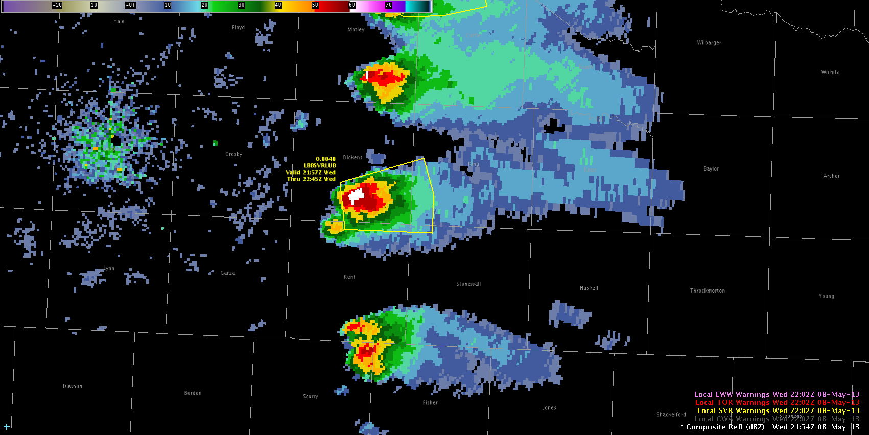
Two persistent supercells across the TX Panhandle region have shown signs of strong mid level rotation, but spotters and local observations suggest cloud bases are much too high for tornado formation. Therefore, these MRMS TDS signatures appear to be false alarms. The images below show examples from two storms.

Category: Live Blogs
Real-time posts made during testbed nowcast and warning operations.
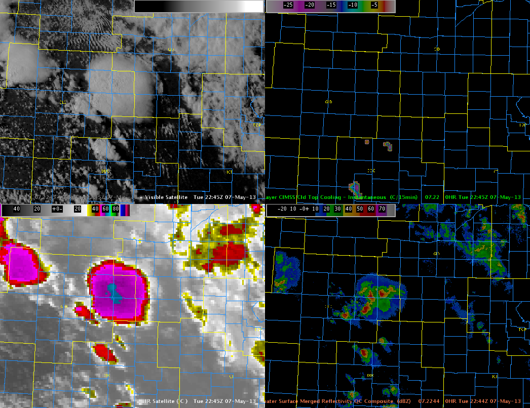
Large CTC Values Providing Excellent Lead Time for Severe Hail
Developing supercells over the TX panhandle became severe appox 30 to 45 min after a significant CTC signal. This signal is shown below in the upper left corner of the 4 panel. 30 to 45 min. after the minimum CTC value of -33, MESH indicated 1 inch or larger hail. This is displayed in the second image below. Of note is how well the CTC algorithm is performing despite a modest cirrus shield. 
Austin
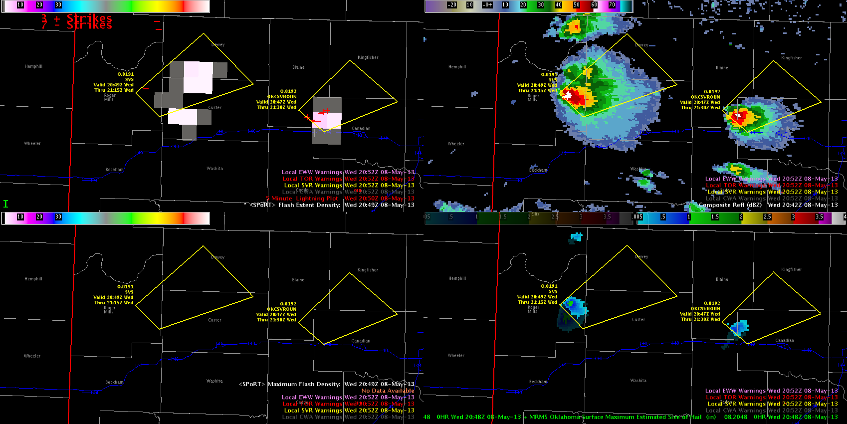
PGML Flash Extent Density Unusually Low for Severe Supercells
Below is a 4 panel image of Flash Extent Density, Composite Reflectivity, and MESH. With two supercells indicating large hail via MESH, one would expect larger values of FED, which have only maxed out around 5 flashes/min. However, this may have something to do with distance from the LMA centroids. We will continue to monitor. In any case, the PGLM products are very useful for aviation and public safety interests for points downstream.
**Update at 2107 UTC**
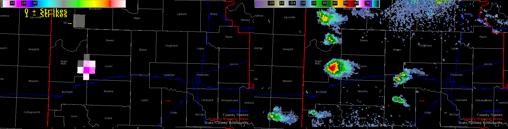
Monitoring the storm following Flash Extent Density Trace Tool, it appears many of the storms have entered a period of decreasing lightning activity. This is also apparent in the plan view of FED. This would suggest a downward trend in storm severity, but will monitor to see if this comes to fruition.

Austin/Hampshire
Diagnosing Storm Growth Using Flash Extent Density
With convective initiation underway, we assess the intensification of thunderstorm updrafts using PGLM Flash Extent Density to determine electrical activity within the storm. The cell below has shown several weak lighting pulses over the last 15 minutes and is showing signs of becoming severe. Reflectivity is on the rise and the lightning activity appears to be foretelling of possible storm severity quite well.
Austin
Using MRMS for Storm Over Radome
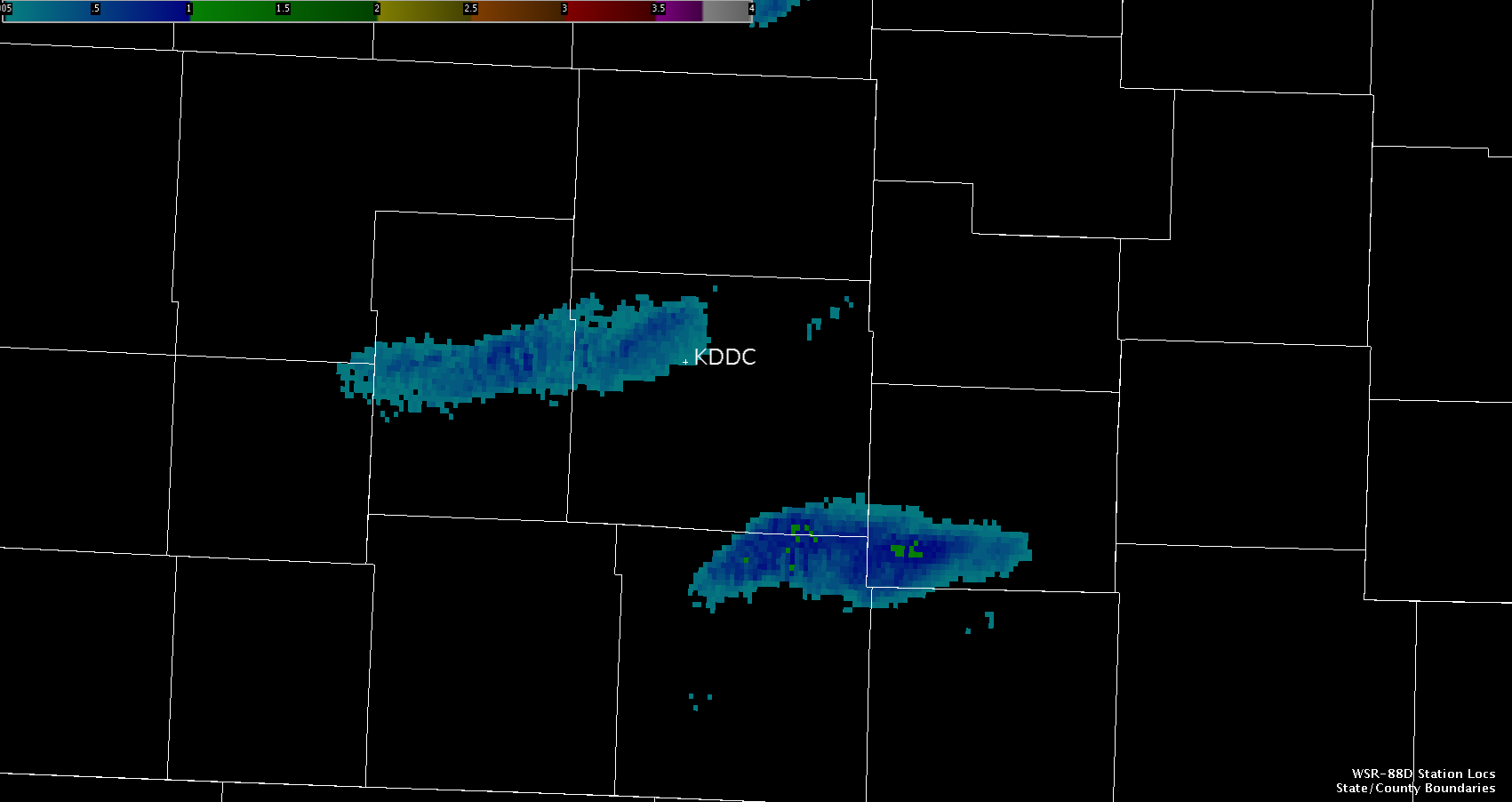
A strong to marginally severe thunderstorm tracked from west to east and passed over the KDDC Radome. If a forecaster were using the single radar, it would be hard to discern the storm’s chances to produce hail due to the highest beam being below the freezing level. MRMS comes into play here because it uses multiple radars to give the forecaster better information about the storm.

MESH was used to determine the estimated hail size as the storm tracked across the Radome. The algorithm was able to use other radars to sample the storm’s updraft and to estimate the hail size within the storm. This provided forecasters with useful information that would not otherwise be possible without the MRMS.
Hampshire
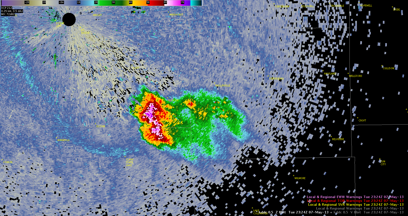
MRMS 50 dbZ Echo Height Above -20C Product Aids in Dropping Warning
A strong to severe thunderstorm across northern Graham County, which previously warranted a Severe Thunderstorm Warning for quarter sized or larger hail, was replaced with a Significant Weather Advisory. This was due to a spotter report of dime sized hail as well as evaluation of the MRMS 50 dbZ Echo Height Above the -20C Product. The product showed a rapid decrease from near 20,000 feet to 6,500 feet before the warning expired. Subsequent product updates decreased this to 0 feet following advisory issuance.
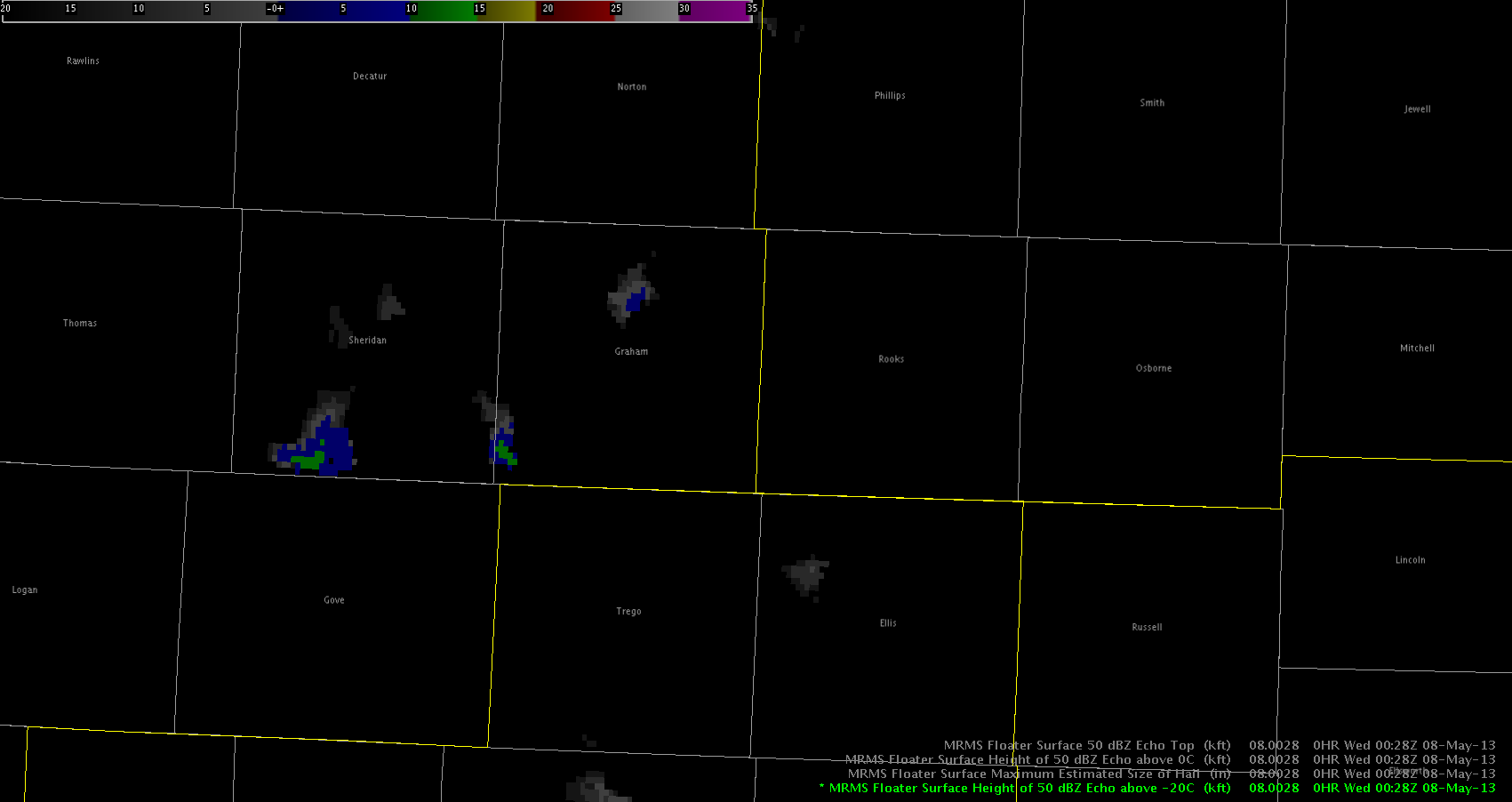
Kurtz/Guseman
Hail Lead Time from Cloud Top Cooling Products
As several storms developed in the DDC forecast area, and very slowly reached maturity (and severe intensity), the Cloud Top Cooling (CTC) product provided a significant amount of lead time.
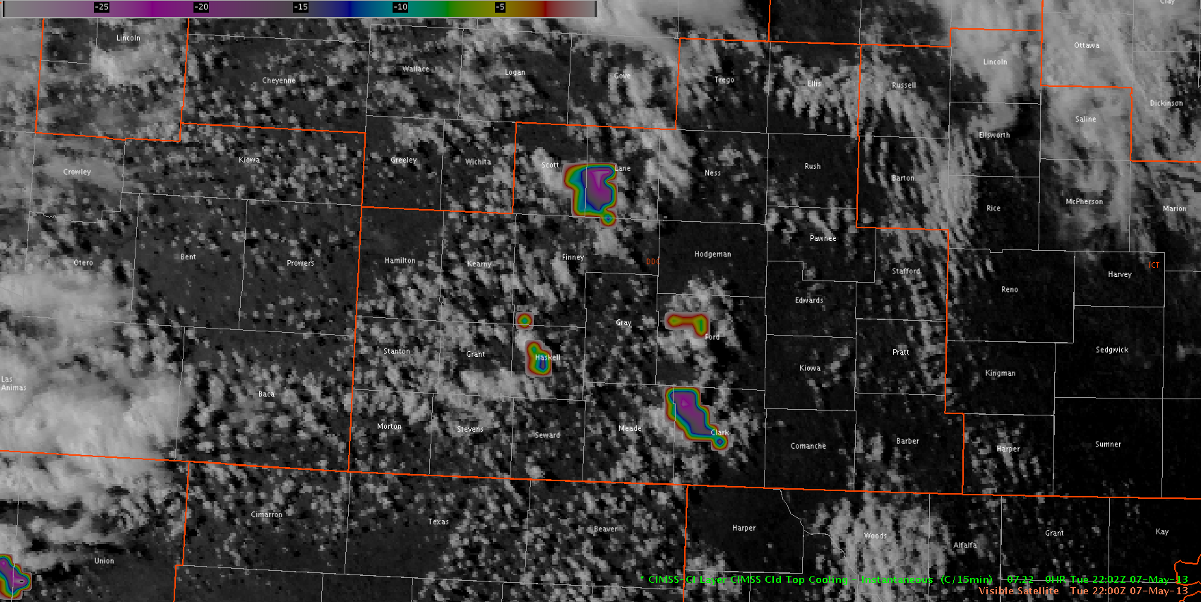
At 2202Z, three areas showed strong (20+) indications on the CTC product. The two areas in Lane and Clark Counties went on to produce severe thunderstorms. However, the smaller area in Haskell County did not end up with severe hail reports. All three of these CTC areas continued for several consecutive time steps.
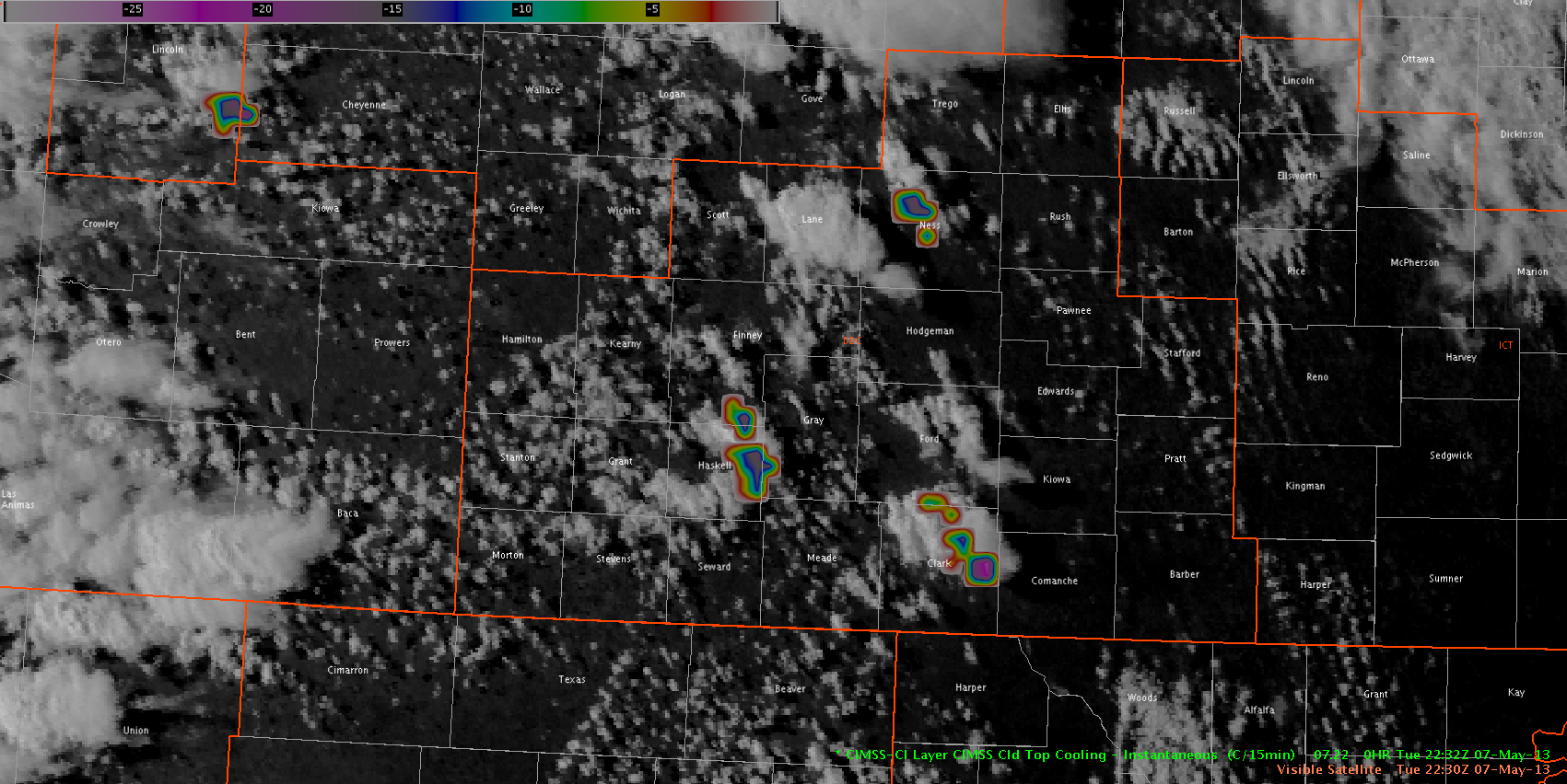
An hour and a half later, a new area of strong CTC developed in Ness County. This area also persisted for several time steps, and preceded severe thunderstorm development as the storm moved into Trego and Ellis Counties. The area near Haskell County was associated with the one storm that did not become severe, while the Clark County CTC area was associated with the severe storm moving out of Ford County.
With the exception of the sub-severe Haskell County storm, the other three CTC indications were associated with future severe hail reports.
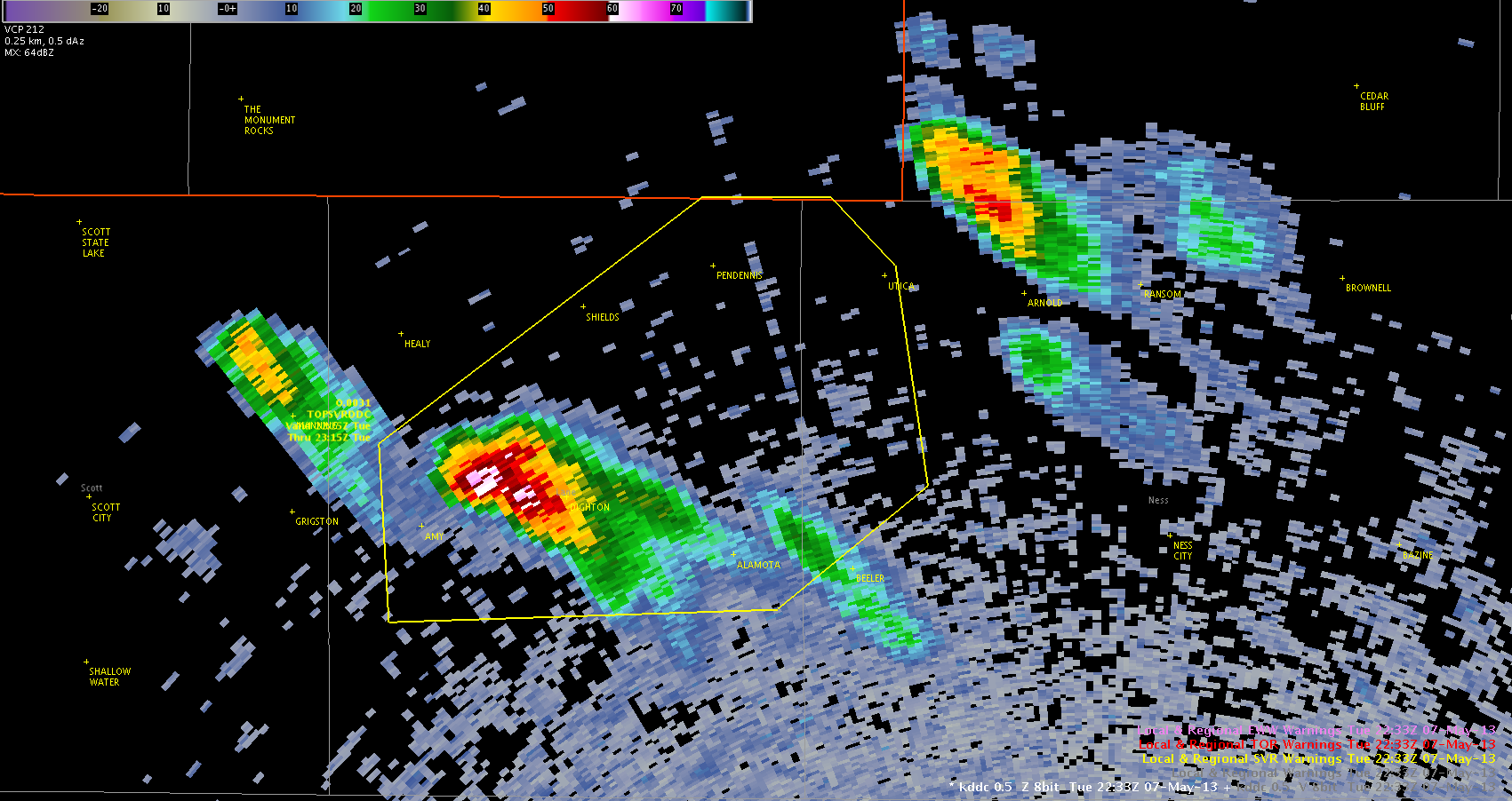
–Hatzos
Possible impacts to CTC from Cloud Ice in Anvil Cirrus Shield
The use of CTC was restricted quickly across the GLD CWA this evening as the cirrus shield from the first updraft quickly contaminated the region due to cloud ice. From this point on, the MRMS products became the primary aids in deducing severe hail development.
Note the lack of CTC within the GLD CWA, while new updrafts continue to be detected by the CTC across the northern portion of the DDC CWA.
Kurtz/Guseman
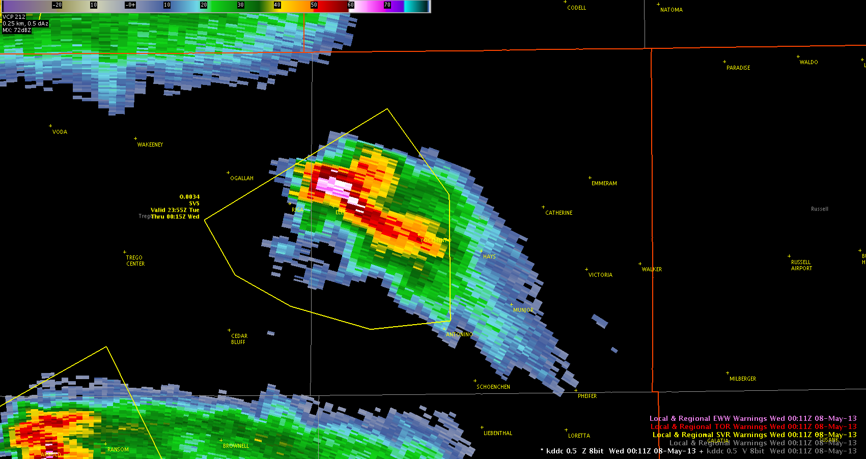
Cloud Top Cooling rate combined with MESH for Enhanced Lead Times
We continued to monitor Cloud Top Cooling (CTC) rates in combination with MESH from the MRMS to investigate a elevated storm in Sheridan County Kansas. CTC was able to provide 15 to 20 minutes of lead time before the MESH indicated .71 inch hail. Below is a four panel at 2115z of the CTC, instantaneous MESH, base reflectivity at KGLD, and 120 min MESH.
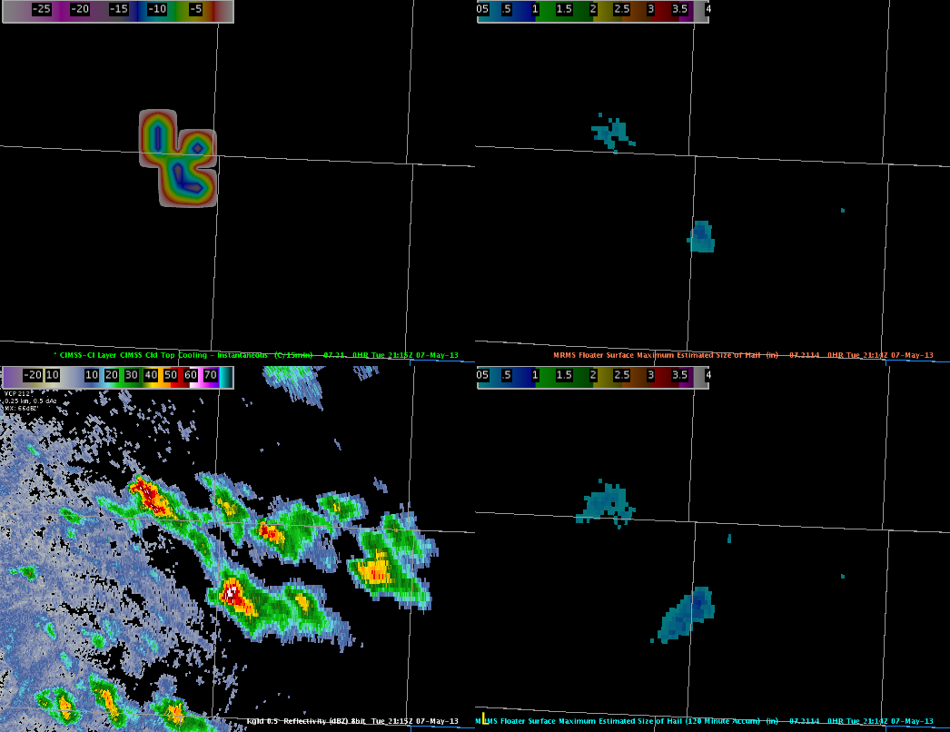
Continuing to monitor the storm, the HSDA has continued to indicate large (LH) to giant (GH) hail. With modest mid-level lapse rates (7.0-8.5 C/km) and decent mid-level shear, these storms continue to indicated mid and upper level rotation, indicative of large hail growth.
Guseman/Kurtz
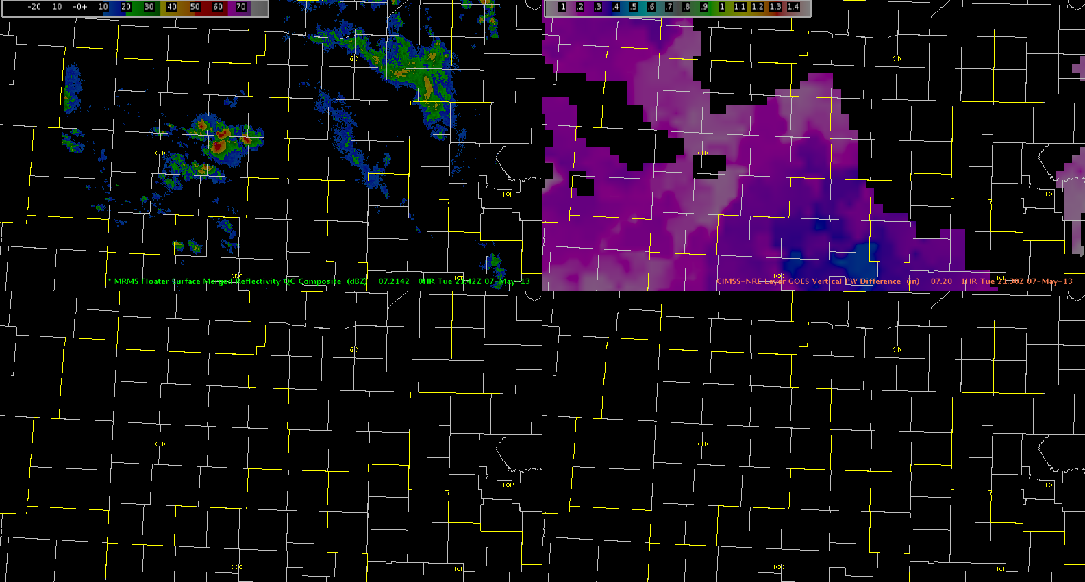
Updrafts have reached Moisture
The updrafts have reached the airmass with higher low-level moisture as evident by the darker pink/purple colors in the GOES PW Difference product. The updrafts have become better organized with a marginally severe storm currently in Western Kansas.
Hampshire