

Lightning Jump suggestion: Instead of having blocks/blobs of color that cover up radar and/or satellite imagery, why not have outline rings that are similar to what is displayed in ProbSevere, or at least something that is more transparent in nature? – J-Money
Category: Lightning Jump Algorithm
Lightning Jump Algorithm
Is there a way to display the lightning jump algorithem with more transparancy? I like to look at it however I do not like how it masks the relfectivity underneath. Just a thought…
torman1
Webb County, TX Storm Update
Overall, PROBSvr continues to show high probabilities of severe hail. So far no reports have been received at the WFO, not surprising considering the low population density in this part of TX. Otherwise, Lightning Jump data showed a 2 sigma increase approximately 20 minutues before warning went out the door. Finding little utility with the Convective Initiation products so far.

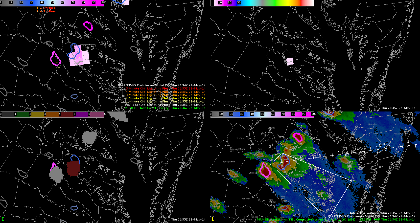
Looking at Lightning Jump
We’ve got a lot of action going on across our CWA this afternoon, and most of the storms have had at least a 1 sigma lightning jump. Some of them have had a significant jump, up to 7 sigs.
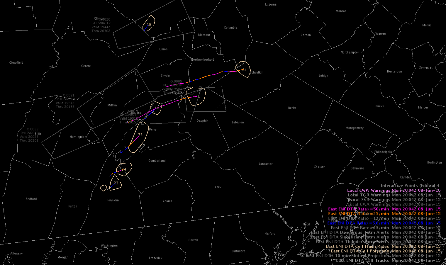
One cell we were tracking (eventually turning more linear) was moving across Perry Co, PA. We spotted an 80 flash/min jump (from 20-100) in 10 minutes.
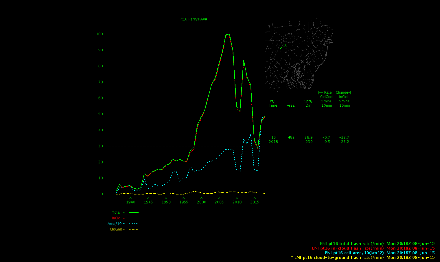
This area did receive reports of a tree down (~1950z) and pea-sized hail (~1950z) just before that huge jump. There was still a smaller jump taking place at that time (from 10-20/min over 10 minutes).
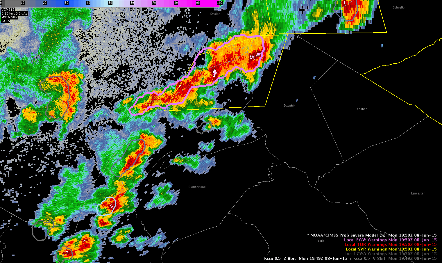
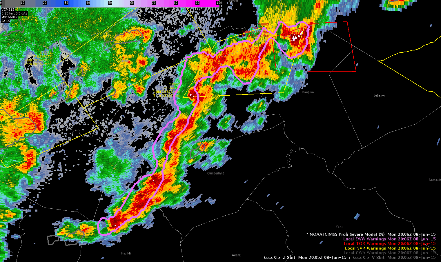
We did notice there were some tracking issues in terms of cells merging and determining a jump. We account this to the amount and speed of convection in our area. Visual jumps were spotted on the time series graph, but it did not show well on the LJDA map.
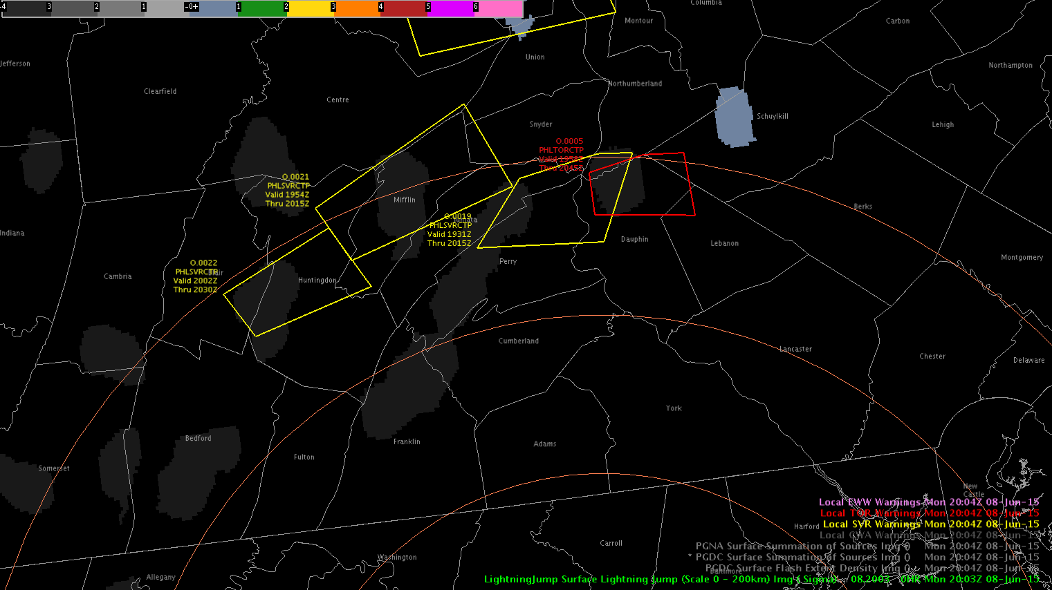
-BT
Lightning jump and another updraft
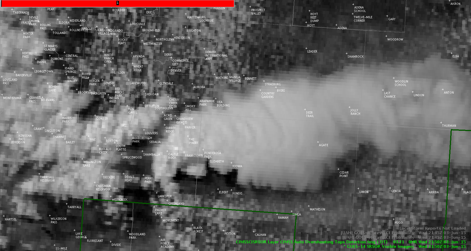
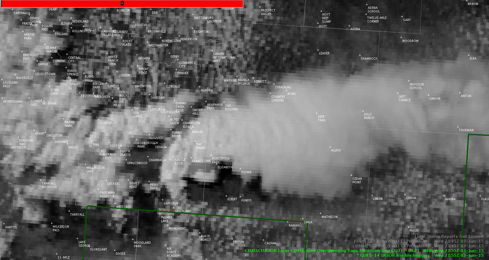
Lightning jump nearly coincident with yet another updraft (sat images are five minutes apart from one to another).
Radar reflectivity increased shortly thereafter. An aside: MRMS VII also jumped.
Jason Williams
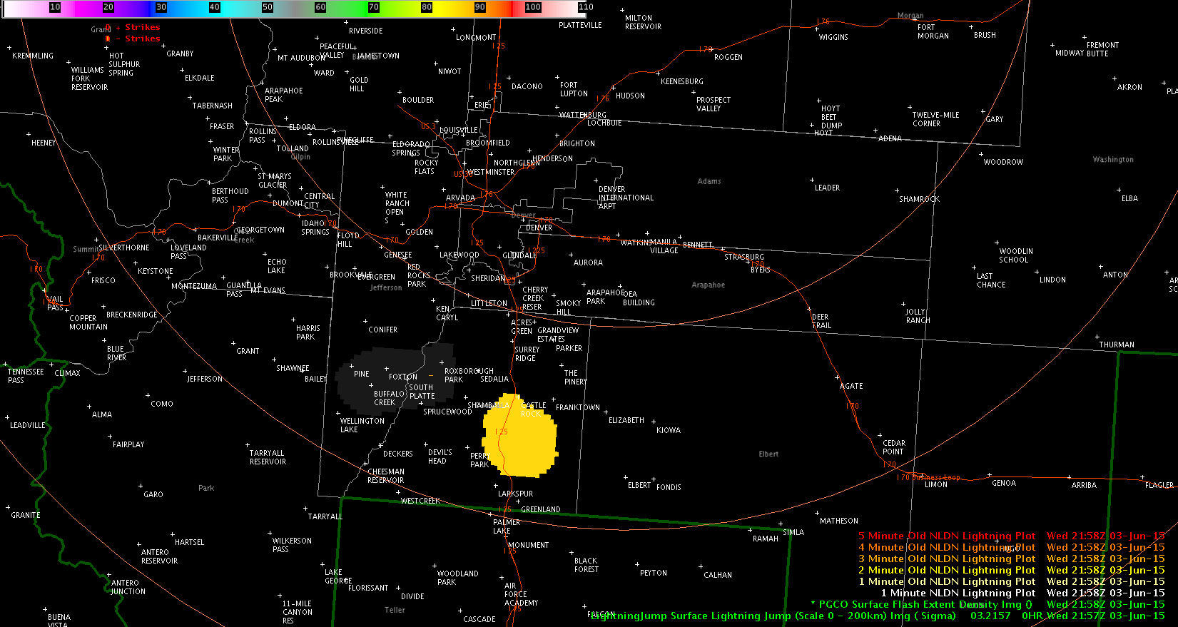
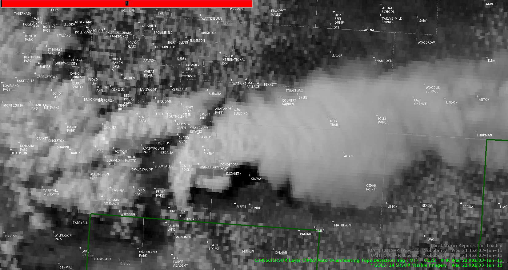
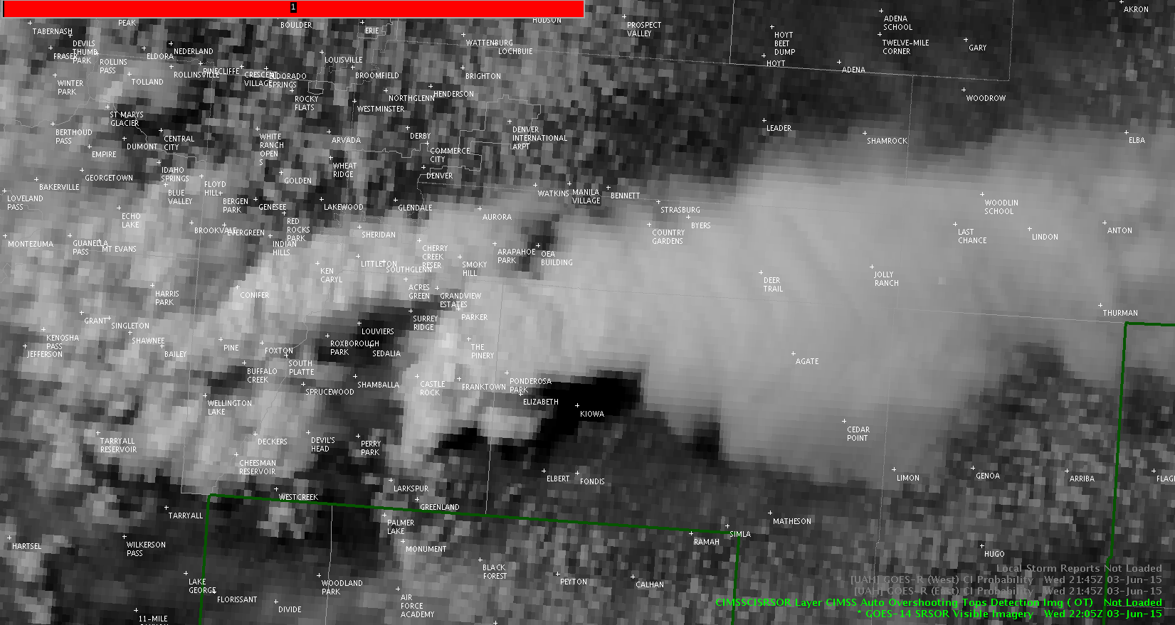
Lightning jump, 1 min vis support BOU cell reintensification
Click for loop – you can see another updraft shoot up on the west side of the storm.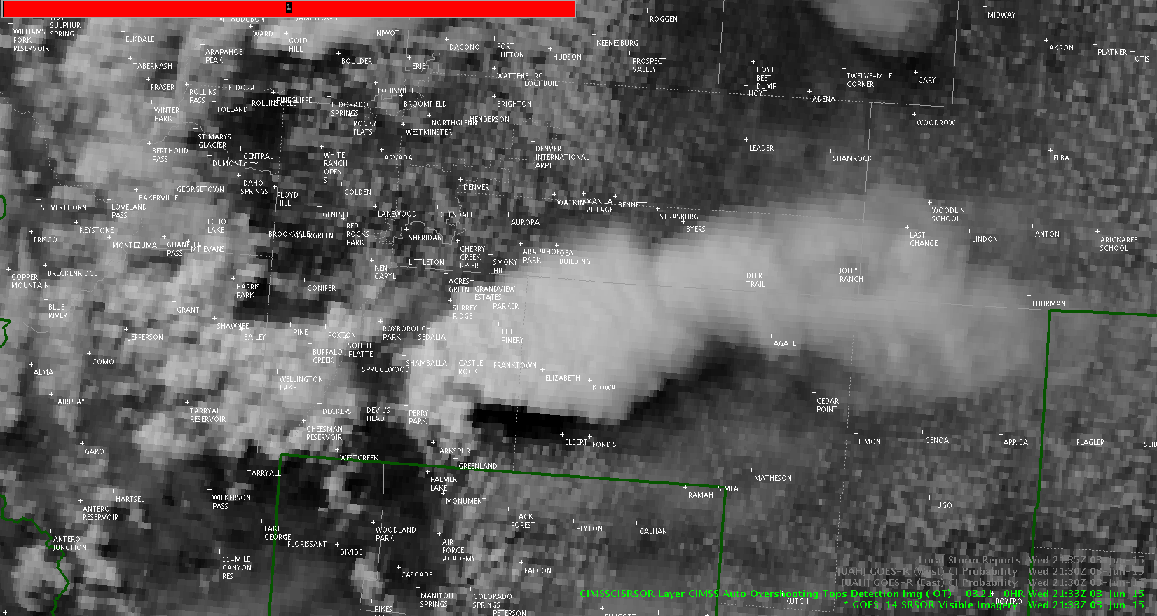
Jason Williams
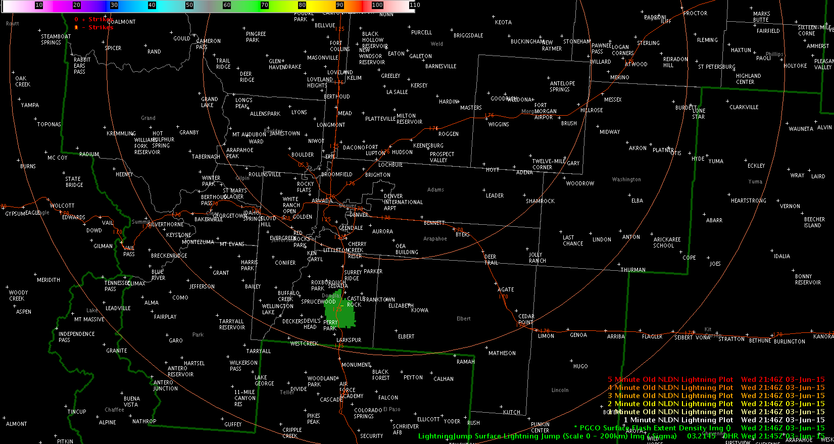
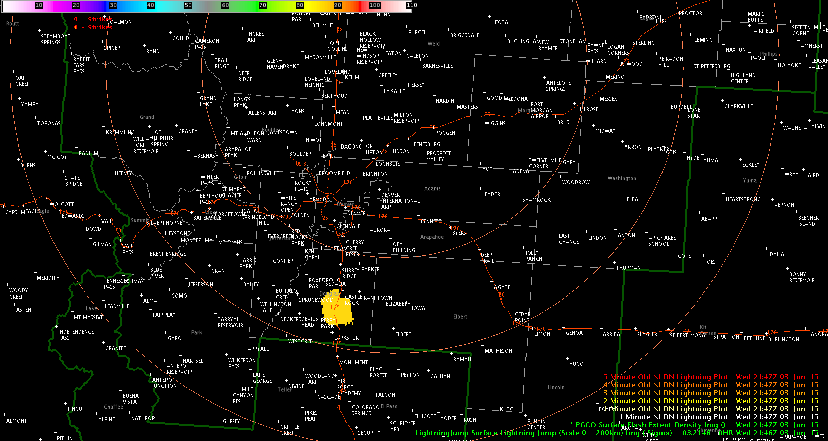
Southern BOU storm shows severe signals
ProbSevere had a big jump – 10% at 2115z to 70% at 2122z and hitting 86% at 2126z.
TBSS evident on higher tilts.
Lightning jump of 3 sigma at 2122z.
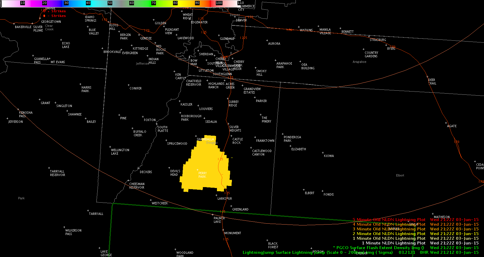
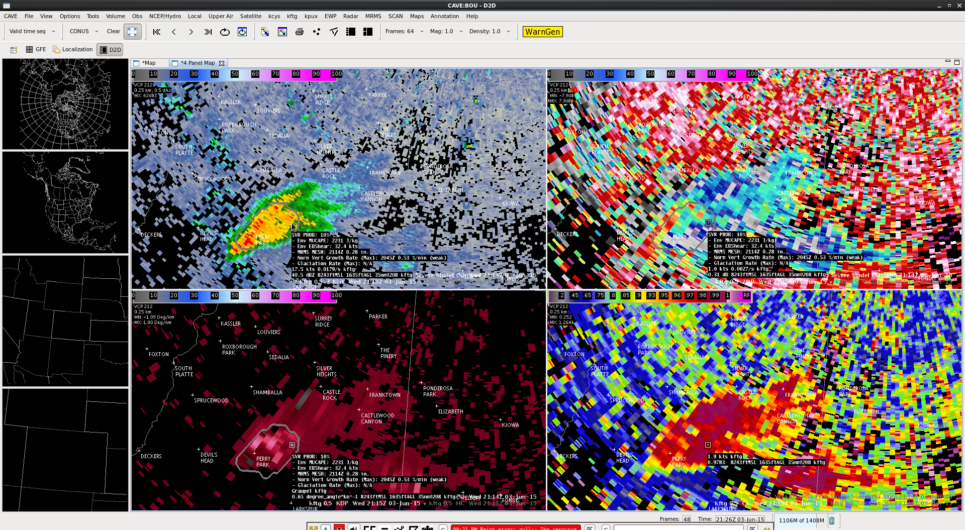
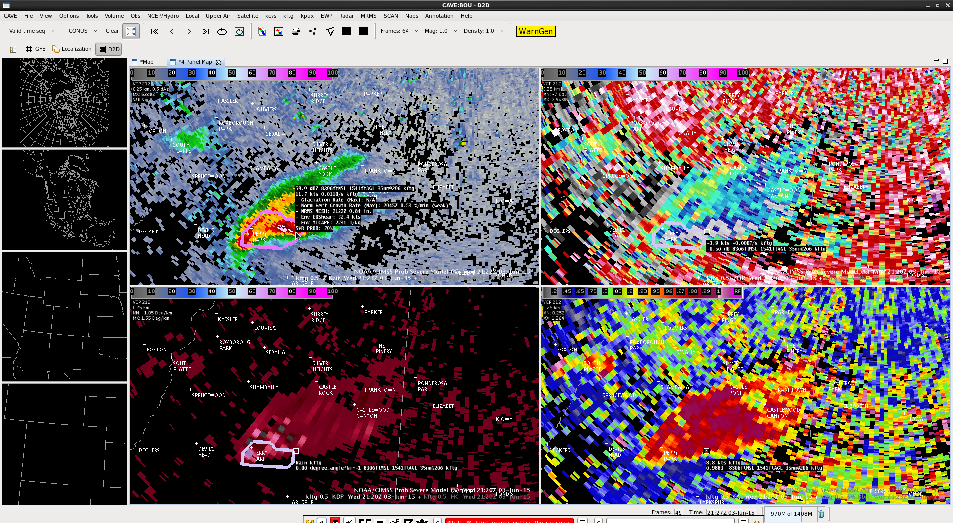
Jason Williams
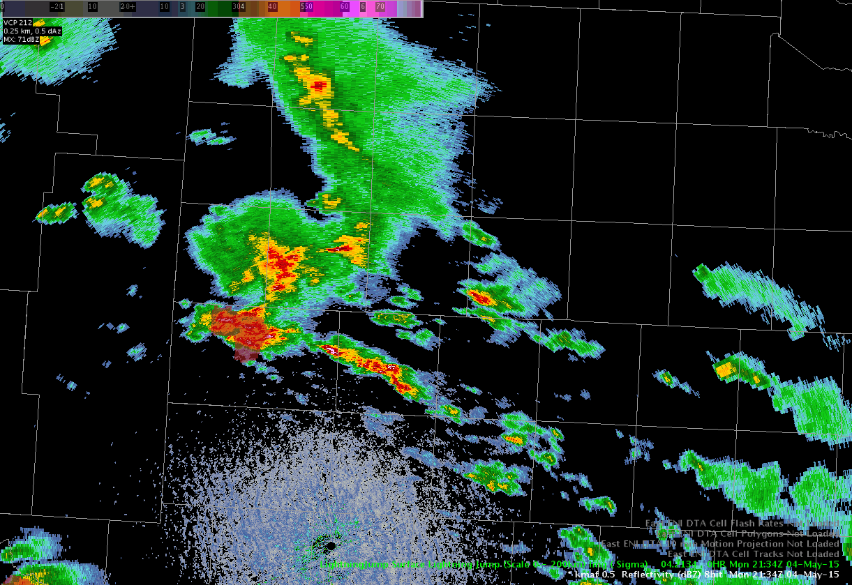
Lightning Jump and Cell Intensification
Another significant lightning jump occurred in west Texas (Midland CWA) around 2134Z (434 PM CDT). The jump was 4 sigma – shaded red below.
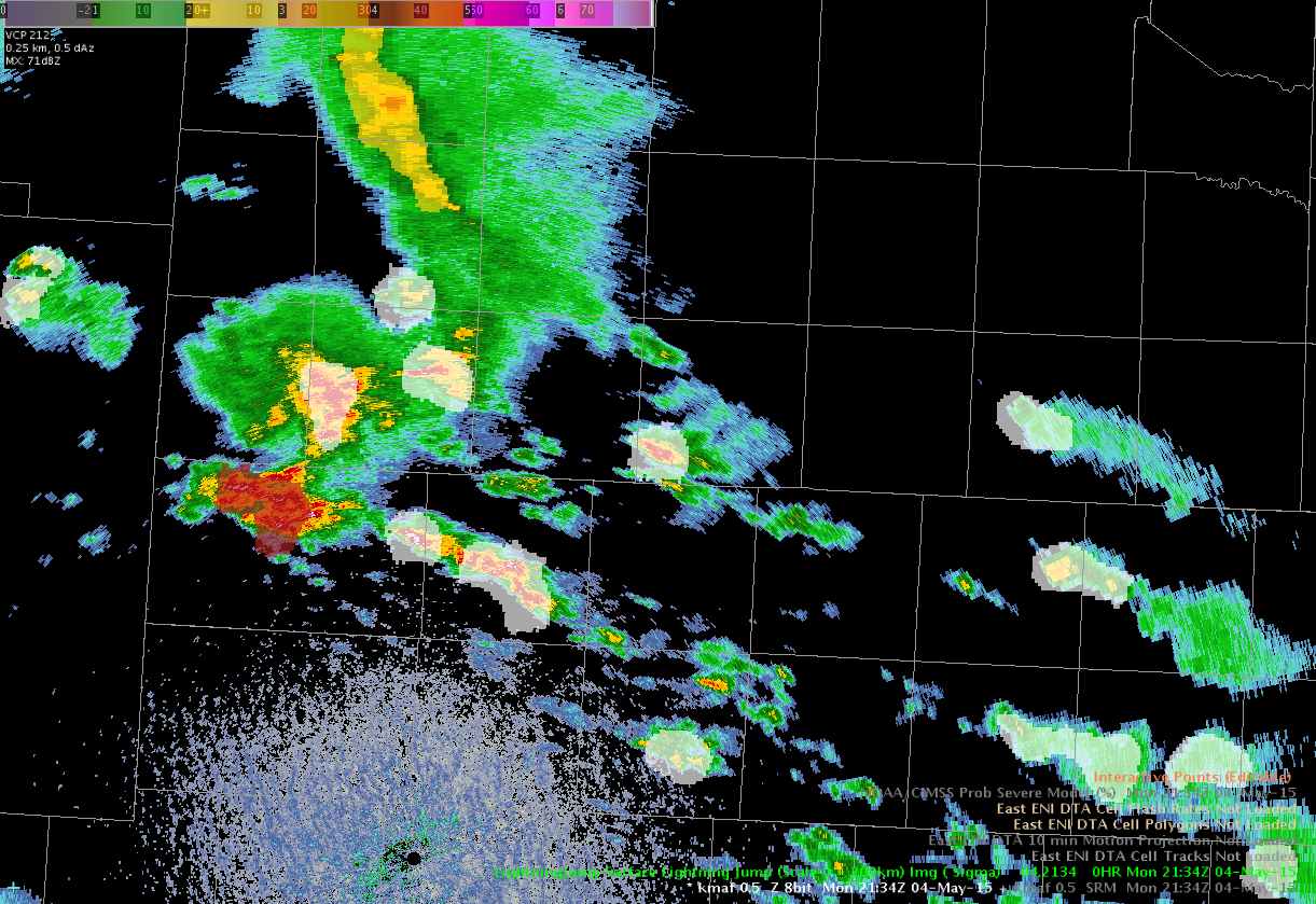
A time series reveals this was the first in a series of jumps.
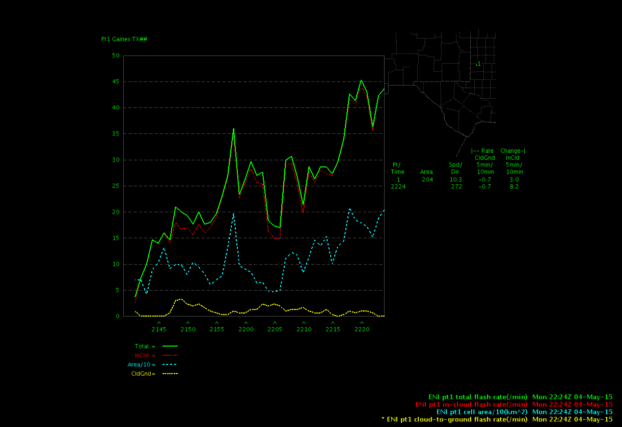
The second jump around 22Z was 2 sigma. A loop of the 0.5 deg reflectivity shows the cell intensifying after the lightning jumps occurred. The max Z at the 0.5 deg tilt increaed from around 63 dBZ to around 71 dBZ in 8 minutes, or two volume scans.
(click image to animate)
In this case, the lightning jump is a good indicator of imminent storm intensification.
-V Darkbloom
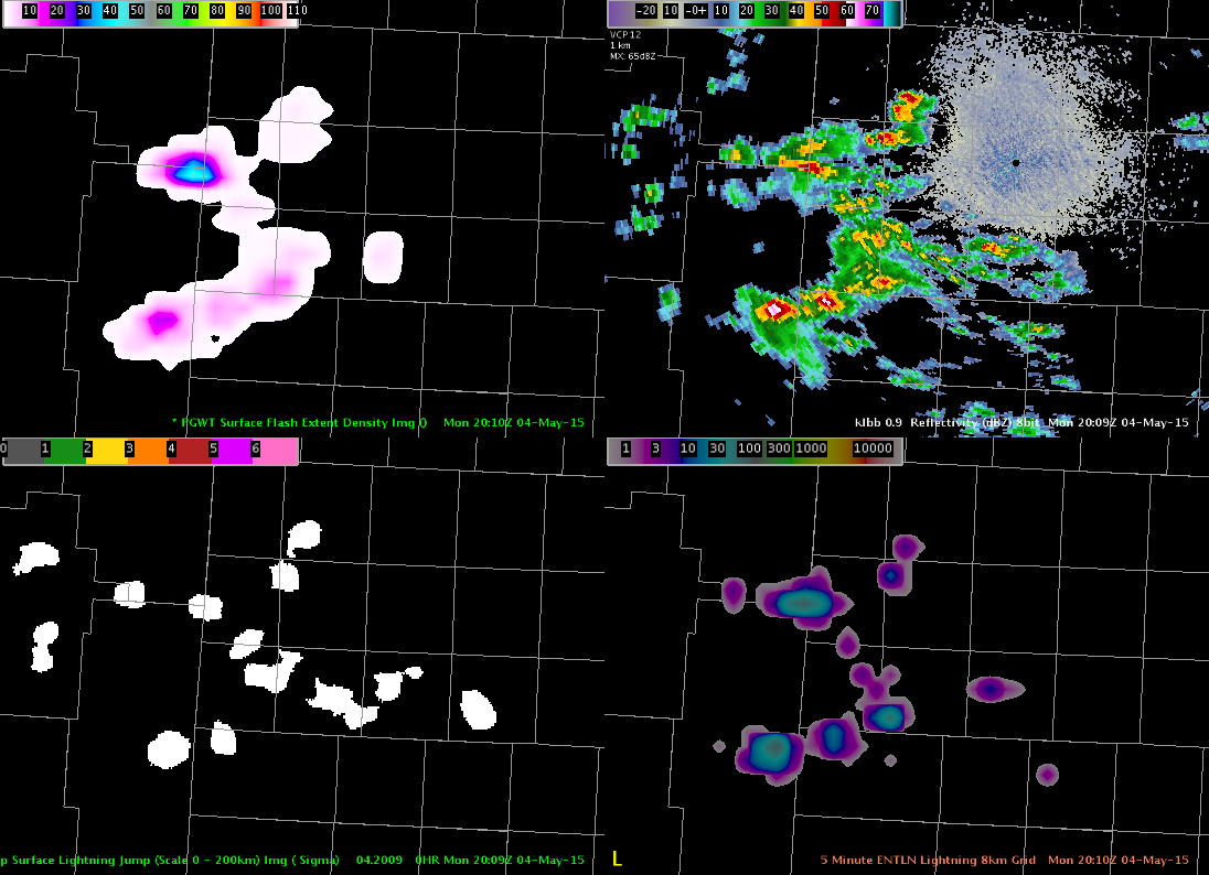
Lightning Observations at HWT
Total lightning has a large role in the Experimental Warning Program this year. We are on day 1 of the first week and everyone is familiarizing themselves with the various products. I have shown an quick comparison of some of the products that we will be evaluating throughout the week.
The storms cooperated by moving into the West Texas LMA domain (Lubbock county warning area) allowing for the first views of the NASA SPoRT pseud-geostationary lightning mapper (PGLM) this year. The image shows the PGLM (upper left), radar reflectivity (upper right), the lightning jump showing the sigma level change using Earth Networks data (lower left), and the Earth Networks total lightning over a 5 min summation and put on an 8 km grid.
The PGLM is showing a maximum value of 41 flashes over a 2 min window with the Earth Networks showing ~40 flashes over a 5 min window. The lightning jump indicated the storm in the north as having a 1-sigma change, which is not enough to indicate severe weather is imminent. The PGLM gives another view of spatial extent of the lightning, which is particularly evident in the northernmost section. The main advantage of Earth Networks is the coverage, unlike the small domains from the lightning mapping arrays that are used to derive the PGLM.
Lightning Jump Really Helps!
I once again was watching a cluster of storms and the lightning jump turned to red. I immediately started to monitor that storm and started to see flash extent density increased. Then Prob Severe started to jump and I actually issued it before it turned hot pink. I will have to see if this verifies but I think I got a jump by at least 15 minutes or so about issuing a warning! ~ Vollmar
Update it did produce wind damage! WICKED AWESOME!