NDAM in my DMA

DMA is a television market area and my home market is next to my assigned CWA for the day. A storm on the fringes of the DMA, approaching the CWA is in a known radar hole…lowest tilt of KPUX radar (Even DDC) doesn’t provide good low-level analysis of storms that far from the dish, but NDAM showing similar detection to existing products at 2308Z…

-icafunnel

Lightning Event Density As A Proxy For Storm Intensity

Lightning Event Density was mirroring the storm near point F for a fair amount of time. Notice how the prob severe graph almost directly correlates to the product. When Flash Event Density decreased, the Prob Severe decreased as well. Greater Flash Event Density seems to correlate to storm intensity.

Lightning Event Density Before Storm Weakens (Point F)
Lightning Event Density After Storm Weakens (Point F)
Trend-line for the storm…notice the drop-off that occurs when the flash event density decreases.

South Beach

All-Sky PWAT

The AllSkyLAP PWAT compared fairly well with surface conditions and the merged product however it struggled in the wake of the front/dryline and was too generous with the PWAT values when compared to earlier UA obs. Values in the warm sector were more representative (higher) than the merged product.

— SCoulomb

NUCAPS Modified Sounding Compared to Surface Obs

NUCAPS gridded 700-500mb Lapse Rate and Modified sounding points.  Lapse rates are favorable for storm intensification across the southern part of FWS CWA.

NUCAPS Modified sounding had 72/69 (temp/dewpoint), compared to closest surface METAR KLHB 74/69 (temp/dewpoint).  This sounding data showed un-capped and unstable environment supportive of surface based convection in southern FWS CWA. -Jake Johnson

Mesoscale discussion using All Sky and SPC mesoanalysis page

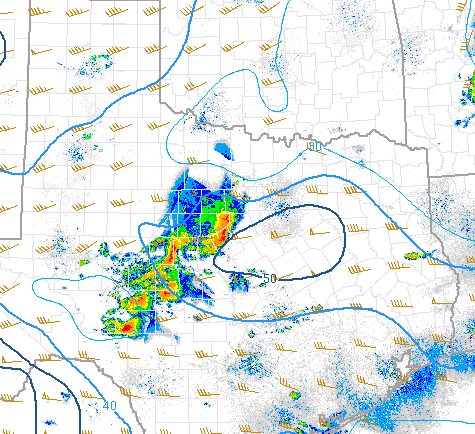
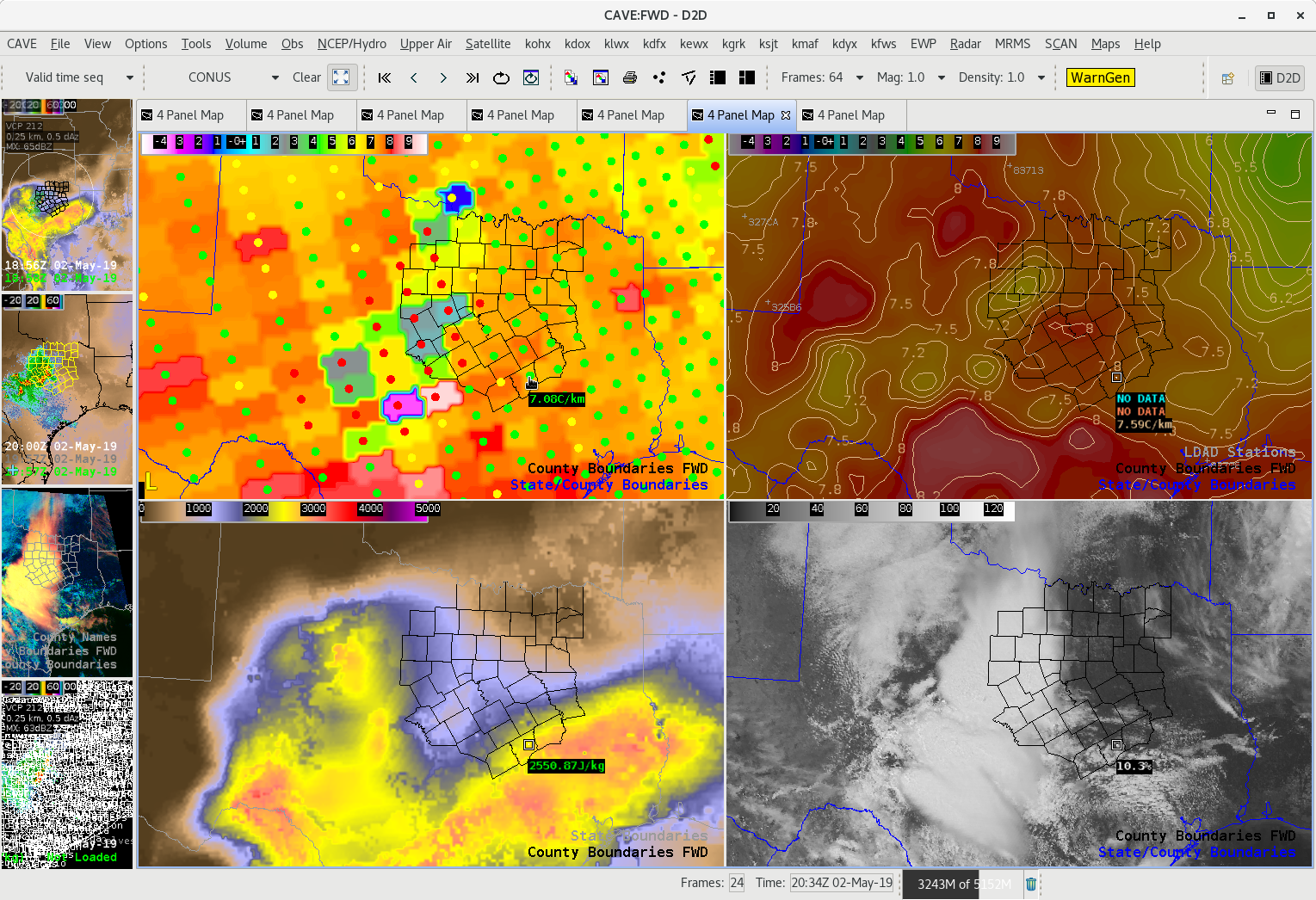
Favorable 0-6km shear aloft from SPC Mesoanalysis page above across FWS CWA

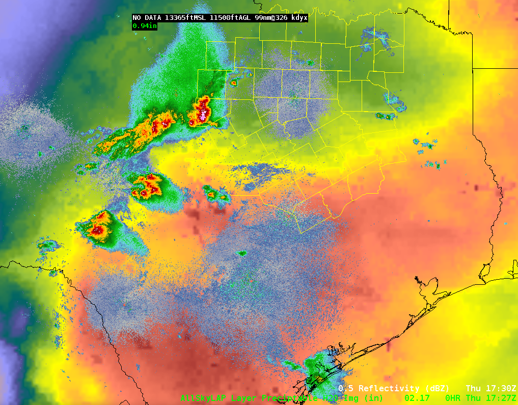
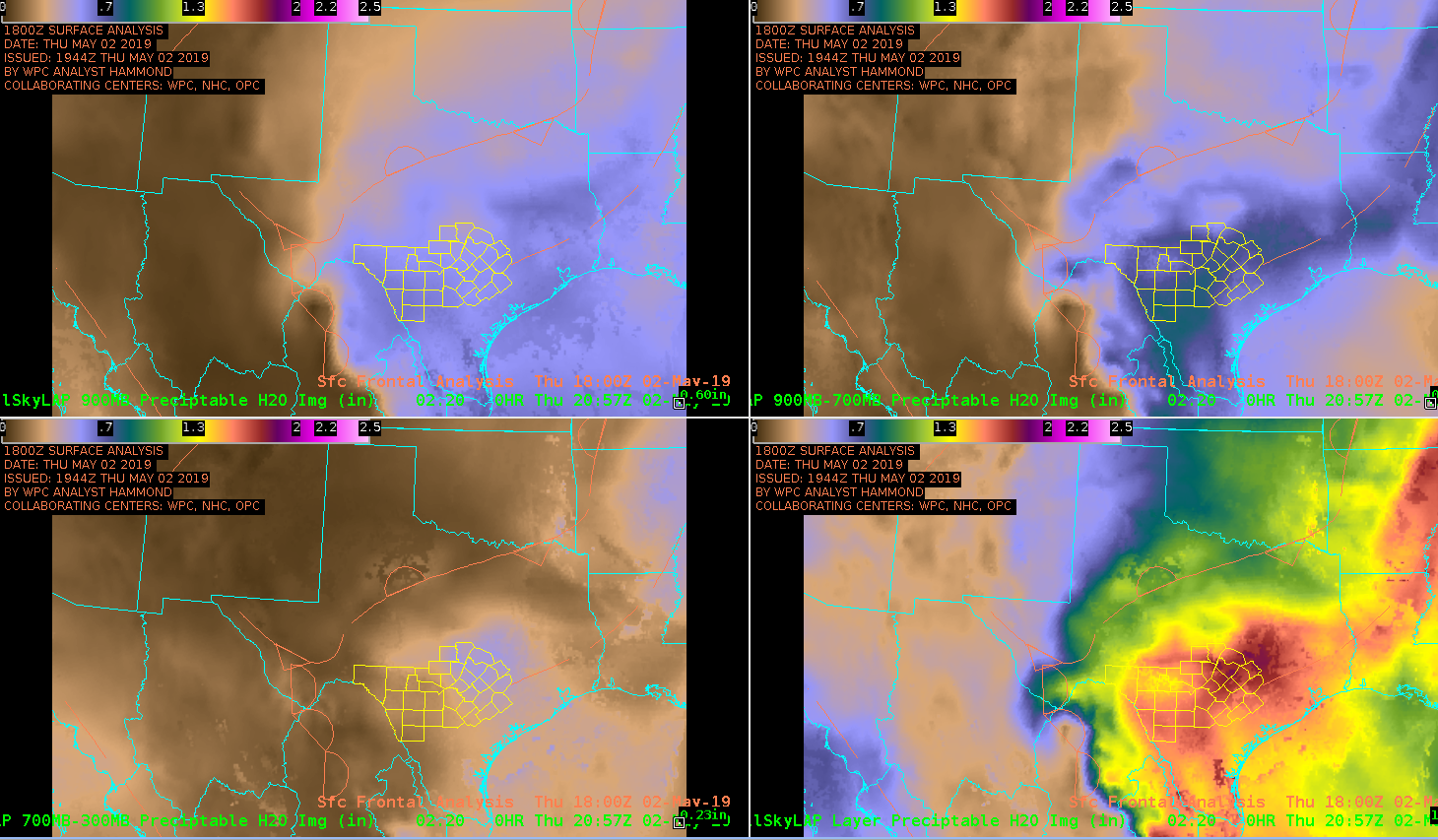
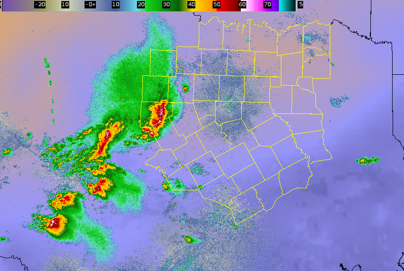
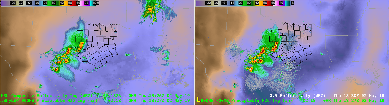
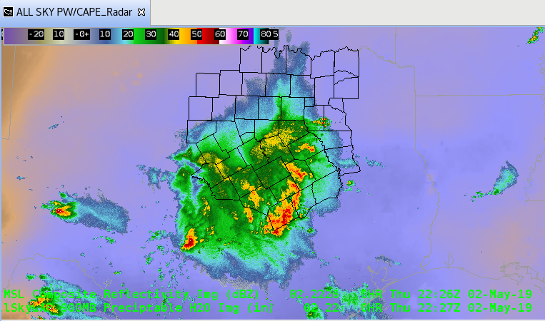
All Sky Total PW above shows deeper moisture in southern FWS CWA.

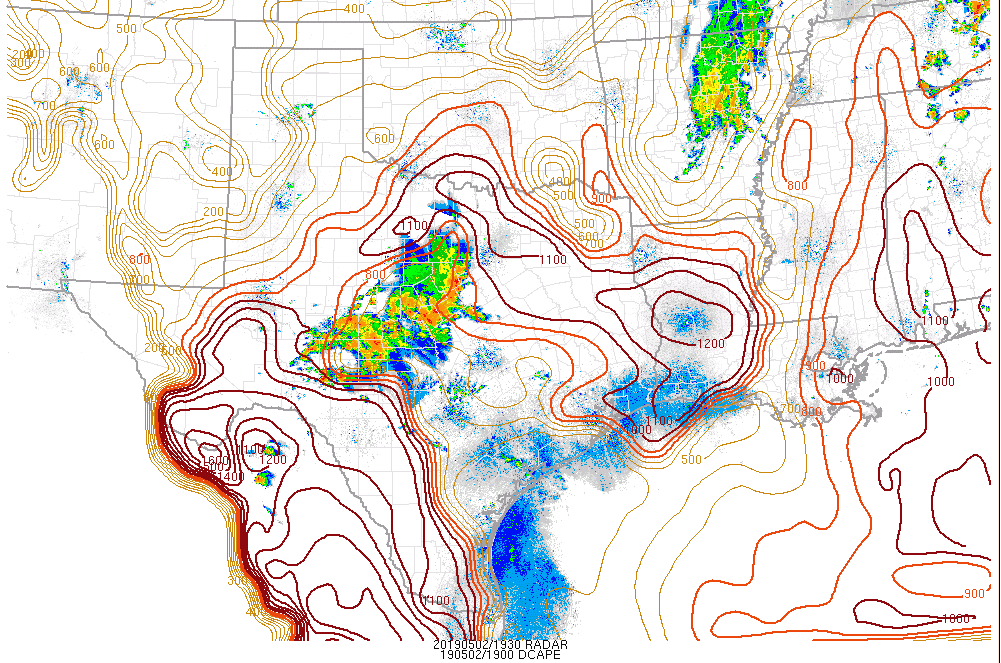
High DCAPE values across the FWS area per SPC mesoanalysis page above


Mesoscale Discussion…40-50kts of wind shear aloft and high DCAPE values show conditions favorable for severe winds to occur, mainly for locations where  All Sky total PW shows strong moisture gradient along surface front in southern part of the CWA.

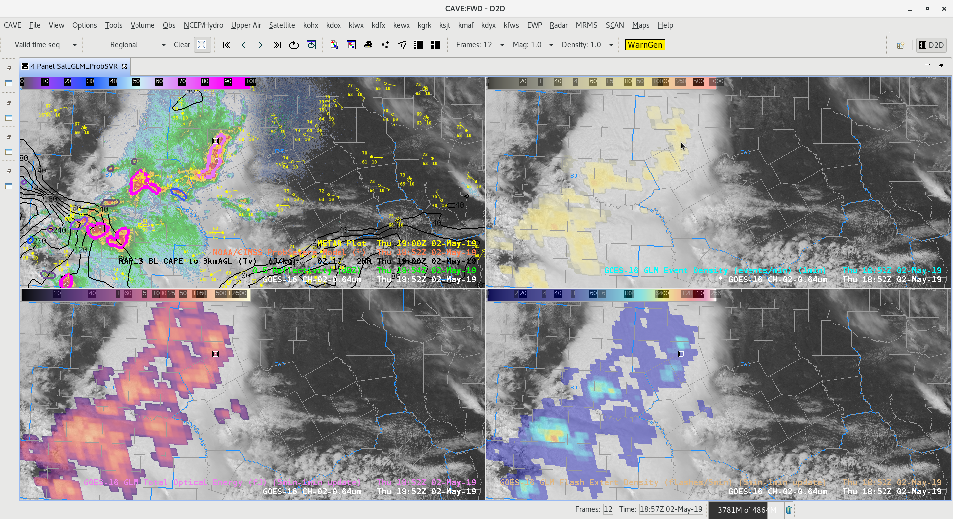
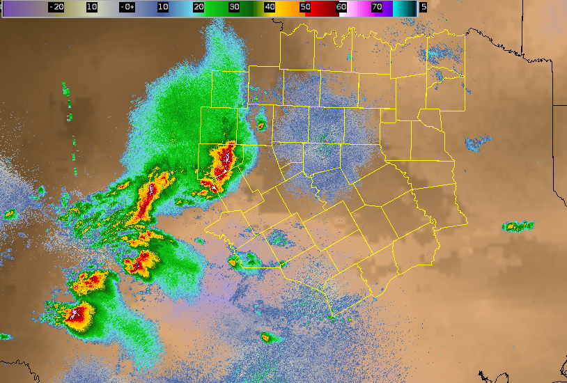
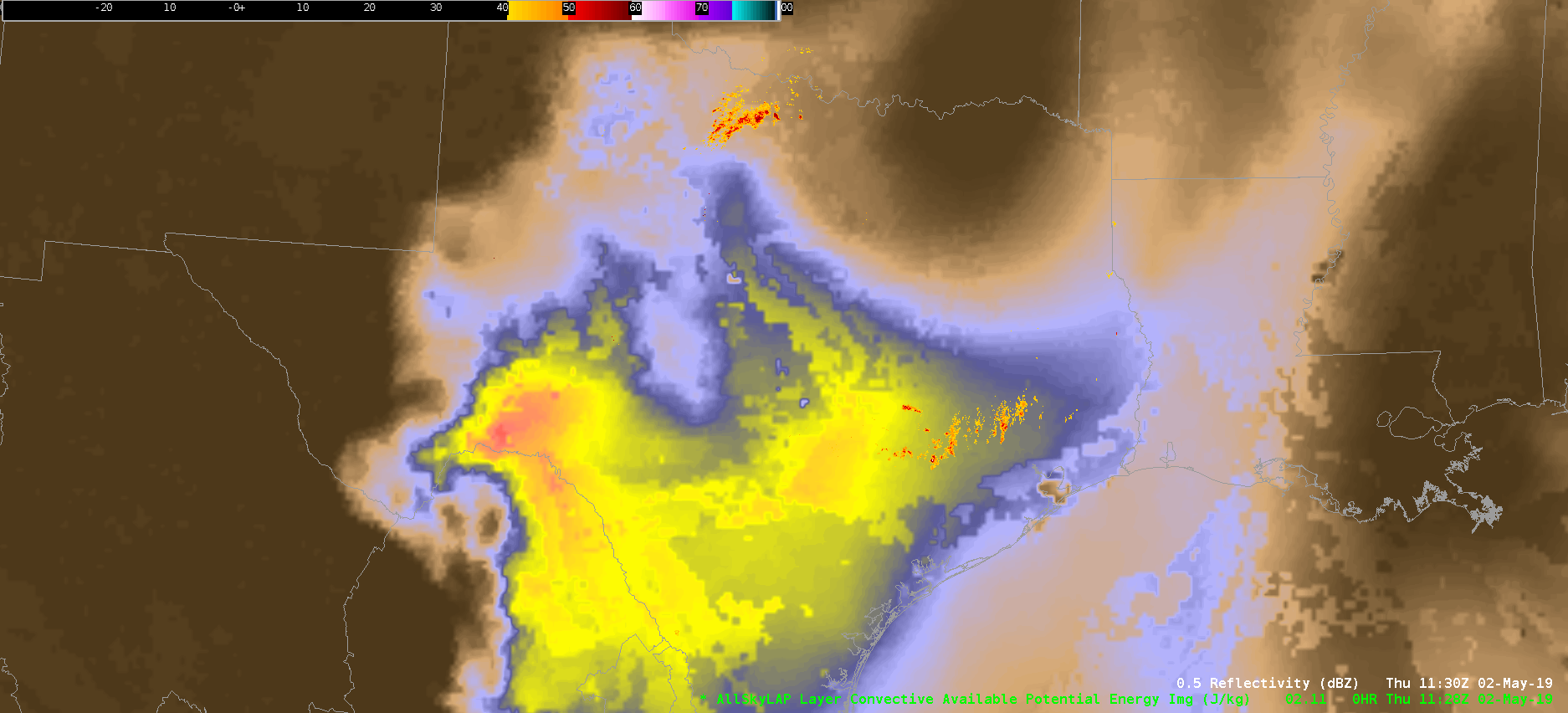
This is a loop of radar and All Sky LAP CAPE.  Notice the higher CAPE values in the southern part of the CWA. This is were linear convection could grow upscale become surface based and capable of produce damaging winds.  -Jake Johnson


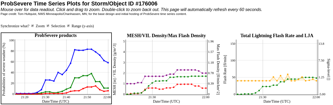
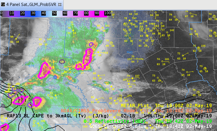
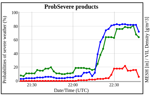
The ProbSevere Wind spiked to 80% with a thunderstorm that later moved across southern FWS CWA, which was our area of concern.
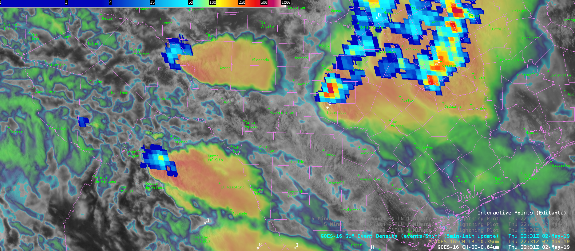
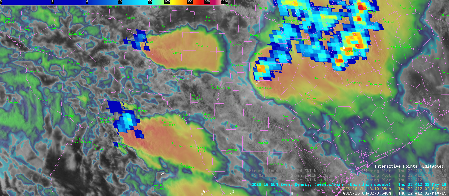
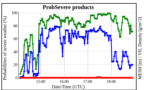
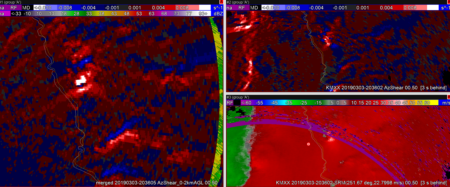
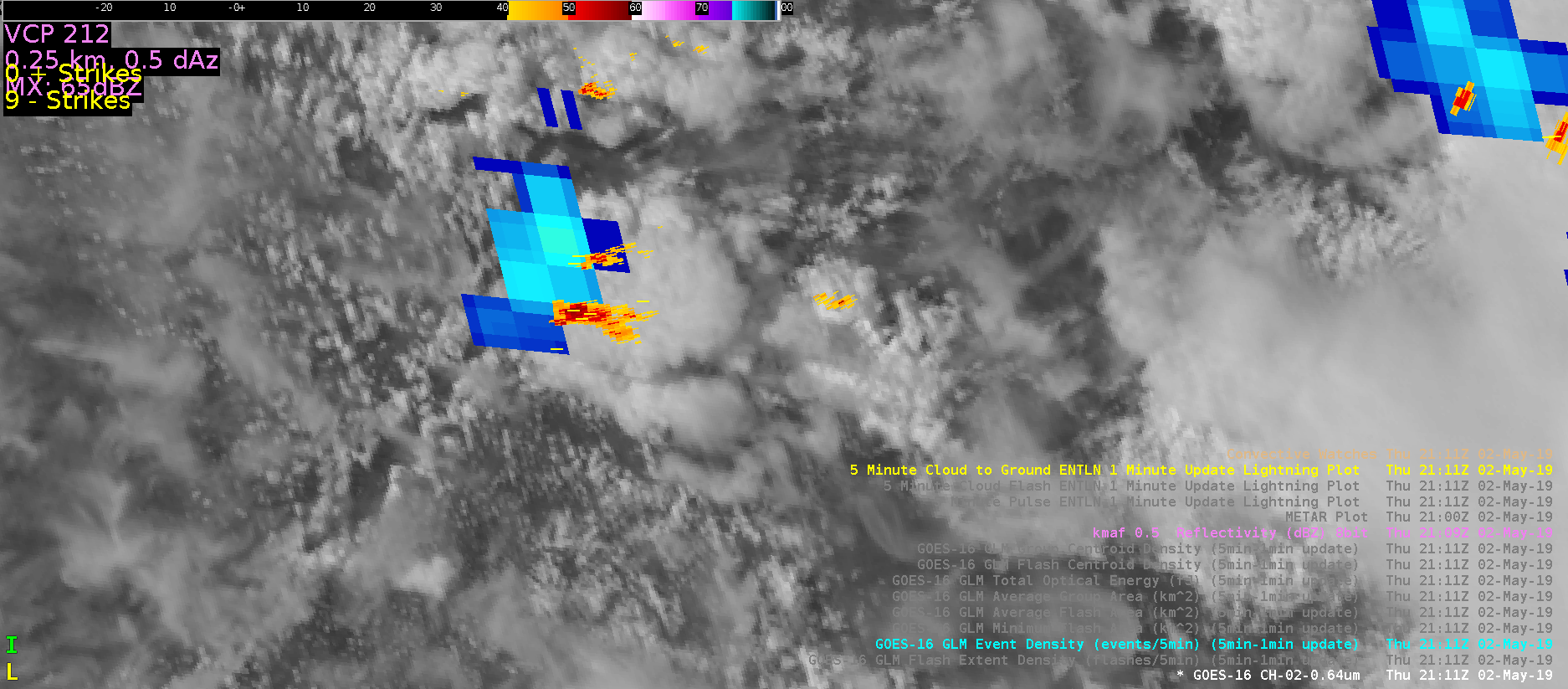
GLM comparison for Line of thunderstorms

A linear storm was moving east across western FWS CWA producing 1″ size hail.  Look at the cursor location, GLM Flash Extent Density and Event Density products were highlighting the most intense part of the storm better the GLM TOE product.  The GLM Total Optical Energy is preferred for initial storm development.  When thunderstorms become mature its best to use the GLM Flash Extent Density or GLM Event Density product to compare storms in the mature phase.  -Jake Johnson

Merged AzShear for the win!


As the circulation moved into the Range Folded area on KMXX, the merged product was available to continue to track the strength/position of it. Even though the merged product showed multiple circulations on previous scans it was still possible to track the shear values through the time the storm of interest was in the Range Folded area which would help with messaging or product updates.

— SCoulomb