

21:45 Z…had an area of 60% CI in NE TN (Claiborne Co.) on Cu developing in conjunction with a little disturbance and perhaps some outflow from convection farther west. No storms an hour later. A reminder to use these tools in conjunction with all your other tools and be aware of the overall set-up. Minima in theta-e and precip. water were trending that direction as well.
Category: General
General Information and News
Surface Convective Initiation Application
The CI product is deemed most useful leading up to a severe weather event. As intended, it seems that it can provide at least an idea where convection will occur. There are two things that came to mind when looking at this tool.
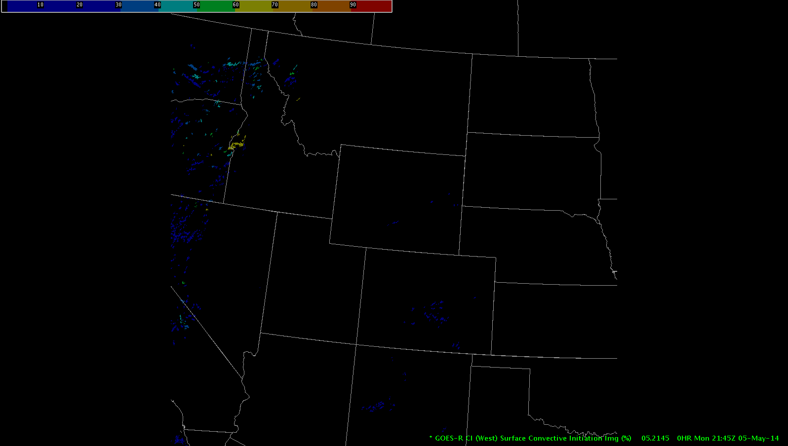
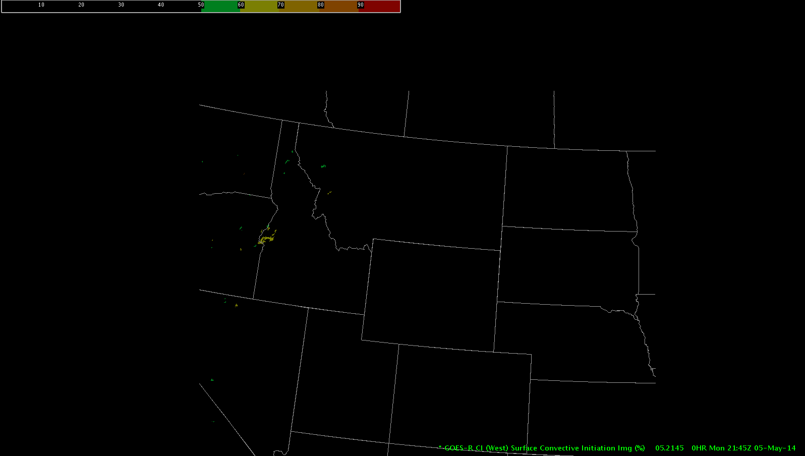
On quieter days this tool can become noisy. By editing the colors in the RGB color model, I was able to black out all probabilities below 50% and to clean up the product. This will bring attention to the higher probabilities, as opposed to cluttering the field with lower end probabilities. The threshold (<20%, <30%, <40% etc) a person chooses to ignore is up to the user. To do this, though, you must continually edit the color model. This isn’t difficult, but takes time. It would be nice if a default button existed that allows you to black out a specified range. Below is a result between the two (normal view 1-100% and 50-100% probabilities, respectively):
The second thought pertains to what application this could have during lake effect snow events. In the proper environment, convective snow banding could lead to heavy, consistent snowfall of greater than 35 Dbz. This may be a useful tool for updates to geographical locations of higher intensity snowfalls in these events.
GOES-R-CI
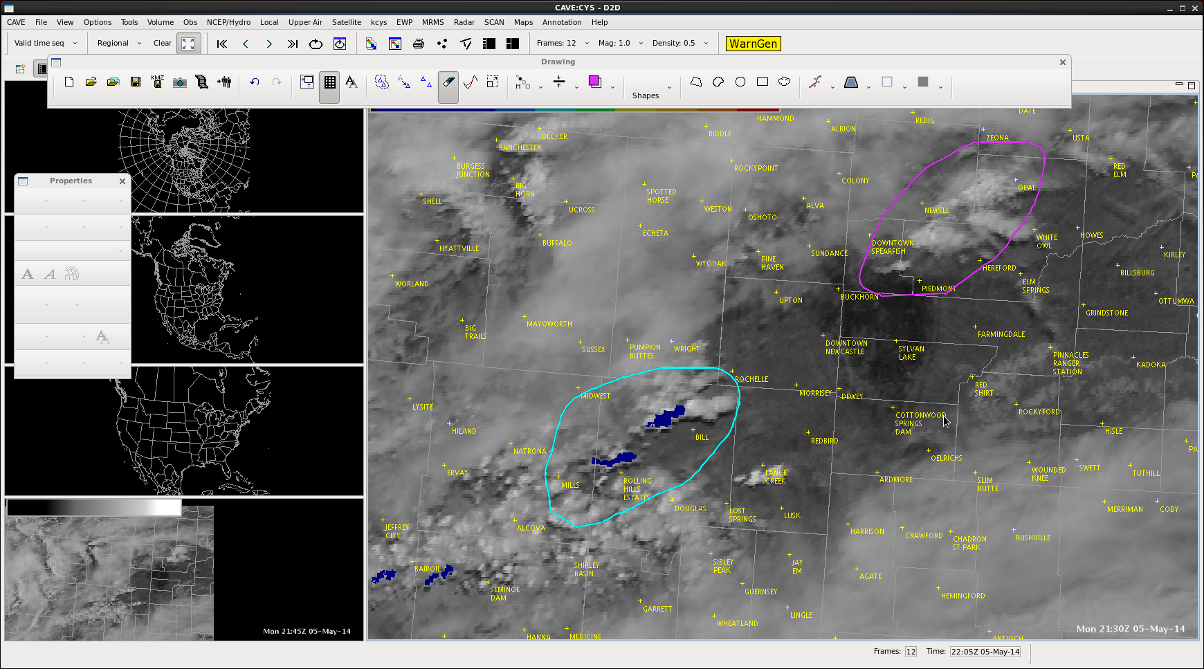
GOES-R CI product shows low chances for convection in EC Wyoming
Isolated weak storms formed just north of the Black Hills with no probability
of CI (could be a thin cirrus issue).
Bthoren
CI indicated 83% chance for a cell in Claiborne, Co., TN as of 21:45Z. Subtle impulse and perhaps outflow from old convection to the east may be puffing up the Cu…we’ll see how it develops over the next hour.—DB
EWP Big Spring Day 1: 5 May 2014
Day one of our Big Spring Experiment and operations are already well underway.
The focus for today is primarily hands-on training. The forecasters have been asked to examine all the experimental products and issue occasional blog posts as they see interesting or note-worthy items. The goal is to develop a familiarity with both the new products and blogging process.
Two forecasters (Thoren / Maples) are localized to the Sterling, VA (LWX) WFO and watching ongoing convection there and areas south including the Blackburg, VA WFO. The other forecasters (Rudge / Bickford) are localized to the Cheyenne, WY (CYS) WFO, monitoring the region for CI.
As the week continues, are focus will become a little more defined and move to writing mesoscale / forecast discussions and warnings. Expectations are that the probability for severe convection will increase with each day of operations this week.
-Kristin Calhoun, Week 1 Coordinator
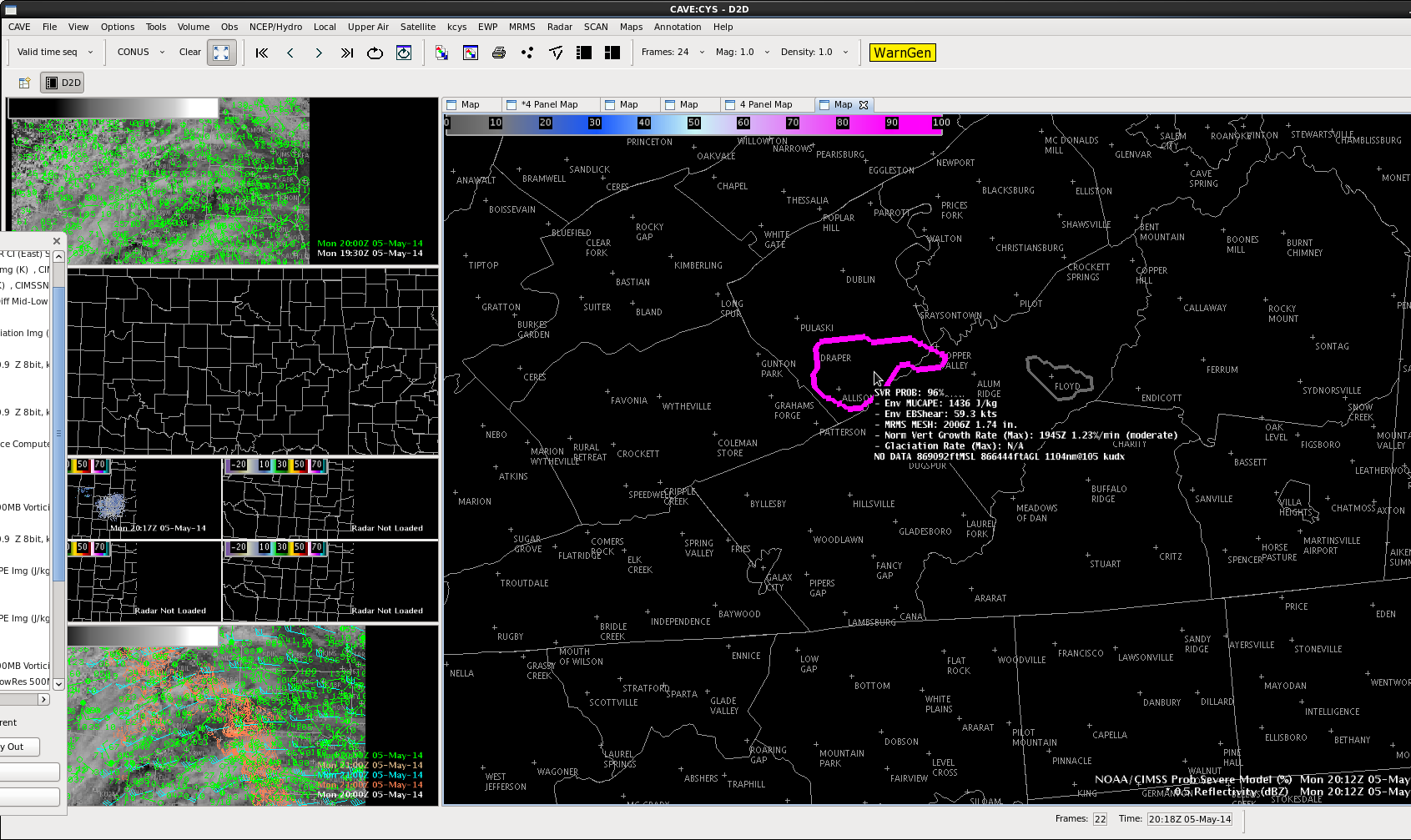
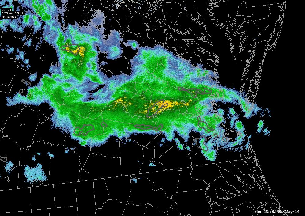
Western VA High Prob Storm
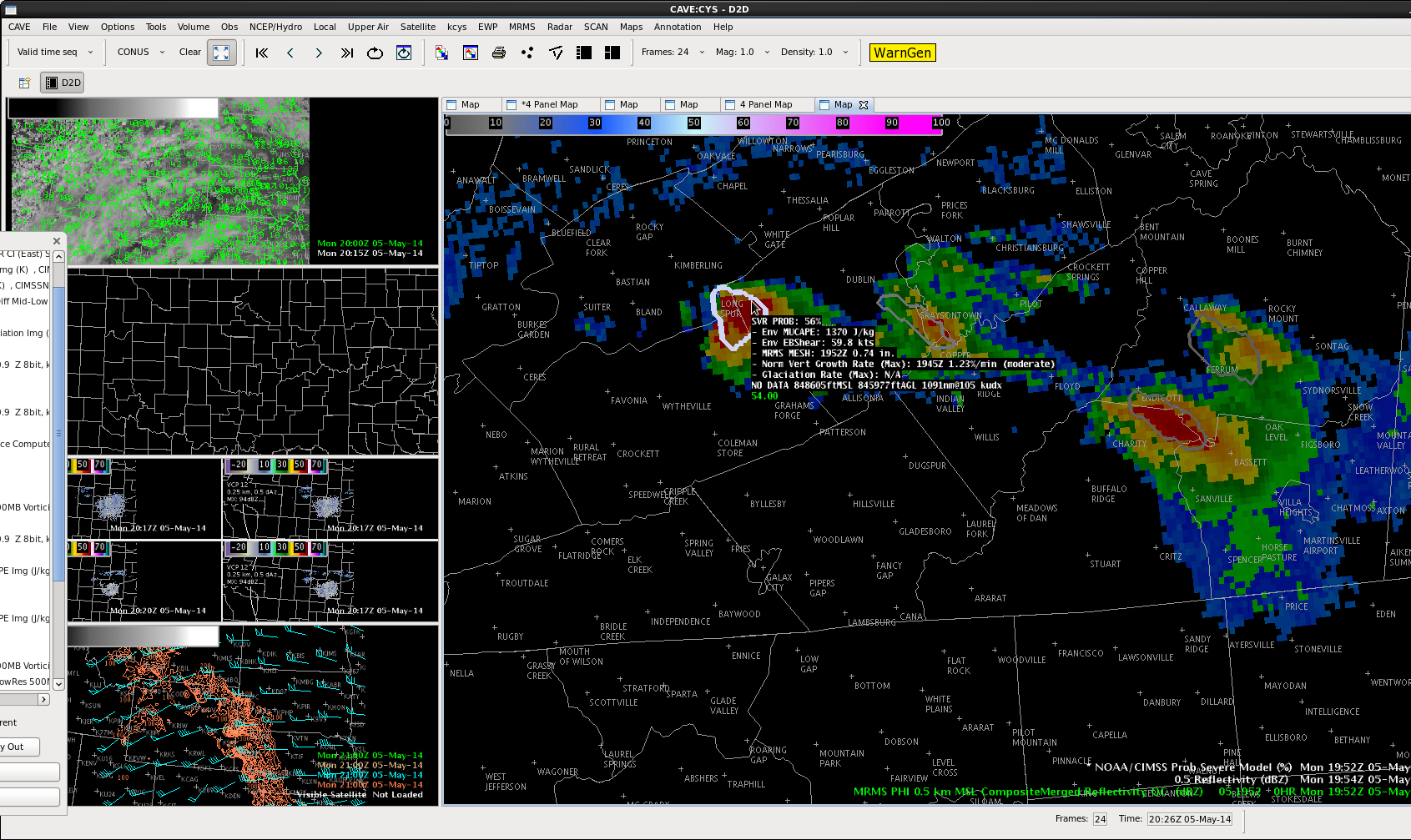
A storm developed in Western Virginia around Long Spur, just west of Pulaski. In early stages of development, probabilities of severe weather occurring were low. Radar reflectivity was generally between 50-60 Dbz. Severe probability quickly increased from 11% to 96% within 18 minutes. In the same time span reflectivity of up to 71 Dbz was detected. MRMS MESH maximum was 1.74 inches, while there was a notable increase in MUCAPE and EBSHEAR.
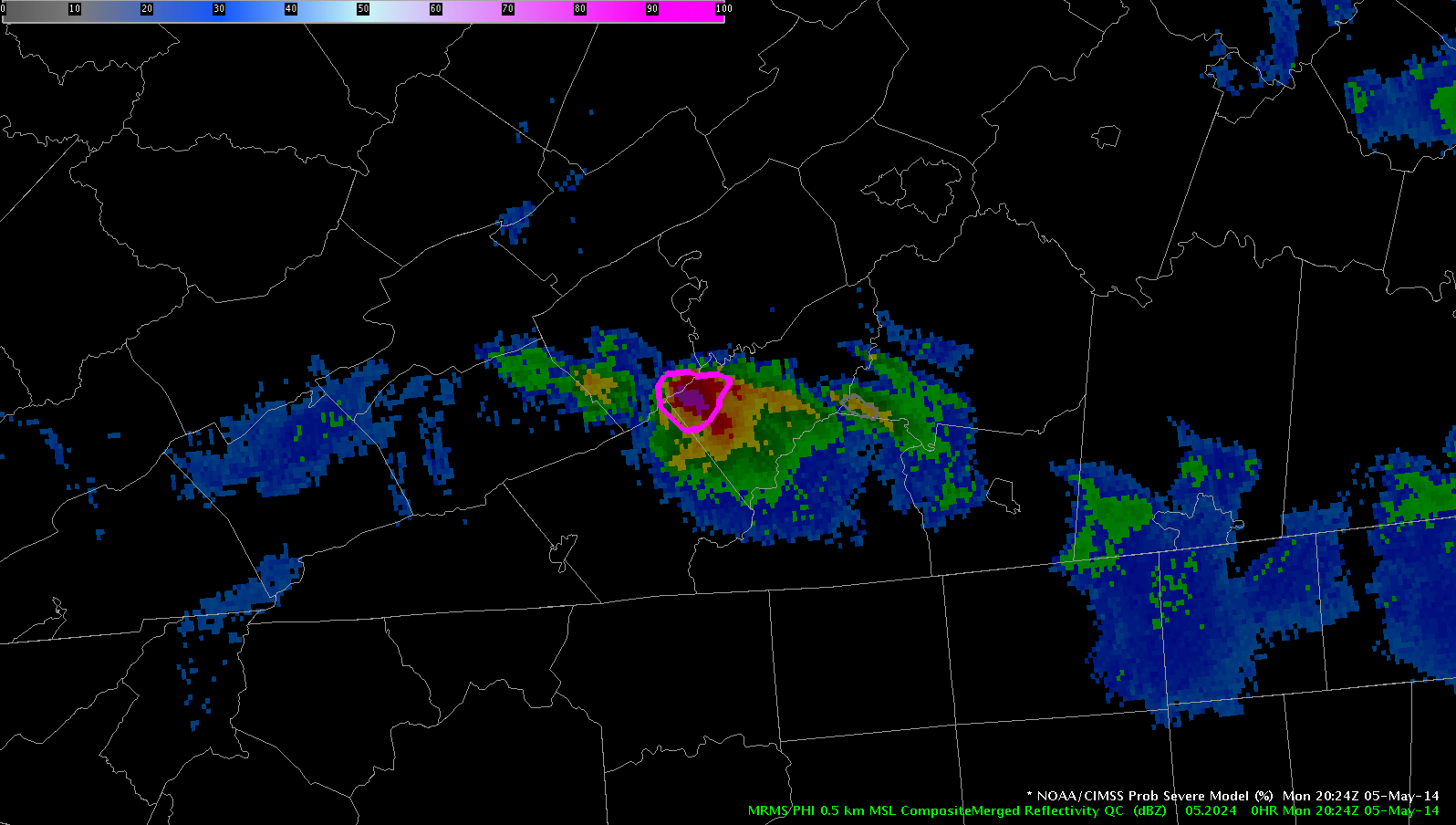
Prob Severe Model
Not really our area today, but prob severe model indicated
a 56% chance this storm would produce severe weather
at 1950Z . At 2012Z prob was up to 96%. Model has
low probabilities with other storms in area.
b thoren
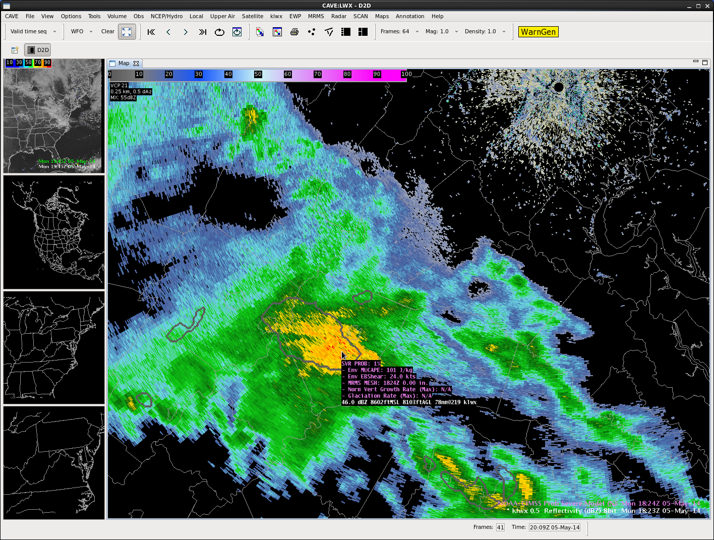
Prob Severe in VA
Probability of this cell in VA producing severe wx in the next hour is 1% !!!
Scott Rudge
Watching Testbed Tools Cinco de Mayo
Been watching an area of showers across central Virginia…located north and east of a cold front.
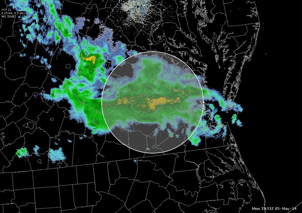
Typically would not expect to see vigorous convective development in the relatively stable air here. The NOAA/CIMSS ProbSevere Model agrees….it’s been outlining some cells, but typically have not seen anything higher than a 10% severe probability.
Of some interest is the GOES-R CI model, which for a time pegged a 60% chance for some more cell development to the south and west of the current area of precipitation in southwest VA. Surface analysis shows this area to be much closer to a surface boundary separating 80s from 60s.
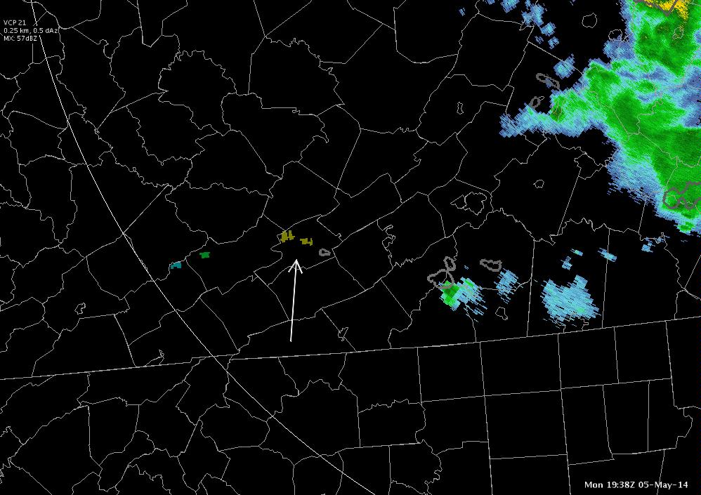
Some further monitoring of the CI has seen the value dip back into the 40% range within about 15 minutes time. Will be interesting to see if this parameter continues to move some over the next hour or so…or if any development actually occurs.
UPDATE
Convection developed within the hour…with high severe probs!
Also to be noted after the fact: the forecast theta-e difference between 500 and 780 mb leading into the convection showed a nice and persistent…although not overwhelming in magnitude (-6 at worst)…piece of instability rolling into SW VA.
So far, the forecast tools have done a good job in pointing to an area…even if it was marginally outlooked this morning…of an area of vigorous convection that did develop.
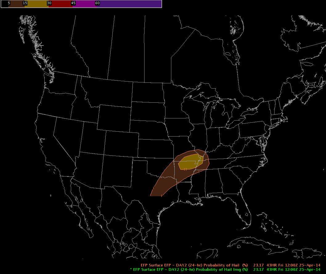
Probability of Hail
Probability of hail over the next 24 hours.
Scott Rudge