0012Z 4 June: 1KM Vis and OT detection


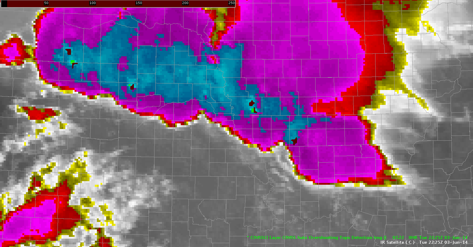
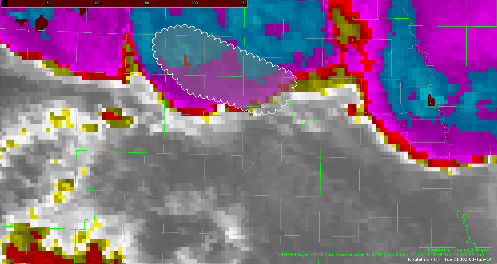
1km vis and OT detection.
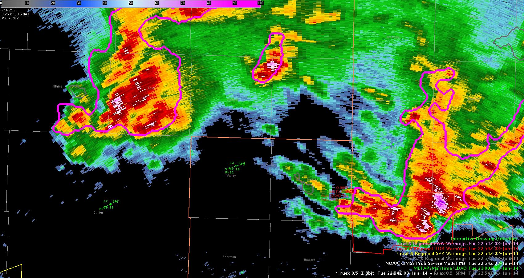
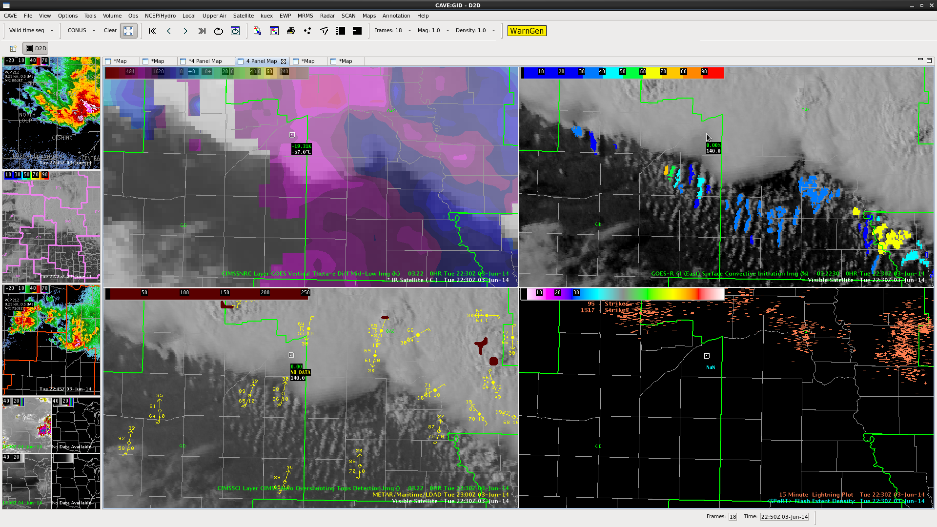
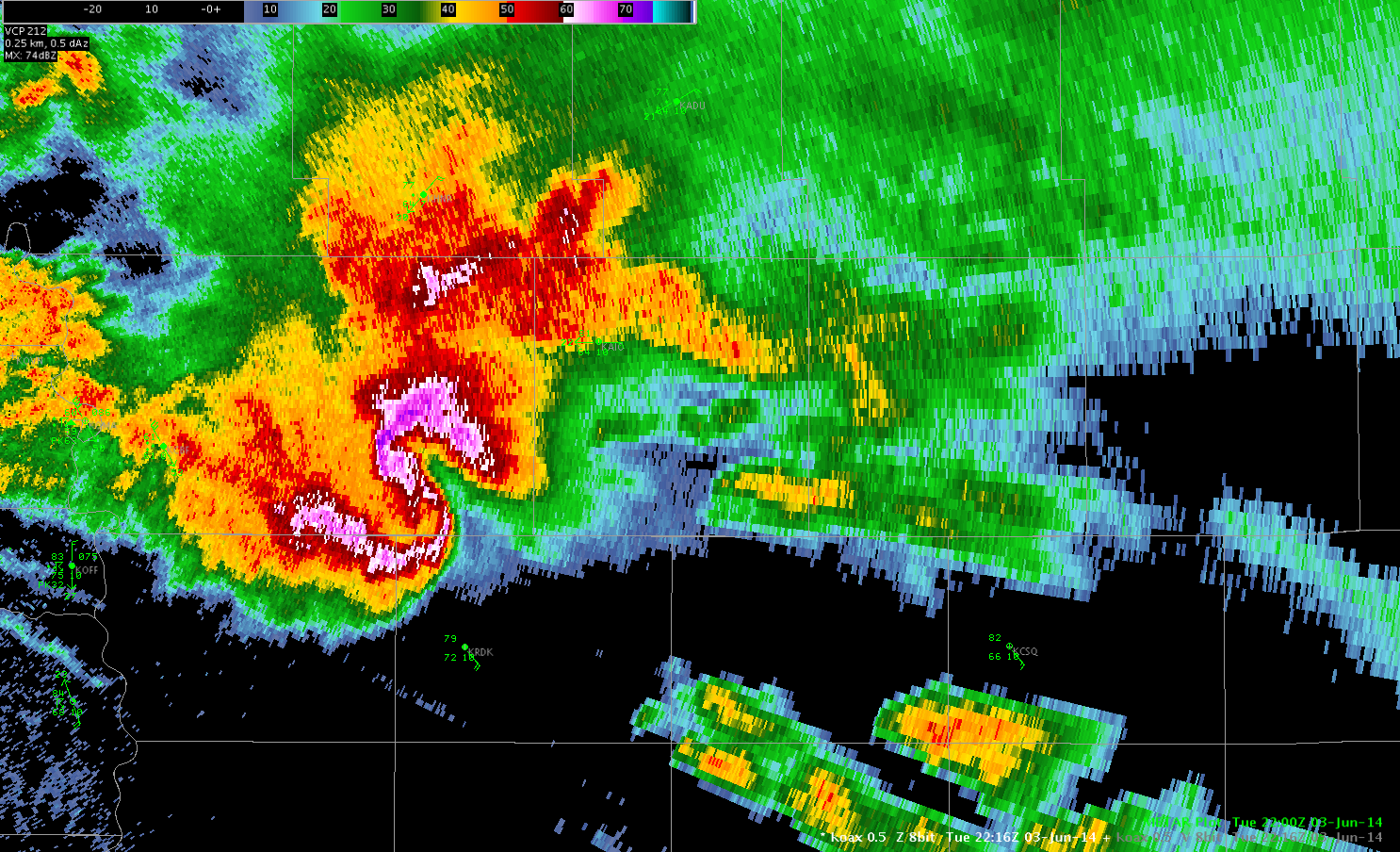
An example of the display on awips 2 showing mature supercells and the OT detect. With no visible imagery at night this would be an exc. discriminator of severe cells. Prob Severe on all of the storms with OT detect was over 90%, The VLAPS Cape was useful in analyzing the environment of the far western storm (It was at the edge of the domain) which is in a small area of high instability but surrounded by much more unfavorable environment.
D Satterfield


1KM VIS

Tags: None

North Platte Hail – 2238 UTC

Got a report of golf ball sized hail 8 South of North Platte at 2238Z.  At this time, ProbSevere was low – about 40% and did not encompass LBF at all (see image).  MESH at this time was also low – 0.56.”  The hail core was fairly small – and maybe the report is suspect??  It was from a trained spotter.  Possible example of ProbSevere being underforecast.ProbSevere

Tags: None

2305Z Cell near KLBF.

Cell near KLBF had rapidly rising prob of SEVERE (during the time of the spotter report, but MESH below one inch. Trained spotter report of golf ball hail at 2238. Have serious doubt (based on past experience over many years!)about spotter report based on storm core and satellite presentation/MRMS VIL etc.north platte 2300

DSatterfield 2315Z 3 June

Tags: None

prob severe to warning

probseveretowarningThis storm in the NW corner of the picture has a prob severe of 97% with the probabilities 95% or above for more than 15 min. The MESH has consistently been 15 inches or larger. We are getting ready to issue a SVR based on this info and the fact that North Platte WFO has a warning on the storm.

jca

Tags: None

Overshooting Top Update 2253Z

Discussed the OT apparent miss with forecasters here and after looking at the 4KM IR data it was clear that there was not enough difference to trigger it. It was borderline in the 1km vis but when the GOES R resolution is available this will become a very valuable tool, especially for nighttime use.  DSatterfield WBOC Salisbury md.IR OT

Tags: None

CI helpful again…

CIhelpfulNow that cirrus has pushed off to the NE…we are finally seeing increasing trends in the CI just on the SW edge of the large supercells in NE GID CWA. Values have gone from nothing to 61% in 12 min.

jca

Tags: None

New Storm South of North Platte – Storm of the Day???

Many of the prognostic fields continued to show CI south of KLBF in that 21-22z timeframe – from the VLAPS and OUNWRF.  These were both too early with the CI – with more vigorous development evident as of 2215Z.  Prob severe quickly rose:

2214:  16%

2216:  53% (SVR issued here)

2218:  53%

2220:  78%

2222:  85%

ProbSVR_SouthofNorthPlatteMike Fowle

Tags: None

overshooting tops

overshootingThe hatched area shows pretty much continuous overshooting tops along with numerous reports of golf ball size hail and several tornadoes. This product is useful for this purpose because the radar is sampling these storms at or above 10kft.

jca

Tags: None