NMDA Tracking well thus far in Tx

Below is a loop of NMDA on the top left, and the operational MDA on the top right. The NMDA seems to be tracking the mesocyclone moving north of Amarillo fairly well as object 2. It does occasionally identify spurious mesos as well (the smaller circles which pop up), but it does seem to have done a better job of identifying and  tracking the primary meso when compared to the operational MDA.

-64BoggsLites

Mesocyclone Detection Algorithms Performance on Marginal Supercell(s)

A cluster to 2 merged supercells traversed across northern Oklahoma this evening. The loop below shows the performance of all three mesocyclone detection algorithms.

The legacy MDA performed the most poorly of all 3 detecting several inaccurate mesocyclones with inconsistent tracking. The DMD performed remarkably well in both tracking and intensity on the main meso  The NMDA experienced occasional dropouts where data was unavailable, but also performed pretty well on this storm. It particularly detected intensity well through the lifecycle of the meso.  The AzShear product also tracked the main mesocyclone very well. The DMDA performed best of all three for this storm  but the NMDA also showed promise. -Atlanta Braves

NMDA Struggles to Identify Tight Rotation

The new MDA seems to be missing out an area of obvious rotation in central OK Wednesday afternoon. The new MDA (upper right) has no storm ID on the couplet, but the digital MDA (bottom right) has correctly identified the mesocyclone. The problems may be due to quality control within new MDA, as the rotation is occurring within an area of low reflectivity (upper left) and high spectrum width.

Dave Grohl

NMDA slow to identify St Louis supercell

The NMDA initially identified a mesocyclone with the embedded supercell at 2253Z, however the storm was exhibiting supercell characteristics for at least 15 to 20 minutes before this time, including a very well defined bounded weak echo region capped off by a 70+ dBz echo above 20 kft. Below is a loop showing the line approaching St Louis with NMDA overlaid.


Below are 4 panel radar images from klsx at approximately 2235z (nearly 20 minutes before the NMDA first identified a mesocyclone), showing the 8.0 (top) 4.0 (middle) and 0.5 (bottom) elevation cuts. A very well defined bounded weak echo region is evident in the reflectivity images in the top left.

-64BoggsLites

NMDA vs MDA observations

Looking at the line moving into the LSX CWA and comparing the legacy MDA to the NMDA, a couple things are evident. The legacy MDA (not shown, couldn’t get the image to save properly) only identifies a couple mesocyclines further south along the line, but identifies them both as being in the lowest scan. The NMDA on the other hand identifies numerous circulations along the line, however none of these are identified as being at the lowest elevation slice.  Granted the algorithms typically struggle with linear features, but the MDA seems to be filtering out a lot of the noise and keying on the two stronger areas of rotation while the NMDA seems to be overly sensitive to shear along the line.


update…. as the line gets closer to the RDA the NMDA has now detected several areas of rotation which are marked with cross hairs. Again the algorithm does seem to be too sensitive with identification of mesocyclones.


-64BoggsLites

The good and bad of Prob Tor/AzShear/Meso Detection Algorithms

The image below looks at 2 cells in central Oklahoma. The northern cell has a prob tor of 77%, but is falsely lightning up a shear zone with little chance of a tornado. The southern cell shows all the characteristics of a tornadic supercell, but has a prob tor of 37%. However, the southern cell is closer to producing a tornado (via live media).

Here’s another image using KVNX instead of KTLX, and shows only the prob tor.

The two cells to the north have 90 and 91 percent, respectively, while the southern supercell has only 33 percent.

Not to pick on the prob severe product, the meso detection algorithms a similarly struggling. Below is a 4-panel showing the legacy mesocyclone alogrithm (upper left), the digital mesocylone algorithm (upper right), the low level AzShear (lower left), and the experimental meso algorithm (lower right).

All three detection algorithms are flagging the circulations as equally important, but an examination of the base data shows otherwise.

Thorcaster

Bad Velocity Data Trips Alogrithms

Just after 20z on the eastern fringe of the LUB CWA, the KFDR radar indicated an area of very high inbound velocity. However, this data is in question as the elevated velocity occurred in an area of low Z and high SW, and likely not representative of the actual storm. This may have been caused by a side lobe. This had cascading affects with algorithms being tested which could not filter out the bad data. Low level az shear spiked to over 0.01 in a group of stationary pixels. This caused algorithms that ingest the az shear product to spike including ProbTor which increased to over 90%, as well as CPTI which showed lower end probabilities of a violent tornado in progress.

Dave Grohl

NMDA sensitivity issues. No anticyclonic detection either.

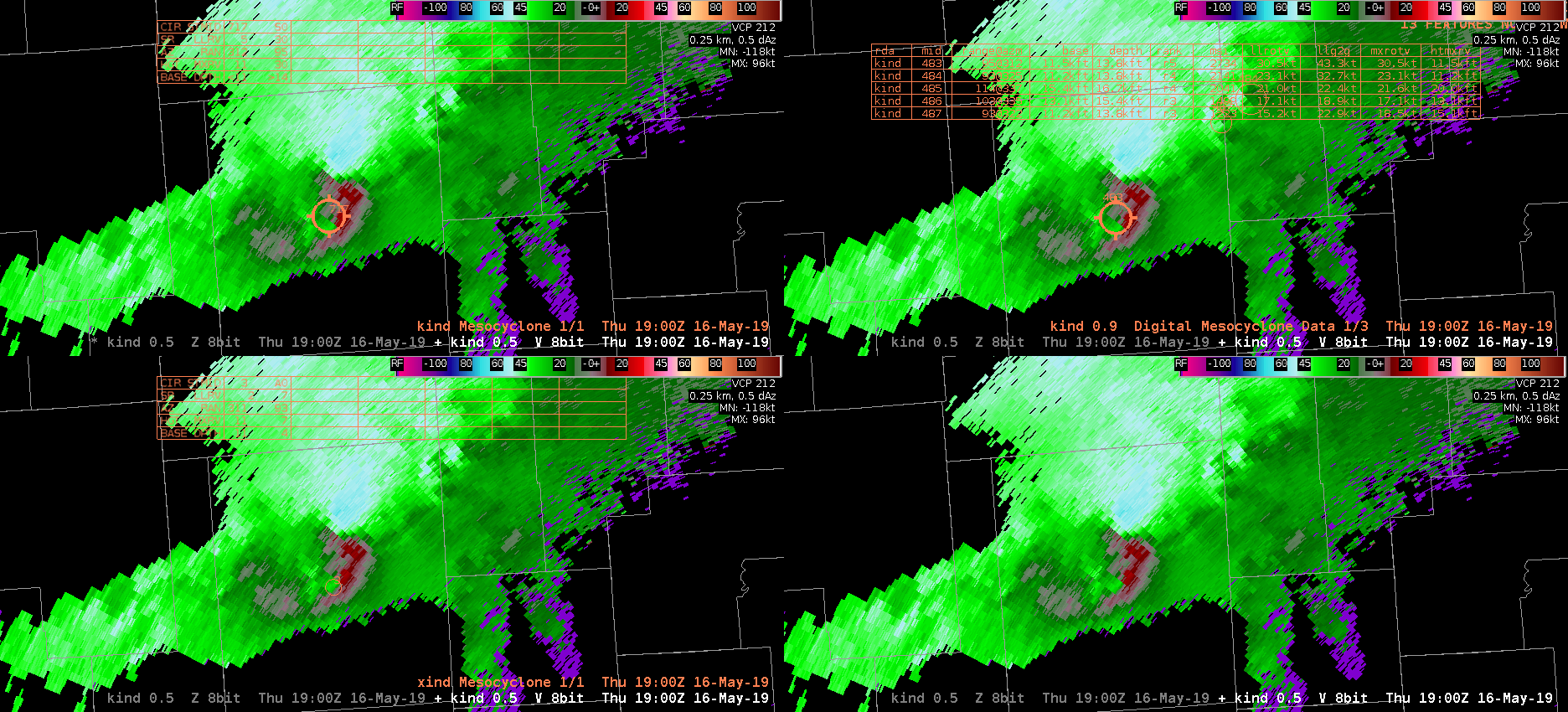
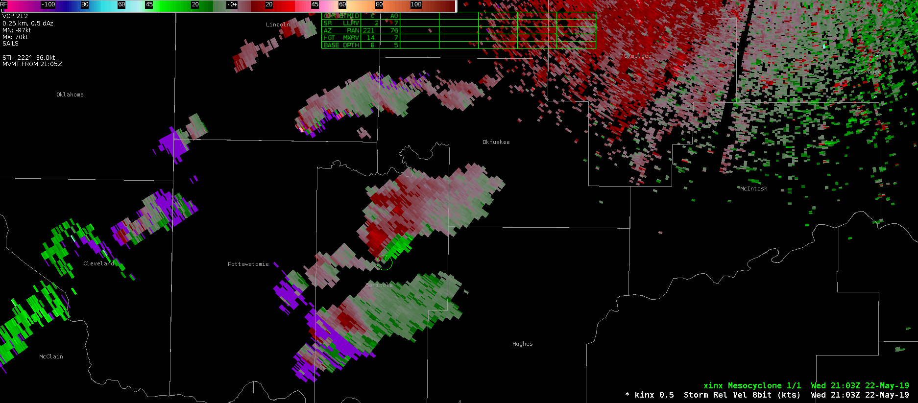
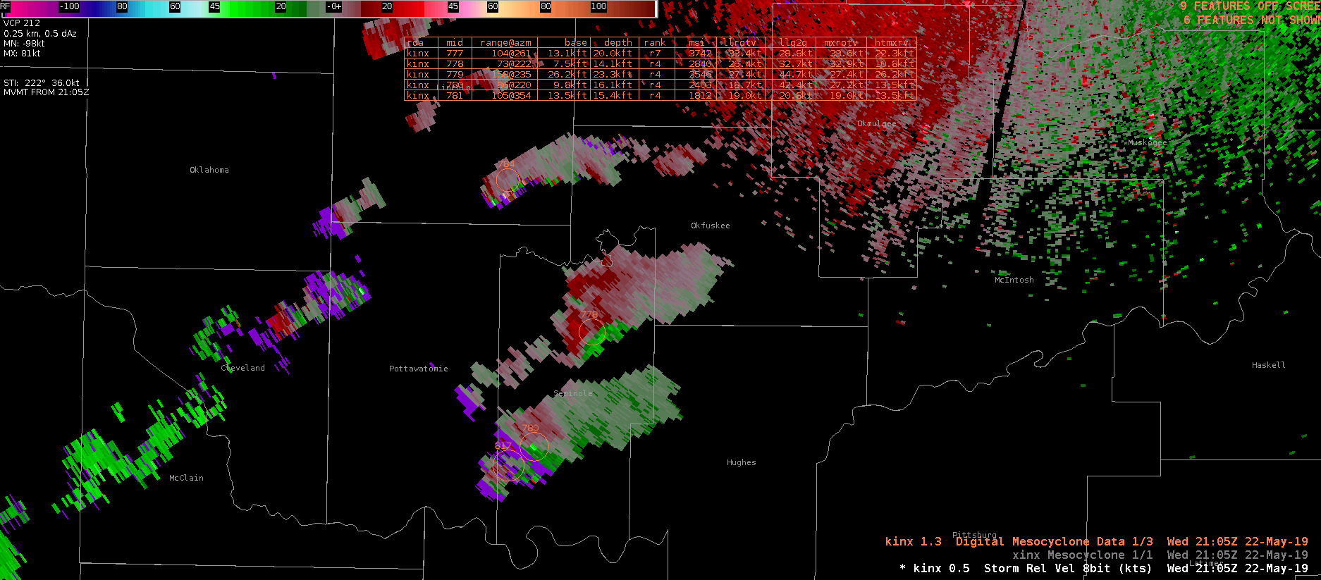
This will be a great case study to follow up on with the NMDA:

As we were watching the differences between the NMDA compared to the MDA and DMD on a QLCS/squall event over east-central Illinois/northwest Indiana, we noticed some differences in circulation detection. Particularly, it was noted that the detection sensitivity was poor when there was a strong anticyclonic circulation present aloft (KIND ~100nm southeast of storm; 0.5deg; 12kft AGL). Interestingly, all 3 of the algorithms picked up on the weaker cyclonic circulation instead; all with different sizes and intensities.

See below 1847Z: MDA upper left, DMD upper right, NMDA lower left.

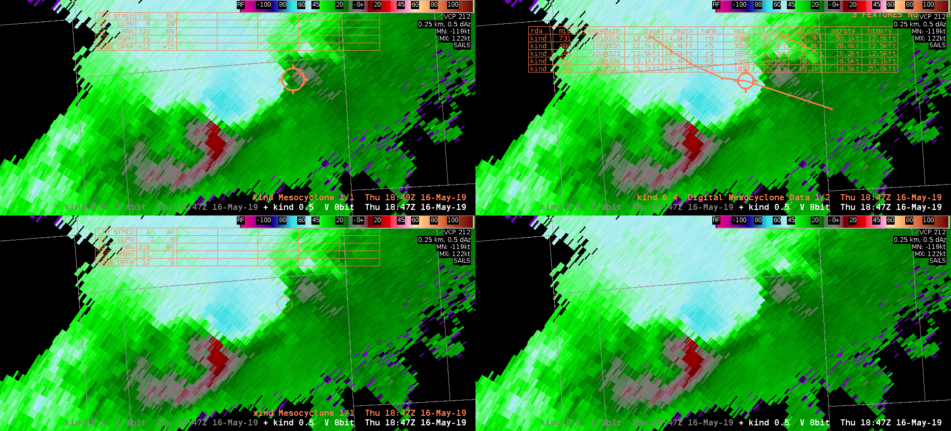
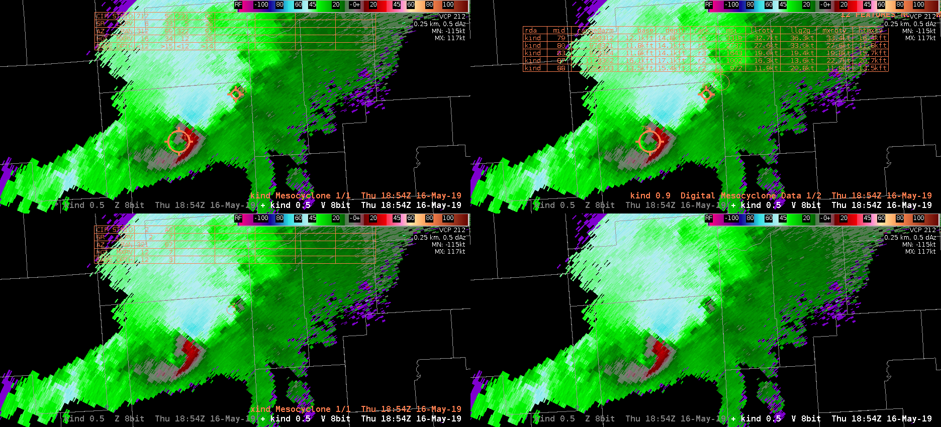
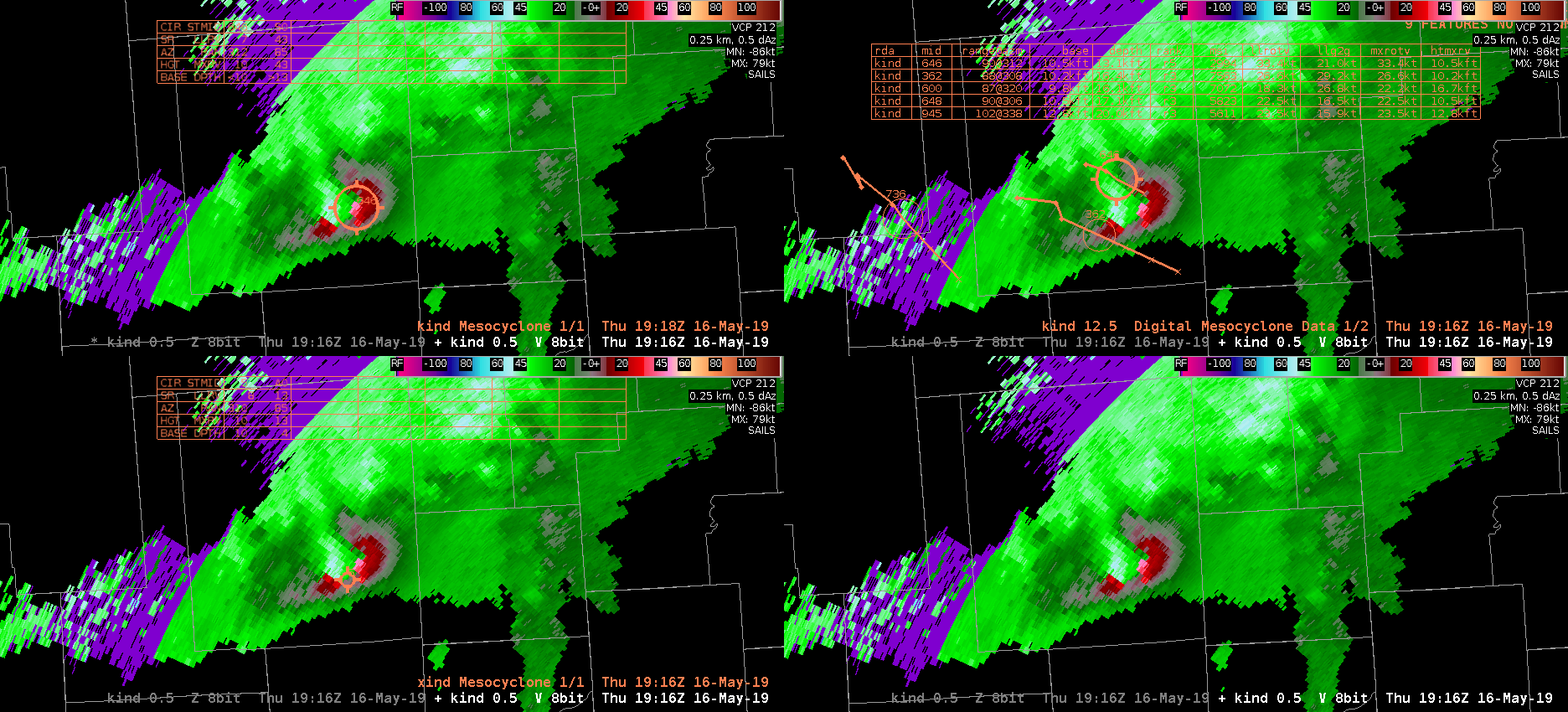
Image below 1854Z: As the storm progressed and started having a cyclonic rotation associated with the area of interest right next to an anticylconic area of rotation, the MDA (upper left), DMD (upper right), picked up that particular circulation first. The NMDA (lower left) was still slow to grasp onto this very strong circulation aloft that could have a Severe lead time significance as the rear inflow and convergence strengthens.

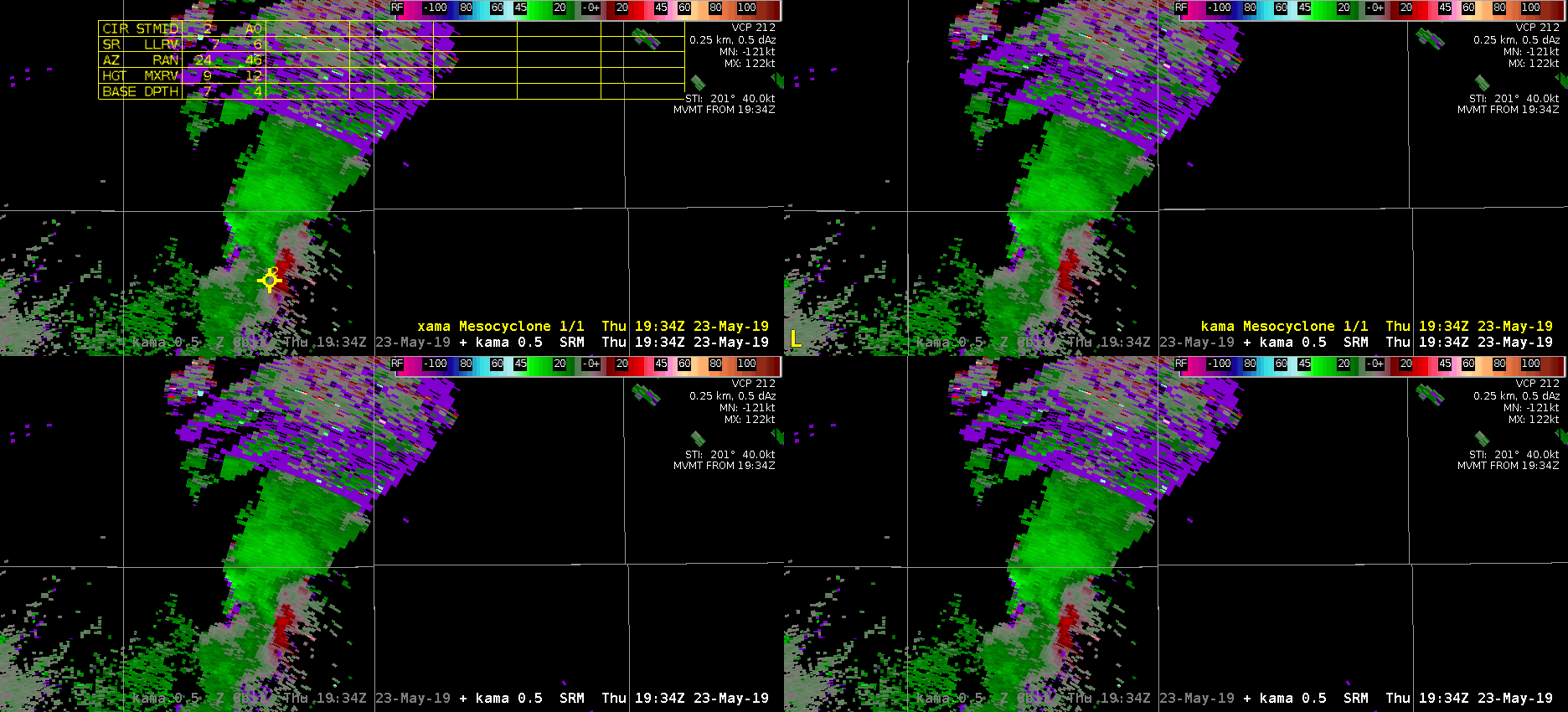
Looking several radar scans forward now below (1900Z), the NMDA finally recognizes significance of this large feature (see below; lower left panel). However, it is still does not signify a strong circulation as denoted by its tiny circle. I’m curious about LSRs during this time.

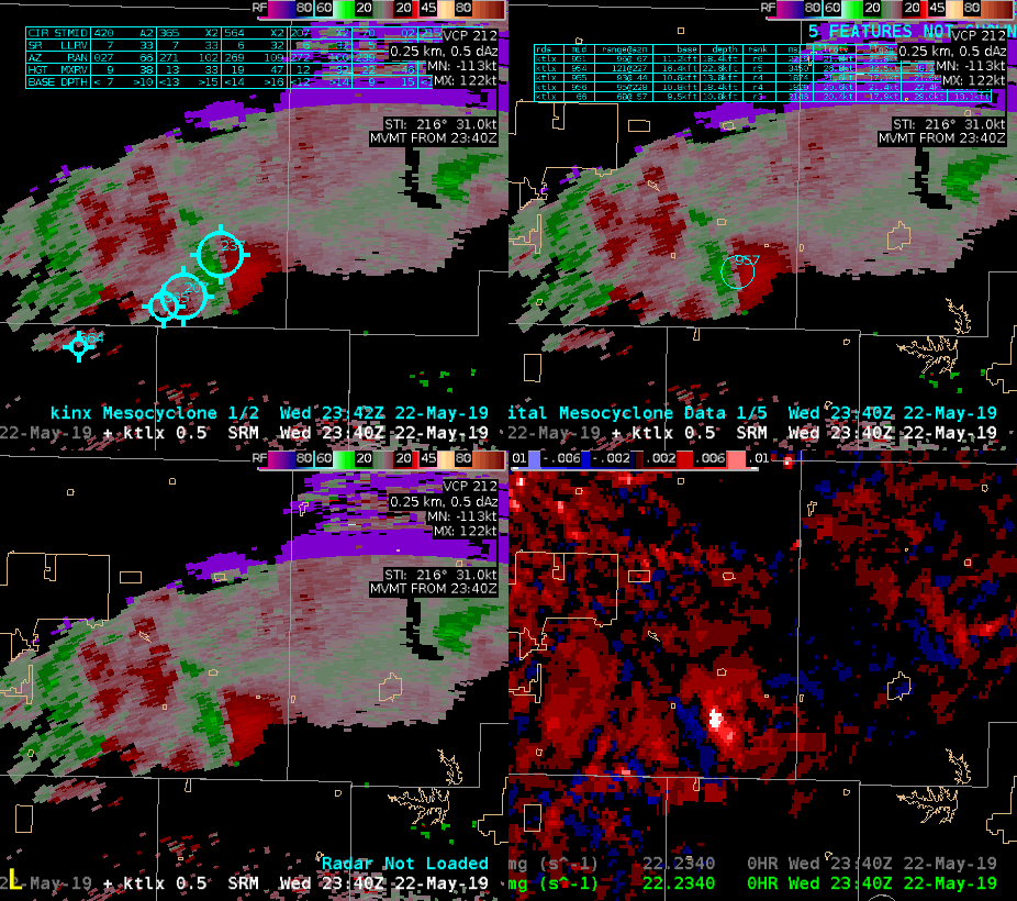
Finally, 16 min later (1916Z see below; 11kft AGL), the NMDA finally shows a significant circulation center due to a strong descending rear inflow jet/notch. I would suggest that the NMDA does not give me a lot of lead time confidence in issuing a severe thunderstorm warning in this instance (probwind showing over 90% at this time). NMDA only seems to help give confidence once it detects the feature after it has already evolved. What’s also interesting to note from the below image is that the DMD and MDA picked their denotations on (only) the cyclonic circulation, whereas the NMDA only seems to centrally focus on a weird convergence region and not the cylconic side of this lowest scan velocity data (i.e. more localized for NMDA). None of the products seem to attract to the anticyclonic side, which actually strengthens with time due to the descending notch. -shearluck
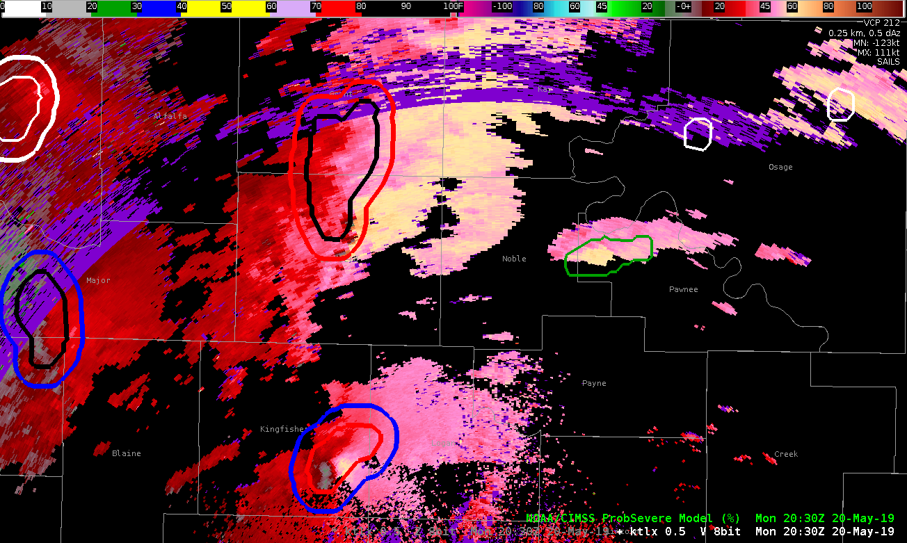
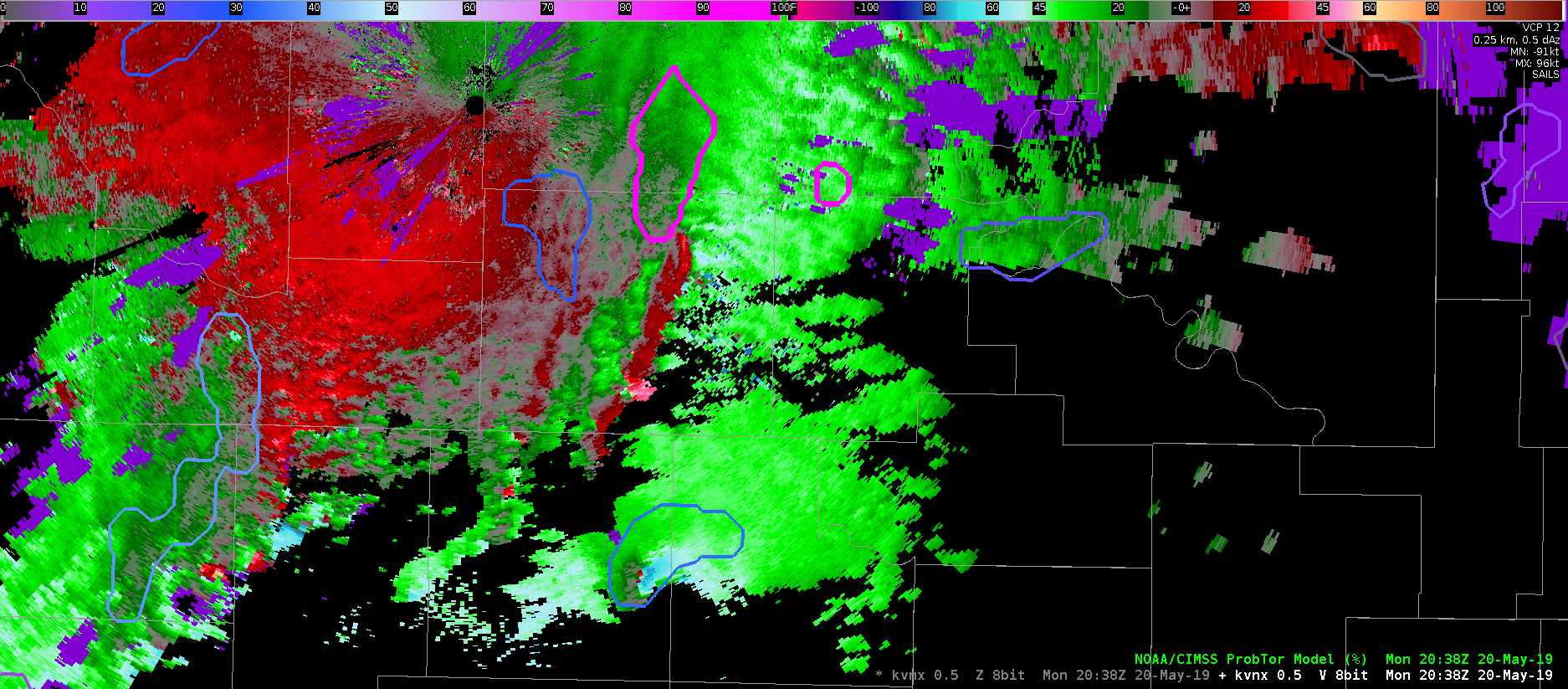
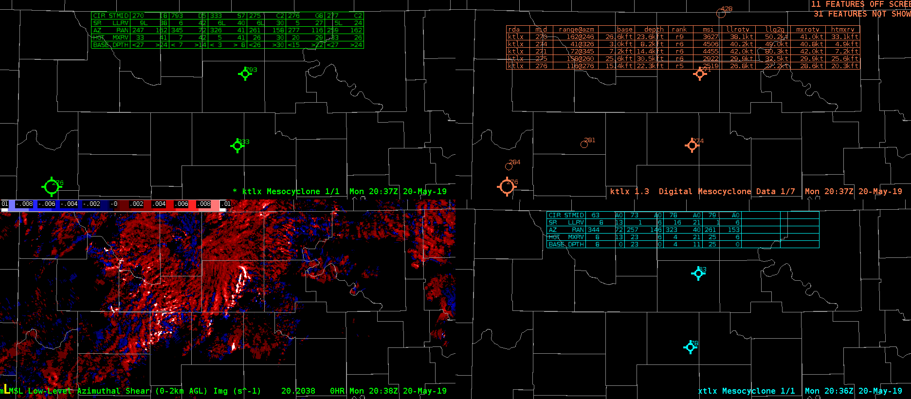
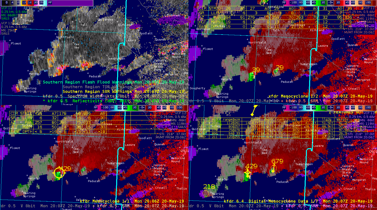
NMDA QLCS Anticyclonic Meso

A strong anti-cyclonic mid-level meso developed near the southern end of a QLCS south of Chicago (view form KLOX). NMDA did not pick up on this feature. Would definitely want to have this detection since a warning forecaster may not quickly pick-up on a developing mid-level circulation if they are closely watching for low-level mesovortex spinups, and this may be important in hail development as well as focusing and outflow wind surge.

11 minutes later on the 0.5 degree tilt, one the developing rear inflow jet starts to develop, the NMDA keys in the developing low-level cyclonic circulation. However, the additional 11 minutes of being alerted to the developing mid-level meso could help extend warning lead times.

— warmbias —