Shorter TORP Timescales on QLCS Case

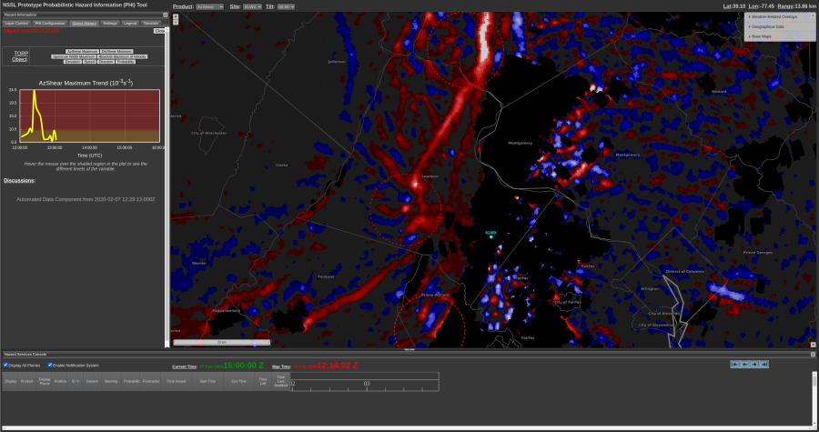
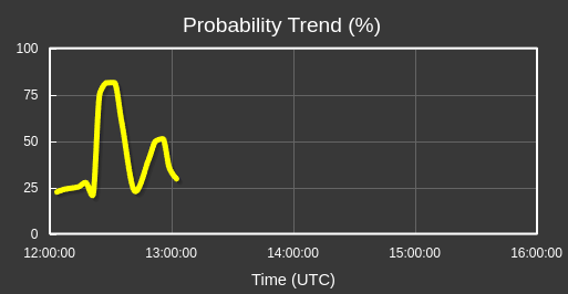
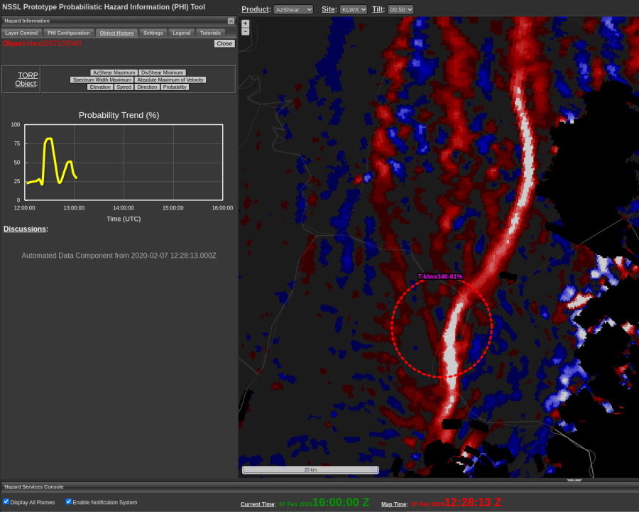
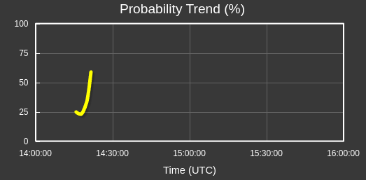
Most of the TORP objects in this case had very short timescales. This is an example from a tornadic mesovortex where TORP did pick up higher probabilities, but just for a short time. This is largely due to the nature of the storm mode as QLCS tornadoes (and QLCS signatures in general) are quicker and more transient in nature. In previous cases with supercells, the timescale is usually longer.

-Stormy Surge

Tags: None

AzShear Increase with Clutter

Just south of the couplet that did produce damage, AzShear looked quite good with what appears to be clutter near the radar. No damage reports were noted in this area. 
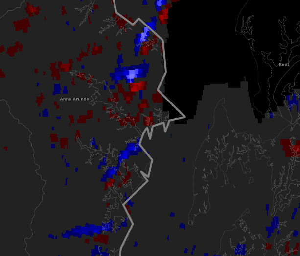
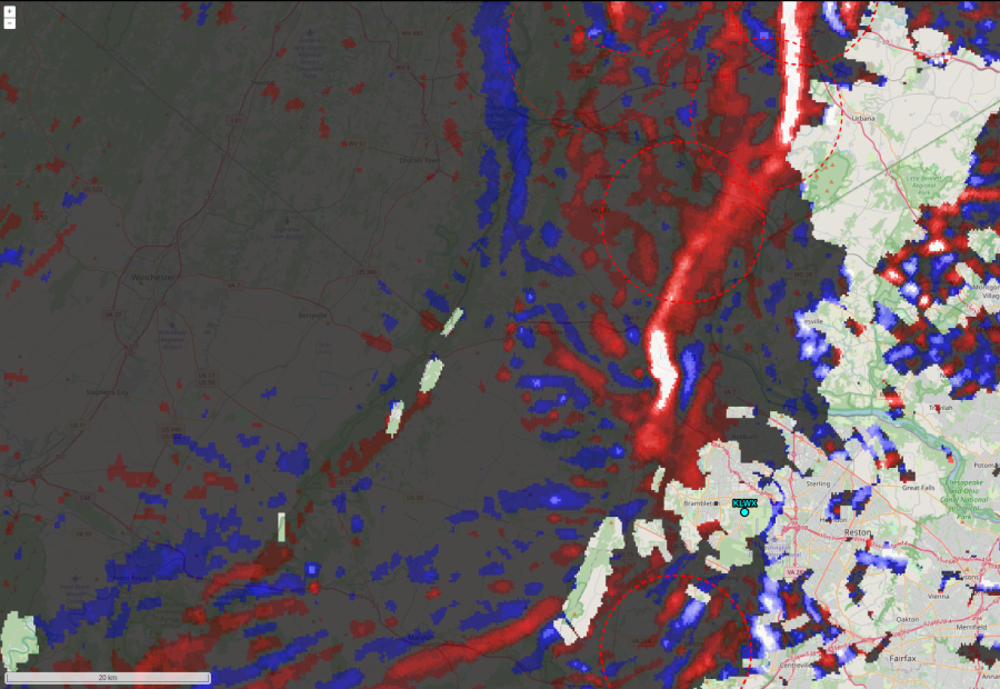
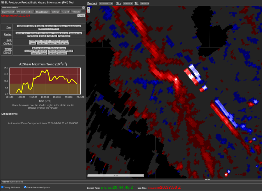
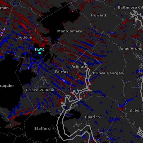
TORP wasn’t that interested in this feature, which is good, but the AzShear certainly caught the eye. This is important to identify as a forecaster and use TORP in tandem with AzShear so as to not be tricked by clutter near the radar that causes AzShear to spike. -newt

Tags: None

Waves

Interesting wave like structure behind the front in an area of relatively steady (light) precip with a TORP object on leading edge (30ish) prob. Wind report closer to the front at 1417Z that has  a weak rotation and signal in AZshear, but does not have a TORP object. – Wildcat

Tags: None

TORP Performance for QLCS Case(s)

As has been noted, TORP lead time is nearly non-existent when it comes to QLCS events. This is especially true when applying a threshold filter >40-50%. However, in this case and others assessed so far this week, FAR with TORP is relatively low for even these marginal/transient cases. The example above displays nearly zero lead time to confirmed event (~1244 UTC), though would be eye-catching should a TOR warning not yet be in place.  -QLCS

Tags: None

QLCS Spinups

This is a difficult case with the spin ups nearly perpendicular to the radial where most of the damage occurred. TORP wouldn’t have provided much lead time as it very quickly jumped from 21-76% in one volume scan after the couplet had already developed. There was a well-defined velocity signature at the 1217z scan from KLWX. 
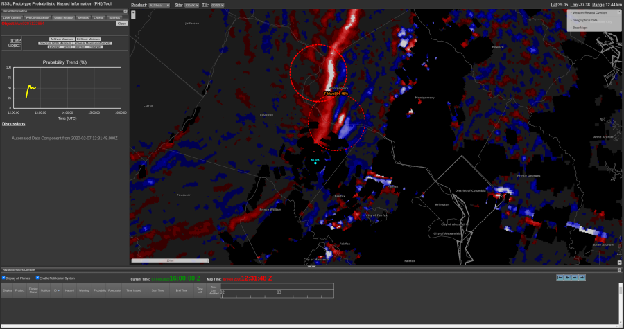
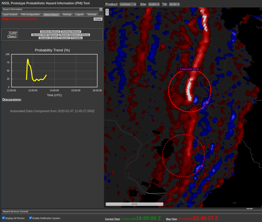
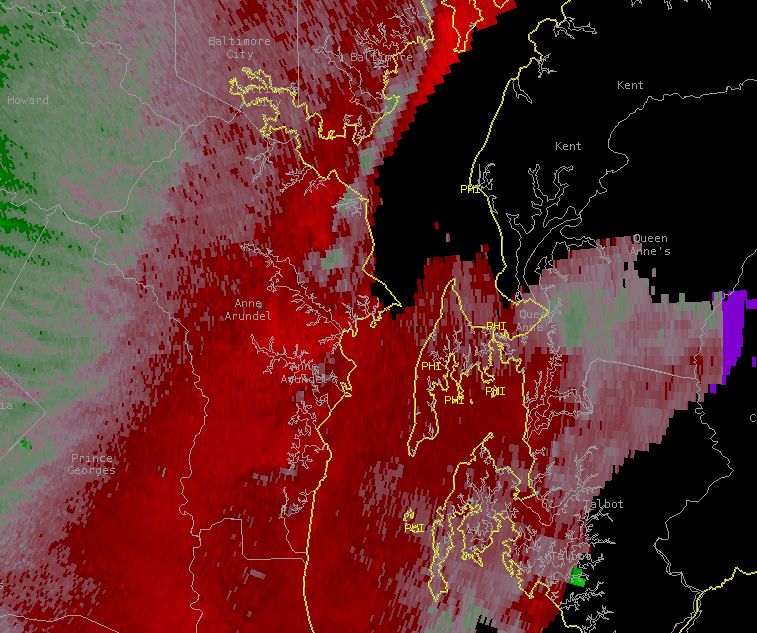
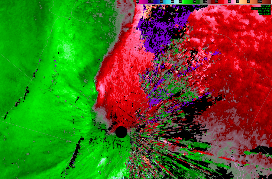
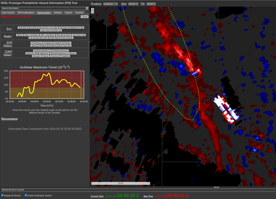
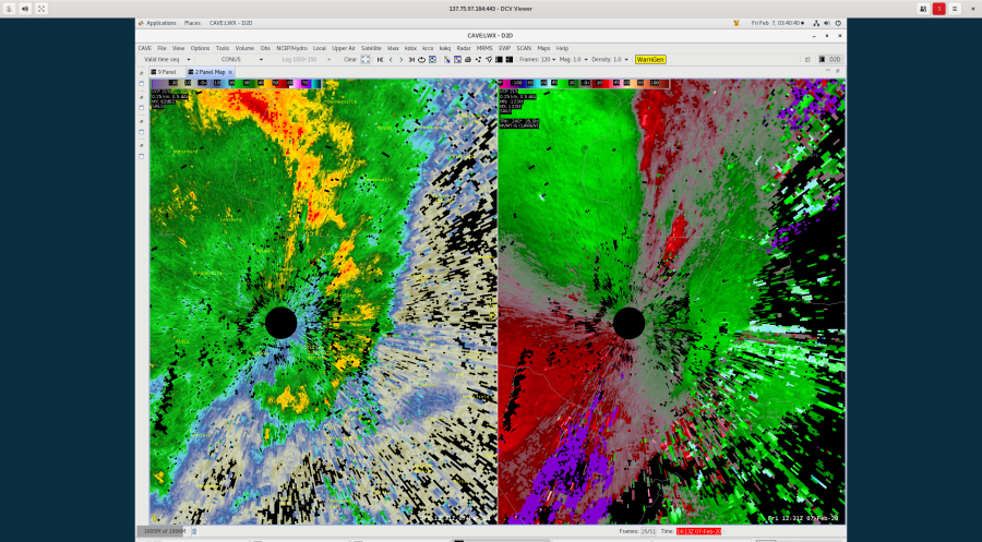
AzShear started to light up at 1214z. Given the environment, it would have been difficult to lean on AzShear and make a tornado warning decision before any signature developed on radar, but in hindsight some lead time may have been possible using that 1214z AzShear signature. -newt

Tags: None

1402 LSR

Very weak AZshear detection although no TORP on this scan. Have to go back 3-4 scans to see a TORP object – which was only one single frame at 33%. – Wildcat

Tags: None

Low TORP Probability Next to Radar

An area of higher AzShear moved close to the KLWX radar at 1221z and TORP struggled to pick up on this. TORP has a known QC to filter out data within a certain range (30km) from the radar, but even when that was turned off, TORP did not have anything. 

Looking at the velocity data, there is a couplet there just to the northwest of the radar where AzShear is maximized. So, even though AzShear responded well to the couplet, TORP struggled due to the close proximity to the KLWX radar.

The TORP graph shows that when the couplet with the high AzShear moved farther away from the radar, the probabilities shot up from 25% to 80%. And this couplet did produce a tornado.

-Stormy Surge

Tags: None

Beam Blockage & Storm Interaction on AzShear

Had a line of semi-organized storms cross multiple radials of beam blockage (as evident from KDVN radar). As this occurred, AzShear pattern associated with storms maintained character (bottom image/2044 UTC). No TORP object was created  as I hypothesized (i.e. as real/artifact “combined”). -QLCS

Tags: None

SideLobe Example

AzShear exhibits a “blocky pattern” while dual pol shows evidence of a hail core resulting in side lobe contamination for this storm in the DVN forecast area on the afternoon of April 16th.

Posted by Rigel.

Tags: None