Week 6 Summary: 2-6 June 2008

Visiting forecasters this week were George Phillips (SOO, WFO Topeka), Jon Hitchcock (Forecaster, WFO Buffalo), and Chris Sohl (Lead Forecaster, WFO Norman). In addition, Milovan Radmanovac from the Weather Service in Serbia also participated. John Ferree (OCWWS) was an observer. Other participants who supported testing included Angelyn Kolodziej, Kevin Scharfenberg, Travis Smith, Greg Stumpf, Jerry Brotzge, Dave Priegnitz, Kevin Manross, Pam Heinselman, Rick Hluchan, David Pepyne. Liz Quoetone and Kiel Ortega were Weekly Coordinators.

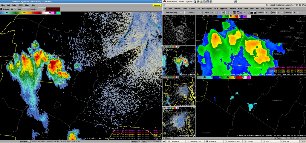
Weather during the week was predominately outside the Oklahoma Testbed. Forecasters spent the first half of each shift on training or simulations for Phased Array and CASA. Monday through Wednesday evening IOPs were Probabilistic Warning events generally associated with weather in the central and southern Plains. Thursday both teams did the Prob Warn exercise from Grand Forks. This was followed by the only live event to make it into the testbed. Storms reached the PAR network and were viewable (albeit at longer ranges) for a couple hours. Storms ultimately reached the CASA network with less than an hour remaining in the shift.

General observations:

Prob Warn

Participants got very comfortable with the technological end of this process such that by the end of the week, they were putting out multiple threat areas for the same storm and keeping track of things. Both groups used AWIPS to interrogate storms and WDSS II for assigning the actual threat area. This seemed like a good way to keep the technology from getting overwhelming, as well as involving both members of the team. Some discussion involved how the users would interpret these probabilities. The idea was that most would have a trigger point for various actions based on the probabilities. However, once the forecaster becomes aware of those trigger points, does this factor into the assigned probabilities (even though we are technically not suppose to consider any societal aspects of this).

Forecasters experimented with probabilities with one team issuing a 100% hail threat for 60minutes with no degradation. This was associated on a long-lived HP supercell and obviously confidence was high. The group did some wind threats but speculated that this could be much more complicated in squall line situations (which nature did not afford us during the live events).

CASA and PAR

Scientists captured more thorough findings from the group but in general, everyone found the temporal improvements to be beneficial. While the improved resolution was also a plus, it was felt that this was somewhat offset by the release of the Super Res products in the 88D. Some mentioned the sector scanning for CASA as not very useful. Participants talked about the small scale (time and space) features that you could see with each radar and the benefits of perhaps getting a warning out earlier, but also weighing this against the inclination to overwarn on features which are transient and not associated with severe weather. A definite learning curve.

The Friday wrap-up session was followed by two talks:

“December 19, 2004 Southern Lake Michigan Single Band” Jon Hitchcock, Buffalo NY

“Radar Network and Hail Suppression System in Serbia” Milovan Radmanovac, Serbia


Liz Quoetone (EWP Weekly Coordinator, 2-6 June)

Tags: None

Forecaster Thoughts – Chris Sohl (2008 Week 6)

While the weather in the local area started out rather quiet, it ultimately picked later in the week allowing us to view PAR and CASA radar data in real time. In the early part of the week we also had the opportunity to view archived data and issue real-time probabilistic forecasts for thunderstorms in the central plains.

For both the real-time and archived cases where we made probabilistic forecasts for thunderstorms, the process seemed to work reasonably well. The fact that many of the storms were discrete probably made the task relatively manageable. It would be interesting to experiment with cases of widespread strong/severe thunderstorm development including a few high-end storms such as supercells. Managing the boxology and frequency of updates could be a challenge.

I can envision the additional value that the probabilistic forecasts could provide to some customers especially for values below some “threshold” that might trigger a warning. For example, tornado probability trends for a supercell could give an EM or TV weather person some insight on the likelihood that a storm may subsequently have a tornado warning issued on it.

The strength of the PAR data was clearly its capability to perform rapid volume scans. Storm evolutions seemed to be easier to follow and also allowed the detection of features a little sooner than you might with the 88-D. The archive data of a developing microburst nicely demonstrated the advantage of having more frequent volume scans available.

While the range of the CASA radars was limited, they did provide additional information about the near surface wind speeds in storms than could be detected using the 88-D which was located farther away from the storms.

Although only available for a few volume scans, live radar data from a SMART radar was available for display on a workstation. To be able to view a remotely transmitted dataset in real time was impressive.

In the back of my mind, as I explored many of these datasets, I was trying to visualize how a warning forecaster could incorporate all of this information during warning operations. The long term solution may be short-term storm-scale forecast models that incorporate all available datasets. However, in the interim, it might be worthwhile to also explore the development of tools that would allow all available radar data sources to be combined into a seamless dataset for interrogation by the forecaster. This would also include developing robust 3D and 4D visualization tools.

Chris Sohl (NWS Norman OK – Week 6 Participant)

Tags: None

Forecaster Thoughts – George Phillips (2008 Week 6)

While PAR, CASA and probabilistic warnings are quite away down the road, I appreciated the fact that they are obtaining considerable input so far in advance.  This is, of course, the way every significant change in technology/operations should be tested and input from operational people received.

PAR – We only had one day where real storms impacted the PAR coverage area.  On the other days we played back archived cases.  While working the real weather day, it didn’t seem to help a great deal while I was the one investigating the storms early in the event.  Very strong wind fields on that day (June 5th) led to multiple dealiasing failures, making especially the early part of the real-time case, difficult.  As the event progressed and storms moved closer to the radar, rotation could sometimes be seen earlier on the PAR than on the 88D.

On the playback cases, the high temporal resolution would have helped greatly with the issuance of warnings for pulse storms, and would have led to more lead time in a tornado case.  If the high frequency updates from the PAR were coupled with a display like GR2AE, the ability to see updraft/core development and downdraft/core descent, would greatly help in visualizing what was going on with storms, and could easily help with understanding when warnings are or aren’t warranted based on their evolution.

Another advantage of the PAR was obtaining time continuity for questionable quality data.  Let’s say on the 88D you see an interesting velocity signature in an interesting area of the storm, but it doesn’t quite look right.  You may have to wait for another volume scan (4-5 minutes) before making a decision based on this signature to see if it is a dealiasing failure.  With the PAR, you have time continuity in very short order and can usually evaluate data quality much quicker.

On the challenging side was the fact that we are not used to such high frequency updates.  Transient features, that may or may not mean anything from a warning perspective, are seen much more frequently.  It will take awhile to adjust to mentally calibrate the WDM process with such high temporal resolution updates.  Concern was expressed about possible data overload as the volume scan could come in at 30 second or 1 minute periodicity.  While this is a valid concern, good visualization software would certainly help with this situation

CASA -  These radars are southwest of Norman, and are only about 30 km from each other.  Once again, only one day had real weather that impacted the radars, and that was late in the shift on the last day, so real-time evaluation was not extremely useful during that week.

We played back a few cases using the CASA radars and they showed some of the strengths.  In particular, with wind storms, the actual winds are often at some large angle to the 88D radar beam.  Or, the 88D is showing strong winds with a storm, but 0.5 degrees is intercepting the storms at 8000 ft.  Are those strong winds making it to the surface?  With CASA radars spaced relatively close together, sampling the lower atmosphere is easy, and the likelihood of being able to obtain a good estimate of the winds as they approach (or move away from) one or more of the radars, is also good.

Also, being able to sample the lower atmosphere in high resolution means that velocity and reflectivity signatures of small scale features should show up much better/more frequently.  We saw this in an example case with a mini-supercell associated with a tropical system, which had a nice little hook, and decent velocity couplet on the CASA display, while the 88D showed it as a blob with no real velocity signature until after the tornado had touched down.

Of course at 3 cm wavelength, attenuation occurs frequently, so any future CASA network would seem to need to be a supplement to a network of 10 cm radars.

Probabilistic “Warnings” -  Ever issued a deterministic warning and wish 10 minutes later you could cancel it, or reorient it, but are concerned about the verification implications, or possible consequences if you are wrong?  In the era of probabilstic warnings, one simply decreases/increase the probabilities, or reorients the track to produce a different area of probabilities.

We did this each day, in real time for various CWAs across the Plains.  We also did this on the last day with a canned case that all the participants in the EWP went through.

This actually worked better than I had expected.  But one could see that following more than two storms around with probabilities for tornadoes, winds and hail, quickly became a workload.  Of course there are also challenges with reasonably assigning probabilities, since that is not something we are used to.

On the last day we worked an archived case that all the participants in this EWP went through.  We had VERY limited environmental information for this event.  Assigning tornado probabilities without good environmental information was very frustrating, and really emphasized the importance of having this data.

There are a number of problems with the current warning system.  How we would transition from what we do now, to this method is not entirely clear, and how some of our users would react to this change is also unclear.  However, one can see that sophisticated users could obtain useful information that they currently don’t have.  Frequent updates to threat areas has the potential to give earlier heads up to people downstream of the ongoing severe storms, than issuing periodic warnings does.

George Phillips (NWS Topeka KS – Week 6 Participant)

Tags: None

Forecaster Thoughts – Milovan Radmanovac (2008 Week 6)

Coming from Serbia, my intention was to get familiar with the new technologies and new endeavors in meteorology, especially in radar meteorology, because that is the field where I’ve worked in for more than 15 years. The 2008 Experimental Warning Program spring experiment was a great opportunity to see the possibilities and practical implementation of some ongoing projects like the Phased Array Radar, CASA radars, probabilistic warnings…At the same time, through the EWP, I learned a lot about some other projects and systems (Mesonet, verification of severe weather, collaboration with TV and radio stations) and got a lot of ideas which can be applied or implemented within the meteorological services in Serbia. The Experimental Warning Project is especially important because there is the intention for improvement and modernization of the Serbian warning system, so the experience I got here will have a great practical value in my country.

Personally and on behalf of Hydrometeorological Service of Serbia, I’d like to thank you for being kind and making it possible for me to be a part of this program.

Milovan Radmanovac (Hydrometeorological Service of Serbia – Week 6 Participant)

Tags: None

Summary – 5 June 2008

End of IOP. Sent forecasters home. CASA now sampling data but we will look at this first thing tomorrow. Most feedback today will be on long range PAR which is not the best especially since this was (so far) mainly a wind event.

Liz Quoetone (EWP Weekly Coordinator, 2-6 June)

Tags: None

Live Blog – 5 June 2008 (8:19pm)

Will go live PAR to 9pm tonight with data finally getting close in PAR and just nudging into CASA. Chris and Milovan doing PAR/KTLX comparisons. Groups have conceded to high wind threat everywhere along line and are now looking for anything different than that.

Plan for tomorrow is to spend 1st hour reviewing a few minutes of both PAR and CASA as they finally get well sampled (later this evening). Group has worked this event much of the afternoon/evening and payoff is not coming til after they leave.

Liz Quoetone (EWP Weekly Coordinator, 2-6 June)

Tags: None

Live Blog – 5 June 2008 (6:49pm)

Moving PAR wedge back southwest again by 10 degrees. There is a tradeoff between established storms moving northeast out of the area and up and coming cells moving in range from the southwest. Still no immediate hope for CASA.

Liz Quoetone (EWP Weekly Coordinator, 2-6 June)

Tags: None