CI along sea breeze over NE Florida

Westward moving sea breeze front helped to spark sporadic showers/thunderstorms during the afternoon hours. We captured the interaction of an already ongoing weak shower, as front moved in from the east.

1932 Z; UAH-CI and Cloud top cooling
1940 Z; UAH-CI and Cloud top cooling

The southern parts of Nassau and Charlton county and Baker county were monitored. At 1932Z an increase in cloud top cooling was noticed and 8 min later, CI product also had probabilities of 70 % plus for this area. At the same time, a cooling rate of roughly -15K/15 min was detected. Rapid development occurred thereafter with 50 dBz and more seen in the JAX radar side at 1947 Z, which gave a good lead time for focusing on the potential hot-spot over NE Florida. The storm was a pulsating one with rapid weakening thereafter.

Helge

Tags: None

LWX 5/24: UAH-CI Signal Precedes UW-CTC Signal…Both Precede Convective Initiation

The more I look at these products, the more I’m convinced they work very well in tandem with each other.  Given an environment that supports convective growth, a strong UAH-CI signal (upper image, top left panel) typically precedes a strong UW-CTC signal (middle image, top right panel).  In this case, the strong UAH-CI signal (1615 UTC) preceded the UW-CTC signal (1645 UTC) by about 30 minutes.  By 1715-1730 UTC, 30-45 minutes later, deep-moist convection did indeed form as evidenced by the numerous CG strikes (bottom image, bottom left panel).  We’ve seen this all week…UAH-CI gives us a heads up that general convection is initially building, then a short time later UW-CTC typically picks up on the stronger convection building.  Given a strong cap isn’t present and instability is sufficient, deep-moist convection typically develops 30-60 minutes thereafter.

1615 UTC. Notice the 70% UAH-CI signal in the top left panel.
1645 UTC...30 minutes later. Notice strong cloud-top-cooling signal in the UW-CTC product (top right panel).
1715-1730 UTC...30-45 minutes later. Deep-moist convection did indeed develop in the vicinity of aforementioned CI/CTC signals, as evidenced by numerous CG lightning strikes (bottom left panel).
Tags: None

CI mainly inland across FL peninsula

Latest CI image shows moderately high probabilities for CI along ahead of the westward moving sea-breeze boundary.  Best chance for thunderstorms appears to be from the interior counties towards the west coast.  Some initiation is possible across Northern Brevard County…though the prospects for lightning are looking slim at this point.

HIRSCH

Tags: None

Overview of sea breeze fronts in Florida

We’re currently monitoring the rapidly inland moving see breeze front over NE Florida with enhanced TCU present along the convergence zone, whereas the west coast see breeze has trouble to move inland within dominant easterly wind regime. Both convergence zones enter an area over N-C Florida where slightly lower dewpoints (lower to mid 60s) are present. With ongoing diabatic heating, cap continues to weaken or has already vanished with isolated initiation possible over N-C Florida in the following hours but ongoing large-scale weak subsidence seems to delay initiation a bit. HRRR quite aggressive with initiation mainly along the western sea breeze front with RUC also showing sporadic storms over N-C Florida. Overall set-up is not impressive and favors only the development of a few thunderstorms. Moderate CAPE and weak shear environment may result in a few strong and slow moving storms.

Neither CI nor Cld top cooling products showing robust signs for initiation … mainly over C Florida. Both products however show more vivid activity offshore over the Atlantic, where mid-levels remain a bit cooler.

1800Z VIS and station data
1745Z; UAH-CI (upper left) and CIMSS Cld Top Cooling (upper right)

Helge

Tags: None

Outlook 24 May 2012: Week 3, Day 4

We’re operating today during the first mod risk of the experiment, however, that is not where we are focusing today… at least not initially.

In order to try and get lightning data into the experiment this week, we’ve initialized in the Sterling, VA and Melbourne, FL domains.

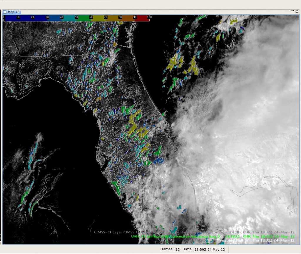
For the FL domain, we’re hopeful that storms will get going as the sea breeze front sets up across the state.  Already, the UAH-CI product is flagging cumulus for development (consistently 50-60%) along the line from Sanderson to -Orlando to just northwest of Okeechobee.

UAH-CI & Visible Satelllite for central FL @ 1830 UTC on 24 May 2012.

For the DC domain, the CI alg is also flagging development generally a bit lower on the probability though. A region of SBCAPE of >1500-2000 J/kg extends from eastern NC to over much of the LWX CWA, so it appears possible that we could at least see some convective development across some of the DC LMA though likely only marginally severe.

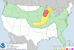
Our observers and some PIs are keeping an eye over central WI and the associated moderate risk region for development of surface based storms (as of now all development across Minnesota appears to be elevated).  Currently instability is limited across much of the region, but we do expect additional destablization with daytime heating and enhanced lift as the cold front moves in.

SPC day 1 outlook for 24 May 2012

-Kristin Calhoun, Week 3 Coordinator

Tags: None

EWP STATUS FOR 24 MAY 2012: 1-9pm SHIFT

EWP STATUS FOR 24 MAY 2012: 1-9pm SHIFT

Planning on a 1-9pm shift for our final day in the testbed this week…

We will likely be operating in the Iowa / Minnesota / Wisconsin region tomorrow afternoon and evening. Expectation is for isolated storms early before joining into a line / MCS later in the evening with possible embedded supercells.  Hopeful for convection as early as 1800-2100 UTC, although the last few days all the models have seemed to be a bit too aggressive for the timing of convection initiation across the central Plains… However, boundary layer moisture has been a concern the last couple days and may be less of a concern tomorrow.

Another possibility for operations tomorrow may be the Florida domain, which, depending on timing and location, may allow for at least one operational period utilizing lightning data. Or, similar to today, there is also the possibility of multicell convection across eastern NC earlier in the afternoon.

-K. Calhoun, Week 3 Coordinator


Tags: None

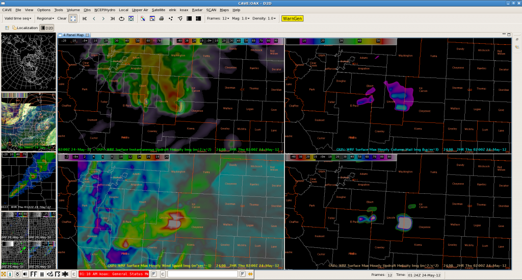
OAX: Another Example of 3D-VAR Utilized as Good Heads-Up Display

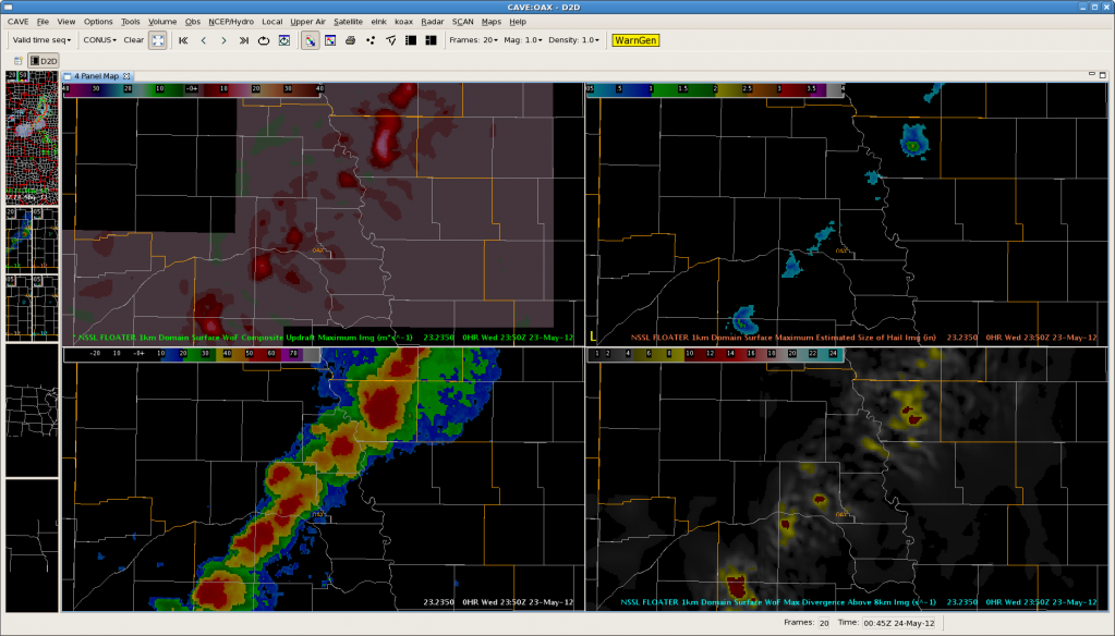
The below image illustrates once again that 3D-VAR may be best utilized as a “heads-up” display for the biggest storms on the scope.  It appears the best products for this are the max composite updraft speed (upper left) and max divergence above 8km (lower right).

2350 UTC on 5/23. Upper left (max composite updraft speed), upper right (MRMS MESH), lower right (max storm-top divergence), lower left (simulated reflectivity).

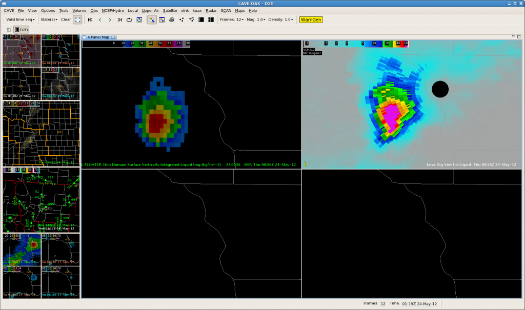
WFO OAX-Finally, a CTC Fail!

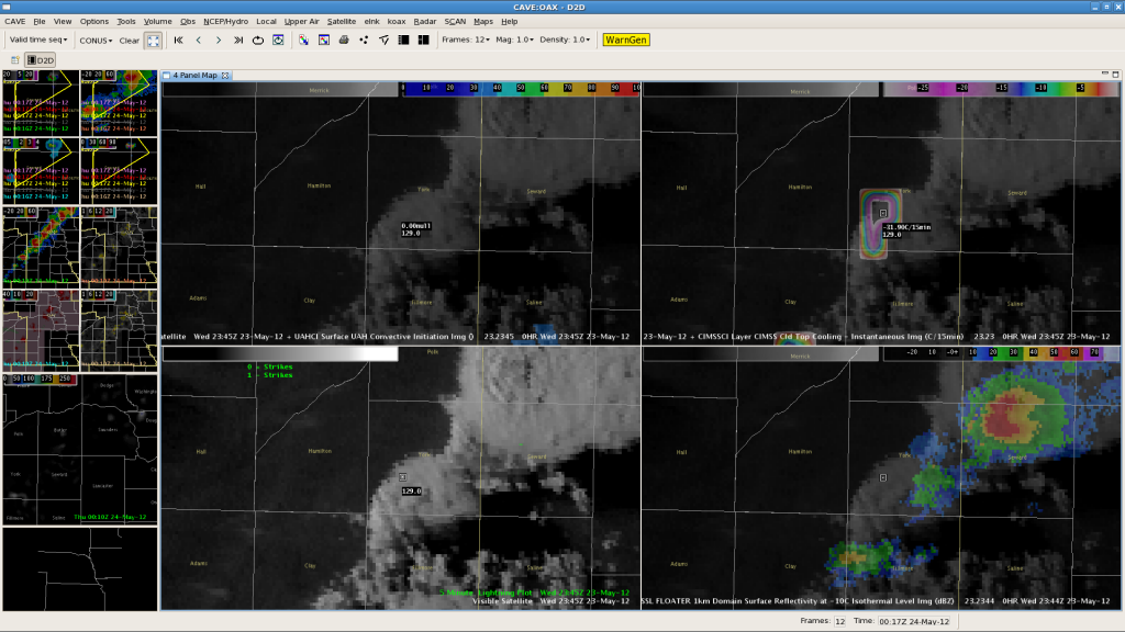
No computer-based algorithm is perfect, right?  We had a failure of the Cloud Top Cooling (CTC).  Here is a CTC image from 2345Z, in the top right panel:

Cloud Top Cooling (CTC). Values in York County, NE are over -30C/15min.

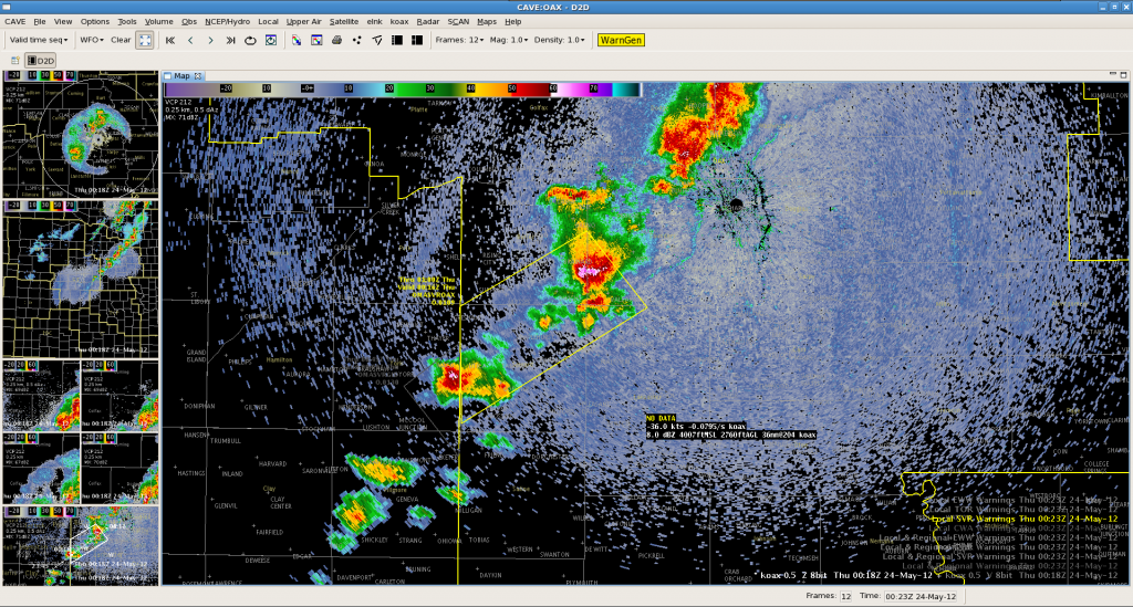
The developing storm over York County has values over -30C/15min, which is usually a strong indicator of a developing severe thunderstorm.  As this storm developed and approached Seward County from WFO GID, a warning was issued based on CTC.  Maximum Expected Size of Hail (MESH) was 0.87″ and increasing.  However, as the storm entered Seward County, it weakened.  No severe reports were received, and the MESH dropped pretty rapidly.  Here is an image as the storm entered the CWA:

0018Z KOAX 0.5 degree Base Reflectivity image.

The moral of the story?  You can’t win ’em all, CTC!–Gordon Strassberg for WFO OAX.