DFW:06JUNE

Cloud top cooling at 1745 showed evolution but it was already in place and immediately on radar.

Cooling with initial convection no lead team
Composite reflectivty 1748

Lightning flash density peaking over 50 flashes minute near Red River.Image 1927 UTC.

MESH got hail over 1 inch near Red River and we found we had KDYX which showed good rotation for storm along line.

3DVAR stuff with our warnings. The updraft and helicity stuff is nice but at 0.5km it is 2 time periods behind the other stuff. Latency issues abound. It looks good though, if it were only timely. Updrafts peaked 29ms-1 which is really good as we had 24ms-1 in Montanna yesterday with the hunkering supercell.

3D-VAR with warnings

1 to 1.5 inch hail near our big lightning strike area
Maximu lightning to our north near OK border
Tags: None

BOU:OUNwrf/Synthetic Satellite on Storm Initiation

The above two images predict storm initiation at 19z. The top image is a 4-panel of WRF-derived synthetic satellite products and the bottom image is a single panel OUNwrf 1km agl reflectivity from roughly the same time. Both products show rapid thunderstorm initiation around 19-1930z. Given recent vis satellite imagery, this appears too early. Only time will tell…

21z Update:

The above products, as expected, were overzealous with storm initiation. Recent radar imagery suggests storms are just now beginning to develop, approximately 2 hours after forecast development. Still, the general area of expected initiation was correct and timing is within a reasonable window of a couple of hours.

Tags: None

STATUS FOR 6 JUNE 2012: 1-9pm SHIFT

EWP STATUS FOR 6 JUNE 2012: 1-9pm SHIFT

We’ll plan on a 1pm start on Wed.  The most likely areas for operation based on the day 2 SPC outlook and 21Z SREF probabilities are NE Colorado (best chance of supercells) and OK/W TX (for low-shear pulse storms in the Lightning Mapping Array)

– T. Smith, Week 4 coordinator

Tags: None

TFX: Long-lived supercell continues – we got a tornado report! Rotation/MESH tracks shown

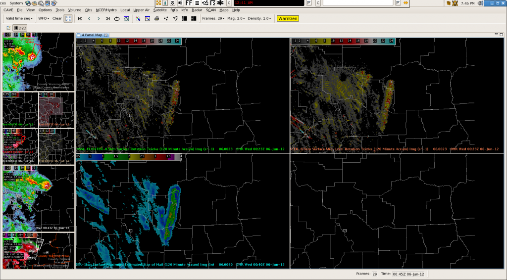
The storm we reported on in earlier posts is still ongoing.  Below are the surface rotation track (upper left), midlevel rotation track (upper right) and MESH swatch (lower left).  You can see the long track that this storm has had through the TFX CWA.  Baseball sized hail was reported from this storm.  We were also able to see a feed from a chaser cam trained on this storm.  We finally got a public report of a tornado near Hobson at 5:41 MDT.  This storm was clearly the star of the day!  CL

Tags: None

TFX: Our third domain…and finally an interesting storm! 3D-VAR data within…

So…after storms in MLB weakened early in our shift, we moved our domain to Tallahassee.  We did issue a warning there, but it became apparent that the most interesting action today is in Montana, so we are on our third domain, Great Falls.  This area was the best in the country as far as supercell potential, and we now have a strong storm for which I issued a TOR.  Below is a selection of 3D-VAR products for this particular storm.  The current SRM is on the bottom left.  Top left is updraft helicity…that max is about 140 m/s^2.  Top right is composite updraft maximum, which pegs this storm up to 19 m/s of upward motion.  Finally, in the bottom right is maximum vorticity below 3 km.  This scan only showed 13.4/s of vorticity, but the scan before had values as high as 27/s.  Not a bad storm at all for this area of the country.  We did get a golfball hail report out of this storm, but no tornado yet…  CL

Tags: None

TFX: 3D-Var Works in Montana too!

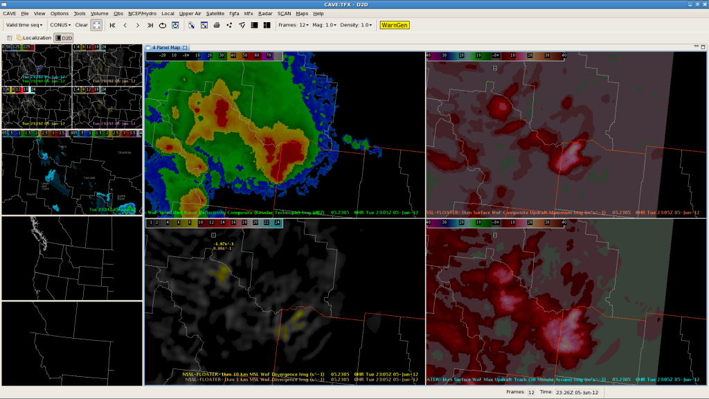
With limited areas favoring severe convection, we’ve moved to TFX to the lee of the Montana Rockies. Despite somewhat limited radar coverage, 3D-Var has performed very well with the supercells ongoing across the CWA. The right-most panels in the image above depict Max updraft and accumulated max updraft. The greatest magnitudes are co-located with a tornadic supercell in Judith Basin county. 3D-Var analyses appear to work relatively well even with sparse radar coverage.

Tags: None

OUN: 3DVar Locates Strongest Storm/Strong Winds

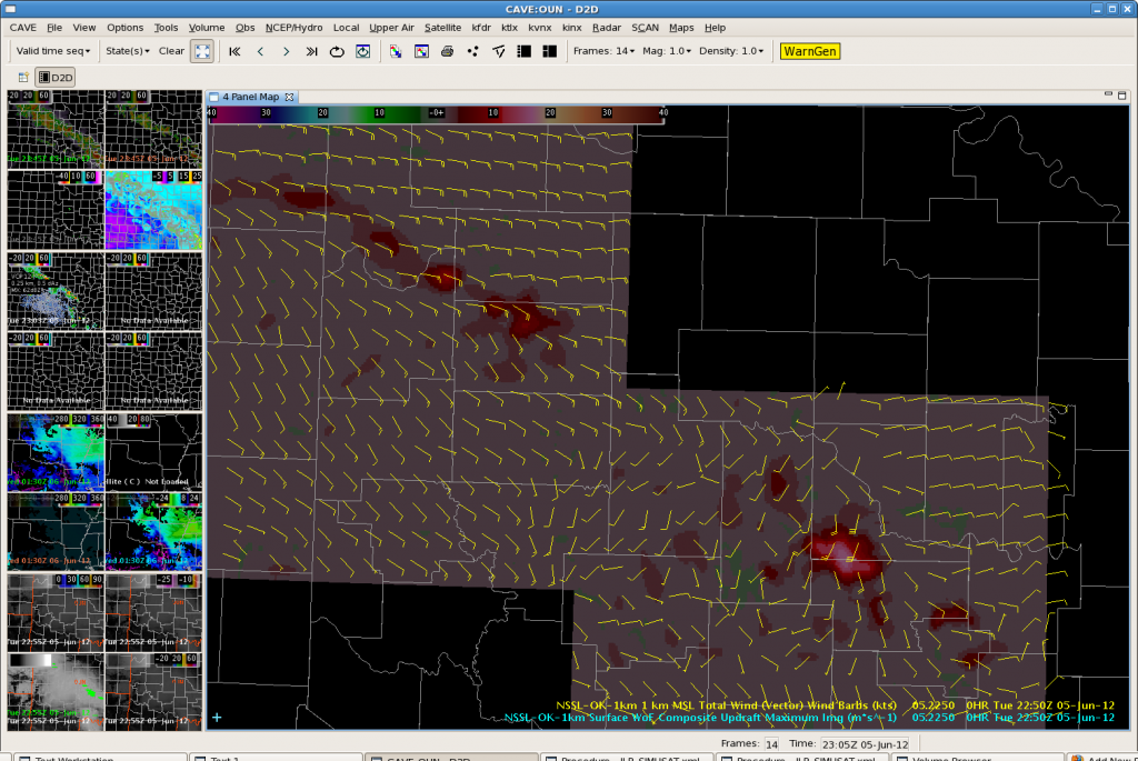
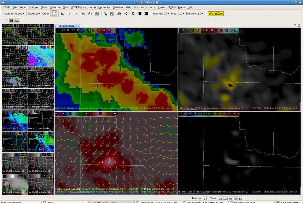
After a significant period of marginal convection, the 3DVar data picked up on a stronger updraft, and subsequently, a very strong outflow boundary. It is very easy to pick out the strongest storm amongst the broken line of convection in the Max Updraft Composite imagery.  Updraft values of 17 m/s noted at 2250z, with values as high as 23 m/s at 2230z in McClain County.  Elsewhere, updrafts in the line were less than 10 m/s.

Max Updraft Composite at 2250Z

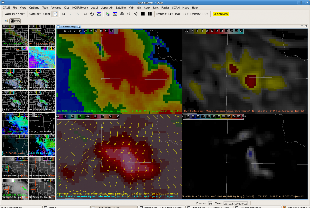
Zooming in, the 3DVar 1 km total wind vectors clearly pick up on the strong outflow winds at 2250z.

3DVar data at 2250z

At 2305Z, it is clear that the spatial extent of the intense updraft is decreasing. 1 km winds are also decreasing which matches well with radar data. Thus will not extend severe thunderstorm warning.

3DVar Data at 2305z

OUN: An Aviation Perspective…

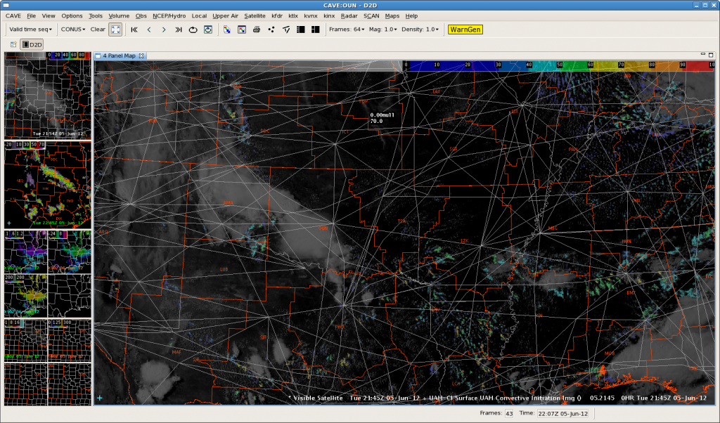
The image below (Figure 1) illustrates the potential for convective initiation, using the UAH-CI tool. The high altitude jet routes overlaid with the CI and latest satellite data show the potential impacts to aviation. I expect that the CI tool will be very useful in operations – especially at the CWSUs.

Figure 1: Convective Initiation Impacts on Aviation

TMU is always asking about timing and location of convective development. Things become problematic when routes need to be changed at the last second as a result of developing thunderstorms. If we have more tools to provide a larger lead time, TMU personnel can plan farther in advance – which leads to saving money and time…and stress!

Tags: None

OUN (LBB): CI with Boundary Interaction?

Agitated cumulus on visible satellite noted over Childress County.  UAH CI values currently at 53, but have been steadily increasing the last few volume scans. Outflow boundary from western Oklahoma storms continues to push southwestward.  Watching to see if storms will develop if the boundary helps initiate convection. 21Z OUN WRF now showing a second line of convection developing along the southwest boundary. Stay tuned.

Agitated Cu over Childress County. UAH CI values at 53.

Latest run of the OUN WRF….

2 hour forecast of the OUN WRF. Second line of convection develops.
Tags: None

JAX:Marine supercells

The MRMS algorithms have done well in depicting large hail and moderate storm rotation with supercells over the marine area. The first 4-panel image above depicts a cross-section through a supercell northeast of Jacksonville. A pronounced BWER is evident and correlates well with the MESH/rotation tracks panels in the bottom image.

Tags: None